Items Similar to Tony Sarg Map of Nantucket Town, 1937

Want more images or videos?
Request additional images or videos from the seller
1 of 7
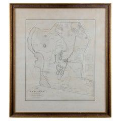
Tony Sarg Map of Nantucket Town, 1937
$1,200
£912.79
€1,052.18
CA$1,703.75
A$1,828.50
CHF 980.15
MX$22,005.19
NOK 12,358.24
SEK 11,269
DKK 7,859.77
About the Item
Tony Sarg Map of Residential Main Street, Nantucket, 1937, a black and white printed map of our historic downtown area, with images of each building, street names and whimsical figures, and an insert in the upper left giving details of many of the historic houses; flanked by two columns of iconic island figures and landmarks; signed and dated in the print lower right.
The map remains in excellent condition, and has been recently mounted in conservation matting and an ebonized frame.
Measures: 18-3/4 in H x 16-5/8
Framed: 24-1/4 in H x 22-1/8 in W
- Creator:Tony Sarg (Designer)
- Dimensions:Height: 24.25 in (61.6 cm)Width: 22.13 in (56.22 cm)Depth: 0.75 in (1.91 cm)
- Style:Other (Of the Period)
- Materials and Techniques:Paper,Other
- Place of Origin:
- Period:
- Date of Manufacture:1937
- Condition:Wear consistent with age and use.
- Seller Location:Nantucket, MA
- Reference Number:Seller: AD - BO-171stDibs: LU903942119612
About the Seller
5.0
Gold Seller
Premium sellers maintaining a 4.3+ rating and 24-hour response times
1stDibs seller since 2010
281 sales on 1stDibs
Typical response time: <1 hour
- ShippingRetrieving quote...Shipping from: Nantucket, MA
- Return Policy
More From This Seller
View AllHand Colored Map of Nantucket by Austin Strong (1881 - 1952), circa 1921
Located in Nantucket, MA
Map of Nantucket by Austin Strong (1881 - 1952), circa 1921, an original print on paper whimsical map of Nantucket Island by Robert Louis Stevenson's step- grandson, noted stage set ...
Category
Vintage 1920s American Folk Art Maps
Materials
Paper
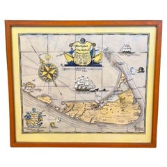
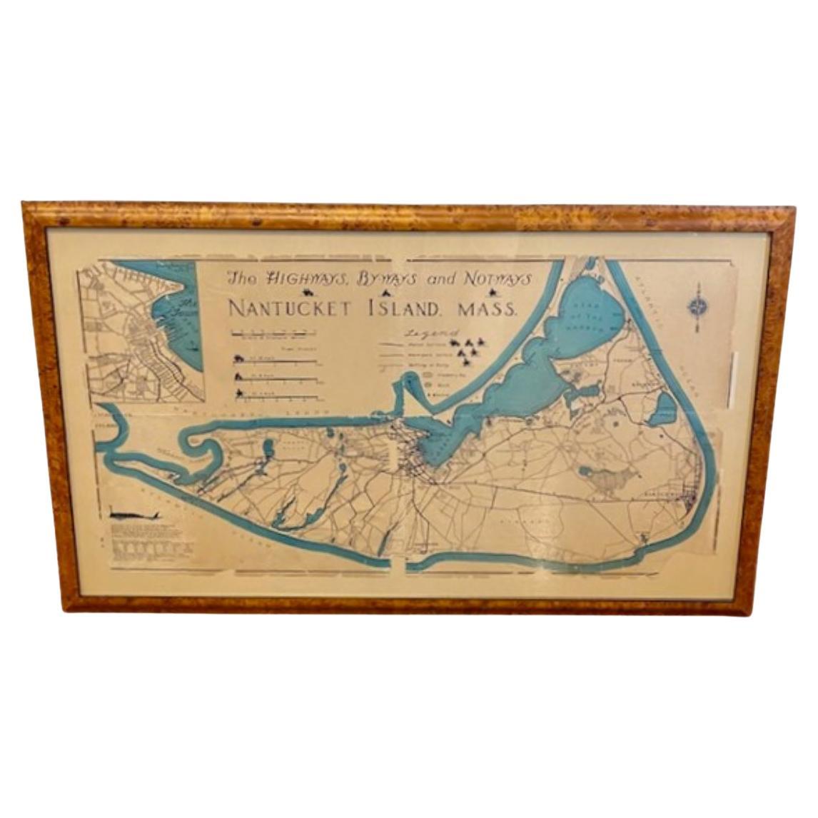
Nantucket High-Ways, By-Ways and Not-Ways Decorative Map by Tony Sarg, ca 1930
By Tony Sarg
Located in Nantucket, MA
Vintage Nantucket High-Ways, By-Ways and Not-Ways Decorative Map by Tony Sarg, (Nantucket: 1880 - 1942) circa 1930, a decorative tourist map of Nantucket Island with details of roadw...
Category
Vintage 1930s American Other Maps
Materials
Paper

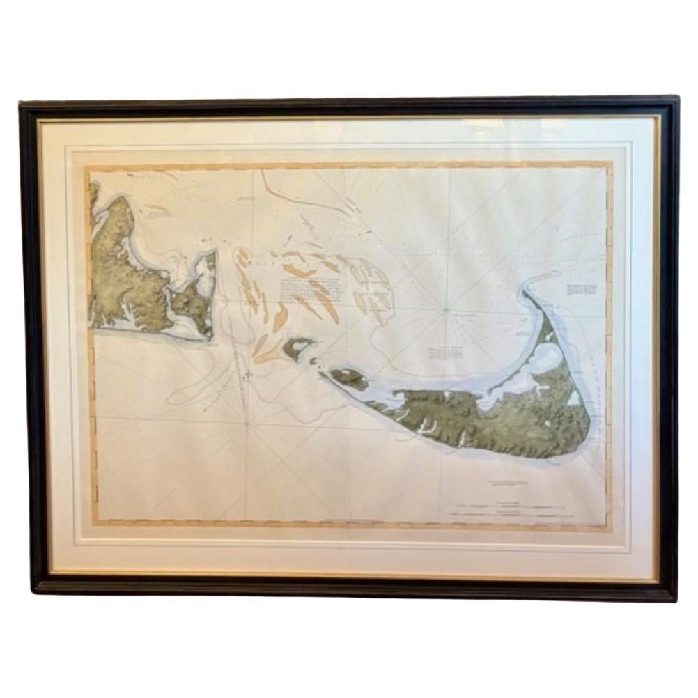
DesBarres (1776) Chart of Nantucket Island, 1966 Restrike
Located in Nantucket, MA
DesBarres (1776) Chart of Nantucket Island and the Eastern Half of Martha's Vineyard Restrike, published by the Massachusetts Historical Society in association with Haley
Steel...
Category
Vintage 1960s American Other Maps
Materials
Paper
18th Century Hand Colored Map of The State of Massachusetts, 1796
Located in Nantucket, MA
18th Century Hand Colored Map of "The State of Massachusetts from the best information," 1796, by cartographer and illustrator John Reid published in his "American Atlas," a period e...
Category
Antique 1790s American American Colonial Maps
Materials
Paper

19th Century Chart of New England Coast, 1847
By U.S. Government
Located in Nantucket, MA
19th Century Chart of New England Coast: the U.S. Coast Survey Sketch A - Section 1, a triangulation chart showing the progress of the survey and details along the New England coas...
Category
Antique 1840s American Other Maps
Materials
Paper

Nantucket Watercolor of Old North Wharf, by Doris and Richard Beer, circa 1940
Located in Nantucket, MA
Vintage Nantucket Watercolor of Old North Wharf, by Doris and Richard Beer, circa 1940, a watercolor on paper view of shell lane down center of ol...
Category
Vintage 1940s American Folk Art Paintings
Materials
Paper
You May Also Like
Antique Map of American Cities, Vignette of New York City, circa 1920
Located in St Annes, Lancashire
Great maps of American Cities
Unframed
Original color
By John Bartholomew and Co. Edinburgh Geographical Institute
Published, circa 1920
Category
Vintage 1920s British Maps
Materials
Paper

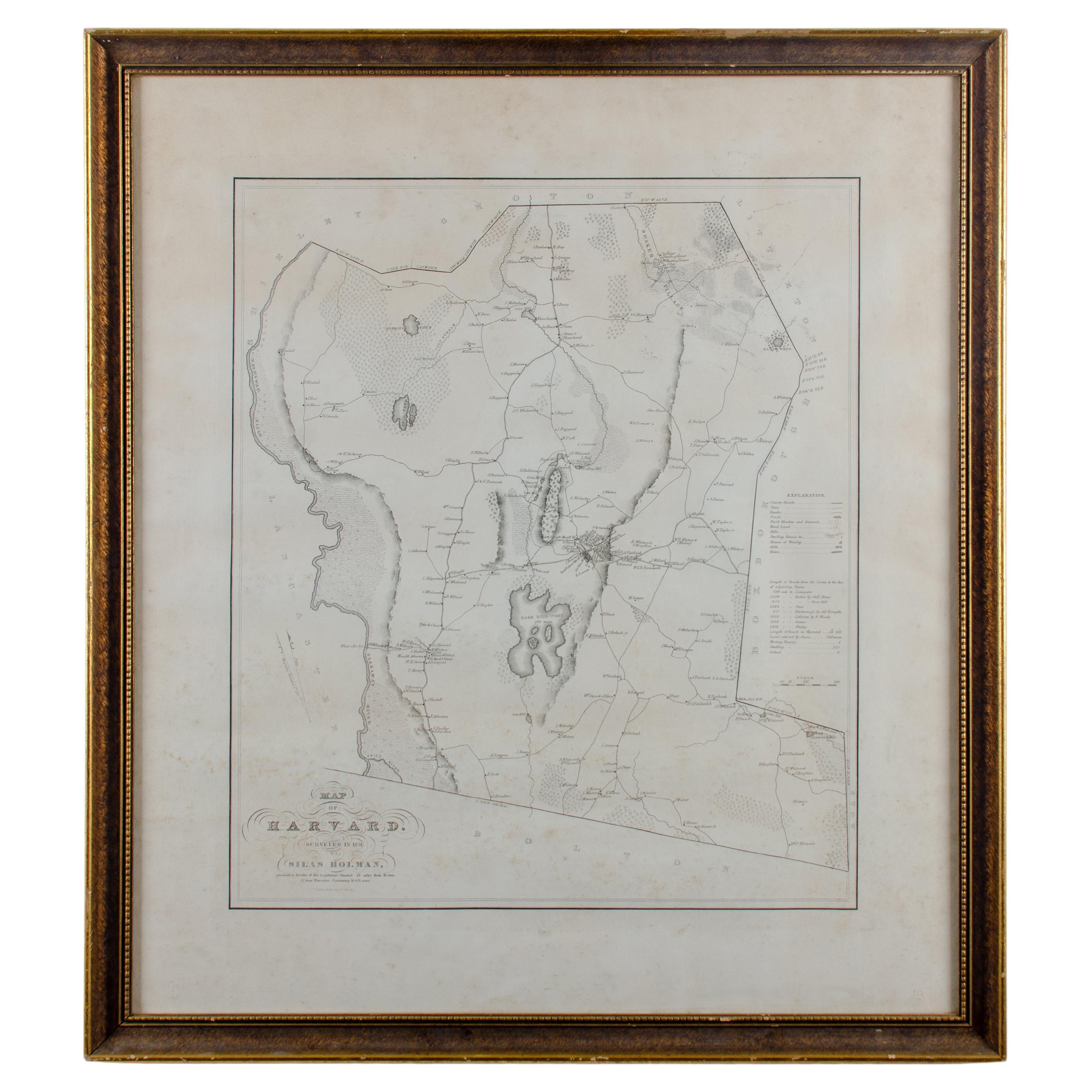
Silas Holman Map of Harvard
Located in Savannah, GA
A framed historic map of Harvard, as surveyed in 1831 by Silas Holman, reproduced circa 1920s.
frame: 29 by 32 inches
Category
Vintage 1920s Other Prints
Materials
Glass, Wood, Paper
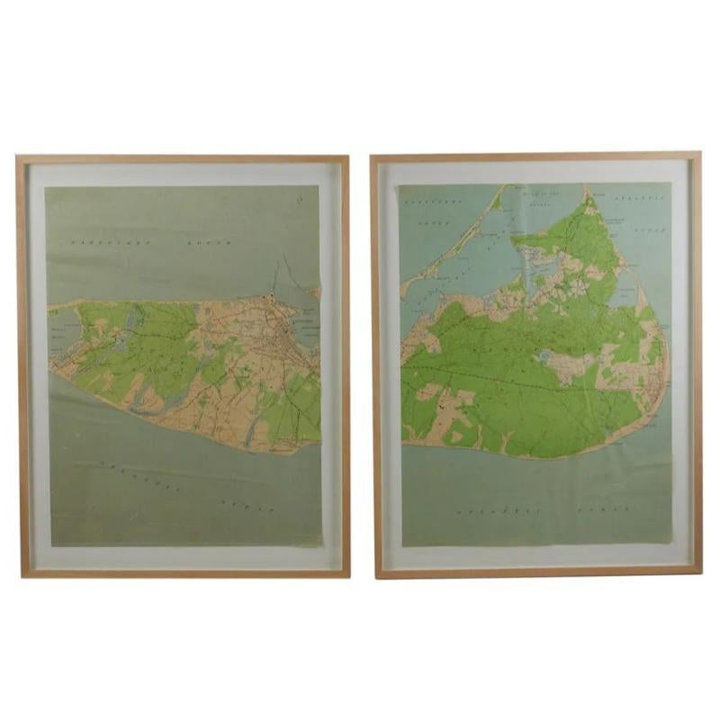
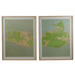
Maps of Nantucket Sound and Harbor Provenance: The Susie Hilfiger Collection
Located in Bristol, CT
Map Sz: 22 1/2"H x 17"W
Frame Sz: 26 1/2"H x 20 3/4"W
*w/ age toning/ slight creasing/ waving to mounted maps*
Provenance: The Susie Hilfiger Collection
From "Point of View", the...
Category
20th Century Drawings and Watercolor Paintings
Materials
Paper
Framed Mid-19th Century Wall Map of Long Island, the Hamptons
Located in Sag Harbor, NY
A Framed museum quality find. This large wall map dates to the mid-1800s. Detailed inset maps of, Sag Harbor, East Hampton, Amagansett, Shelter Island and most villages in Long Island. It also has agriculture stats for 1855. Detailed prints of homes on Scuttle Hole in Bridgehampton as well as several other detailed prints. Lists of businesses, distance tables and railroad schedules and stops. The total amount of detailed information about Suffolk County Long Island is staggering. A unique rare New York map...
Category
Antique Mid-19th Century American Maps
Materials
Linen, Paper

$7,100 Sale Price
20% Off
Antique Map of the City of Haarlem by Tirion, 1742
By Isaak Tirion
Located in Langweer, NL
Antique map titled 'Grondtekening van Haarlem (..)'. Original antique map of the city of Haarlem, the Netherlands. Published by I. Tirion, 1742.
Artists and Engravers: Isaak Tirio...
Category
Antique 18th Century Maps
Materials
Paper
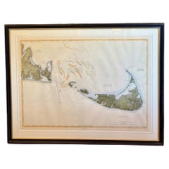
1873 Martha
s Vineyard and Nantucket Chart
Located in Norwell, MA
Original chart of Nantucket and Martha's Vineyard by George Eldridge, Cartographer, 125 State Street, Boston. Dated 1873. Mounted to canvas. Also showing the coast of Cape Cod includ...
Category
Antique 1870s North American Maps
Materials
Paper

More Ways To Browse
The Vintage Map
Black Scandinavian Modern Dining Chairs
Gold Modern Coffee Table
Round Glass Coffee Tables
18th Century Wood Side Tables
Antique Hand Carved Dining Room Sets
Mid Century Modern Pitcher
Vintage Italian Leather Dining Chair
Vintage Movie Posters
Blue Green Wool And Silk Rug
Brown Sheepskin Chair
Vintage Brass Bar Carts
Antique Botanical Prints
Green Persian Rug
17th Century Blue And White
50 X 50 Coffee Table
Antique Wood Panel Painted
Milo Baughman 1970