Items Similar to Two Antique Sea Charts of the Thousand Islands between Batavia and Bantam, c1734

Want more images or videos?
Request additional images or videos from the seller
1 of 7
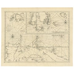
Two Antique Sea Charts of the Thousand Islands between Batavia and Bantam, c1734
$1,585.18per set
$1,981.48per set20% Off
£1,174.07per set
£1,467.58per set20% Off
€1,320per set
€1,650per set20% Off
CA$2,168.45per set
CA$2,710.57per set20% Off
A$2,359.94per set
A$2,949.93per set20% Off
CHF 1,251per set
CHF 1,563.75per set20% Off
MX$28,391.92per set
MX$35,489.90per set20% Off
NOK 15,866.74per set
NOK 19,833.43per set20% Off
SEK 14,516.96per set
SEK 18,146.20per set20% Off
DKK 10,058.63per set
DKK 12,573.28per set20% Off
About the Item
Antique maps titled 'A large draught of the Coast of Iava from Bantam Point to Batavia'. Two seperate sheets, joined together they depict the island of Java, Indonesia.
Condition: Good. Minor tears and repairs. Map has been cleaned before. Please study image carefully.
- Dimensions:Height: 20.08 in (51 cm)Width: 49.61 in (126 cm)Depth: 0.01 in (0.2 mm)
- Sold As:Set of 2
- Materials and Techniques:
- Period:1730-1739
- Date of Manufacture:circa 1734
- Condition:Repaired: Minor repairs and cleaning. Minor fading. Condition: Good. Minor tears and repairs. Map has been cleaned before. Please study image carefully.
- Seller Location:Langweer, NL
- Reference Number:Seller: BG-007791stDibs: LU3054326707092
About the Seller
5.0
Recognized Seller
These prestigious sellers are industry leaders and represent the highest echelon for item quality and design.
Platinum Seller
Premium sellers with a 4.7+ rating and 24-hour response times
Established in 2009
1stDibs seller since 2017
2,813 sales on 1stDibs
Typical response time: 1 hour
- ShippingRetrieving quote...Shipping from: Langweer, Netherlands
- Return Policy
More From This Seller
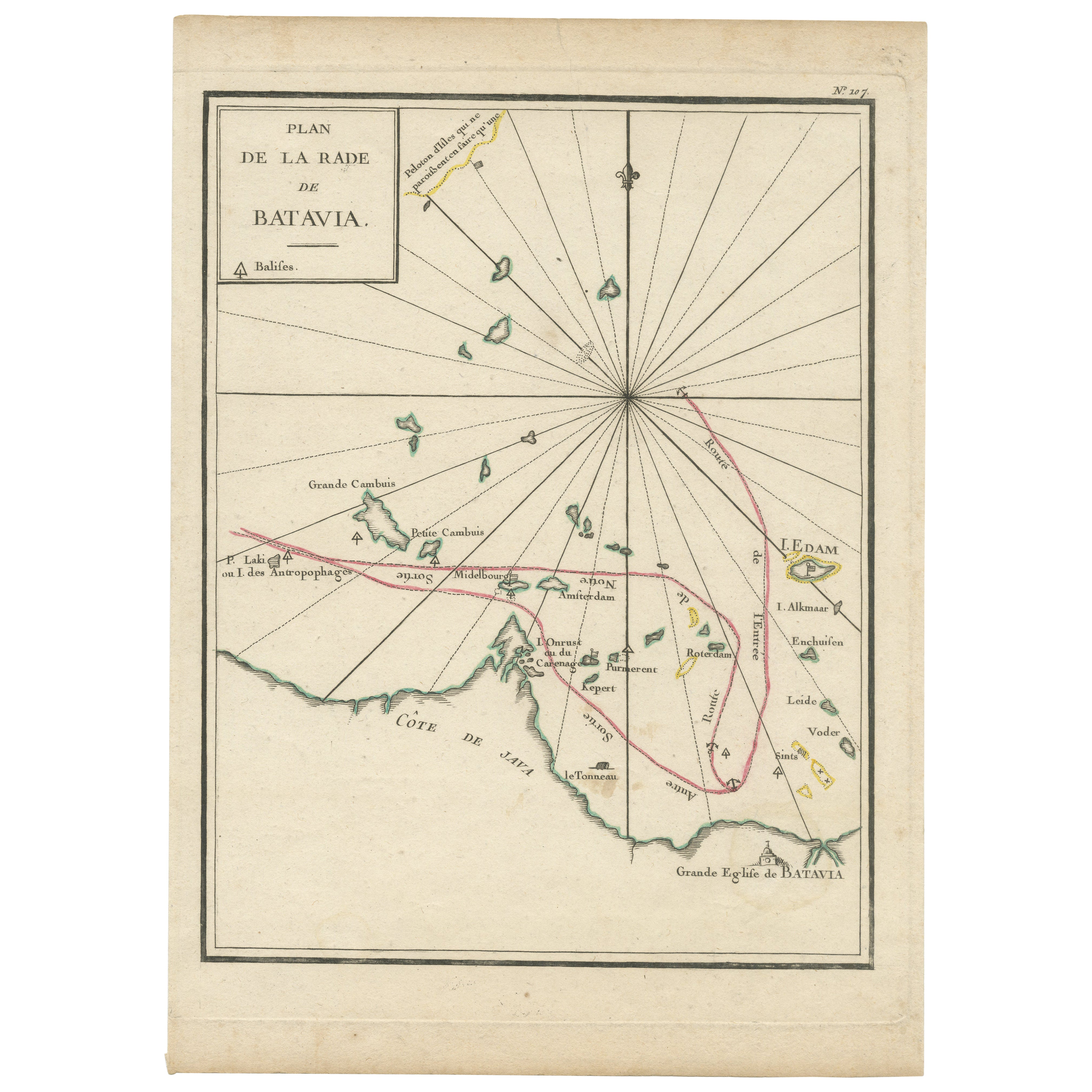
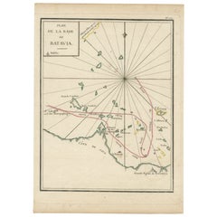
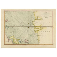
View AllInteresting Map of the Thousand Islands in the Bay of Batavia
Jakarta
, ca.1740
Located in Langweer, NL
A single unfolded page border colored engraved map, printed no. 107 in top corner. This same map is found as plate 107 in Atlas Universelle aus dem Jahre 1787 by Philippe de Pretot b...
Category
Antique 1740s Maps
Materials
Paper
$326 Sale Price
20% Off
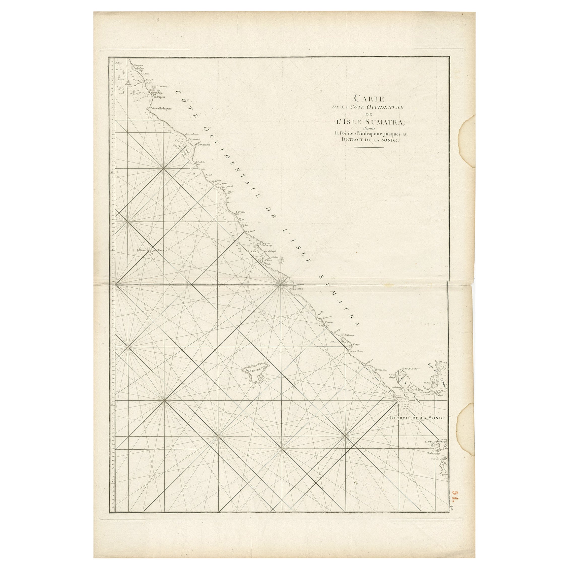
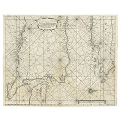
Antique Sea Chart of the Coast of Sumatra, Indonesia, circa 1775
Located in Langweer, NL
Antique map titled 'Carte de la Côte Occidentale de l'Isle Sumatra'. Sea chart of the part of the south-western coast of Sumatra with the Nassau (Nias) and Fortune isles.
Artists ...
Category
Antique 18th Century Maps
Materials
Paper
$518 Sale Price
20% Off
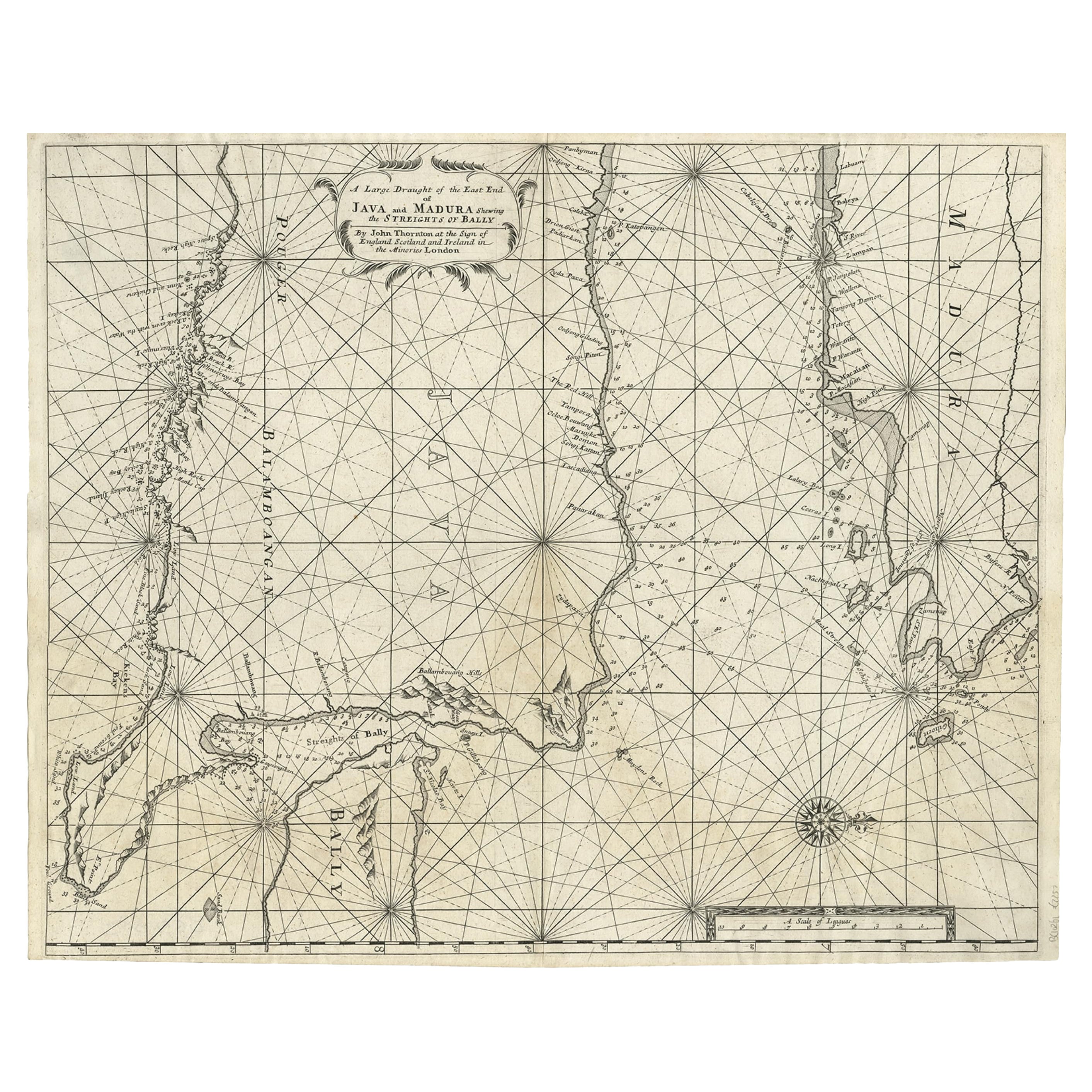
Rare Old English Sea Chart of Part of Indonesia with Java, Madura and Bali, 1711
Located in Langweer, NL
Antique map titled 'A Large Draught of the East End of Java and Madura shewing the Streights of Bally.'
Rare early example of this working English Sea Chart of part of Indonesia ...
Category
Antique 1710s British Maps
Materials
Paper
$1,585 Sale Price
20% Off
Sea Chart of Part of the Southwestern Coast of Sumatra
Nias, Indonesia, C1775
Located in Langweer, NL
Antique map titled 'Carte de la Côte Occidentale de l'Isle Sumatra'. Sea chart of the part of the south-western coast of Sumatra with the Nassau (Nias) and Fortune isles.
Artists ...
Category
Antique 1770s Maps
Materials
Paper

$486 Sale Price
25% Off
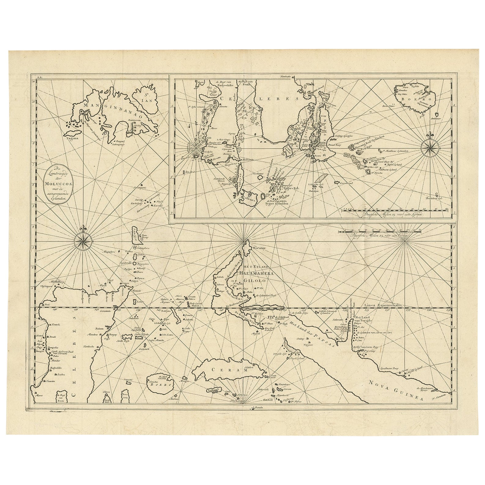
Large Antique Detailed Map of a Part of the Spice Islands, Indonesia, 1726
Located in Langweer, NL
Antique matitled 'De Landvoogdy der Moluccos met de aangrenzende Eylanden'.
Large detailed map of a part of the Spice Islands. It includes Baru (Boero), Ambon, Seram and part of Ma...
Category
Antique 1720s Maps
Materials
Paper
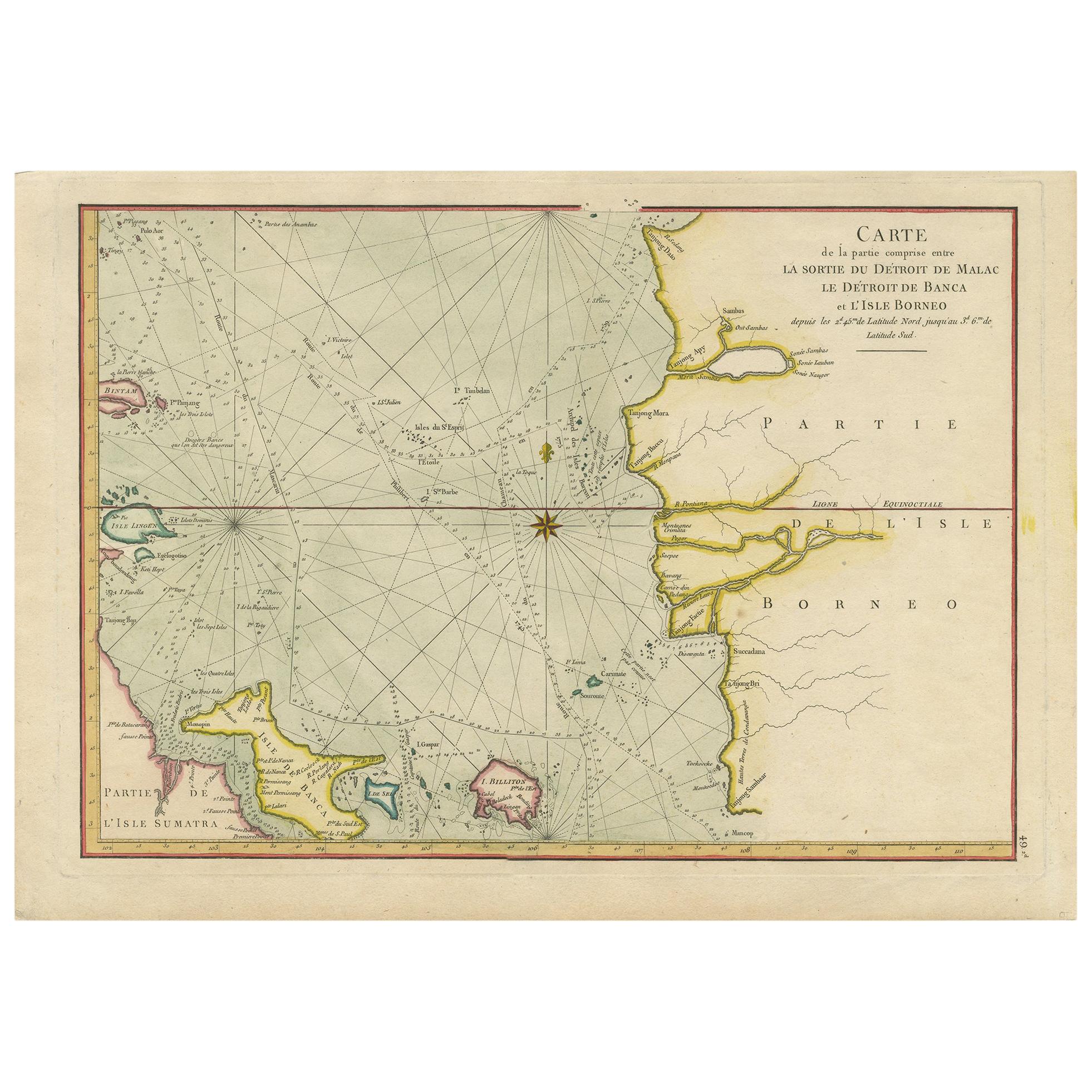
Antique Map of the Malacca and Bangka Strait by De Mannevillette
1775
Located in Langweer, NL
Antique map titled 'Carte de la Partie Comprise entre la Sortie du Detroit de Malac Le Detroit de Banca et L’Isle Borneo'. Chart of the Strait of Malacca and Bangka Strait. It shows ...
Category
Antique Late 18th Century Maps
Materials
Paper
$1,152 Sale Price
20% Off
You May Also Like
Plymouth, England: A Hand-Colored 17th Century Sea Chart by Captain Collins
By Captain Greenvile Collins
Located in Alamo, CA
This hand-colored sea chart of the area around Plymouth, England from "Great Britain's Coasting Pilot. Being a New and Exact Survey of the Sea-Coast of England", first published in 1...
Category
Antique Late 17th Century English Maps
Materials
Paper

$2,220 Sale Price
20% Off
West Coast of Africa, Guinea
Sierra Leone: An 18th Century Map by Bellin
By Jacques-Nicolas Bellin
Located in Alamo, CA
Jacques Bellin's copper-plate map entitled "Partie de la Coste de Guinee Dupuis la Riviere de Sierra Leona Jusquau Cap das Palmas", depicting the coast of Guinea and Sierra Leone in ...
Category
Antique Mid-18th Century French Maps
Materials
Paper

$460 Sale Price
20% Off
Dartmouth, England: A Hand-Colored 17th Century Sea Chart by Captain Collins
By Captain Greenvile Collins
Located in Alamo, CA
This hand-colored sea chart of the area around Dartmouth, England is from "Great Britain's Coasting Pilot. Being a New and Exact Survey of the Sea-Coast of England", first published ...
Category
Antique Late 17th Century English Maps
Materials
Paper

$2,220 Sale Price
20% Off
Hand-Colored 18th Century Homann Map of Denmark and Islands in the Baltic Sea
By Johann Baptist Homann
Located in Alamo, CA
An 18th century copper plate hand-colored map entitled "Insulae Danicae in Mari Balthico Sitae utpote Zeelandia, Fionia, Langelandia, Lalandia, Falstria, Fembria Mona" created by Joh...
Category
Antique Early 18th Century German Maps
Materials
Paper

$620 Sale Price
20% Off
Antique Map - Mare Pacificum - Etching by Johannes Janssonius - 1650s
By Johannes Janssonius
Located in Roma, IT
Mare Pacificum is an antique map realized in 1650 by Johannes Janssonius (1588-1664).
The Map is Hand-colored etching, with coeval watercolorang.
Good conditions with slight foxing...
Category
1650s Modern Figurative Prints
Materials
Etching

Captain Cook
s Exploration of Tahiti 18th C. Hand-Colored Map by Bellin
By Jacques-Nicolas Bellin
Located in Alamo, CA
This beautiful 18th century hand-colored copper plate engraved map is entitled "Carte de l'Isle de Taiti, par le Lieutenant J. Cook" was created by Jacques Nicolas Bellin and publish...
Category
Antique Mid-18th Century French Maps
Materials
Paper

$620 Sale Price
20% Off
More Ways To Browse
Persian Maps
Afghanistan Antique Map
Antique Furniture Delaware
Antique Furniture Wisconsin
Antique Map By Coronelli
Antique Map Iceland
Cyprus Antique Maps
John Speed Maps
M Howard
Used Office Furniture Michigan
Antique Geological Maps
Antique Manitoba
Australian Colonial
Bengal Map
Stanford Furniture
Tennessee Antique Furniture
Used Furniture Alabama
Used Office Furniture Maine