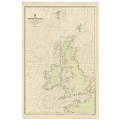
Items Similar to Uncommon, Large Map of the British Islands to Petshora Bay, 1891
Want more images or videos?
Request additional images or videos from the seller
1 of 5
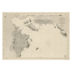
Uncommon, Large Map of the British Islands to Petshora Bay, 1891
$1,115.36
$1,394.2020% Off
£826.19
£1,032.7320% Off
€928
€1,16020% Off
CA$1,525.78
CA$1,907.2220% Off
A$1,663.02
A$2,078.7820% Off
CHF 879.22
CHF 1,099.0320% Off
MX$20,019.61
MX$25,024.5120% Off
NOK 11,159.55
NOK 13,949.4320% Off
SEK 10,231.02
SEK 12,788.7820% Off
DKK 7,070.85
DKK 8,838.5620% Off
About the Item
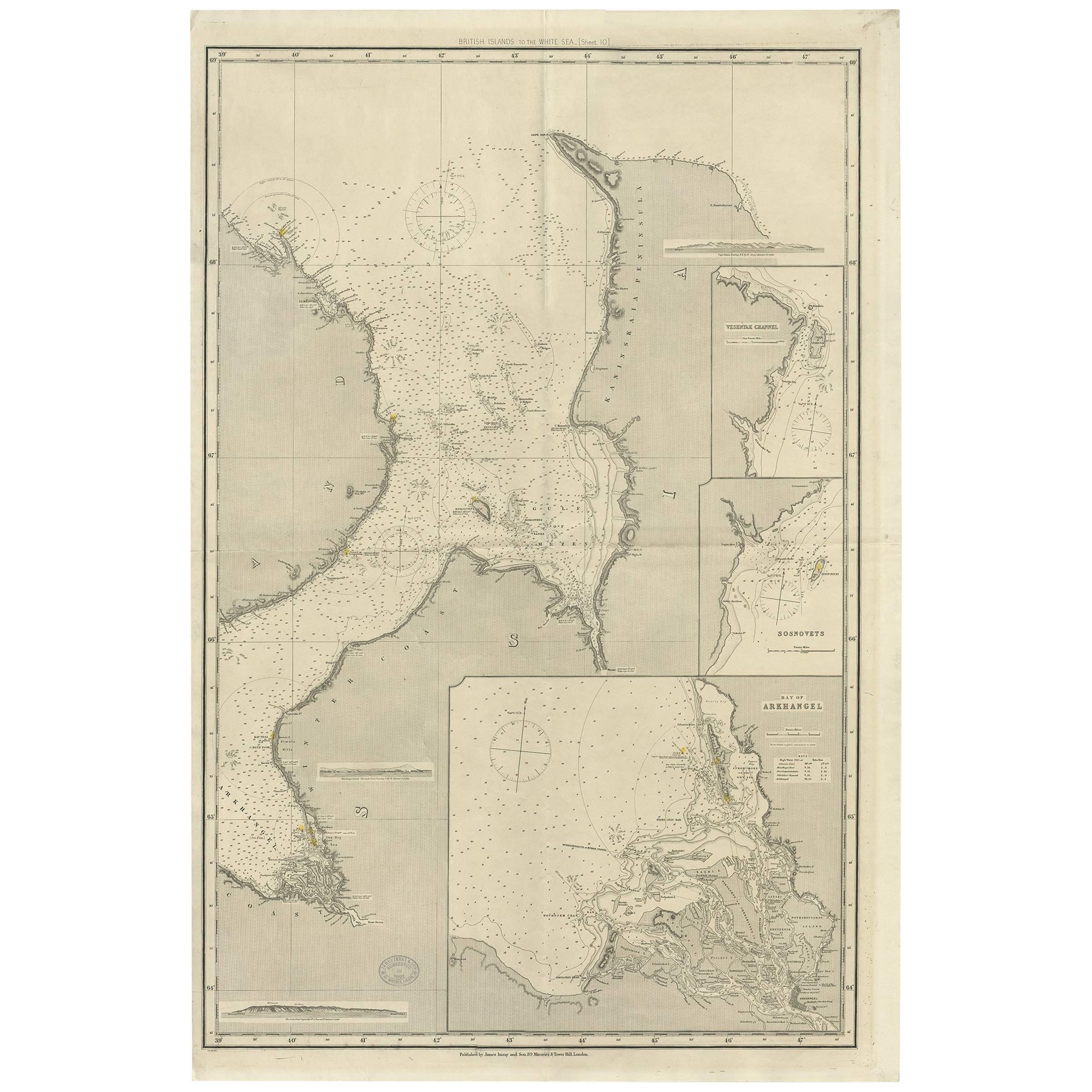
Antique map titled 'British Islands to Petshora Bay - White Sea'. Uncommon, large map of the British Islands to Petshora Bay. It shows the White Sea and inset maps of Onega Road, Onega Bay, Sem Islands, Iukanskie and Nokuev Island.
Artists and Engravers: Published by James Imray and Son.
- Dimensions:Height: 42.13 in (107 cm)Width: 27.56 in (70 cm)Depth: 0 in (0.02 mm)
- Materials and Techniques:
- Period:
- Date of Manufacture:1891
- Condition:Condition: Good, general age-related toning. Small defect/split in center of the folding lines, blank verso. Please study image carefully.
- Seller Location:Langweer, NL
- Reference Number:Seller: BG-061901stDibs: LU3054327386192
About the Seller
5.0
Recognized Seller
These prestigious sellers are industry leaders and represent the highest echelon for item quality and design.
Platinum Seller
Premium sellers with a 4.7+ rating and 24-hour response times
Established in 2009
1stDibs seller since 2017
2,811 sales on 1stDibs
Typical response time: 1 hour
- ShippingRetrieving quote...Shipping from: Langweer, Netherlands
- Return Policy
More From This Seller
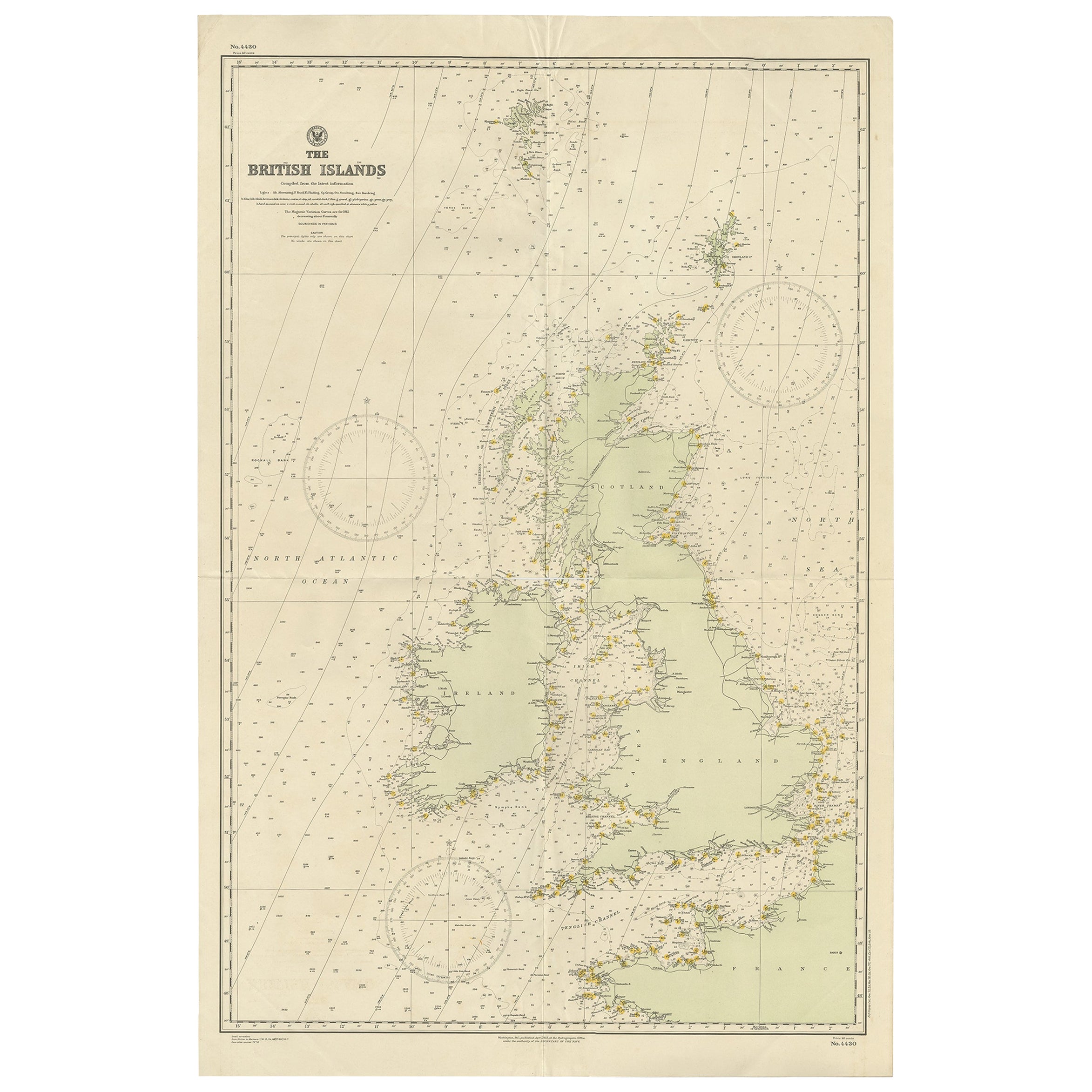
View AllAntique Map of the British Islands to the White Sea by J. Imray
Located in Langweer, NL
Antique large nautical chart of the British Islands to the White Sea. With insets of Veshnyak Channel, Sosnovets and the Bay of Arkhangel. Published by James Irmay and Son, circa 1875.
Category
Antique Late 19th Century Maps
Materials
Paper
Large Sea Chart of the British Islands, 1918
Located in Langweer, NL
Antique map titled 'The British Islands'.
Large sea chart of the British Islands. It shows Ireland, Scotland, England, the Shetland Islands and part of Fra...
Category
Vintage 1910s Maps
Materials
Paper
$538 Sale Price
20% Off
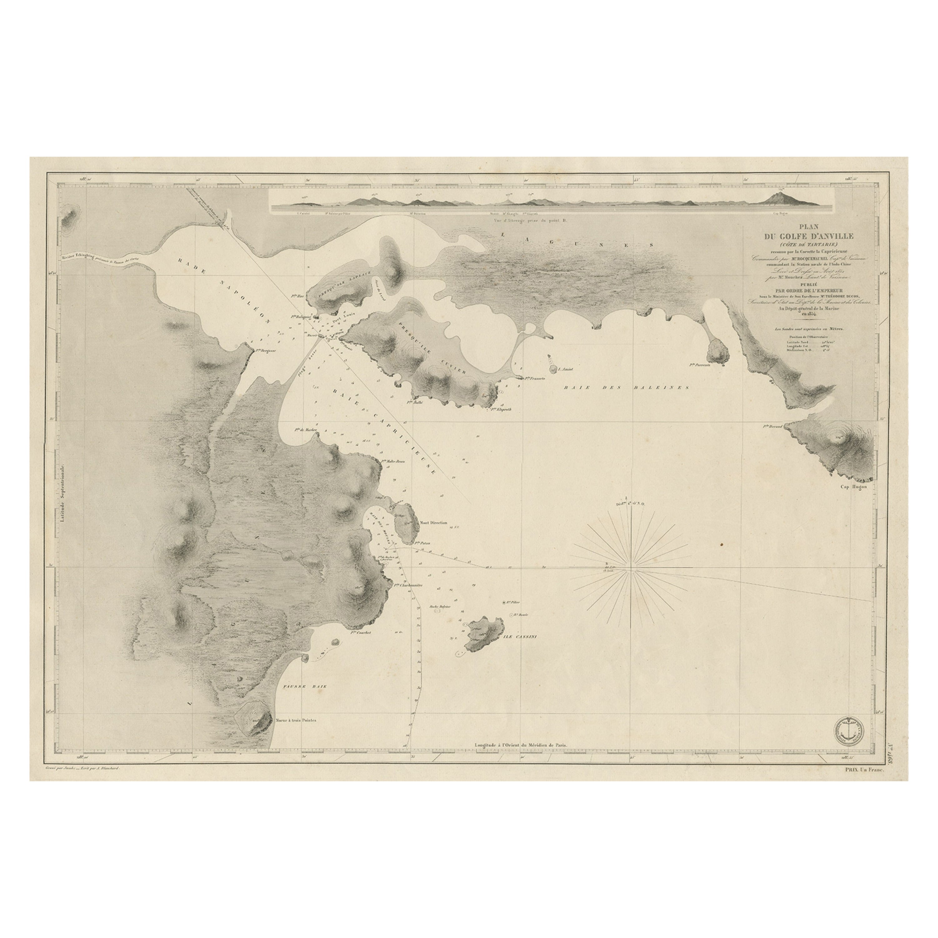
Antique Map of Part of the Chinese Coast, Explored by the French, Ca.1852
Located in Langweer, NL
Antique map titled 'Plan du Golfe D'Anville (Côte de Tartarie)'.
Old map of part of the Chinese coast, explored with the French corvette 'Caprieuse'. The Capricieuse was a late 2...
Category
Antique 1850s Maps
Materials
Paper
$664 Sale Price
34% Off
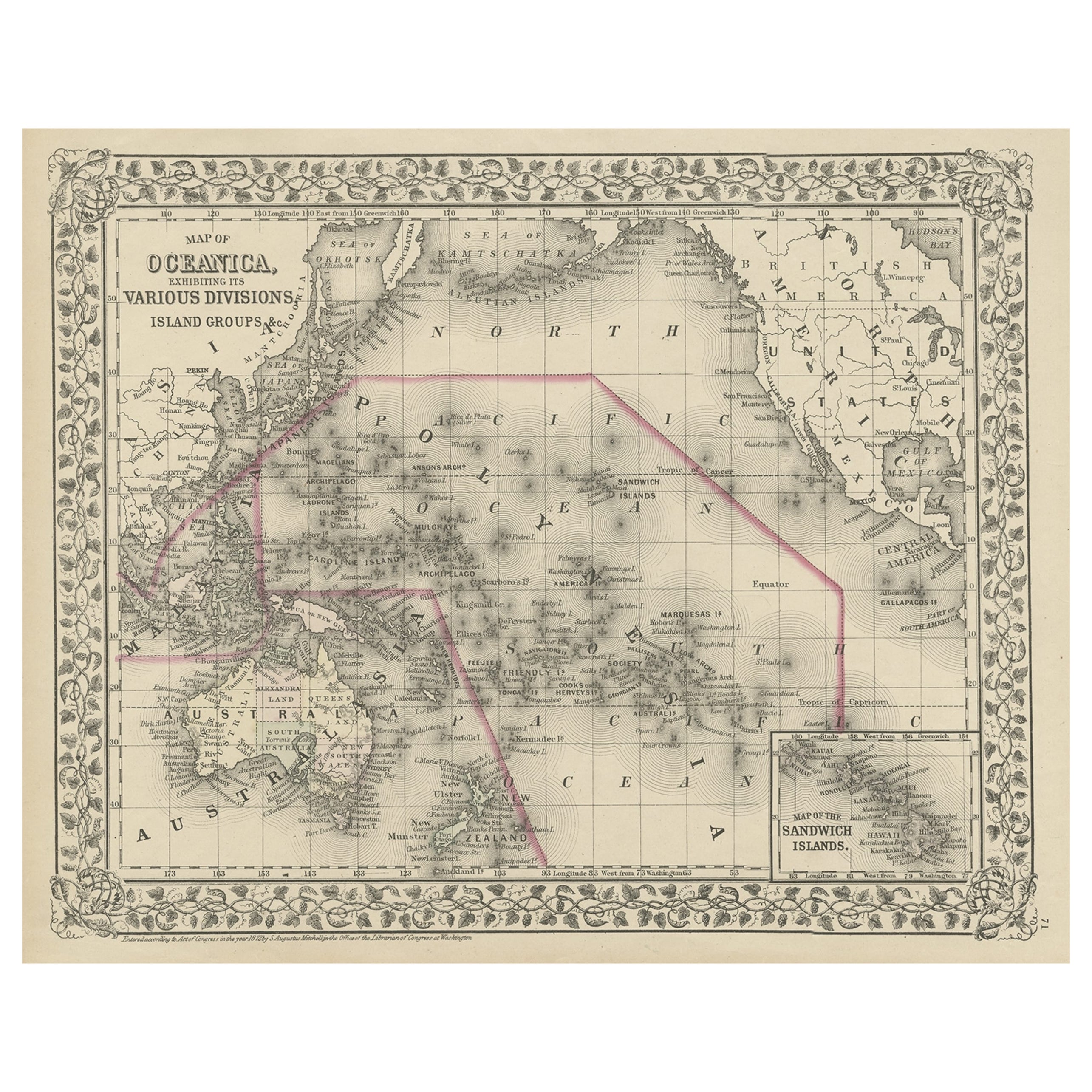
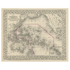
Old Map of the Pacific, Incl Australia, Polynesia, Melanesia and Malaysia, 1872
Located in Langweer, NL
Antique map Oceania titled 'Map of Oceanica exhibiting its various divisions, island groups & c'.
Map of the Pacific, including Australia, Polynes...
Category
Antique 1870s Maps
Materials
Paper
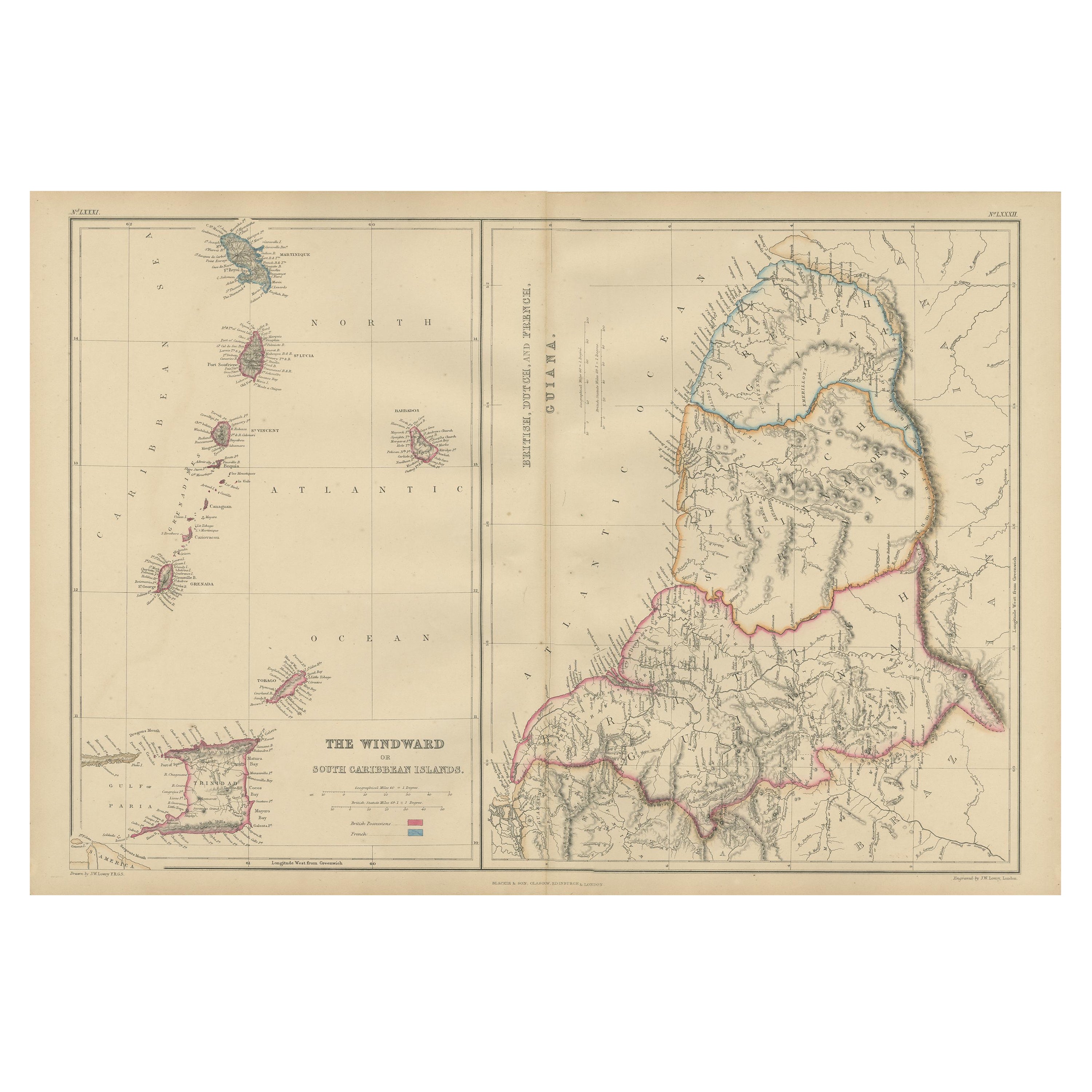
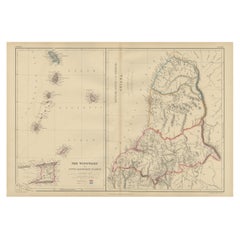
Antique Map the Windward or South Caribbean Islands and Guiana, 1859
Located in Langweer, NL
Antique map titled 'The Windward or South Caribbean Islands'. Original antique map of South Caribbean Islands. This map originates from ‘The Imperial Atlas of Modern Geography’. Published by W. G. Blackie, 1859.
The Windward Islands, also known as the Islands of Barlovento, are the southern, generally larger islands of the Lesser Antilles. Part of the West Indies, they lie south of the Leeward Islands...
Category
Antique Mid-19th Century Maps
Materials
Paper
Antique Map of Taluti Bay by Stemler, C.1875
Located in Langweer, NL
Antique map titled 'Kaart der Teloeti Baai op Ceram.' This scarce map shows the Taluti Bay on the Moluccan island of Ceram. Originates from 'Tijdschrift Aardrijkskundig Genootschap',...
Category
Antique 19th Century Maps
Materials
Paper

$118 Sale Price
20% Off
You May Also Like
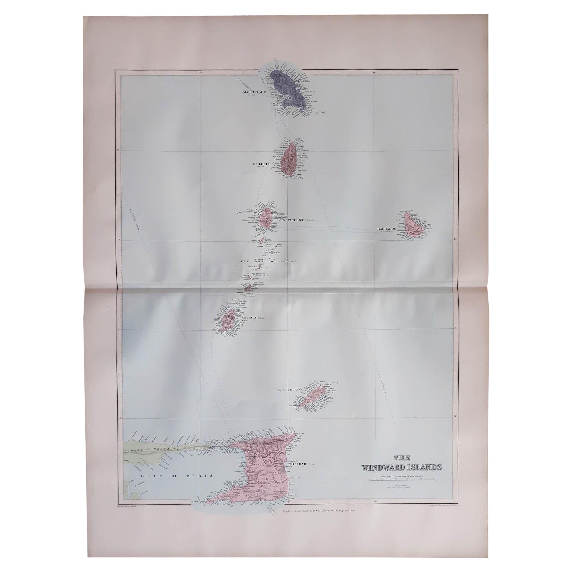
Large Original Antique Map of the The Windward Islands. 1894
Located in St Annes, Lancashire
Superb Antique map of The Windward Islands
Published Edward Stanford, Charing Cross, London 1894
Original colour
Good condition
Unframed.
Free shipping
Category
Antique 1890s English Maps
Materials
Paper

Large Original Antique Map of The Leeward Islands. 1894
Located in St Annes, Lancashire
Superb Antique map of The Leeward Islands
Published Edward Stanford, Charing Cross, London 1894
Original colour
Good condition
Unframed.
Free shipping
Category
Antique 1890s English Maps
Materials
Paper

Large Original Antique Map of The Greek Islands. 1894
Located in St Annes, Lancashire
Superb Antique map of The Greek Islands
Published Edward Stanford, Charing Cross, London 1894
Original colour
Good condition
Unframed.
Free shipping
Category
Antique 1890s English Maps
Materials
Paper

Large Original Antique Map of The Canary Islands. 1894
Located in St Annes, Lancashire
Superb Antique map of The Canary Islands
Published Edward Stanford, Charing Cross, London 1894
Original colour
Good condition
Unframed.
Free shipping
Category
Antique 1890s English Maps
Materials
Paper

Original Antique Map of US Possessions In The Pacific Ocean, C.1900
Located in St Annes, Lancashire
Fabulous map of US possessions in the Pacific Ocean
Original color.
Engraved and printed by the George F. Cram Company, Indianapolis.
Published, C.1900.
Unframed.
Free shipping.
Category
Antique 1890s American Maps
Materials
Paper

Large Original Antique Map of The Falkland Islands. 1894
Located in St Annes, Lancashire
Superb Antique map of The Falkland Islands
Published Edward Stanford, Charing Cross, London 1894
Original colour
Good condition
Unframed.
Free shipping
Category
Antique 1890s English Maps
Materials
Paper

More Ways To Browse
Antique Map Of Thailand
Louisiana Antique Furniture
Map Of Ancient Greece
Map Of Native American Tribes
Old Spice
Romania Map
Used Furniture Nova Scotia
18th Century Scottish Collectibles
Antique Furniture Northumberland
Antique Map Nova Scotia
Antique Map Palestine
California Island Map
Constantinople Map
Croatian Antiques
Jamaican Antique
Large Map Of Italy
Louisiana Antiques
Maps South East Asia