Items Similar to United States Antique Map c.1888 – Railroads, Territories
State Stats

Video Loading
Want more images or videos?
Request additional images or videos from the seller
1 of 11
United States Antique Map c.1888 – Railroads, Territories
State Stats
$550.19
£408.55
€460
CA$755.88
A$821.79
CHF 435.71
MX$9,851.16
NOK 5,537.69
SEK 5,073.28
DKK 3,506.68
About the Item
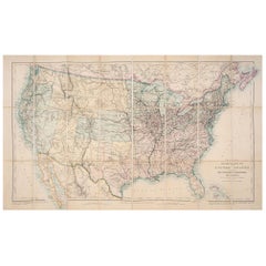
Antique Map of the United States – Rand McNally, circa 1888
This antique map of the United States was published by Rand, McNally
Co. around 1888. It presents a colorful overview of the nation during a period of expansion, industrialization, and rail connectivity, offering both decorative appeal and historical insight.
The map covers the full United States, with each state and territory outlined in distinctive pastel colors. Major cities and towns are marked, and the dense network of railroads—one of Rand McNally’s specialties—is shown with exceptional clarity, particularly in the eastern states. The western frontier states and territories, including Dakota (still undivided into North and South), Montana, Wyoming, Arizona, and New Mexico, reflect the nation’s ongoing development just before statehood.
The map includes Alaska, shown as “Russian Possessions” transitioning to U.S. territory, and an inset list at right provides statistical data for each state, including population and size. The Gulf of Mexico, Atlantic Ocean, and Pacific coastline are finely engraved with wave patterns, enhancing the map’s decorative qualities.
This nationwide view complements Rand McNally’s detailed state and regional maps, serving as both a general reference and a striking display piece. It appeals strongly to collectors of Americana, U.S. cartography, and 19th-century transportation history.
Condition report:
Very good condition with mild age toning. Original center fold as issued with slight darkening along the crease. Plate mark visible. Margins clean with minimal handling wear. Strong impression with vibrant original outline colors.
Framing tips:
A black or walnut frame with a cream mat will highlight the pastel coloring. For emphasis on the coastal detail, a double mat with ivory outer and muted blue inner will bring out the engraved oceans and create a balanced presentation.
Technique: Lithograph with original hand-color
Maker: Rand, McNally
Co., Chicago, circa 1888
--
- Dimensions:Height: 14.18 in (36 cm)Width: 20.67 in (52.5 cm)Depth: 0.01 in (0.2 mm)
- Materials and Techniques:Paper,Engraved
- Place of Origin:
- Period:
- Date of Manufacture:1888
- Condition:Very good condition with mild age toning. Original center fold as issued with slight darkening along the crease. Plate mark visible. Margins clean with minimal handling wear. Strong impression with vibrant original outline colors.
- Seller Location:Langweer, NL
- Reference Number:Seller: BG-12794-121stDibs: LU3054346475652
About the Seller
5.0
Recognized Seller
These prestigious sellers are industry leaders and represent the highest echelon for item quality and design.
Platinum Seller
Premium sellers with a 4.7+ rating and 24-hour response times
Established in 2009
1stDibs seller since 2017
2,823 sales on 1stDibs
Typical response time: 1 hour
- ShippingRetrieving quote...Shipping from: Langweer, Netherlands
- Return Policy
More From This Seller
View All1874 Map of Western United States – Detailed Atlas by Keith Johnston
Located in Langweer, NL
1874 Map of Western United States by Keith Johnston – Detailed Atlas
This is an original antique map titled “United States of North America (Western States)” by Alexander Keith John...
Category
Antique 1870s Scottish Maps
Materials
Paper

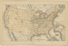
Antique Railroad Map of the United States by Rand, McNally
Co, 1900
Located in Langweer, NL
Antique map titled 'Rand, McNally & Co's New Official Railroad map of the United States with portions of The Dominion of Canada, The Republic of Mexico and the West Indies'. Large railroad map of the United States, sectionalised and laid on linen. Map shows state boundaries for the United States, Mexico, the West Indies, and lower portion of Canada; major cities and towns, military posts, Native American reservations, and railroads; Oklahoma and "Indian Territory." Inset: "Map of Alaska...
Category
20th Century Maps
Materials
Linen, Paper

$2,242 Sale Price
25% Off
Free Shipping
1876 Map of the United States: Detailing the Railroads and Unsettled Territories
Located in Langweer, NL
Stanford’s Smaller Railway Map of the United States, 1876
This original 1876 map, titled "Stanford's Smaller Railway Map of the United States Distinguishing the Unsettled Territorie...
Category
Antique 1870s Maps
Materials
Paper
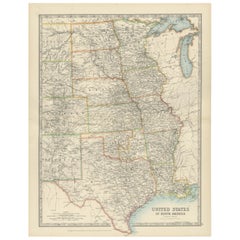
Map of Western United States 1903 – Railroads, State Borders, and Terrain
Located in Langweer, NL
Map of Western United States 1903 – Railroads, State Borders, and Terrain
This beautifully engraved map titled "United States of North America (Western Sheet)" was created by Keith ...
Category
Early 20th Century Maps
Materials
Paper

1874 Map of the United States with Territorial Boundaries
Located in Langweer, NL
Title: 1874 Map of the United States with Territorial Boundaries
Description: This is an 1874 map titled "Map of the United States," showcasing the country during a period of rapid ...
Category
Antique 1870s Maps
Materials
Paper
$248 Sale Price
20% Off
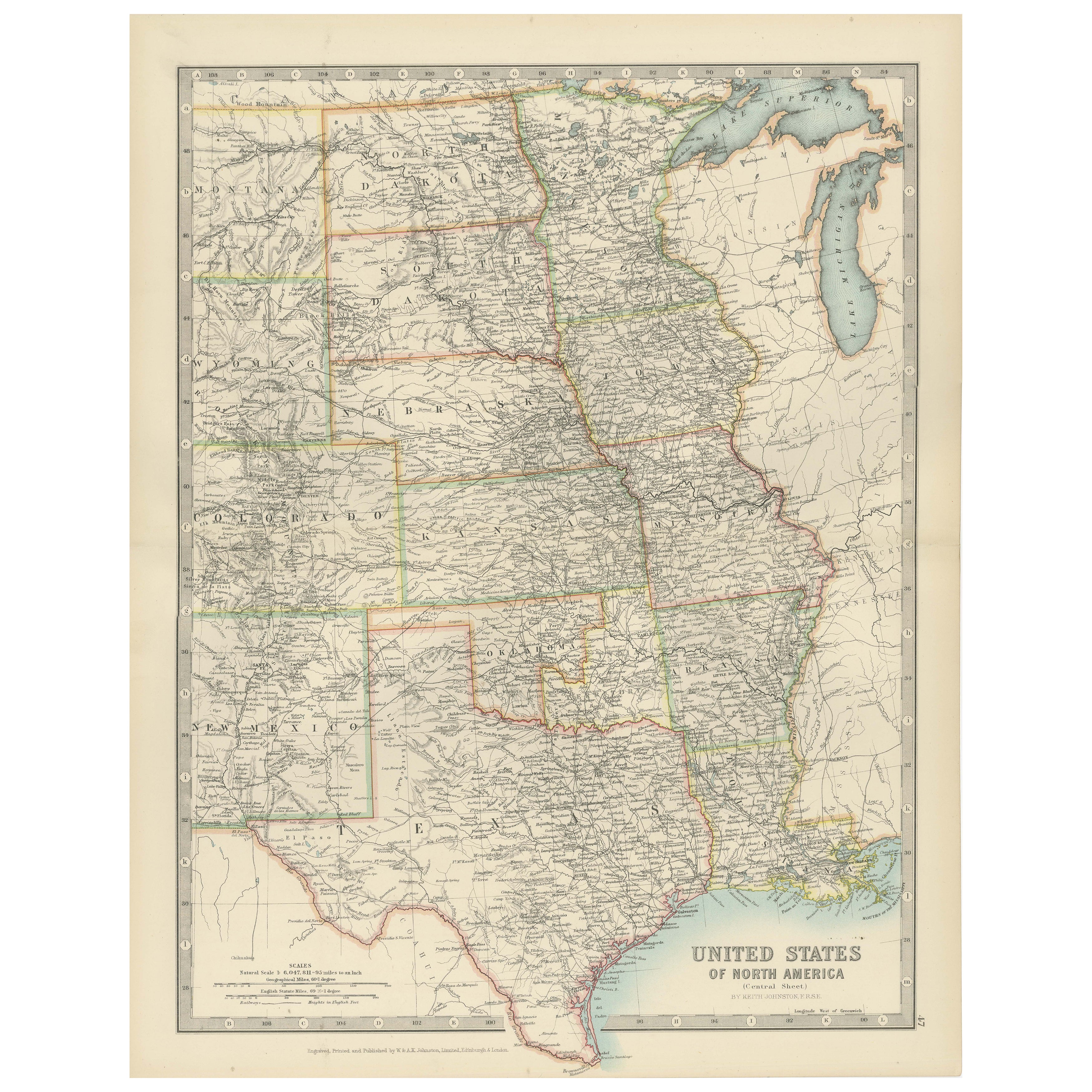
Map of United States Central Sheet 1903 – Railroads, States, and Topography
Located in Langweer, NL
Map of United States Central Sheet 1903 – Railroads, States, and Topography
This is a finely engraved and beautifully colored map titled "United States of North America (Central She...
Category
Early 20th Century English Maps
Materials
Paper
$325 Sale Price
20% Off
You May Also Like
Original Antique Map of The United States of America by Dower, circa 1835
Located in St Annes, Lancashire
Nice map of the USA
Drawn and engraved by J.Dower
Published by Orr & Smith. C.1835
Unframed.
Free shipping
Category
Antique 1830s English Maps
Materials
Paper

Original Antique Map of United States, Grattan and Gilbert, 1843
Located in St Annes, Lancashire
Great map of United States
Drawn and engraved by Archer
Published by Grattan and Gilbert. 1843
Original colour
Unframed.
Category
Antique 1840s English Maps
Materials
Paper

Large Original Antique Map of the United States of America. 1891
By Rand McNally
Co.
Located in St Annes, Lancashire
Fabulous map of The United States
Original color
By Rand, McNally & Co.
Dated 1891
Unframed
Free shipping.
Category
Antique 1890s American Maps
Materials
Paper

North America. Century Atlas antique vintage map
Located in Melbourne, Victoria
'The Century Atlas. North America'
Original antique map, 1903.
Central fold as issued. Map name and number printed on the reverse corners.
Sheet 40cm by 29.5cm.
Category
Early 20th Century Victorian More Prints
Materials
Lithograph

1866 "Johnson
s United States" Map, Published by Johnson and Ward
Located in Colorado Springs, CO
Presented is a detailed map of the United States by A. J. Johnson. Spanning the whole of the continental United States, as well as adjacent parts of Canada and Mexico, the map reflec...
Category
Antique 1860s American Victorian Maps
Materials
Paper

1856 "Map of the United States" by Ensign, Bridgeman, and Fanning
Located in Colorado Springs, CO
Presented is a scarce American wall map of the United States and Mexico issued by Ensign, Bridgman, and Fanning in 1856. As the title suggests, the map covers all of the United State...
Category
Antique 1850s American Victorian Maps
Materials
Paper
