Items Similar to Upper
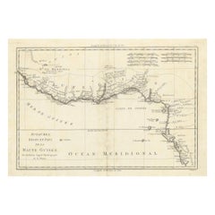
Lower Guinea Coast Map – West Africa by Bonne c.1780

Want more images or videos?
Request additional images or videos from the seller
1 of 9
Upper
Lower Guinea Coast Map – West Africa by Bonne c.1780
$408.65
£302.70
€340
CA$559.01
A$609.30
CHF 322.13
MX$7,334.77
NOK 4,088.63
SEK 3,748.44
DKK 2,590.61
About the Item
Upper
Lower Guinea Coast Map – West Africa by Bonne c.1780
DESCRIPTION
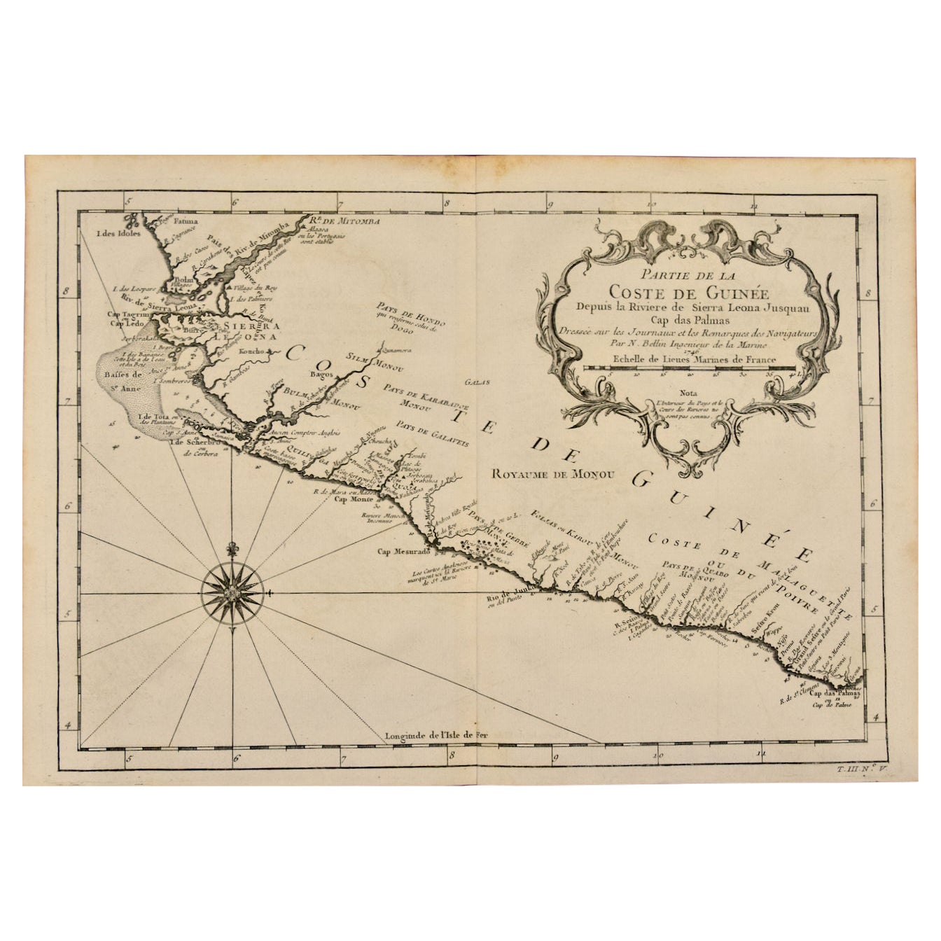
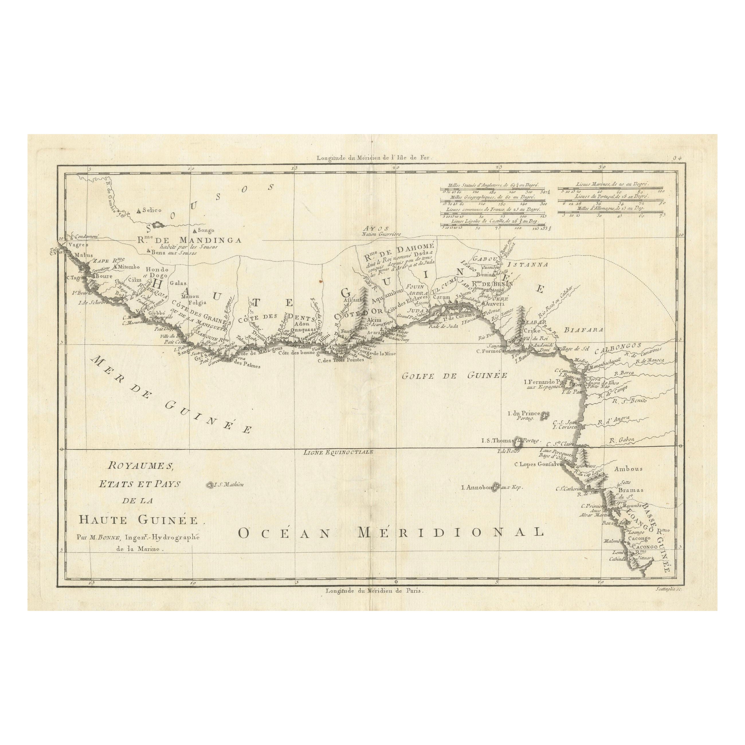
This detailed coastal map covers Upper and Lower Guinea, extending from Sierra Leone toward Central Africa. Compiled by Rigobert Bonne, it reflects European maritime priorities, showing river mouths, anchorages, and coastal settlements essential to navigation and trade. Inland detail diminishes rapidly, illustrating contemporary limits of geographic knowledge. The map documents a critical region in Atlantic trade history and remains a powerful historical reference.
KEYWORDS
Guinea Coast map, Sierra Leone, Congo coast, Atlantic trade routes, West Africa ports, maritime Africa
CONDITION REPORT
Uniform toning. Central fold as issued. Light marginal wear and minor spotting.
FRAMING TIPS
Wide mat balances the horizontal format; muted gilt or dark wood frame recommended.
Technique: Engraving
Maker: Rigobert Bonne, France, circa 1780
- Dimensions:Height: 10.24 in (26 cm)Width: 16.15 in (41 cm)Depth: 0.01 in (0.2 mm)
- Materials and Techniques:Paper,Engraved
- Place of Origin:
- Period:
- Date of Manufacture:Circa 1780
- Condition:Uniform toning. Central fold as issued. Light marginal wear and minor spotting.
- Seller Location:Langweer, NL
- Reference Number:Seller: BG-14105-101stDibs: LU3054348107922
About the Seller
5.0
Recognized Seller
These prestigious sellers are industry leaders and represent the highest echelon for item quality and design.
Platinum Seller
Premium sellers with a 4.7+ rating and 24-hour response times
Established in 2009
1stDibs seller since 2017
2,813 sales on 1stDibs
Typical response time: 1 hour
- ShippingRetrieving quote...Shipping from: Langweer, Netherlands
- Return Policy
More From This Seller
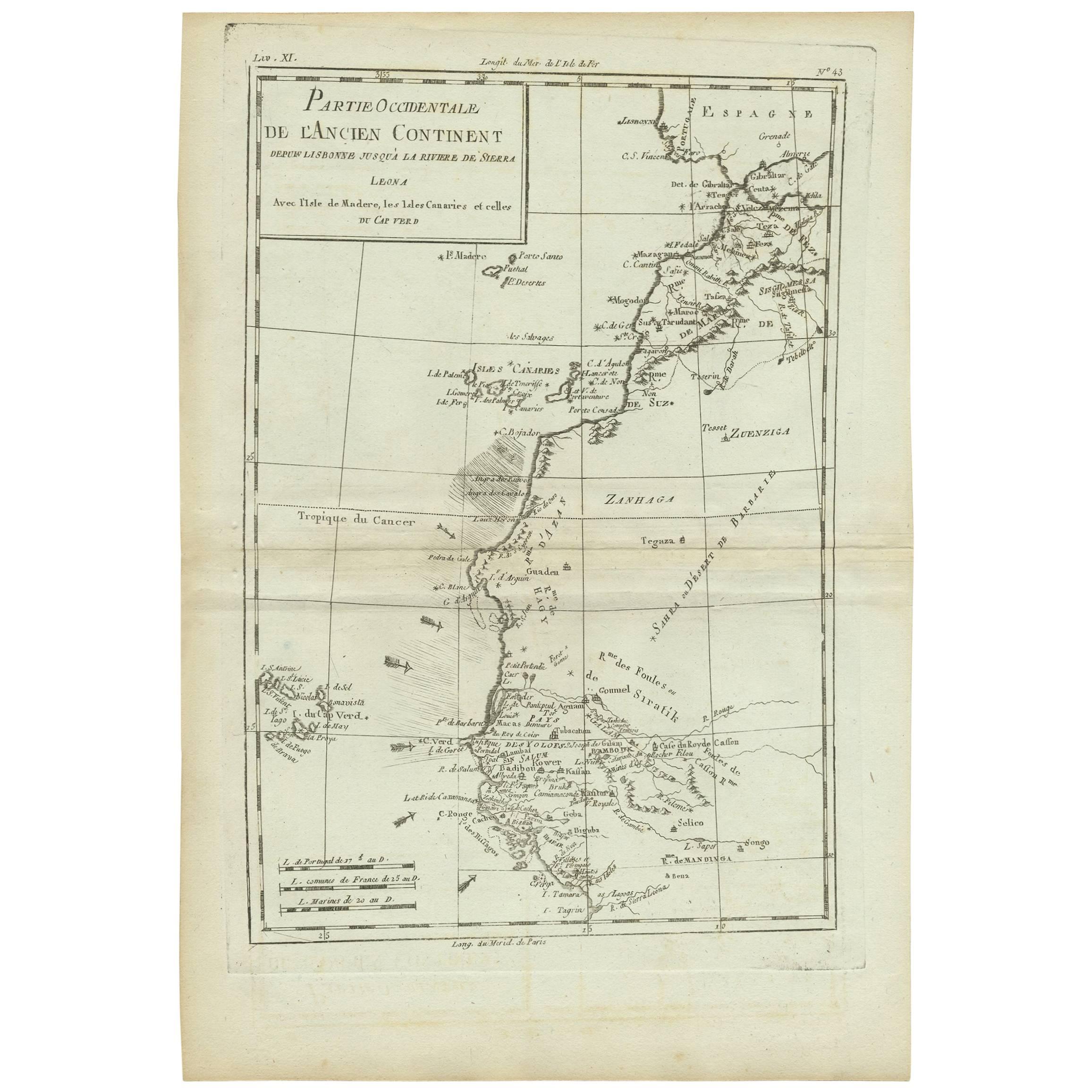
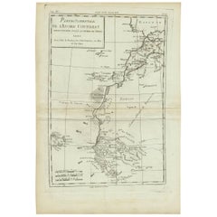
View AllAntique Map of West Africa by R. Bonne, 1780
Located in Langweer, NL
Antique map titled 'Partie Occidentale De L'Ancien Continent Depuis Lisbonne Jusqua La Riviere De Sierra Leona Avec L'Isle de Madere, les Isles Canaries et celles Du Cap Verd'. Parts...
Category
Antique Late 18th Century French Maps
Materials
Paper
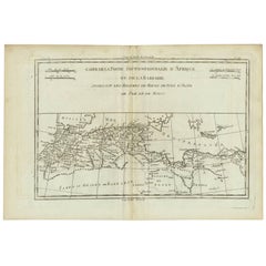
Antique Map of the Coast of Guinea, Africa, c.1780
Located in Langweer, NL
Antique map Africa titled 'Carte de la Haute et de la Basse Guinée'. Map of the Coast of Guinea, Africa. Represents modern day Liberia, Ivory Coast, Ghana, Nigeria, Cameroon, Gabon, Congo, and Equatorial Guinea...
Category
Antique 18th Century Maps
Materials
Paper

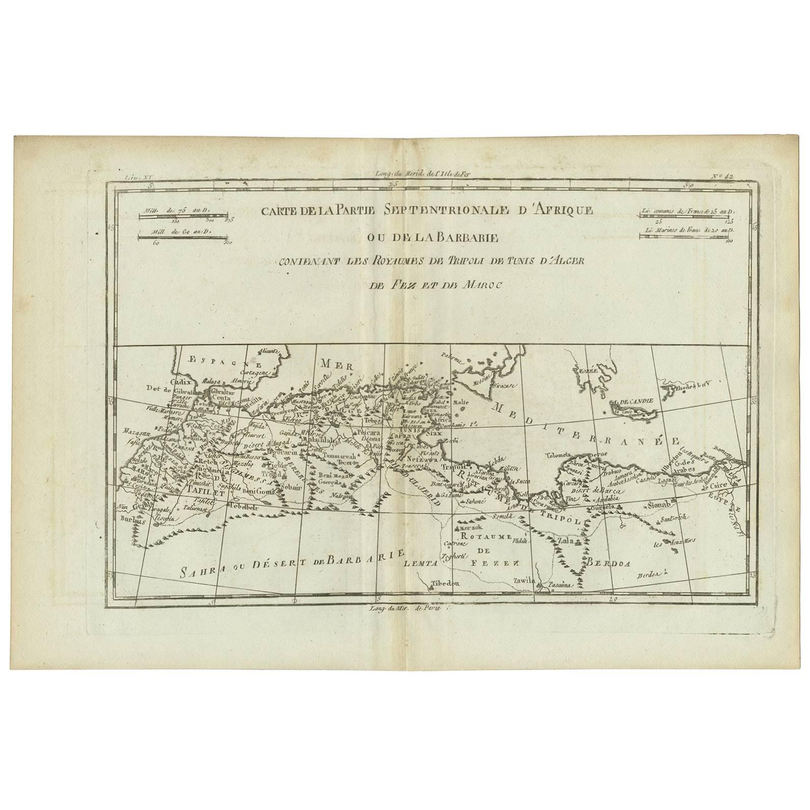
Antique Map of Northern Africa "Barbary Coast" by R. Bonne, circa 1780
Located in Langweer, NL
A fine example of Rigobert Bonne and Guilleme Raynal’s 1780 map of northwestern Africa or the Barbary Coast. Includes the modern day countries of Morocco, Algeria, Tunisia, Libya, and parts of adjacent Spain, Italy and Greece. This map was made in response to European interest in the region due to coastal attacks and incursions by the Barbary Pirates...
Category
Antique Late 18th Century French Maps
Materials
Paper
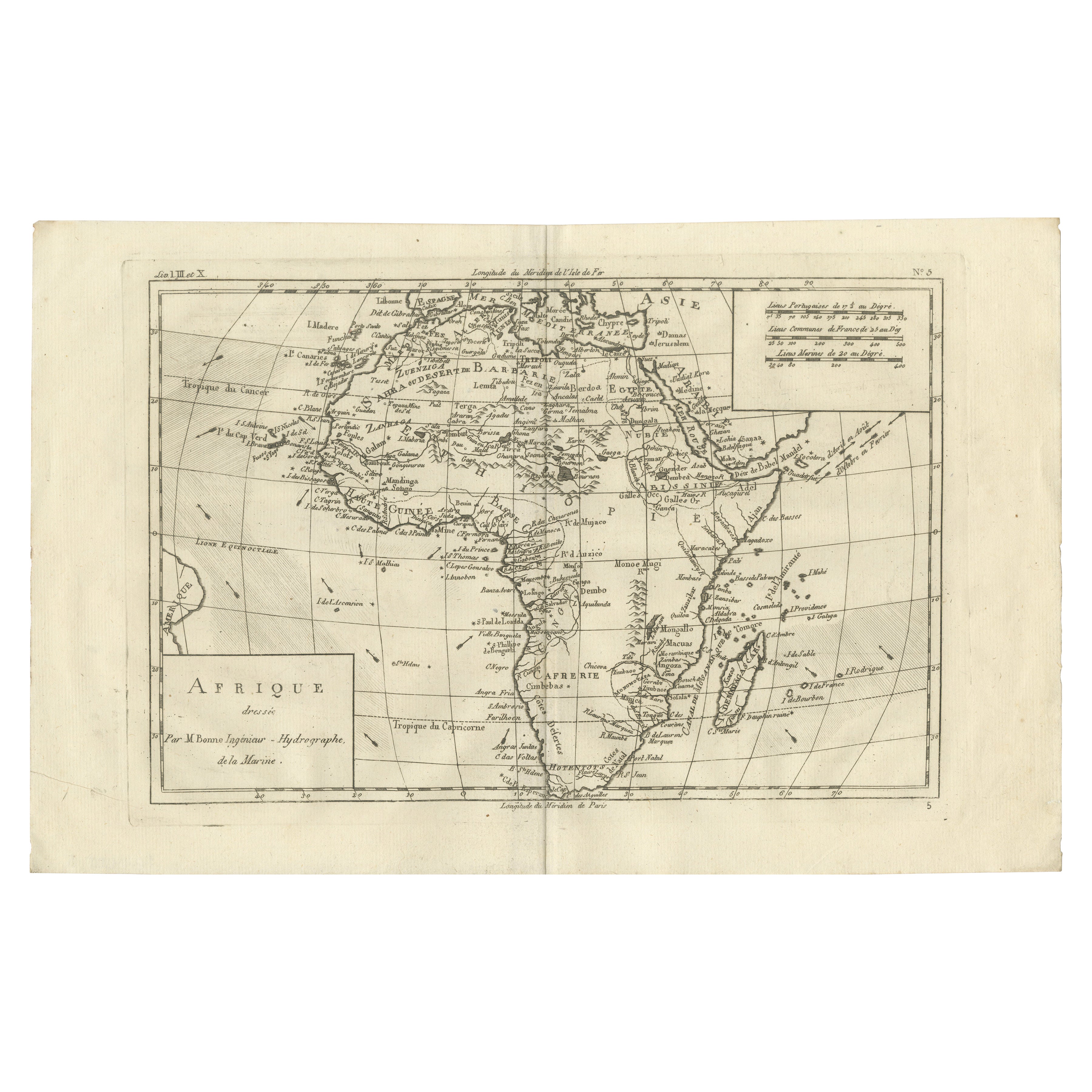
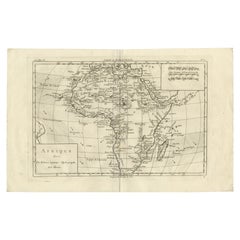
Africa Map by Rigobert Bonne – Pre-Colonial Geography c.1780
Located in Langweer, NL
Africa Map by Rigobert Bonne – Pre-Colonial Geography c.1780
DESCRIPTION
This map of Africa captures European geographic knowledge prior to large-scale colonial penetration. Engrave...
Category
Antique Late 18th Century French Maps
Materials
Paper
18th Century Map of Upper Guinea: Kingdoms and Coastal Regions of West Africa
Located in Langweer, NL
This is an antique map depicting the coastal regions of West Africa, specifically the Gulf of Guinea and surrounding areas, including parts of what is now Senegal, Guinea, Sierra Leo...
Category
Antique 1780s Maps
Materials
Paper
$230 Sale Price
20% Off
Antique Map of Europe by R. Bonne, 1780
Located in Langweer, NL
A fine example of Rigobert Bonne and Guilleme Raynal’s 1780 map of Europe. Drawn by R. Bonne for G. Raynal’s Atlas de Toutes les Parties Connues du Globe Terrestre, Dressé pour l'His...
Category
Antique Late 18th Century French Maps
Materials
Paper

$151 Sale Price
30% Off
You May Also Like
West Coast of Africa, Guinea
Sierra Leone: An 18th Century Map by Bellin
By Jacques-Nicolas Bellin
Located in Alamo, CA
Jacques Bellin's copper-plate map entitled "Partie de la Coste de Guinee Dupuis la Riviere de Sierra Leona Jusquau Cap das Palmas", depicting the coast of Guinea and Sierra Leone in ...
Category
Antique Mid-18th Century French Maps
Materials
Paper

$460 Sale Price
20% Off
West Africa Entitled "Guinea Propria": An 18th Century Hand Colored Homann Map
By Johann Baptist Homann
Located in Alamo, CA
This is a scarce richly hand colored copper plate engraved map of Africa entitled "Guinea Propria, nec non Nigritiae vel Terrae Nigrorum Maxima Pars" by Johann Baptist Homann (1664-1...
Category
Antique Mid-18th Century German Maps
Materials
Paper

$1,500 Sale Price
20% Off
Antique Lithography Map, West Africa, English, Framed, Cartography, Victorian
Located in Hele, Devon, GB
This is an antique lithography map of Western Africa. An English, framed atlas engraving of cartographic interest by John Rapkin, dating to the early Victorian period and later, circ...
Category
Antique Mid-19th Century British Early Victorian Maps
Materials
Wood

Original Antique Decorative Map of South America-West Coast, Fullarton, C.1870
Located in St Annes, Lancashire
Great map of Chili, Peru and part of Bolivia
Wonderful figural border
From the celebrated Royal Illustrated Atlas
Lithograph. Original color.
Published by Fullarton, Edi...
Category
Antique 1870s Scottish Maps
Materials
Paper

Antique West African Ivory Coast Baule - Senufo Currency Bracelet in Bronze
Located in Esbjerg, DK
Senufo/baule Locking Currency Bracelet: a time honored texture and form define this Senufo sculptural object. The abstract etchings were achieved through a process known as scarifica...
Category
Antique 19th Century Ivorian Tribal Collectible Jewelry
Materials
Bronze
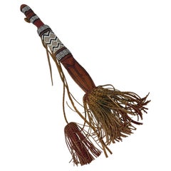
Vintage African Mandingo Tuareg Dagger Mali West Africa
Located in Moreno Valley, CA
Vintage African Mandingo Tribal Tuareg Dagger Mali West Africa.Collectible Tuareg Knife from Mali circa 1950s.This collectible dagger was hand-crafted by...
Category
Mid-20th Century Malian Folk Art Arms, Armor and Weapons
Materials
Steel