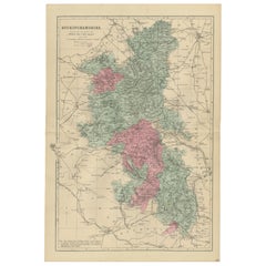
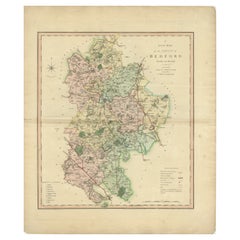
Items Similar to Victorian Map of Bedfordshire, 1885 – Railways
County Detail


Want more images or videos?
Request additional images or videos from the seller
1 of 9
Victorian Map of Bedfordshire, 1885 – Railways
County Detail
$237.31
£177.16
€200
CA$329.70
A$354.64
CHF 189.53
MX$4,180.15
NOK 2,389.50
SEK 2,184.46
DKK 1,524.22
About the Item
Antique Map of Bedfordshire, 1885 – County Detail
Railways, George W. Bacon
This finely detailed antique map of Bedfordshire was published in 1885 by George W. Bacon in London as part of the *New Large Scale Ordnance Atlas of the British Isles with Plans of Towns*. Reduced from Ordnance Survey mapping, it presents the county with remarkable clarity, showing towns, villages, railways, roads, rivers, and boundaries in a carefully balanced composition.
NOTE: The map is offered unframed, giving flexibility to select a frame that best suits the intended interior. The attached image of the map in a frame is an impression only.
The county is rendered in soft original color, with Bedford itself highlighted, while surrounding counties are subtly indicated to give geographic context. The dense network of rail lines and roads reflects the importance of infrastructure in late Victorian England and adds strong linear structure to the map. Fine engraving and restrained coloring make this sheet especially appealing as decorative wall art.
Well suited for interior designers and decorative buyers, this map works beautifully in studies, offices, libraries, or residential interiors. It offers local English character combined with a calm, orderly aesthetic that complements both traditional and modern spaces.
Condition Report:
Good antique condition. Light age toning and scattered spotting consistent with age. No major tears or losses; details remain clear and legible.
Framing Tips:
A dark wood or black frame pairs well with the historic look. An ivory or warm off-white mat will enhance the soft coloring and keep the presentation refined.
Technique: Lithograph with original color
Maker: George W. Bacon, London, 1885
- Dimensions:Height: 19.69 in (50 cm)Width: 13.39 in (34 cm)Depth: 0.01 in (0.2 mm)
- Materials and Techniques:
- Place of Origin:
- Period:
- Date of Manufacture:1885
- Condition:Good antique condition. Light age toning and scattered spotting consistent with age. No major tears or losses; details remain clear and legible.
- Seller Location:Langweer, NL
- Reference Number:Seller: BG-14216-31stDibs: LU3054348335882
About the Seller
5.0
Recognized Seller
These prestigious sellers are industry leaders and represent the highest echelon for item quality and design.
Platinum Seller
Premium sellers with a 4.7+ rating and 24-hour response times
Established in 2009
1stDibs seller since 2017
2,836 sales on 1stDibs
Typical response time: 1 hour
- ShippingRetrieving quote...Shipping from: Langweer, Netherlands
- Return Policy
More From This Seller
View AllAntique Map of Buckinghamshire, 1885 – Victorian Railways
County Detail
Located in Langweer, NL
Antique Map of Buckinghamshire, 1885 – Victorian Railways & County Detail
This finely engraved antique map of Buckinghamshire was published in 1885 by George W. Bacon in London as p...
Category
Antique Late 19th Century British Maps
Materials
Paper
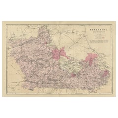
Antique Map of Berkshire, 1885 – Victorian Railways, Towns
County Detail
Located in Langweer, NL
Antique Map of Berkshire, 1885 – Victorian Railways, Towns & County Detail
This elegant antique map of Berkshire was published in 1885 by George W. Bacon in London as part of the *N...
Category
Antique Late 19th Century British Maps
Materials
Paper
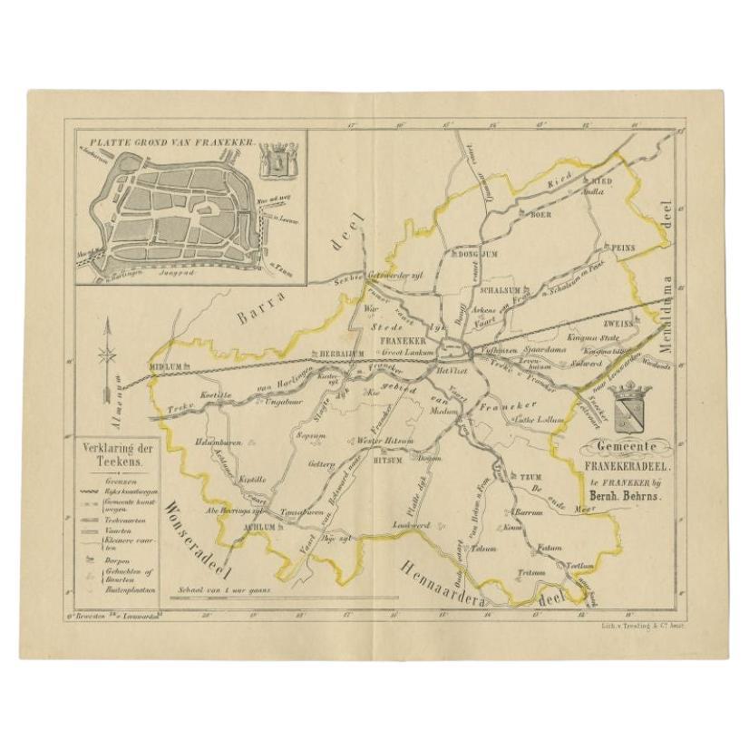
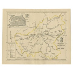
Antique Map of the Franekeradeel Township by Behrns, 1861
Located in Langweer, NL
Antique map titled 'Gemeente Franekeradeel'. Old map depicting the Franekeradeel township including cities and villages like Franeker, Midlum, Hitsum, Schalsum, Dongjum, Peins and Ac...
Category
Antique 19th Century Maps
Materials
Paper
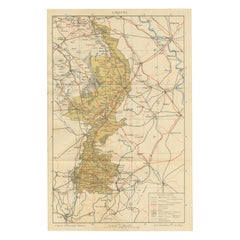
Rare Antique Map of Limburg – Sleeswijk Atlas of the Netherlands, 1914
Located in Langweer, NL
Antique Map of Limburg – Sleeswijk Atlas, 1914
Description:
This antique map of Limburg was published in 1914 in the Sleeswijk Atlas, a widely used Dutch school atlas of the early 2...
Category
Early 20th Century Dutch Maps
Materials
Paper
Antique Colourful and Decorative County Map of Bedfordshire, England, 1804
Located in Langweer, NL
Antique county map of Bedfordshire first published c.1800. Villages, towns, and cities illustrated include Bedford, Todington, and Potton.
Charl...
Category
Antique Early 1800s Maps
Materials
Paper
$308 Sale Price
20% Off
Antique Map of Ferwerderadeel, a County in Friesland, The Netherlands, 1868
Located in Langweer, NL
Antique map titled 'Provincie Friesland - Gemeente Ferwerderadeel'. Map of the township of Ferwerderadeel including Ferwerd, Blija and many other villages. This map originates from '...
Category
Antique 19th Century Maps
Materials
Paper
You May Also Like
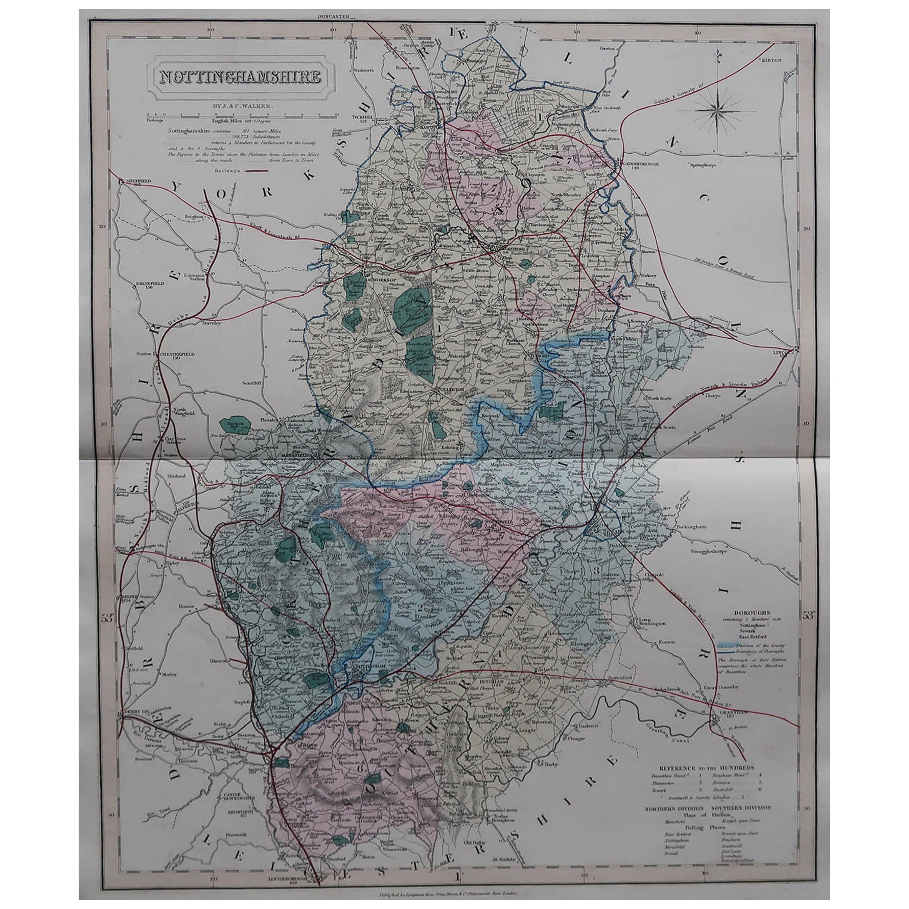
Original Antique English County Map, Nottinghamshire, J
C Walker, 1851
Located in St Annes, Lancashire
Great map of Nottinghamshire
Original colour
By J & C Walker
Published by Longman, Rees, Orme, Brown & Co. 1851
Unframed.
Category
Antique 1850s English Other Maps
Materials
Paper

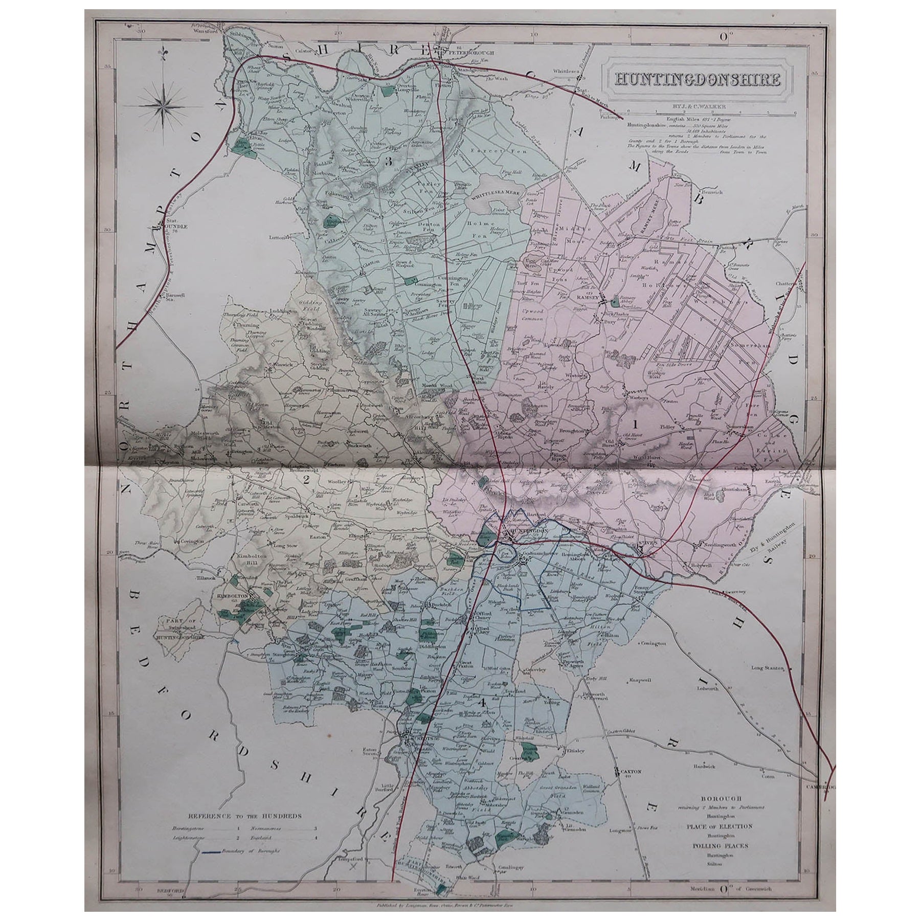
Original Antique English County Map, Huntingdonshire, J
C Walker, 1851
Located in St Annes, Lancashire
Great map of Huntingdonshire
Original colour
By J & C Walker
Published by Longman, Rees, Orme, Brown & Co. 1851
Unframed.
Category
Antique 1850s English Other Maps
Materials
Paper

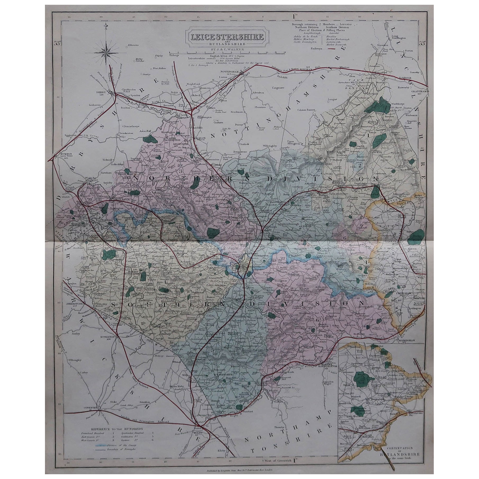
Original Antique English County Map, Leicestershire, J
C Walker, 1851
Located in St Annes, Lancashire
Great map of Leicestershire
Original colour
By J & C Walker
Published by Longman, Rees, Orme, Brown & Co. 1851
Unframed.
Category
Antique 1850s English Other Maps
Materials
Paper

Original Antique English County Map, Buckinghamshire, J
C Walker, 1851
Located in St Annes, Lancashire
Great map of Buckinghamshire
Original colour
By J & C Walker
Published by Longman, Rees, Orme, Brown & Co. 1851
Unframed.
Category
Antique 1850s English Other Maps
Materials
Paper

Original Antique English County Map, Derbyshire, J
C Walker, 1851
Located in St Annes, Lancashire
Great map of Derbyshire
Original colour
By J & C Walker
Published by Longman, Rees, Orme, Brown & Co. 1851
Unframed.
Category
Antique 1850s English Other Maps
Materials
Paper

Original Antique English County Map, Cambridgeshire, J
C Walker, 1851
Located in St Annes, Lancashire
Great map of Cambridgeshire
Original colour
By J & C Walker
Published by Longman, Rees, Orme, Brown & Co. 1851
Unframed.
Category
Antique 1850s English Other Maps
Materials
Paper
