Items Similar to Zevenwolden, Friesland – von Reilly antique map, 1791


Video Loading
Want more images or videos?
Request additional images or videos from the seller
1 of 11
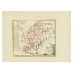
Zevenwolden, Friesland – von Reilly antique map, 1791
$420.35
£311.37
€350
CA$575.14
A$625.80
CHF 331.35
MX$7,528.80
NOK 4,207.45
SEK 3,849.52
DKK 2,667.29
About the Item
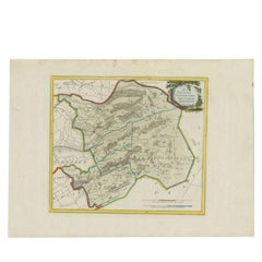
Title: Zevenwolden, Friesland – von Reilly antique map, 1791
Fine late-18th-century engraved map of the region of Zevenwolden in Friesland, the Netherlands. Published in 1791 for Franz Johann Josef von Reilly’s atlas Schauplatz der fünf Theile der Welt, the map presents the area between the Zuiderzee, Drenthe, and Oostergo. It details towns, waterways, reclaimed polders, and roads in the fertile Frisian countryside. Villages such as Heerenveen, Wolvega, and Gorredijk are clearly marked, while the Zuiderzee (now IJsselmeer) is shown along the western edge. The neat cartouche at the upper left corner carries the German title, with decorative engraving typical of von Reilly’s Vienna production.
Von Reilly (1766–1820) was one of the first Austrian publishers to attempt a comprehensive world atlas, aiming to make geographical knowledge accessible in a compact format. The engraving was executed by Ignaz Alberti (also known as Ignaz Albrecht, 1760–1794), an Austrian illustrator and engraver known for his precision and delicate linework. These maps are notable for their clarity and contemporary geographical accuracy, reflecting Enlightenment-era efforts to standardize cartographic information across Europe.
This sheet, with its contemporary outline hand-colour highlighting district boundaries, is a highly decorative and historically significant representation of Friesland. It appeals to collectors of Dutch regional history, as well as those interested in Austrian Enlightenment cartography.
Condition report:
Very good. Wide margins, light and even toning, faint handling marks. Original outline hand-colour well preserved. Strong plate impression visible. Blank verso. No folds, tears, or repairs noted.
Framing tips:
An ivory or pale cream mount will balance the sheet’s natural paper tone. A thin green or soft grey fillet may echo the original outline colour, while a dark wood or black frame will provide classical contrast. For a warmer appearance, a maple or walnut frame pairs well with the earthy tones.
Technique: Copper engraving with contemporary outline hand-colour
Maker: Franz J. J. von Reilly (engr. Ignaz Alberti), Vienna, 1791
Important places on the von Reilly 1791 map of Zevenwolden (Friesland):
Heerenveen – main town in the region, founded in the 16th century and important for trade
Wolvega – centre of Weststellingwerf
Gorredijk – developed as a peat colony and trading hub
Beetsterzwaag – village known for estates and noble houses
Oosterwolde – key settlement in eastern Friesland
Oldeberkoop – historic medieval village
Makkinga – agricultural village
Drachten – small settlement at the time, later a major Frisian town
Nieuweschoot – small polder village
Haskerland – regional village and polder area
Steenwijkerwold – village near the border with Overijssel
Giethoorn – water village, just beyond the border of Friesland
Geographic features:
Zuiderzee (Süder See) – major inland sea, later IJsselmeer
Tjonger River (De Tjonger / Kuinder) – important east–west waterway
Peat colonies and reclaimed land – central to the economy of Zevenwolden
Forests and moorlands – less developed areas, especially in the south
Keywords:
Zevenwolden, Friesland antique map, Heerenveen 18th century, Wolvega, Gorredijk, Beetsterzwaag, Oosterwolde, Oldeberkoop, Drachten early map, Zuiderzee, IJsselmeer, Tjonger River, peat colonies Friesland, von Reilly map 1791, Ignaz Alberti engraving, Schauplatz der fünf Theile der Welt
- Dimensions:Height: 13.19 in (33.5 cm)Width: 15.36 in (39 cm)Depth: 0.01 in (0.2 mm)
- Materials and Techniques:Paper,Engraved
- Place of Origin:
- Period:
- Date of Manufacture:1791
- Condition:Very good. Wide margins, light and even toning, faint handling marks. Original outline hand-colour well preserved. Strong plate impression visible. Blank verso. No folds, tears, or repairs noted.
- Seller Location:Langweer, NL
- Reference Number:Seller: BG-002261stDibs: LU3054329258202
About the Seller
5.0
Recognized Seller
These prestigious sellers are industry leaders and represent the highest echelon for item quality and design.
Platinum Seller
Premium sellers with a 4.7+ rating and 24-hour response times
Established in 2009
1stDibs seller since 2017
2,816 sales on 1stDibs
Typical response time: 1 hour
- ShippingRetrieving quote...Shipping from: Langweer, Netherlands
- Return Policy
More From This Seller
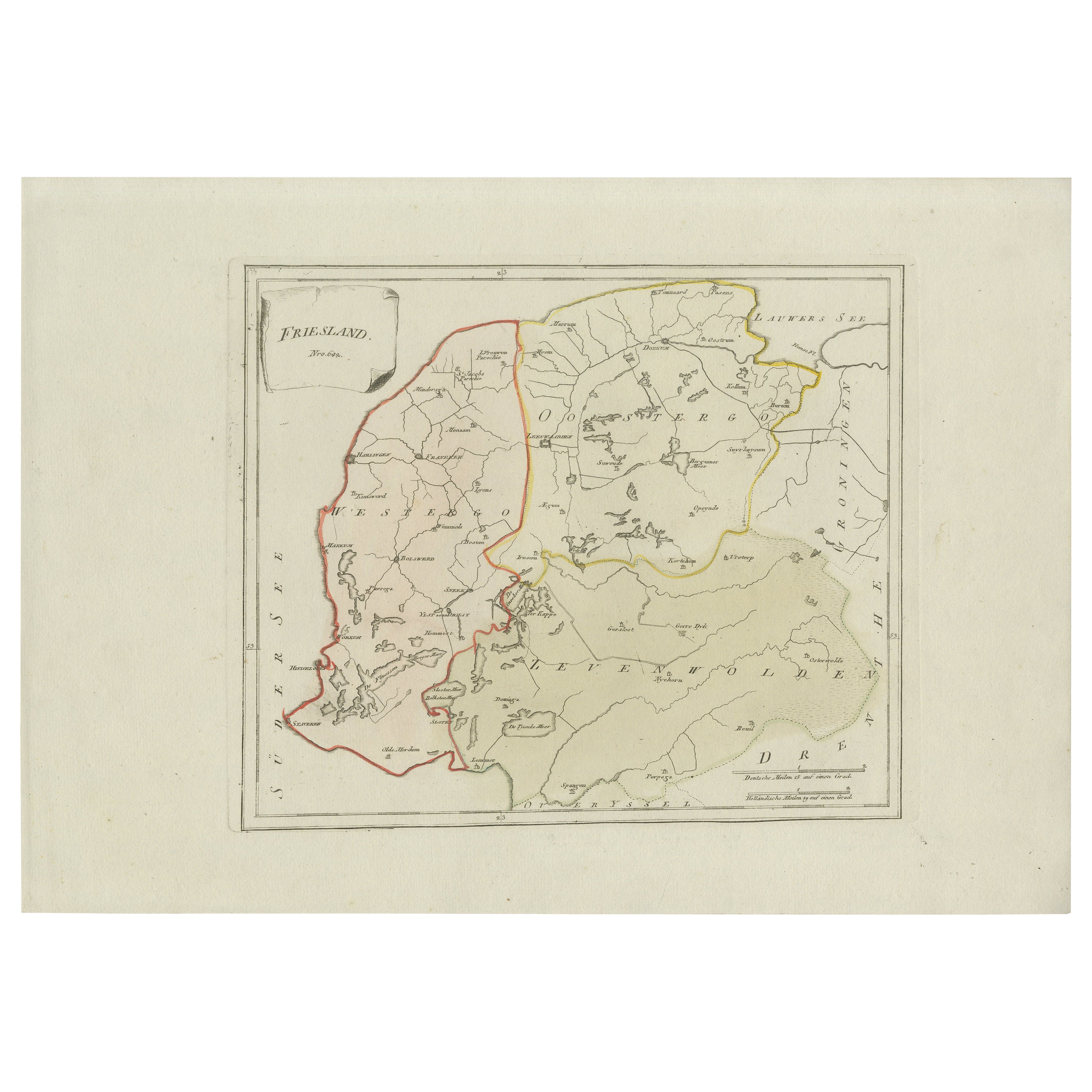
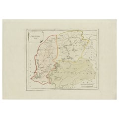
View AllAntique Map of Friesland by Von Reilly, 1791
Located in Langweer, NL
Antique map titled 'Friesland'. Map of the province of Friesland, the Netherlands. This map orginates from 'Schauplatz der fünf Theile der Welt'. Artists and Engravers: Franz Joseph ...
Category
Antique 18th Century Austrian Maps
Materials
Paper

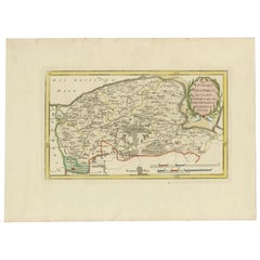
Antique Map of Zevenwolden by Von Reilly, 1791
Located in Langweer, NL
Friesland Zevenwouden eastern districts map, Reilly, Vienna, c.1791–95
Description:
Engraved map with original hand color of the Zevenwouden (Seven Forests) region in Friesland, Net...
Category
Antique 18th Century Austrian Maps
Materials
Paper
Rare 1791 von Reilly Map of Friesland Province, Netherlands, 18th Century
Located in Langweer, NL
Antique General Map of Friesland by von Reilly, 1791
Original engraved map titled *Friesland*, published in Vienna in 1791. This is the general overview map of the province of Fries...
Category
Antique Late 18th Century Austrian Maps
Materials
Paper
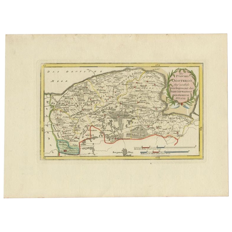
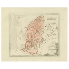
Antique Map of the Region of Leeuwarden and Dokkum in The Netherlands, 1791
Located in Langweer, NL
Antique map titled 'Der Provinz Oostergo fünf nördliche Grietenyen mit der Stadt Leeuwaarden und Dokkum'. Map of the region of Leeuwarden and Dokkum, Friesland, the Netherlands. This...
Category
Antique 18th Century Maps
Materials
Paper
$151 Sale Price
20% Off
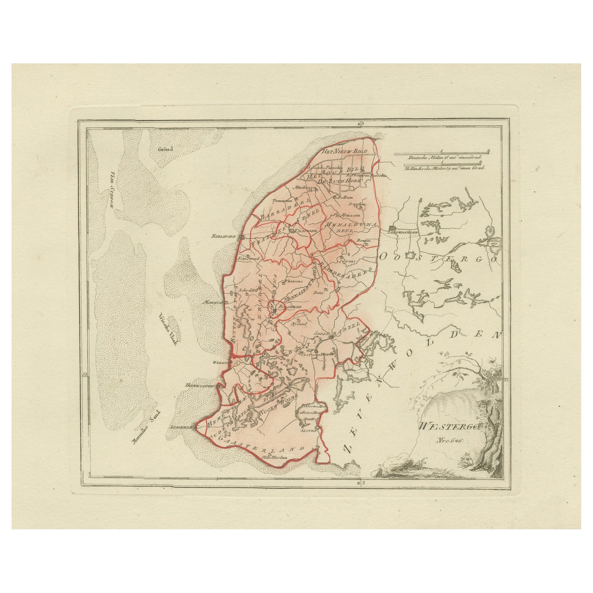
Antique Dutch Map – Westergo Region in Friesland by von Reilly, 1791
Located in Langweer, NL
Antique Map of Westergo, Friesland by von Reilly, 1791
Original engraved map titled Westergoo No. 640, published in Vienna in 1791. This sheet presents the region of Westergo, the h...
Category
Antique 18th Century Austrian Maps
Materials
Paper
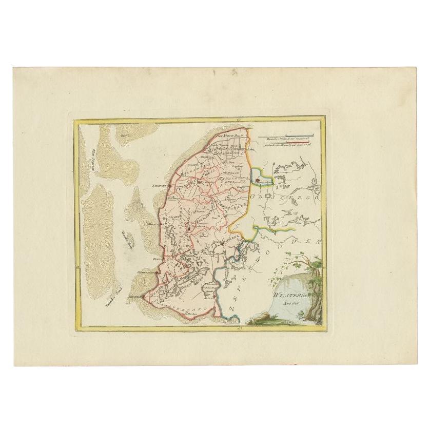
Antique Map of Westergo in Friesland, 1791
Located in Langweer, NL
Antique map titled 'Westergo'. Map of the Westergo region, Friesland, the Netherlands. This map orginates from 'Schauplatz der fünf Theile der Welt'.
Artists and Engravers: Franz...
Category
Antique 18th Century Maps
Materials
Paper
You May Also Like
1752 Vaugoundy Map of Flanders : Belgium, France, and the Netherlands, Ric.a002
Located in Norton, MA
Large Vaugoundy Map of Flanders:
Belgium, France, and the Netherlands
Colored -1752
Ric.a002
Description: This is a 1752 Didier Robert de Vaugondy map of Flanders. The map de...
Category
Antique 17th Century Unknown Maps
Materials
Paper

Original Antique Map of Hungary, Arrowsmith, 1820
Located in St Annes, Lancashire
Great map of Hungary
Drawn under the direction of Arrowsmith.
Copper-plate engraving.
Published by Longman, Hurst, Rees, Orme and Brown, 1820
Unframed.
Category
Antique 1820s English Maps
Materials
Paper

1839 Map of Karte Des "Russischen Reiches in Europa Und Asien" Ric.R0013
Located in Norton, MA
1839 map of Karte Des
"Russischen Reiches in Europa and Asien"
Ric.r013
Map of the European and Asian parts of Russian Empire. Karte der Russischen Reiches in Europa und Asien...
Category
Antique 19th Century Unknown Maps
Materials
Paper

1643 Willem&Joan Blaeu Map NW Flanders "Flandriae Teutonicae Pars Prientalior
Located in Norton, MA
1643 Willem and Joan Blaeu map of northwest Flanders, entitled
"Flandriae Teutonicae Pars Prientalior,"
Ric0012
" Authentic" - Map of the northwest Fl...
Category
Antique 17th Century Dutch Maps
Materials
Paper

1627 Hendrik Hondius Map Entitled "Vltoniae Orientalis Pars, " Ric.a009
Located in Norton, MA
1627 Hendrik Hondius map entitled
"Vltoniae orientalis pars,"
Ric.a009
Title:
Vltoniae orientalis : pars
Title (alt.) :
Ultoniae orientalis pars
Creator:
Mercator, Gerh...
Category
Antique 17th Century Dutch Maps
Materials
Paper

1851 Map of "Independent Tartary", Ric. R018
Located in Norton, MA
1851 Map of
Independent Tartary
"Russia"
Ric.r018
A highly decorative 1851 map of Independent Tartary by John Tallis and John Rapkin. Covers the regions between the Caspian Sea and Lake Bakquash and between Russia and Afghanistan. These include the ancient Silk Route kingdoms of Khiva, Tartaria, Kokand, and Bokhara. Today this region roughly includes Kazakhstan, Uzbekistan, Turkmenistan, Kyrgyzstan, and Tajikistan. This wonderful map offers a wealth of detail for anyone with an interest in the Central Asian portion of the ancient Silk Road. Identifies various caravan routes, deserts, wells, and stopping points, including the cities of Bokhara and Samarkand. Three vignettes by W. Bragg decorate the map, these including an image of Tartars on a Journey, a horseback Bride Chase, and a tartar camp site. Surrounded by a vine motif border. Engraved by J. Rapkin for John Tallis's 1851 Illustrated Atlas .
Tartary Antique Map...
Category
Antique 19th Century Unknown Maps
Materials
Paper
