Items Similar to Imray Ocean Chart of the Coast of Brazil 1876


Want more images or videos?
Request additional images or videos from the seller
1 of 6
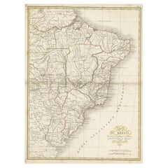
Imray Ocean Chart of the Coast of Brazil 1876
$1,800
£1,358.61
€1,557
CA$2,512.36
A$2,736.99
CHF 1,445.42
MX$32,856.91
NOK 18,416.26
SEK 16,831.77
DKK 11,630.62
About the Item
Imray
Son 1876 Nautical chart of the Coast of Brazil between Cape Frio and the River Plate. Nicely framed. Overall Dimensions: 46" H x 56" W.
About the Seller
5.0
Gold Seller
Premium sellers maintaining a 4.3+ rating and 24-hour response times
Established in 1967
1stDibs seller since 2015
432 sales on 1stDibs
Typical response time: 1 hour
- ShippingRetrieving quote...Shipping from: Norwell, MA
- Return Policy
More From This Seller
View AllAntique Maritime Chart of East Coast Virginia to Nova Scotia
Located in Norwell, MA
1920 nautical chart of the East Coast of the United States from Virginia to Maine, New Brunswick, and Nova Scotia. The chart shows Cape Cod, Long Island, the Connecticut coast, Jersey Shore, Maine, New Hampshire, etc. Very detailed, showing ports, lighthouses, shoals, depths, etc. The chart is by famous cartographer George W. Eldridge, compiled from surveys of the United States government, British Admiralty, George Eldridge, and others. First authorized by George Eldridge, published in 1916 by Wilfred O. White with a merchant's stamp of Charles Hutchinson...
Category
Vintage 1920s North American Maps
Materials
Paper

1898 Chart of Boston Bay
Located in Norwell, MA
Original 1898 chart showing Massachusetts Bay with the coast from Cape Ann to Cape Cod. This is a U.S. Navy Geodetic survey chart. All towns are noted along the coast. Framed with gl...
Category
Antique 1890s Nautical Objects
Materials
Paper

$1,495
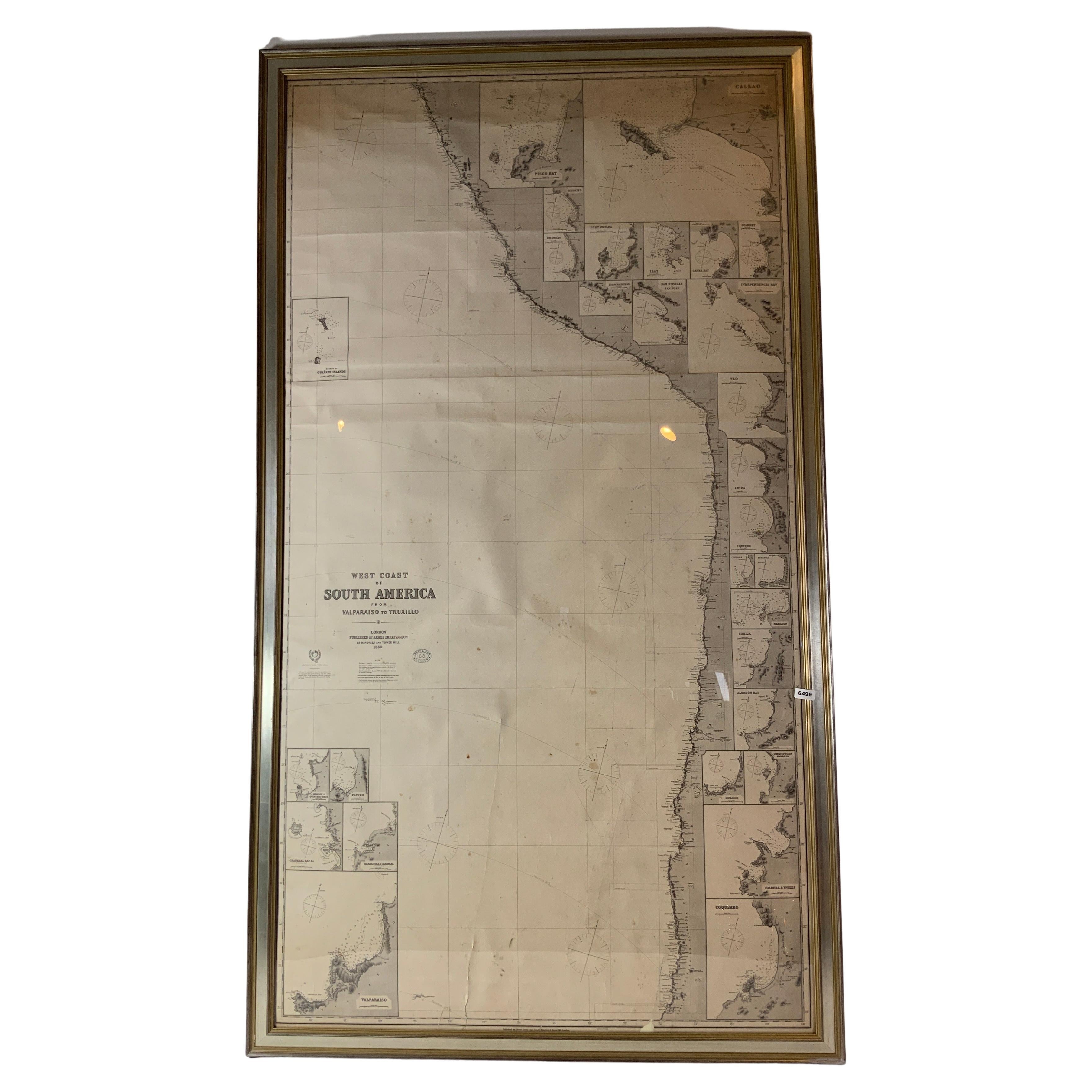
Chart of West Coast of South America by James Imray and Son
Located in Norwell, MA
Chart of West Coast of South America compiled by James F. Imray and published in 1880. The chart captures the west coast from Valparaiso to Truxillo. Includes ...
Category
Antique 1880s English Nautical Objects
Materials
Paper
Original Imray
Son Chart of North Atlantic, 1876
Located in Norwell, MA
Nautical chart of the North Atlantic showing the Eastern United States coast, Caribbean Islands, South America (Venezuela and ), British Possessions (Canada - Gulf of Lawrence, Newfo...
Category
Antique 1870s Nautical Objects
Materials
Paper

19th Century Nautical Chart of Martinique
Located in Norwell, MA
Original map of Martinique from 1887 with chartered waters around the island. Prepared from a French survey, completed in 1825, showing town, ports, rivers and tributaries. Published...
Category
Antique 19th Century Nautical Objects

Long Island Chart from 1828
Located in Norwell, MA
Rare original chart of Long Island Sound by E + G Blunt of New York, 179 Water St. "Surveyed in the years 1828, 29 & 30" Exceedingly rare and early chart, titled Long Island Sound fr...
Category
Antique 1830s Nautical Objects
Materials
Paper

You May Also Like
Large U.S. Coast and Geodetic Survey Chart A of the Atlantic Coast, 1877
Located in Nantucket, MA
Large U.S. Coast and Geodetic Survey Chart A of the Atlantic Coast, 1877, re-issued in February 1881, a printed paper laid down on linen navigational chart of the U.S. Atlantic coast...
Category
Antique 1880s American Other Maps
Materials
Linen

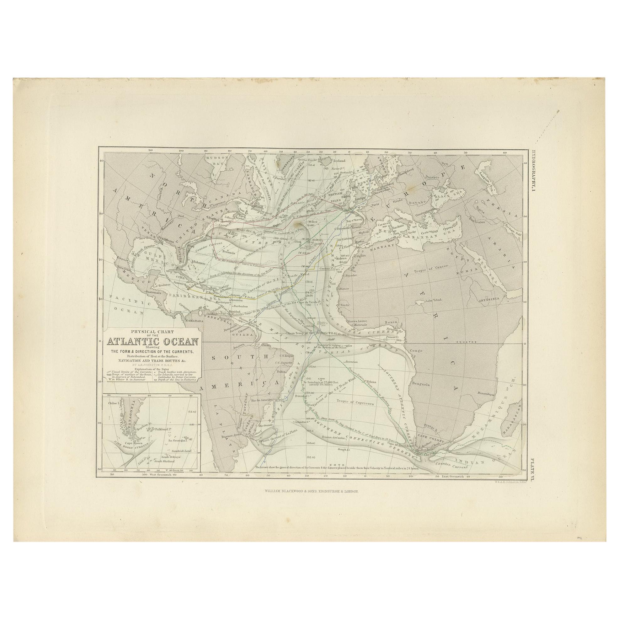
Antique Physical Chart of the Atlantic Ocean by Johnston
1850
Located in Langweer, NL
Antique map titled 'Physical Chart of the Atlantic Ocean showing the form and direction of the currents'. Original antique chart of the Atlantic Ocean. This map originates from 'The ...
Category
Antique Mid-19th Century Maps
Materials
Paper

$192 Sale Price
20% Off
1882 Map of Brazil: Historic Borders, River Systems, and Coastal Regions
Located in Langweer, NL
Title: 1882 Map of Brazil: Historic Borders, River Systems, and Coastal Regions
Description:
This 1882 map presents a detailed cartographic view of Brazil, the largest country in S...
Category
Antique 1880s Maps
Materials
Paper
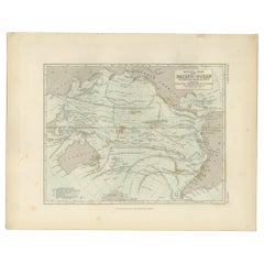
Antique Physical Chart of the Pacific Ocean by Johnston,
1850
Located in Langweer, NL
Antique map titled 'Physical Chart of the Pacific Ocean showing the currents and temperature of the ocean'. Original antique chart of the Pacific Ocean. This map originates from 'The...
Category
Antique Mid-19th Century European Maps
Materials
Paper
Antique Map of Brazil Extending South to the Mouth of the Rio de la Plata
Located in Langweer, NL
Antique map titled 'Carte du Brésil'. ?Beautiful map of Brazil extending south to the mouth of the Rio de la Plata and Buenos-Aires in Argentina. Published by Tardieu, 1821.
Pier...
Category
Antique Early 19th Century Maps
Materials
Paper
$230 Sale Price
20% Off
Large Original Antique Map of The Pacific Ocean, Fullarton, C.1870
Located in St Annes, Lancashire
Great map of The Pacific Ocean
From the celebrated Royal Illustrated Atlas
Lithograph by Swanston. Original color.
Published by Fullarton,...
Category
Antique 1870s Scottish Maps
Materials
Paper

More Ways To Browse
Framed American Flags
Antique Spoke Wheel
Framed Signal Flag
Antique Portholes
Titanic Antique
Wood Ship Wheel
Ships Binnacle
Navigation Instrument
Vintage Winch
Battle Of Trafalgar
Antique Nautical Rope
Binnacle Compass
Yacht Binnacle
Brass Ships Portholes
Nautical Telescope
Ship Compass Antique
Antique Magnets
Galleon Ship