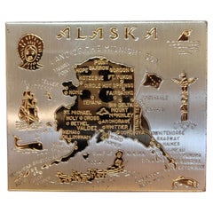
Maps
to
2,520
5,745
256
6,004
3
1
80
43
18
15
9
7
5
4
4
4
1
1
3,035
2,444
525
4
349
36
15
121
10
35
9
2
5
5
3
6
2
5,928
124
82
38
27
1,514
456
417
355
251
6,008
6,008
6,008
102
62
25
24
16
Maps For Sale
Baroque Solar System
Zodiac Map – Homann Doppelmayr, Hand Colored c.1742
Located in Langweer, NL
Baroque Solar System & Zodiac Map – Homann Doppelmayr, Hand Colored c.1742
This impressive celestial engraving depicts the Copernican heliocentric solar system and is titled “System...
Category
Mid-18th Century German Antique Maps
Materials
Paper

Decorative Antique Celestial Map – Zodiac, Stars
Hemel Globe, 1720
Located in Langweer, NL
Antique Celestial Map – Hemel Globe, Zodiac & Constellations by Halma, 1720
This striking double-hemisphere celestial chart, titled Hemel Globe...
Category
Early 18th Century Dutch Antique Maps
Materials
Paper

Antique Map of Southeastern New York by Rand McNally, Lithograph, 1888
Located in Langweer, NL
Antique Map of Southeastern New York – Rand McNally, circa 1888
This antique map of southeastern New York was published by Rand, McNally
Co. around 1888. It offers a detailed ...
Category
Late 19th Century American Antique Maps
Materials
Paper

Hand-Colored Map of the Holy Land Divided Among the Twelve Tribes, c.1720
Located in Langweer, NL
Hand-Colored Map of the Holy Land Divided Among the Twelve Tribes, c.1720
This striking antique map, titled "Iudaea seu Palaestina ob Sacratissima Redemtoris Vestigia Hodie Dicta Te...
Category
Early 18th Century German Antique Maps
Materials
Paper

Imperial Austrian and Hungarian Coats of Arms – Antique Print, c.1880
Located in Langweer, NL
Title: Österreichisch-Ungarische Länderwappen – Imperial Coats of Arms of Austria-Hungary, c.1880
This finely detailed chromolithograph, titled Österreichisch-Ungarische Länderwappe...
Category
Late 19th Century German Antique Maps
Materials
Paper

Original Antique Map or City Plan of Amsterdam, Netherlands. Circa 1835
Located in St Annes, Lancashire
Nice map of Amsterdam
Drawn and engraved by J.Dower
Published by Orr & Smith. C.1835
Unframed.
Free shipping
Category
1830s English Antique Maps
Materials
Paper

Antique Astronomical Chart of the Solar System and Seasons – Black’s Atlas, 1884
Located in Langweer, NL
Antique Astronomical Chart of the Solar System and Seasons – Black’s Atlas, 1884
This striking scientific chart comes from the New and Revised Edition of Black’s General Atlas of th...
Category
1880s Scottish Antique Maps
Materials
Paper

Original Antique Map or City Plan of Rome, Italy. Circa 1835
Located in St Annes, Lancashire
Nice map of Rome
Drawn and engraved by J.Dower
Published by Orr & Smith. C.1835
Unframed.
Free shipping
Category
1830s English Antique Maps
Materials
Paper

Antique Map of Rhodesia
British Central Africa – Published by Philip, 1895
Located in Langweer, NL
Antique Map of Rhodesia & British Central Africa – Published by George Philip & Son, 1895
This detailed antique map titled "Rhodesia & British Central Africa" was published in 1895 ...
Category
Late 17th Century English Antique Maps
Materials
Paper

Rare 1730 Roman Empire Map by Moll - Detailed and Engraved Masterpiece
Located in Langweer, NL
An Historical Map of the Roman Empire and the Neighbouring Barbarous Nations by Herman Moll - Circa 1730
This grand and historically significant map of the Roman Empire was create...
Category
1730s Antique Maps
Materials
Paper

1884 Antique Decorative World Map – Mercator Projection, Victorian Era Print
Located in Langweer, NL
Antique World Map on Mercator’s Projection – Black’s Atlas, 1884
This finely engraved and colored map, titled The World on Mercator’s Projection, was published in the New and Revise...
Category
1880s Scottish Antique Maps
Materials
Paper

Antique Map of the Mediterranean Basin, 1903, with Detailed Coastal and Inland
Located in Langweer, NL
Title: Antique Map of the Mediterranean Basin, 1903, with Detailed Coastal and Inland Geography
Description: This antique map, titled "Basin of the Mediterranean," was engraved and ...
Category
Early 20th Century Maps
Materials
Paper

1573 Ortelius Map: First to Name California, Spanning Tartary to North America
Located in Langweer, NL
"1573 Abraham Ortelius Map of Tartary, Japan, and Western North America"
Description of the Map:
This is an outstanding example of Abraham Ortelius' map titled "Tartariae Sive Magn...
Category
16th Century Antique Maps
Materials
Paper


$2,282 Sale Price
20% Off
Rare Antique Wall-Map of North America: French and Indian War Boundaries, 1793
Located in Langweer, NL
Rare 1793 Map of North America: French and Indian War Boundaries and Historical Notes
This remarkable engraved map of North America, printed in 1793 by Emanuel Bowen and John Gibs...
Category
1790s Antique Maps
Materials
Paper

$5,795 Sale Price
25% Off
1711 Star Chart of Southern Sky with Mythical Constellations and Exotic Animals
Located in Langweer, NL
1711 Star Chart of the Southern Sky - "Mappa Stellarum Australium quae in Altitudine Poli Borei Graduum"
This beautiful star chart, engraved by Arnold van Westerhout in 1711, shows ...
Category
1710s Belgian Antique Maps
Materials
Paper

$1,607 Sale Price
20% Off
Original Antique Map of the American State of Maryland
Delaware, 1903
Located in St Annes, Lancashire
Antique map of Maryland And Delaware
Published By A & C Black. 1903
Original colour
Good condition
Unframed.
Free shipping
Category
Early 1900s English Antique Maps
Materials
Paper

Antique Map of Alexander the Great
s Empire
Campaigns, de Vaugondy, 1753
Located in Langweer, NL
Antique Map of Alexander the Great's Empire & Campaigns, de Vaugondy, 1753
This rare and elegantly engraved map, titled "Antiquor Imperiorum Tabula, in qua Prae Caeteris, Macedonicu...
Category
Mid-18th Century European Antique Maps
Materials
Paper

Antique Map of the World in 12 Globe Gores by Scherer,
circa 1702
Located in Langweer, NL
Antique map titled 'Typus Totius Orbis Terraquei Geographice Delineatus, Et Ad Usum Globo Materiali Superinducendus'. Beautiful example of Scherer's map of the World, configured in 12 globe gores. California is shown as an island. Fascinating Northwest Passage...
Category
Early 18th Century German Antique Maps
Materials
Paper

$1,901 Sale Price
20% Off
Original Antique Map of the American State of Michigan ( Northern Part ), 1903
Located in St Annes, Lancashire
Antique map of Michigan ( Northern part )
Published By A & C Black. 1903
Original colour
Good condition
Unframed.
Free shipping
Category
Early 1900s English Antique Maps
Materials
Paper
, 1903")
Original Antique Map of the American State of North Carolina, 1903
Located in St Annes, Lancashire
Antique map of North Carolina
Published By A & C Black. 1903
Original colour
Good condition
Unframed.
Free shipping
Category
Early 1900s English Antique Maps
Materials
Paper

Unusual Benedictine Map of Italy, Showing Various States of the Church, C.1745
Located in Langweer, NL
Antique map titled 'Italia Benedictina Delineata A.P.R.C.P.W.' Unusual Benedictine map of Italy, showing the various states of the church, with an elaborate cartouche. Part of a seri...
Category
18th Century Antique Maps
Materials
Paper

Ireland Antique Map – Royaume d’Irlande, De Vaugondy, Venice 1778
Located in Langweer, NL
Antique Map of Ireland – Royaume d’Irlande, Robert de Vaugondy, Venice 1778
Description:
This finely engraved 18th-century map depicts the Kingdom of Ireland under the title Royaume d’Irlande divisé en ses quatre Provinces et subdivisé en Comtés. The island is shown in impressive detail, with the traditional four provinces—Ulster, Connaught, Leinster, and Munster—clearly delineated and subdivided into counties by contemporary outline coloring. Coastal features, rivers, towns, and road networks are rendered with the clarity and balance typical of late Enlightenment French cartography.
The map was drawn by Robert de Vaugondy, one of the most influential mapmakers of the 18th century and royal geographer to the King of France. This Venetian edition was published in 1778 by Paolo Santini, who issued a number of high-quality Italian editions of leading French cartographic works. Santini’s publications are prized for their crisp engraving, generous format, and restrained coloring, making them particularly attractive for framing.
The decorative maritime cartouche, left uncolored as issued, provides a refined visual counterbalance to the densely engraved map surface. Longitude and latitude scales frame the composition, while inset coastal details along the eastern seaboard emphasize Ireland’s maritime orientation and strategic importance during the Georgian period. The overall aesthetic is elegant rather than ornate, lending the map strong decorative appeal for both classic and contemporary interiors.
This map sits at the intersection of political geography and decorative cartography, reflecting Ireland’s administrative structure in the late 18th century while remaining visually calm and highly legible. It works exceptionally well as a stand-alone wall piece in libraries, studies, hallways, or heritage-inspired interiors, and also pairs beautifully with maps of England or Scotland from the same period.
Condition report:
Good antique condition. Light, even age toning throughout. Original centerfold as issued. Minor handling wear and soft creases consistent with age. Contemporary outline coloring well preserved. No major tears or losses.
Framing tips:
This map benefits from a wide mat to emphasize its scale and clarity. Recommended combinations include a dark walnut or ebonized frame with an ivory or light parchment mat for a traditional library look, or a slim black frame with an off-white mat for a cleaner, architectural presentation. UV glass is advised to preserve the original coloring.
Technique: Copper engraving with contemporary outline coloring
Maker: Robert de Vaugondy, published by Paolo Santini, Venice, 1778
Keywords:
antique map of Ireland, antique Ireland map, Royaume d’Irlande map, Robert de Vaugondy Ireland, Santini Venice map, 18th century Ireland map, hand colored antique map, Georgian era cartography, historic Ireland wall map, European antique map, French cartographic school, Italian engraved map, copper engraved map, decorative antique map, neutral antique wall art, classic library wall decor, historic wall decor, heritage interior art, gentleman’s library wall art, study wall decor, old world interior decor, English country house style, refined wall map, vintage European wall art, timeless wall decor, architectural interior art, framed antique map...
Category
1770s Italian Antique Maps
Materials
Paper

Balkans
Ottoman Europe Map with Athens Inset – Nieuwe Hand-Atlas, 1876
Located in Langweer, NL
Balkans & Ottoman Europe Map with Athens Inset – Nieuwe Hand-Atlas, 1876
This impressive 19th-century map titled “Turkije in Europa, Griekenland, Roemenië, Servië en Montenegro” provides a richly detailed view of the Balkan Peninsula and the remaining European territories of the Ottoman Empire during a critical historical moment. Published in 1876 in the Nieuwe Hand-Atlas der Aarde in haren Tegenwoordigen Toestand by M. Frijlink, revised by A. van Otterloo and printed by D. Noothoven van Goor in Leiden, this map captures the political and geographical landscape of the Balkans just before the Russo-Turkish War (1877–78) and the subsequent Treaty of Berlin reshaped the region.
The map spans from the Adriatic Sea to the Black Sea, and from the Danube valley down to Crete, covering modern-day Greece, Albania, North Macedonia, Bulgaria, Romania, Serbia, Montenegro, Bosnia and Herzegovina, Thrace, European Turkey, and the Aegean Islands. Hand-colored boundary lines clearly distinguish political units including the Kingdom of Greece, the Principality of Serbia, the United Principalities of Wallachia and Moldavia (Romania), and Ottoman provinces such as Rumelia, Thessaly, Epirus, and Macedonia.
Major cities—Constantinople (Istanbul), Athens, Bucharest, Belgrade, Sofia, Salonika (Thessaloniki), Skodra, Ioannina, Larissa, Adrianople (Edirne), Varna, and Trabzon—are identified with fine engraving work. The map also reflects the complex geography of the region, showing mountain chains such as the Balkans, Pindus, Rhodope, and Dinaric Alps, as well as large river systems including the Danube, Morava, Drina, Vardar, Maritsa, and Iskar.
Inset maps provide valuable additional context: one illustrates the Bosphorus and surrounding fortifications, another focuses on Athens and Piraeus, and a third presents the region around the Gulf of Salonika and Northern Greece. These allow a closer look at strategic locations central to 19th-century European geopolitics.
This plate captures the Balkans at a moment of transition, when national movements were rising and the Ottoman Empire was gradually losing influence. The elegant engraving, refined typography, and harmonious composition are characteristic of Dutch educational cartography at its peak. Today, the map serves as a historical snapshot of a region defined by shifting borders, cultural layers, and emerging nation-states.
Condition Report:
Good condition with gentle toning and scattered small foxing marks, mostly in the margins. Original center fold as issued. Image clean and well-printed with soft, even hand-coloring. No tears, losses, or repairs.
Framing Tips: A light ivory or cream mat works beautifully to highlight the delicate color washes. A slim dark wood or black frame adds contrast and sophistication. Because the map includes attractive insets, a slightly wider mat border enhances balance and readability. Suitable for libraries, studies, travel-themed interiors, and collectors of Ottoman, Greek, and Balkan cartography.
Keywords: Balkans, Ottoman Empire, Turkey in Europe, European Turkey, Greece, Athens, Piraeus, Macedonia, Thrace, Epirus, Thessaly, Crete, Aegean Sea, Bulgaria, Sofia, Varna, Plovdiv, Romania, Bucharest, Wallachia, Moldavia, Danube, Serbia, Belgrade, Montenegro, Cetinje, Albania, Skodra, Ioannina, Thessaloniki, Salonika, Constantinople, Istanbul, Bosphorus, Dardanelles, Adriatic Sea, Aegean Islands, Balkan Peninsula, 19th century Balkans map, 1876 Ottoman map...
Category
1870s Dutch Antique Maps
Materials
Paper

Antique Map of Morbihan by Vuillemin – France Département Map c.1850
Located in Langweer, NL
Antique Map of Morbihan by Vuillemin – France Département Map c.1850
This finely engraved and delicately hand-colored map of the département of Morbihan in Brittany, France, was pub...
Category
Mid-19th Century French Antique Maps
Materials
Paper

Dresden Germany, Old Town Plan by Baldwin
Cradock 1833
Located in Langweer, NL
Dresden, depicted in this antique map by Baldwin & Cradock from 1833, was a historically significant city in Saxony, Germany. This map, published under the supervision of the Society...
Category
1830s Antique Maps
Materials
Paper

Antique Railroad
Township Map of Ohio by C.O. Titus, Paper, 1871
Located in Langweer, NL
Antique map titled 'Railroad
Township Map of the State of Ohio'. Original antique map of the State of Ohio. This map originates from 'Atlas of Preble County Ohio' by C.O. Titus...
Category
Late 19th Century American Antique Maps
Materials
Paper

$855 Sale Price
40% Off
Antique French Map of the Holy Land, Twelve Tribes of Israel, c.1750
Located in Langweer, NL
Antique Holy Land Map, Twelve Tribes of Israel – Robert de Vaugondy, c.1750
Description
This finely engraved and hand-colored map depicts Judea, or the Holy Land, divided according ...
Category
Mid-18th Century French Antique Maps
Materials
Paper

Old Map of Anatolia, part of modern-day Turkey, Armenia and Syria, 1745
Located in Langweer, NL
Title: "Kaartje van Natolie en Syrie opgesteld door de Hr. Lucas en de Hr. Guil de L'Isle en andere auteuren"
The title "Kaartje van Natolie en Syrie opgesteld door de Hr. Lucas en...
Category
1740s Antique Maps
Materials
Paper

$418 Sale Price
20% Off
Ancient World Map of Europe, Asia
Northern Africa with Ancient Names, 1725
Located in Langweer, NL
Antique map titled 'Geografische Kaarte van de Oude Weereld (..).'
Original antique map of the ancient world depicting Europe, Asia, and northern Africa with ancient place names....
Category
1720s French Antique Maps
Materials
Paper

Antique Map of the World, Mercator Projection, by Wyld,
1845
Located in Langweer, NL
Antique map titled 'The World'. Original antique world map, on Mercator's projection. This map originates from 'An Atlas of the World, Compr...
Category
Mid-19th Century Antique Maps
Materials
Paper

$332 Sale Price
20% Off
Rare Antique Engraving with Three Unique Views of Iran, 1711
Located in Langweer, NL
Antique print titled 'Karavane by het dorp Coraming - Brug over de rivier Kiesilosan - Het Dorp 't Sargabrand'. Old print with three views, two of which unidentified villages in Iran, and a bridge over the Kiesilosan river. This print originates from 'Cornelis de Bruins...
Category
18th Century Antique Maps
Materials
Paper

$323 Sale Price
20% Off
Antique Map of the Holy Land and Paradise – Terrae Canaan Map, c.1720
Located in Langweer, NL
Antique Map of the Holy Land and Paradise by François Halma, c.1720
Beautiful early 18th-century hand-colored map of the Middle East extending from the Mediterranean Sea to the Pers...
Category
Early 18th Century Dutch Antique Maps
Materials
Paper

Antique Map of the Region of Batavia by Van Schley, c.1750
Located in Langweer, NL
Antique map titled 'Carte des environs de Batavia - Kaart van de Buitenstreken van Batavia'. Map of the Batavia area (Jakarta) in Indonesia. With cartouche, scale and compass rose. P...
Category
18th Century Antique Maps
Materials
Paper

Old Print of Japanese Noblewoman Transported in a Rickshaw or Jinrikisha, 1669
Located in Langweer, NL
Untitled antique print of a Japanese noblewoman transported in a pushed rickshaw or jinrikisha.
This print originates from Arnoldus Montanus' "Gedenkwaerdige Gesantschappen der O...
Category
1660s Antique Maps
Materials
Paper

$304 Sale Price
20% Off
Original Antique Map of the Route of M. Zurabek – Caspian Sea to Isfahan, 1722
Located in Langweer, NL
Original Antique Map of the Route of M. Zurabek – Caspian Sea to Isfahan, 1722
This 18th-century copperplate map, titled Carte de la Route de M. Zurabek, Ambassadeur du Roi de Polog...
Category
Early 18th Century French Antique Maps
Materials
Paper

Holy Land Map of the Twelve Tribes of Israel – Sanson, Hand Colored, 1696
Located in Langweer, NL
Holy Land Map of the Twelve Tribes of Israel – Sanson, Hand Colored, 1696
Description:
This impressive and richly hand-colored map of the Holy Land depicts the biblical territories ...
Category
Late 17th Century French Antique Maps
Materials
Paper

Original Map of the East Indies Including Sumatra, Java, Borneo
Malaysia, 1755
Located in Langweer, NL
TitlEast Indies map – Java, Sumatra, Borneo & Malay Peninsula, c.1755
Attractive 18th-century map of the East Indies centered on Borneo and the Malay world, showing Sumatra, Java, t...
Category
1750s Dutch Antique Maps
Materials
Paper

Monumental Framed Medieval Facsimile Map Of The World Fra Mauro Wood Wall Panel
Located in Forney, TX
A remarkable palatial nearly 7.5ft x 7.5ft facsimile of the important Map of the World (circa 1450) by Fra MauroFra Mauro (Italian; circa 1400–1464), featuring a solid wood framed hi...
Category
Early 20th Century Medieval Maps
Materials
Linen, Wood, Paper

Antique Map of Italy, Showing Corsica, Sardinia, Croatia, Malta and More, C.1740
Located in Langweer, NL
Antique map titled 'Nieuwe Kaart van Italie na de Nieuwste waarnemingen van de l'Isle en andere.'
Attractive detailed map showing Italy as well as Corsica, Sardinia, Minorca, Croat...
Category
18th Century Antique Maps
Materials
Paper

Map of Corrèze France with Brive, Tulle and Dordogne River Landscape, c.1850
Located in Langweer, NL
Map of Corrèze France with Brive, Tulle and Dordogne River Landscape
Description:
This finely detailed 19th-century map of the Corrèze department in southwestern France was publish...
Category
Mid-19th Century French Antique Maps
Materials
Paper

Palermo – 1620 Braun
Hogenberg Bird’s-Eye Map of Palermo, Sicily
Located in Langweer, NL
Palermo – 1620 Braun & Hogenberg Bird’s-Eye Map of Palermo, Sicily
This beautifully detailed bird’s-eye view of Palermo, Sicily, was created by Georg Braun and Frans Hogenberg aro...
Category
1620s Antique Maps
Materials
Paper

Antique Map of Hindustan, or India
Located in Langweer, NL
Antique map titled 'Hindoostan, or India'. Original antique map of India (Hindustan) and Sri Lanka (Ceylon). Engraved by Russell. Published by Nuttall, Fisher & Co, 1814.
Category
Early 19th Century Antique Maps
Materials
Paper

$275 Sale Price
20% Off
Antique Engraving – Layout of the King of Persia’s Field Camp, 18th Century
Located in Langweer, NL
Antique Engraving – Layout of the King of Persia’s Field Camp, 18th Century
Fascinating 18th-century engraved plan depicting the arrangement of the royal encampment of the King of P...
Category
Mid-18th Century French Antique Maps
Materials
Paper

West View of Cowdray House – Historic Sussex Estate Engraving, 1796
Located in Langweer, NL
West View of Cowdray House – Antique Engraving of Viscount Montague’s Estate, 1796
This detailed antique engraving captures the west-facing elevation of Cowdray House, the celebrate...
Category
18th Century English Antique Maps
Materials
Paper

$151 Sale Price
20% Off
Old Map of Montana – Railroads, Indian Reservations
Frontier Settlements 1888
Located in Langweer, NL
Antique Map of Montana – Railroads, Indian Reservations & Frontier Settlements, 1888
This antique engraved map depicts the Territory of Montana in 1888, engraved and published by Ra...
Category
Late 19th Century American Antique Maps
Materials
Paper

Antique Map of the Location of the Garden of Eden and Travels of the Patriarchs
Located in Langweer, NL
Title: Map of the Location of the Garden of Eden and Travels of the Patriarchs
Cartographer/Publisher:
Pieter Mortier (1661–1711), published by Covens & Mortier (Amsterdam, 1725)...
Category
1720s Antique Maps
Materials
Paper

Antique Map of the Island of Tinos by Dapper, 1687
Located in Langweer, NL
Antique map titled 'Tino.' This original antique map shows the island of Tinos, Greece. Source unknown, to be determined.
Artists and Engravers: Made by 'Olfert Dapper' after an a...
Category
17th Century Antique Maps
Materials
Paper

Antique Map of Polynesia and Australasia by Neele, 1825
Located in Langweer, NL
Antique map titled 'Polynesia and Australasia'. It shows Australia (New Holland), part of Asia, New Zealand and many islands. This map originates from 'Encyclopedia Londinensis'.
Category
Early 19th Century Antique Maps
Materials
Paper

Antique 1830 Map of Ulster, Ireland with Armagh, Down, Antrim, Donegal, Tyrone
Located in Langweer, NL
Title: Antique 1830 Map of Ulster, Ireland with Armagh, Down, Antrim, Donegal, and Tyrone
Description: This 1830 German-language map, titled Britisches Reich – C. Kon: Ireland, ...
Category
1830s Antique Maps
Materials
Paper

Mediterranean, Black Sea
Ottoman Empire Map 1853
Located in Langweer, NL
Mediterranean, Black Sea & Ottoman Empire Map 1853
This impressive antique print shows the Mediterranean and Black Sea regions with a focus on the Ottoman Empire, titled “Das Mittel...
Category
Mid-19th Century German Antique Maps
Materials
Paper

1640 Map of North Africa Nova Barbariae Descriptio or The Barbarian Coast
Located in Langweer, NL
1640 Antique Map of North Africa 'Nova Barbariae Descriptio' by Johannes Janssonius
This antique map titled Nova Barbariae Descriptio*, published by Johannes Janssonius around 1640,...
Category
1640s Antique Maps
Materials
Paper

$456 Sale Price
20% Off
Antique Map of Syria, Mount Lebanon and Palestine – circa 1760
Located in Langweer, NL
Map of Syria and Mount Lebanon – “Carte de la Syrie”, c.1760
This finely engraved 18th-century map, titled Carte de la Syrie nouvellement corrigée, presents the region of Syria and ...
Category
Mid-18th Century French Antique Maps
Materials
Paper

Old Map of Glamorganshire by Lewis 1844 – Swansea Cardiff Merthyr Tydfil Neath
Located in Langweer, NL
Title: Old Map of Glamorganshire by Samuel Lewis 1844 – Swansea Cardiff Merthyr Tydfil Neath
Description: This detailed map of Glamorganshire was published in 1844 for Samuel Lewis’ Topographical Dictionary of Wales. It showcases major towns such as Swansea, Cardiff, Merthyr Tydfil, Neath, and Bridgend. The map features original hand coloring that outlines the county borders and includes shaded topographical elements to show the landscape. A decorative compass rose and a reference to the seven unions add both style and historical context.
Condition:
The map is in good antique condition with minor age toning and clean margins. The engraving remains sharp and the original colors are clear and unfaded. No major damage or repairs are visible.
Framing suggestions:
Use a soft cream or ivory acid-free mat to match the natural tone of the paper. Choose a dark wood, antique gold, or black frame with a soft patina to enhance the historical feel. UV-protective glass is recommended to preserve the colors. This map is ideal for a home office, study, or as a thoughtful gift for those with Welsh heritage.
Keywords:
Glamorganshire map 1844 Samuel Lewis antique...
Category
1840s Antique Maps
Materials
Paper

Konstantinopel – Panoramic View of Istanbul by François Halma, 1705
Located in Langweer, NL
Konstantinopel – Panoramic View of Istanbul by François Halma, 1705
This engaging hand-colored engraving of “Konstantinopel” offers a sweeping panoramic view of 18th-century Istanbu...
Category
Early 18th Century Dutch Antique Maps
Materials
Paper

Old Print of a Bridge of Kimpton Hoo in Kimpton, Hertfordshire, England, c.1770
Located in Langweer, NL
Antique print titled 'Plan & Elevation of a Bridge at Thomas Brand's Esqr. of the Hoo in Hertfordshire'.
This is a scheduled Monument in Kimpton, Hertfordshire
PLan and elevat...
Category
18th Century Antique Maps
Materials
Paper

$437 Sale Price
20% Off
Antique Print of the Royal Palace of Naples in Italy, c.1760
Located in Langweer, NL
Antique print titled 'Amplissimas Aedes quas Pro Regio (..)'.
Old engraving of the Royal Palace of Naples, Italy. It was one of the four residences near Naples used by the House of...
Category
18th Century Antique Maps
Materials
Paper

$789 Sale Price
20% Off
Denmark – Large Format Antique Map by Pinkerton, Fine English Engraving c.1814
By Pinkerton
Located in Langweer, NL
Denmark – Large Format Antique Map by Pinkerton, Fine English Engraving c.1814
This impressive antique map of Denmark originates from John Pinkerton’s celebrated Modern Atlas, publi...
Category
Early 19th Century English Antique Maps
Materials
Paper

$411 Sale Price
30% Off
Antique Map of Southeast Asia by Larousse, 1897
Located in Langweer, NL
"Front: 'Carte Generale des Indes.' (General map of India / The Indies / Thailand / Malaysia). Rear: 'Empire des Indes.' (India; artefacts, architecture, design, ornaments).' This li...
Category
19th Century Antique Maps
Materials
Paper

$71 Sale Price
20% Off
Antique Map of France by T. Kitchin, Engraved, Circa 1779
Located in Langweer, NL
Antique map titled 'The Kingdom of France (..)'. Large antique map of the Kingdom of France. Engraved by T. Kitchin. Published J. Blair, circa 1779.
Category
Late 18th Century British Antique Maps
Materials
Paper

Pl. 40 Antique Print of Decorative Art in the Middle Ages by Racinet, 1869
Located in Langweer, NL
Old print of decorative art in the Middle Ages. This print originates from 'L'Ornement polychrome'. A beautiful work containing about...
Category
19th Century French Antique Maps
Materials
Paper

Still Thinking About These?
All Recently ViewedMore Ways To Browse
Table Vigneron
Tall Wooden Cabinets
Tea Caddy Japan
Tea Clipper
Teak Desk By Kai Kristiansen
Teak Fish
Theodore Alexander Chest
Tigers Eye Sculptures
Tip Top Table
Tole Cabinets
Torring Denmark
Toso Bird
Trapezoid Cabinet
Tree Trunk Sculptures
Tulip Vase Silver
Unusual Dresser
Used 2 Drawer Wood File Cabinet
Used Communion Set