Items Similar to Original 1947 Map of Brazil by Charles Burki – Dutch Colonial Graphic Design

Want more images or videos?
Request additional images or videos from the seller
1 of 8
Original 1947 Map of Brazil by Charles Burki – Dutch Colonial Graphic Design
$735.80
£548.86
€620
CA$1,024.13
A$1,098.71
CHF 589.32
MX$13,228.27
NOK 7,429.11
SEK 6,774.32
DKK 4,724.87
About the Item
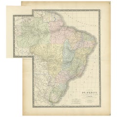
Original 1947 Map of Brazil by Charles Burki – Dutch Colonial Graphic Design
This original 1947 pen-and-ink map of Brazil by Charles Burki (1909–1994) exemplifies the artist’s precision, clarity, and distinctive mid-century graphic style. Executed in fine black linework on cream paper, it blends cartographic accuracy with decorative artistry, a hallmark of Burki’s postwar illustration period.
The map presents Brazil’s geography, resources, and agricultural zones in striking black-and-white contrasts, accompanied by a clear Dutch legend: “Weide Gronden” (pasturelands), “Woudgebied” (forested areas), “Granen” (grains), and “Metalen (ontgonnen)” (mined metals). Major cities such as Rio de Janeiro, São Paulo, and Manaos are identified, along with rivers like the Rio Negro, Rio Madeira, and the Amazon. A beautifully detailed compass rose and a sailing ship in the lower right corner lend the map a maritime flair reminiscent of early exploration charts.
At the bottom left, an inset notes “Tierra del Brasil, in 1500 ontdekt door de Portugeezen,” a reference to the Portuguese discovery of Brazil. This historical nod, combined with Burki’s crisp Art Deco typographic choices, places the map stylistically within the postwar Dutch educational and commercial design tradition, when Burki worked on geography and economic illustrations for magazines and publishing houses such as *Uitgeverij Succes*.
Burki’s map combines educational purpose with graphic elegance. The dense black patterning of economic zones contrasts with the clean coastal lines and ship engraving, demonstrating his background as both illustrator and architect. His compositional sense is evident in how the title “BRAZIL” anchors the lower border, balanced by the inset and ship vignette, making this piece both informative and visually commanding.
Condition report: Very good condition with minor toning consistent with age, small traces of mounting tape on margins, and light handling marks. The printed surface remains crisp, with rich blacks and clean lines.
Framing suggestion: Best displayed in a thin black or walnut frame with a natural off-white mat, highlighting the strong monochrome contrasts and fine linear detail of the map.
Technique: Pen and ink on paper
Maker: Charles Burki (Dutch-Indonesian, 1909–1994), signed and dated 1947
- Dimensions:Height: 12.41 in (31.5 cm)Width: 8.86 in (22.5 cm)Depth: 0.01 in (0.2 mm)
- Materials and Techniques:
- Place of Origin:
- Period:
- Date of Manufacture:1947
- Condition:Condition report: Very good condition with minor toning consistent with age, small traces of mounting tape on margins, and light handling marks. The printed surface remains crisp, with rich blacks and clean lines.
- Seller Location:Langweer, NL
- Reference Number:Seller: BG-Bea341stDibs: LU3054347180782
About the Seller
5.0
Recognized Seller
These prestigious sellers are industry leaders and represent the highest echelon for item quality and design.
Platinum Seller
Premium sellers with a 4.7+ rating and 24-hour response times
Established in 2009
1stDibs seller since 2017
2,830 sales on 1stDibs
Typical response time: 1 hour
- ShippingRetrieving quote...Shipping from: Langweer, Netherlands
- Return Policy
More From This Seller
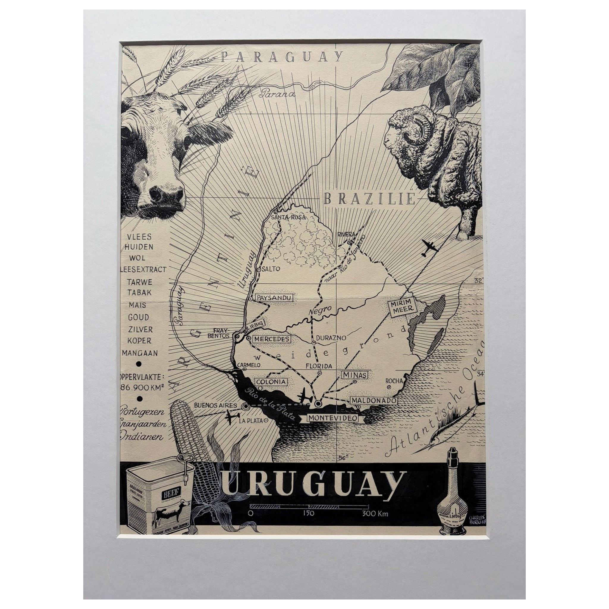
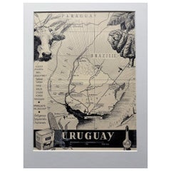
View AllOriginal 1948 Map of Uruguay by Charles Burki – Art Deco Design
Located in Langweer, NL
Title: Original 1948 Map of Uruguay by Charles Burki – Art Deco Design for Liebig Extract
This original 1948 pen-and-ink map of Uruguay by Charles Burki (1909–1994) showcases his re...
Category
Vintage 1940s Dutch Drawings
Materials
Paper
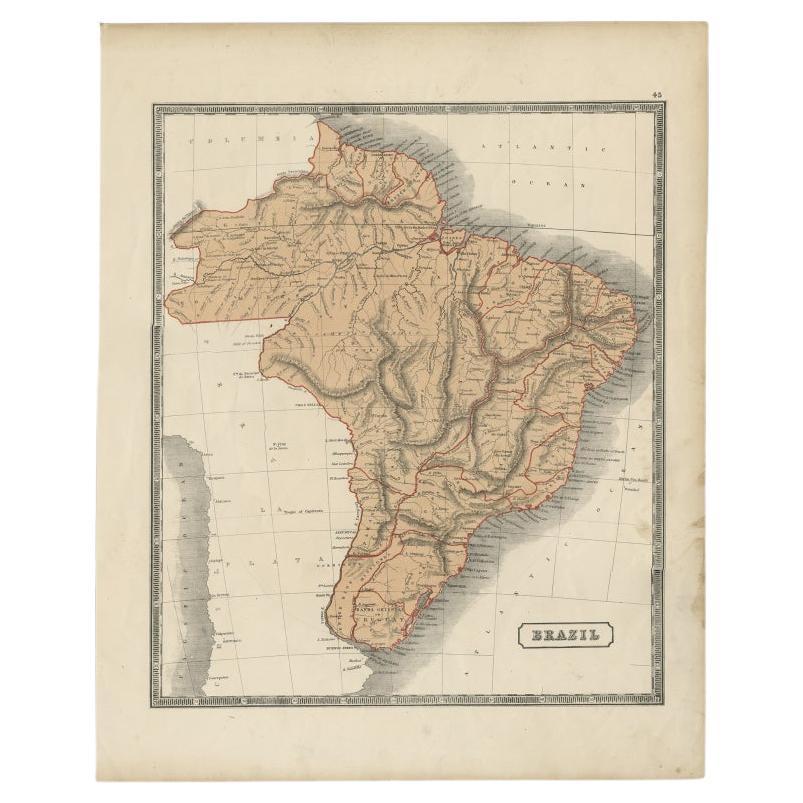
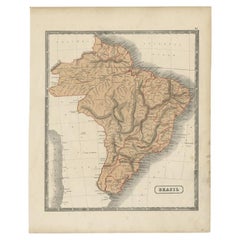
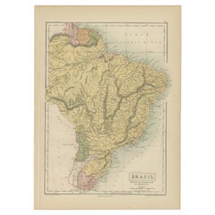
Antique Map of Brazil, Including Part of Colombia, Peru and Chili, c.1880
Located in Langweer, NL
Antique map South America titled 'Brazil'. This map depicts Brazil and its surroundings including part of Colombia, Peru and Chili. Source un...
Category
Antique 19th Century Maps
Materials
Paper
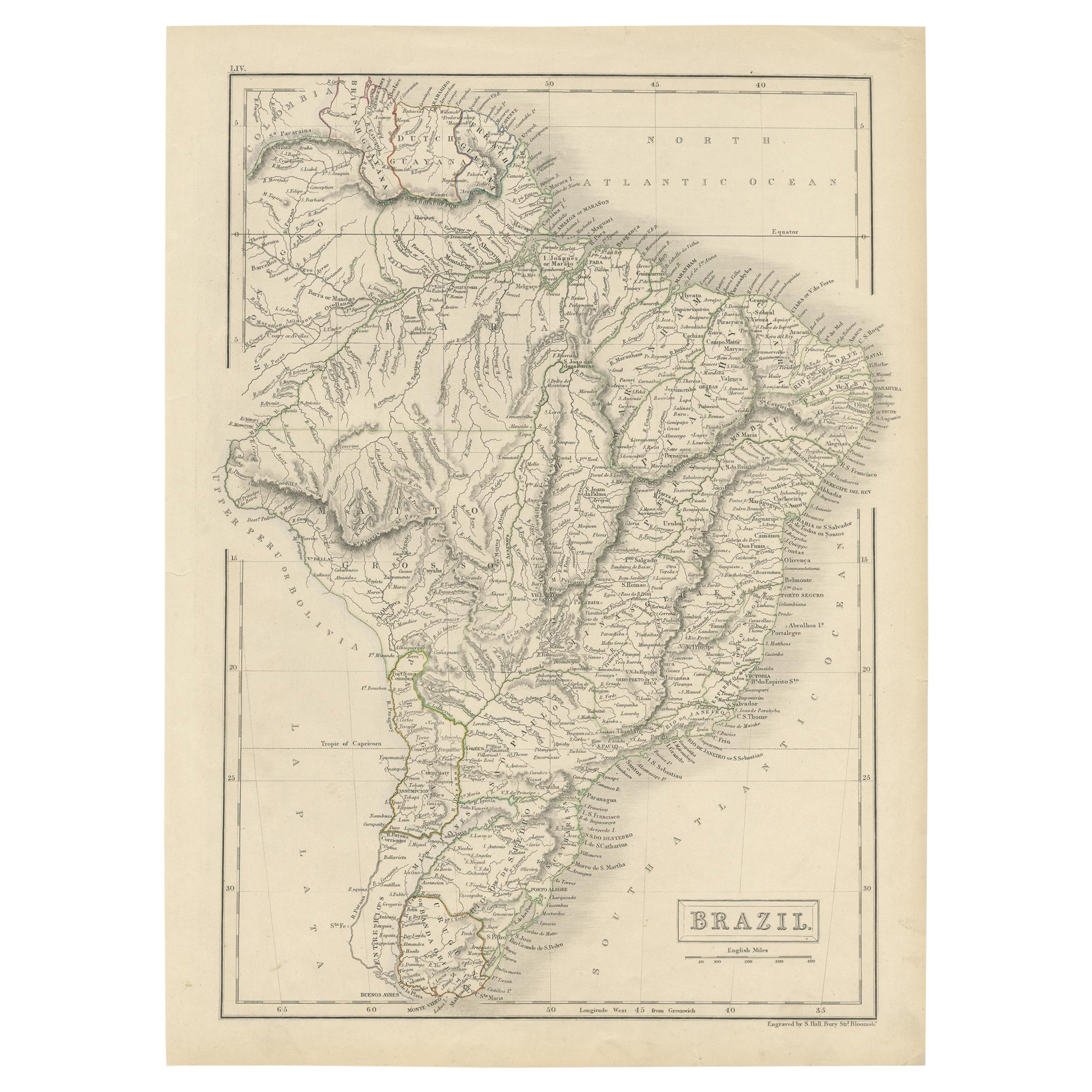
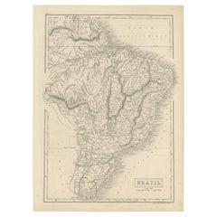
Antique Map of Brazil with Original Outline Hand-Colouring, c.1844
Located in Langweer, NL
Antique map titled 'Brazil'. Beautiful map with outline color of Brazil, engraved by S. Hall.
Artists and Engravers: Sydney Hall (1788-1831) was one of the most recognised and prolific British map...
Category
Antique 19th Century Maps
Materials
Paper
1882 Map of Brazil: Historic Borders, River Systems, and Coastal Regions
Located in Langweer, NL
Title: 1882 Map of Brazil: Historic Borders, River Systems, and Coastal Regions
Description:
This 1882 map presents a detailed cartographic view of Brazil, the largest country in S...
Category
Antique 1880s Maps
Materials
Paper

Antique Map of Brazil by Levasseur
1875
Located in Langweer, NL
Antique map titled 'Carte du Brésil'. Large map of Brazil, with small fold out. This map originates from 'Atlas de Géographie Moderne Physique et Politiq...
Category
Antique Late 19th Century French Maps
Materials
Paper
$379 Sale Price
20% Off
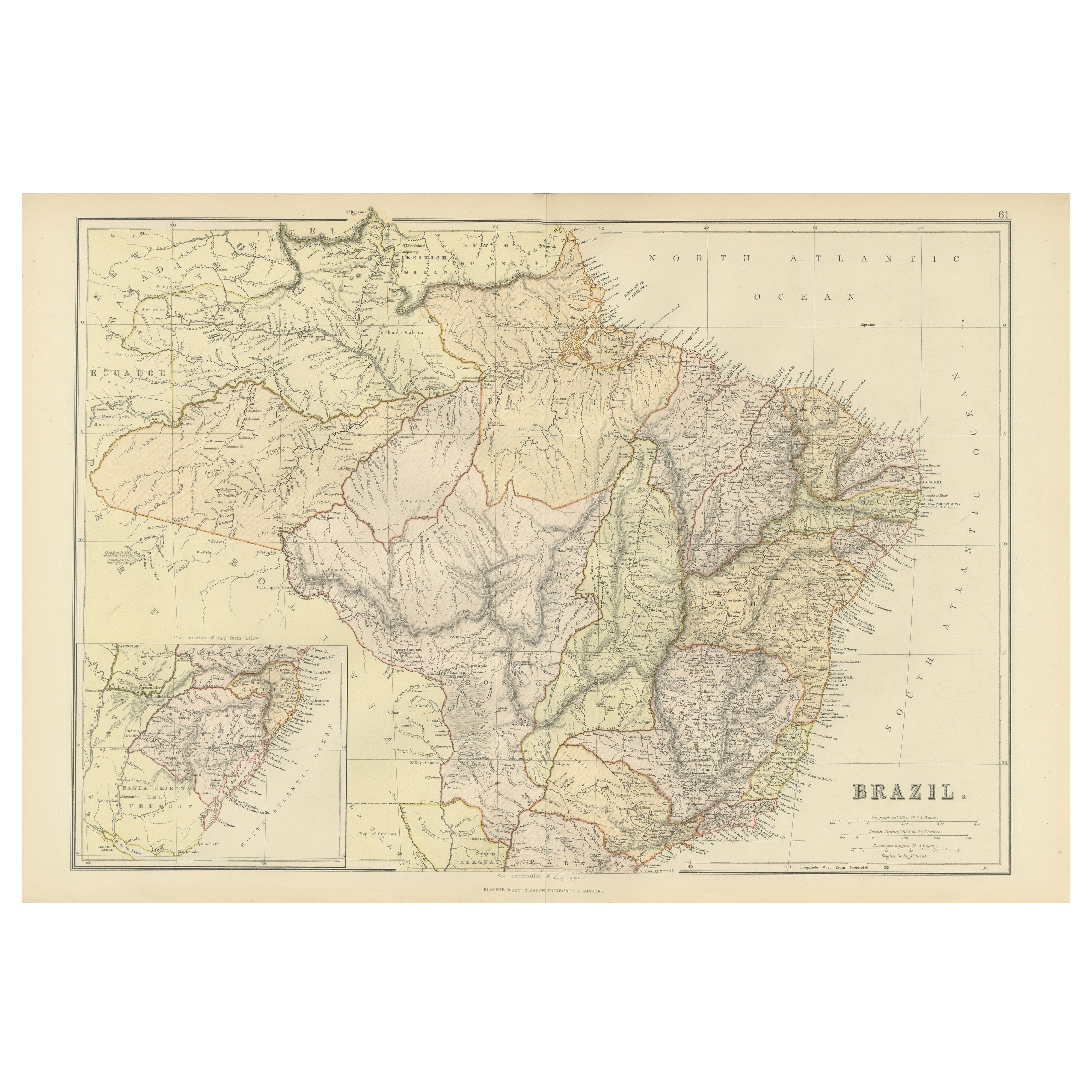
Antique Map of Brazil, Uruguay, Paraguay and Guyana by A
C. Black, 1870
Located in Langweer, NL
Antique map titled 'Brazil'. Original antique map of Brazil, Uruguay, Paraguay and Guyana. This map originates from ‘Black's General Atlas of The...
Category
Antique Late 19th Century English Maps
Materials
Paper
You May Also Like
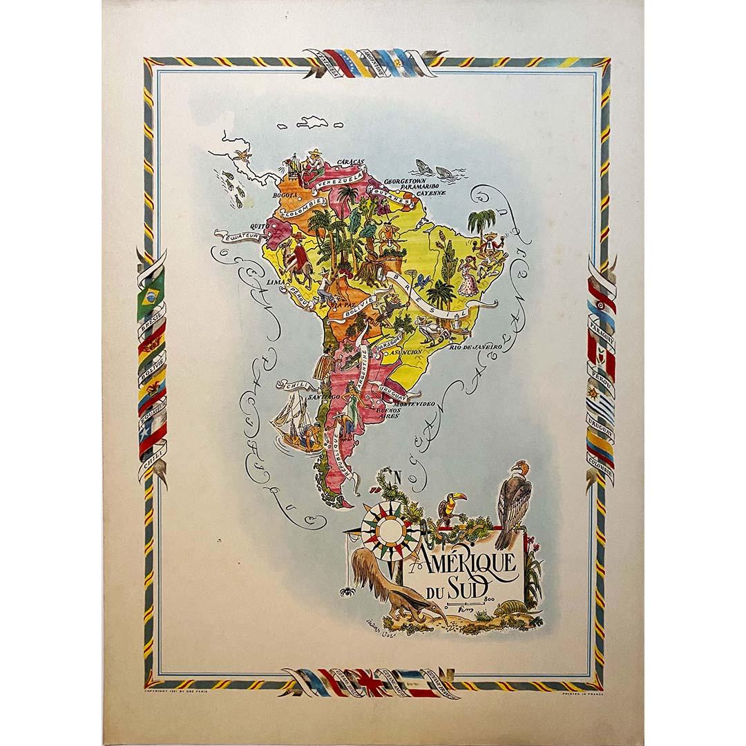
Jacques Liozu
s 1951 illustrated map of South America
By Jacques Liozu
Located in PARIS, FR
Jacques Liozu's 1951 illustrated map of South America is an exceptional work of cartography that skilfully blends art and geography. French artist and cartographer Jacques Liozu crea...
Category
1950s Prints and Multiples
Materials
Paper, Lithograph

Carte du Bresil, antique 1860s engraved map of Brazil
Located in Melbourne, Victoria
'Carte du Bresil'
Engraving with original outline colouring, circa 1860, by Alexandre Vuillemin, published in Paris.
31cm by 41cm (sheet)
21.5cm by 31.5cm (image)
Category
Late 19th Century Victorian More Prints
Materials
Lithograph

Antique Map of South America in Roma Frame
Located in Malibu, CA
Antique map of South America. Displayed in a new Roma frame with museum quality matting. Custom frame in platinum. No print date, but cert...
Category
Antique Late 19th Century Victorian Prints
Materials
Hardwood, Paper

$262 Sale Price
30% Off
Charte von Sud-America (Map of South America) - Etching with Hand-Drawn Outlines
Located in Soquel, CA
Map of south America, engraved by Franz Pluth (Czech, 1800-1871), from the book "Neueste Länder - und Völkerkunde, ein geographisches Lesebuch für alle Stände" by Linder, F. L. (Prag...
Category
1820s Other Art Style More Prints
Materials
Paper, Printer s Ink, Etching

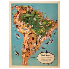
Original Vintage Pan Am Travel Map Poster South America Continent Of Contrasts
Located in London, GB
Original vintage Pan Am travel advertising map poster - South America Continent of Contrasts served by Pan American World Airways and Pan American Grace ...
Category
Vintage 1940s American Posters
Materials
Paper
South America, Eastern Part. Century Atlas antique vintage map
Located in Melbourne, Victoria
'The Century Atlas. South America. Eastern Part'
Original antique map, 1903.
Inset map 'Rio de Janeiro and Vicinity'.
Central fold as issued. Map name and number printed on the rev...
Category
Early 20th Century Victorian More Prints
Materials
Lithograph
