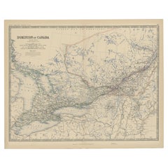
Items Similar to Original 1948 Map of Canada by Charles Burki – Art Deco Mountie Illustration
Want more images or videos?
Request additional images or videos from the seller
1 of 9
Original 1948 Map of Canada by Charles Burki – Art Deco Mountie Illustration
$694.75
£519.51
€580
CA$957.19
A$1,043.95
CHF 553.01
MX$12,515.42
NOK 7,042.91
SEK 6,440.22
DKK 4,419.83
About the Item
Title: Original 1948 Map of Canada by Charles Burki – Mounted Police Illustration and Art Deco Design
This original 1948 pen-and-ink map of Canada by Charles Burki (1909–1994) masterfully combines geographical clarity, artistic finesse, and postwar optimism. It captures the vastness of Canada through meticulous linework and decorative illustration, rendered in Burki’s hallmark Art Deco style that blends precision, order, and elegance.
The map details Canada’s provinces, major cities, and natural landmarks—from Hudson Bay and the Mackenzie River to the St. Lawrence Seaway and the Rocky Mountains—with crisp, balanced composition. Surrounding the map are graphic symbols of national identity and resources. A Royal Canadian Mounted Police officer on horseback dominates the foreground, representing discipline and frontier spirit, while a maple leaf emblem marks the nation’s identity. Additional vignettes—apples, fish, and northern fauna—highlight the country’s agricultural and natural abundance.
A boxed legend lists Canada’s key exports, including gold, coal, copper, nickel, silver, iron, zinc, petroleum, and agricultural products, alongside text in Dutch describing its bilingual population (“waarvan ongeveer 2.000.000 Frans sprekend”). Burki’s rendering of coastlines, topography, and typography demonstrates his architectural training and eye for harmony. The crisp black ink and subtle use of negative space lend the work the refined simplicity typical of his postwar output for *Uitgeverij Succes* and similar educational publishers.
The lower section features the words “God Save the King – Canada,” situating the work in the immediate postwar era, when Canada’s identity was firmly rooted within the British Commonwealth. Burki’s choice to depict the Mounted Police and the Rockies reflects a sense of strength and endurance—qualities that mirrored his own life story.
Charles Burki’s experience during World War II profoundly shaped his art. Born in the Dutch East Indies, he was captured by the Japanese army and endured years of imprisonment and forced labor. He survived the sinking of a prisoner transport ship and later witnessed the atomic bombing of Nagasaki, experiences that left an indelible mark on his outlook. After the war, he moved to the Netherlands, where he turned his trauma into disciplined creativity, producing architectural designs, illustrations, and maps that emphasized structure, resilience, and clarity.
This map of Canada embodies those same traits. Its fine drafting and calm balance express order and optimism after chaos, turning geography into a symbol of renewal.
Condition report: Very good condition with light toning and faint handling traces consistent with age. Minor mounting tape visible on the edges. The black ink remains bold and even.
Framing suggestion: Best presented in a thin black or walnut frame with a cream or off-white mat to accentuate the sharp contrast and precision of Burki’s linework.
Technique: Pen and ink on paper
Maker: Charles Burki (Dutch-Indonesian, 1909–1994), signed and dated 1948
- Dimensions:Height: 14.77 in (37.5 cm)Width: 10.44 in (26.5 cm)Depth: 0.01 in (0.2 mm)
- Materials and Techniques:
- Place of Origin:
- Period:
- Date of Manufacture:1948
- Condition:Condition report: Very good condition with light toning and faint handling traces consistent with age. Minor mounting tape visible on the edges. The black ink remains bold and even.
- Seller Location:Langweer, NL
- Reference Number:Seller: BG-Bea361stDibs: LU3054347183822
About the Seller
5.0
Recognized Seller
These prestigious sellers are industry leaders and represent the highest echelon for item quality and design.
Platinum Seller
Premium sellers with a 4.7+ rating and 24-hour response times
Established in 2009
1stDibs seller since 2017
2,791 sales on 1stDibs
Typical response time: <1 hour
- ShippingRetrieving quote...Shipping from: Langweer, Netherlands
- Return Policy
More From This Seller
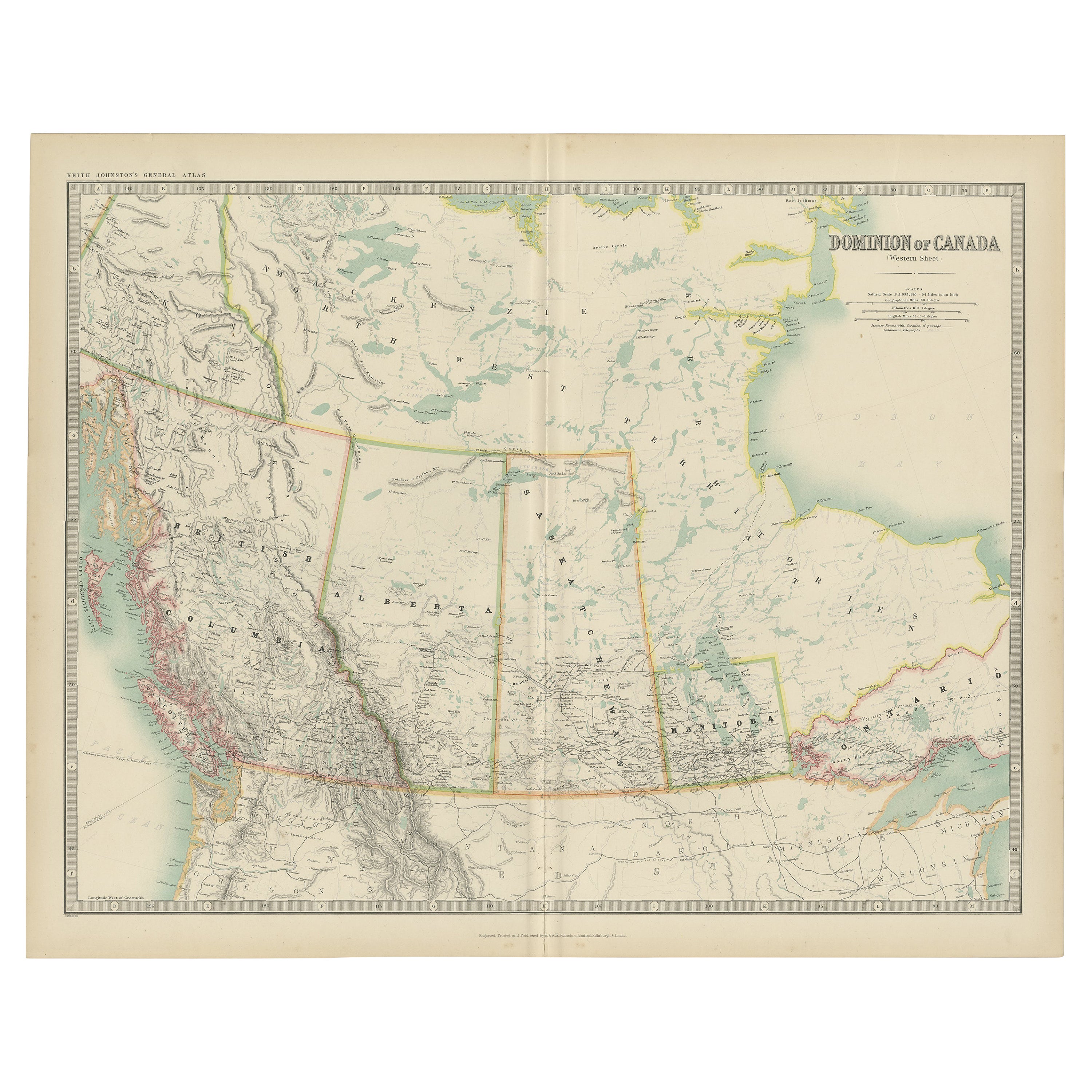
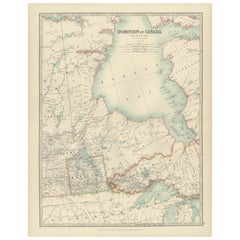
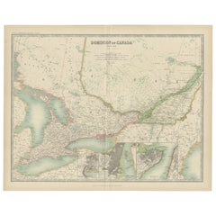
View AllAntique Map of Canada by Johnston
1909
Located in Langweer, NL
Antique map titled 'Dominion of Canada'. Original antique map of Canada. This map originates from the ‘Royal Atlas of Modern Geography’. Publishe...
Category
Early 20th Century Maps
Materials
Paper
$239 Sale Price
20% Off
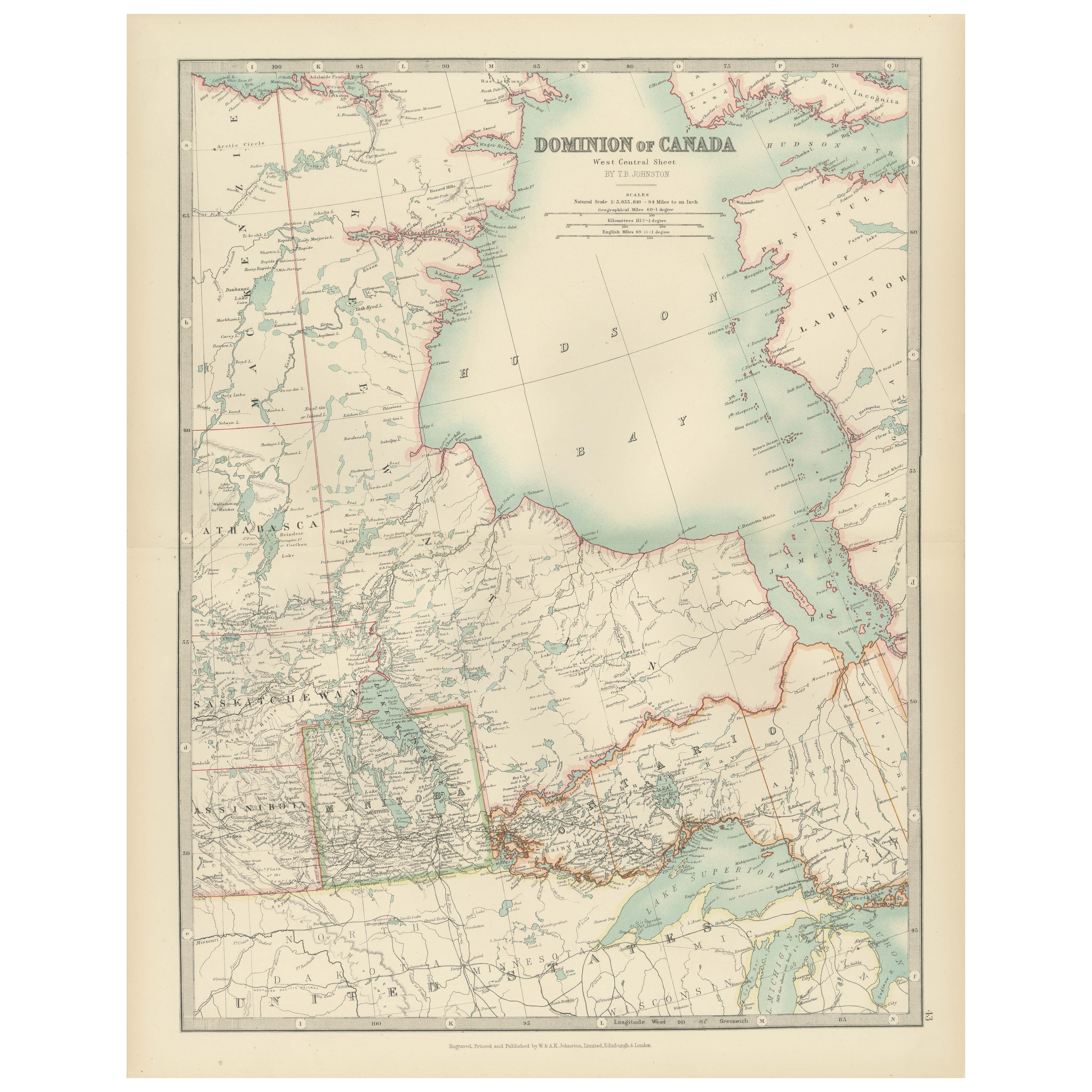
Canada Map 1903 - Dominion of Canada, West Central Sheet
Located in Langweer, NL
Title: Canada Map 1903 - Dominion of Canada, West Central Sheet
Description:
This fascinating 1903 map of the Dominion of Canada’s West Central regions by T.R. Johnston offers a viv...
Category
Early 20th Century Maps
Materials
Paper
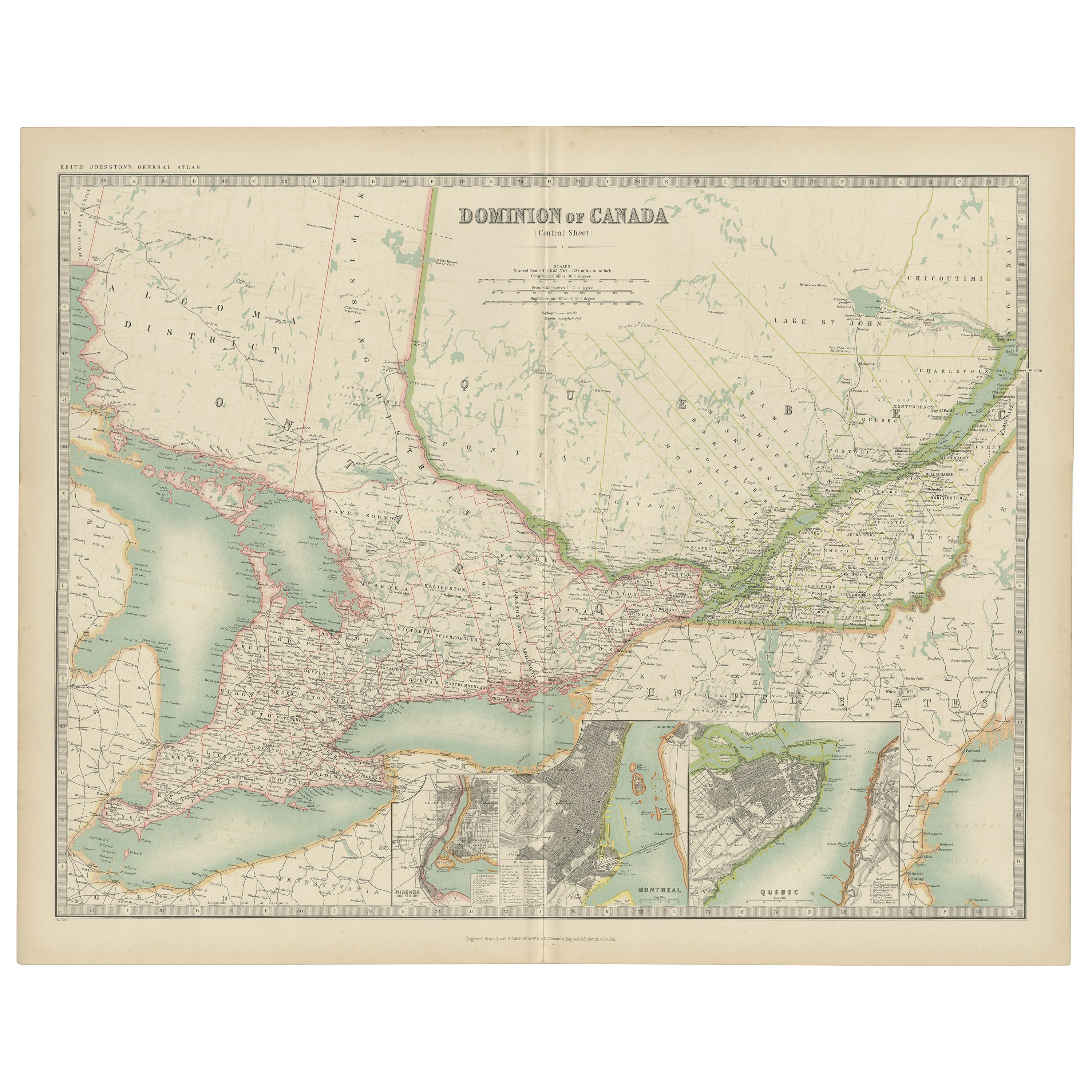
Antique Map of Canada by Johnston
1909
Located in Langweer, NL
Antique map titled 'Dominion of Canada'. Original antique map of Canada. With inset maps of Niagara, Montreal, Quebec. This map originates from t...
Category
Early 20th Century Maps
Materials
Paper
$239 Sale Price
20% Off
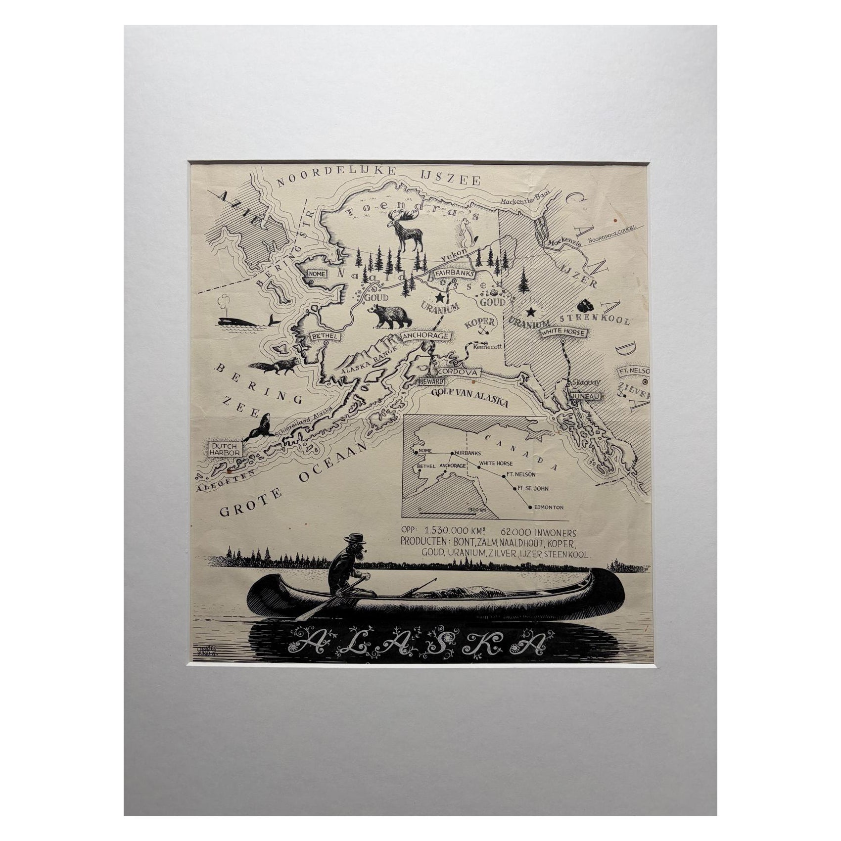
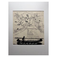
Original Illustration Map of Alaska by Charles Burki, ca. 1945 – Ink Drawing
Located in Langweer, NL
Original Illustration Map of Alaska by Charles Burki, ca. 1945 – Ink Drawing
Original pen-and-ink illustration of Alaska by Dutch artist Charles Burki (1909–1994), executed around 1...
Category
Vintage 1940s Dutch Drawings
Materials
Paper
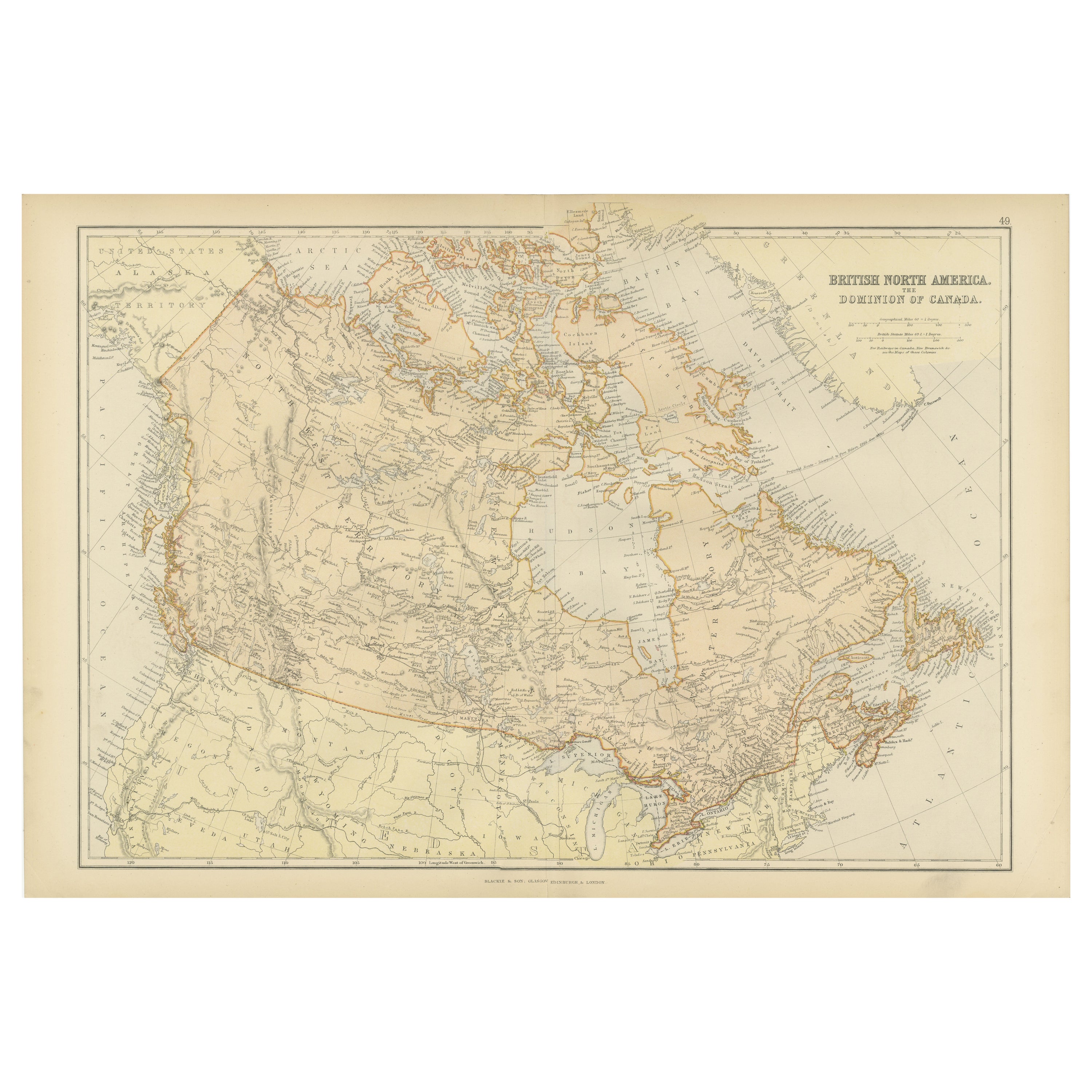
Antique Map of British North America, The Dominion of of Canada, 1882
Located in Langweer, NL
This map is titled "British North America, Dominion of Canada," from the 1882 Blackie Atlas. It features the geographical area that comprises modern-day Canada, with notable features...
Category
Antique 1880s Maps
Materials
Paper

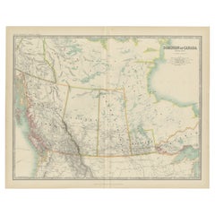
Old Original Antique Map of Western Canada, 1882
Located in Langweer, NL
Antique map titled 'Dominion of Canada'.
Old map of Western Canada. This map originates from 'The Royal Atlas of Modern Geography, Exhibiting, in a ...
Category
Antique 1880s Maps
Materials
Paper
You May Also Like
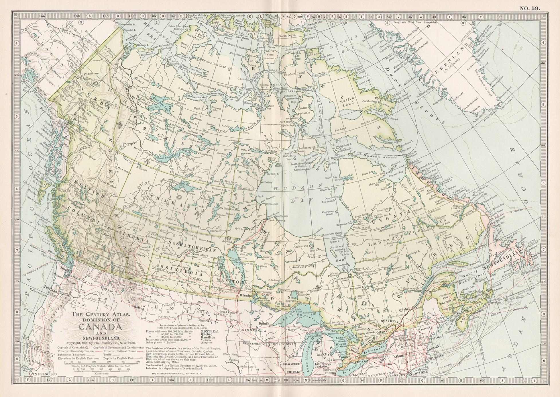
Canada and Newfoundland. Century Atlas antique vintage map
Located in Melbourne, Victoria
'The Century Atlas. Dominion of Canada and Newfoundland.'
Original antique map, 1903.
Central fold as issued. Map name and number printed on the reverse corners.
Sheet 29.5cm by 40...
Category
Early 20th Century Victorian More Prints
Materials
Lithograph

Large Original Vintage Map of North America, circa 1920
Located in St Annes, Lancashire
Great map of North America
Original color. Good condition
Published by Alexander Gross
Unframed.
Category
Vintage 1920s English Edwardian Maps
Materials
Paper

Very Large Vintage Map of Canada, German, Education, Institution, Cartography
Located in Hele, Devon, GB
This is a very large vintage map of Canada. A German, quality printed educational or institution map, dating to the mid 20th century, circa 1965....
Category
Mid-20th Century German Maps
Materials
Paper

Manitoba, British Columbia and NW Territories, Canada. Century Atlas antique map
Located in Melbourne, Victoria
'The Century Atlas. Manitoba, British Columbia and the Northwest Territories, Canada, North America.'
Original antique map, 1903.
Central fold as issued. Map name and number printe...
Category
Early 20th Century Victorian More Prints
Materials
Lithograph

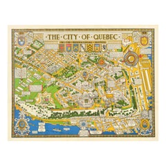
Original Vintage Travel Poster Quebec Map With Historical Notes Canada Pictorial
Located in London, GB
Original vintage travel map poster for The City of Quebec with historical notes drawn by S.H. Maw Toronto (Samuel Herbert Maw; 1881-1952) featuring ...
Category
Vintage 1930s Canadian Posters
Materials
Paper
Large 1848 North America
Territories Map
Located in Stamford, CT
Framed 1848 S. Augustus and Mitchell, Philadelphia , PA North America and territories map.
Featuring the United States, Canada (British Territory) and Mexican Territories.
As found...
Category
Antique 1840s American American Classical Maps
Materials
Glass, Wood, Paper
