Items Similar to Original Illustration Map of South Africa by Charles Burki, c.1945 – Ink Drawing
Video Loading
Want more images or videos?
Request additional images or videos from the seller
1 of 10
Original Illustration Map of South Africa by Charles Burki, c.1945 – Ink Drawing
$1,065.49
£796.80
€890
CA$1,468.19
A$1,601.75
CHF 848.12
MX$19,193.55
NOK 10,801.25
SEK 9,876.94
DKK 6,778.41
About the Item
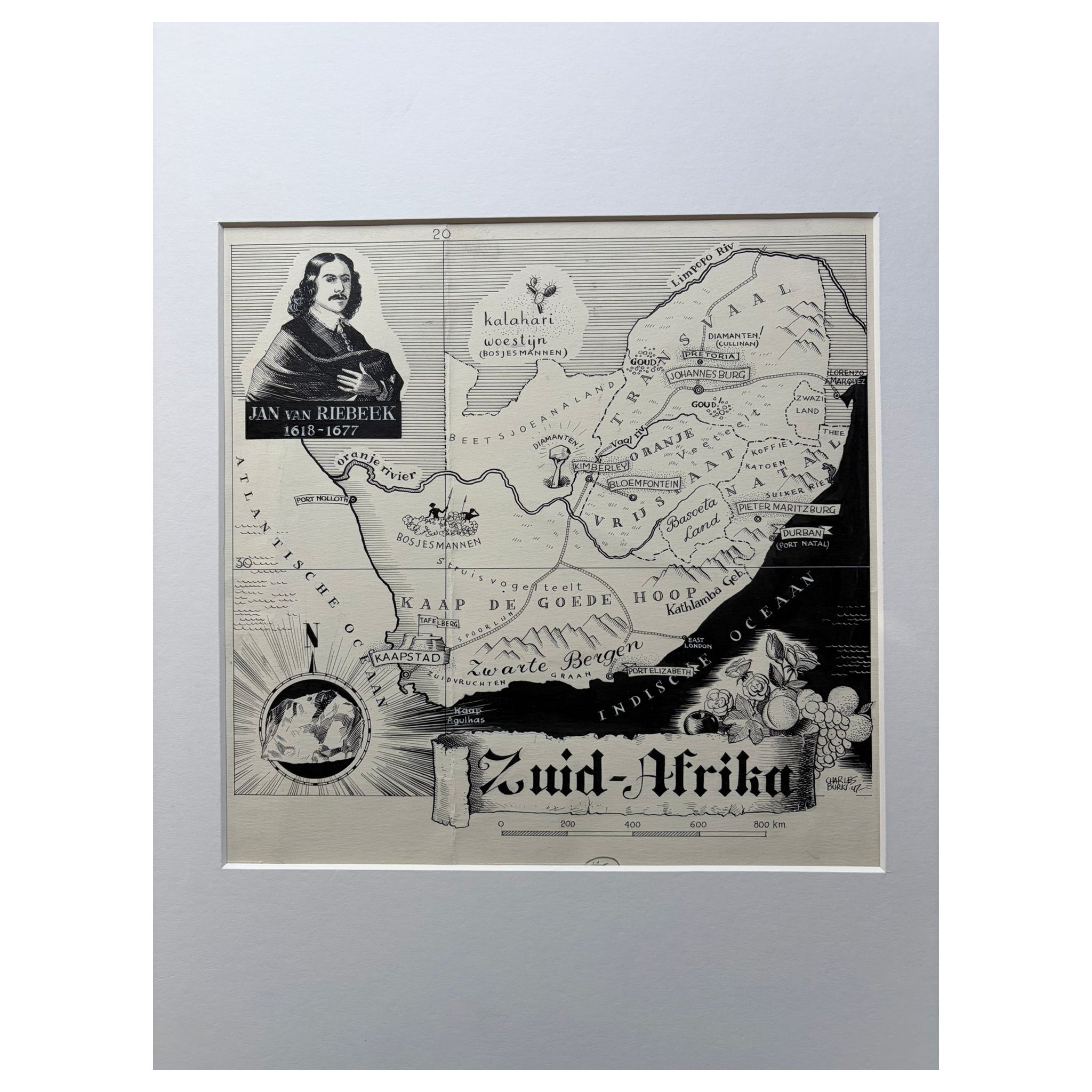
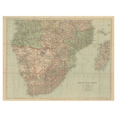
Original Illustration Map of South Africa by Charles Burki, ca. 1945 – Ink Drawing
Description:
Original pen-and-ink illustration of Zuid-Afrika (South Africa) by Dutch artist Charles Burki (1909–1994), executed circa 1945. This finely detailed map combines cartographic precision with Burki’s signature illustrative realism, characteristic of his early post-colonial period.
The composition presents a carefully drafted map of South Africa, highlighting Transvaal, Oranje Vrijstaat, Kaap de Goede Hoop, and Natal, surrounded by evocative imagery symbolizing the region: a stately African elephant at lower left, a woman in traditional headdress at lower right, and a modernist building representing urban progress in the upper left. These visual contrasts between nature, culture, and modernization reflect Burki’s fascination with global geography and human diversity, which informed much of his commercial and educational illustration work.
The artist’s expert use of stippling, cross-hatching, and clean linear composition demonstrates his technical training as an architectural draftsman and his sensitivity to form and tone. The annotations in the margins (“113 mm breed” and “980”) indicate this was likely a production artwork for a mid-century publication or atlas issued by a Dutch publisher such as 'Uitgeverij Succes' or 'Het Spectrum'.
A visually compelling and rare example of Burki’s map-based graphic art, merging scientific clarity with narrative design.
Biographical Note:
Charles Burki (1909–1994) was a Dutch painter and illustrator whose career bridged the colonial and post-war eras. Trained in architectural drafting, he moved to the Dutch East Indies in the 1930s and became known for posters and illustrations for local periodicals. During World War II, he was imprisoned as a POW; during transport to Japan his ship was bombed and sunk. He survived ten hours at sea, endured imprisonment, and was only 1,500 meters from the atomic blast in Japan—an ordeal that profoundly shaped his later art.
After returning to the Netherlands, Burki became one of the nation’s leading illustrators, creating dynamic cover art for Uitgeverij Succes, De Bezige Bij, Het Spectrum, and Kluitman. His precise draughtsmanship, cinematic realism, and restrained palette reflect both technical mastery and lived experience. Today, his original gouache and ink boards are prized as rare examples of mid-century Dutch illustration and narrative art.
Condition report:
Excellent original condition; strong, unfaded black ink on cream paper. Minor pencil and layout marks in the margins, consistent with original use. Sheet clean, crisp, and well preserved.
Framing tips:
Best displayed in a black, walnut, or teak frame with an ivory or warm-grey mat. A floating mount presentation will emphasize the printed border and production notes.
Technique: Pen and ink on paper
Maker: Charles Burki, The Netherlands, ca. 1945
- Dimensions:Height: 11.03 in (28 cm)Width: 9.06 in (23 cm)Depth: 0.01 in (0.2 mm)
- Materials and Techniques:
- Place of Origin:
- Period:
- Date of Manufacture:ca.1945
- Condition:Excellent original condition; strong, unfaded black ink on cream paper. Minor pencil and layout marks in the margins, consistent with original use. Sheet clean, crisp, and well preserved.
- Seller Location:Langweer, NL
- Reference Number:Seller: BG-Bea41stDibs: LU3054347066322
About the Seller
5.0
Recognized Seller
These prestigious sellers are industry leaders and represent the highest echelon for item quality and design.
Platinum Seller
Premium sellers with a 4.7+ rating and 24-hour response times
Established in 2009
1stDibs seller since 2017
2,791 sales on 1stDibs
Typical response time: <1 hour
- ShippingRetrieving quote...Shipping from: Langweer, Netherlands
- Return Policy
More From This Seller
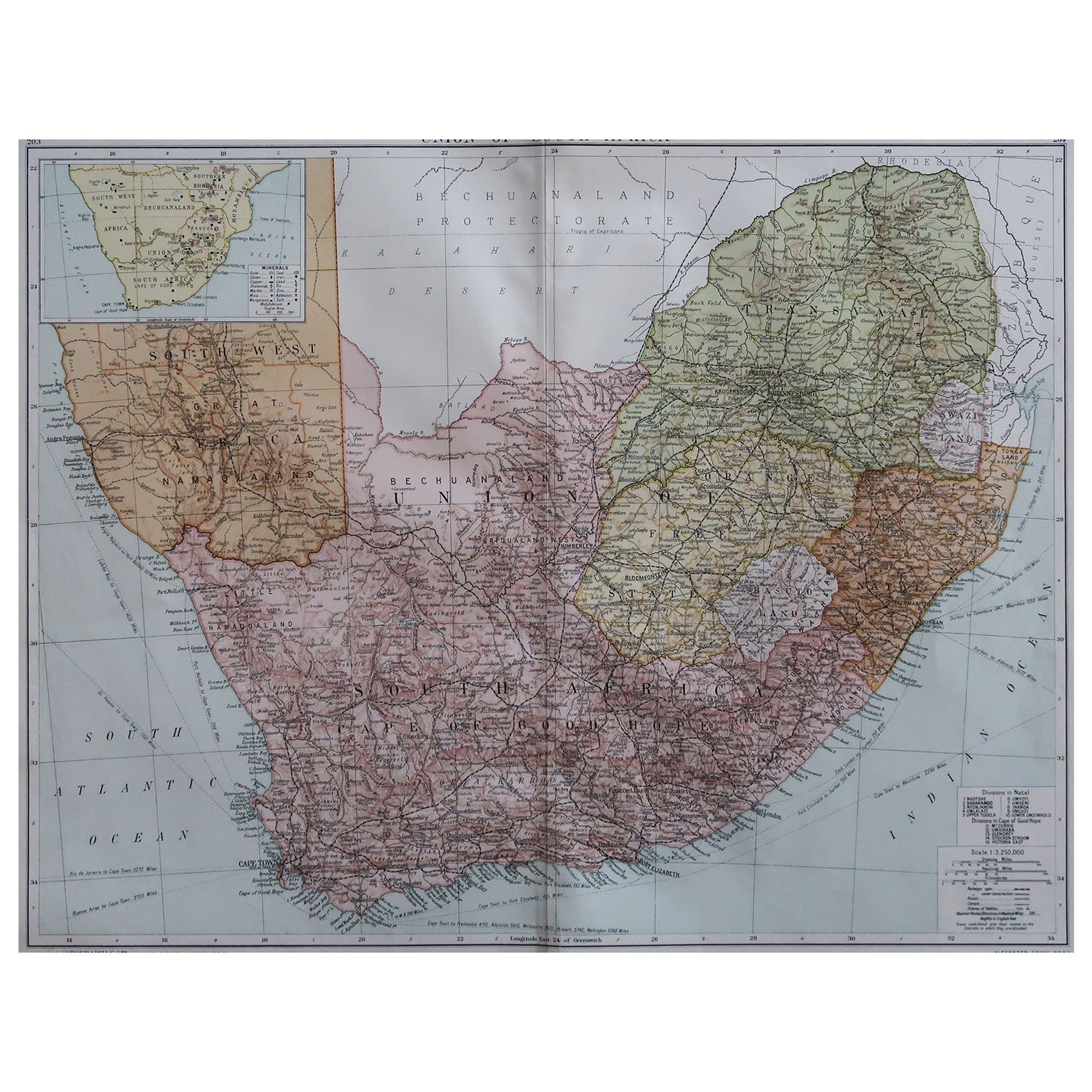
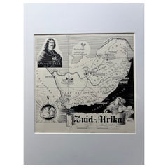
View AllOriginal 1947 Map of South Africa by C. Burki – Jan van Riebeeck
Cape Colony
Located in Langweer, NL
Title: Original 1947 Map of South Africa by Charles Burki – Jan van Riebeeck & Cape Colony
This striking 1947 pen-and-ink map of South Africa by Charles Burki (1909–1994) exemplifie...
Category
Vintage 1940s Dutch Drawings
Materials
Paper
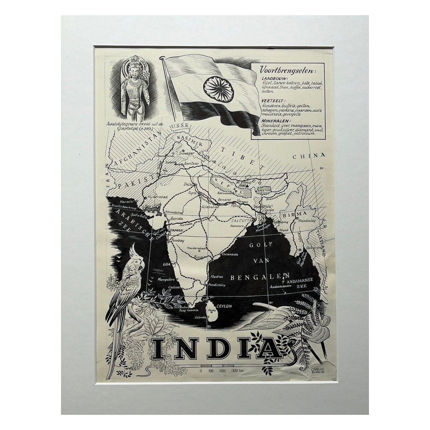
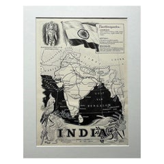
Original Illustration Map of India by Charles Burki, 1951 – Ink Drawing
Located in Langweer, NL
Original Illustration Map of India by Charles Burki, 1951 – Ink Drawing
Original pen-and-ink illustration of India by Dutch artist Charles Burki (1909–1994), executed in 1951. This ...
Category
Vintage 1950s Dutch Drawings
Materials
Paper
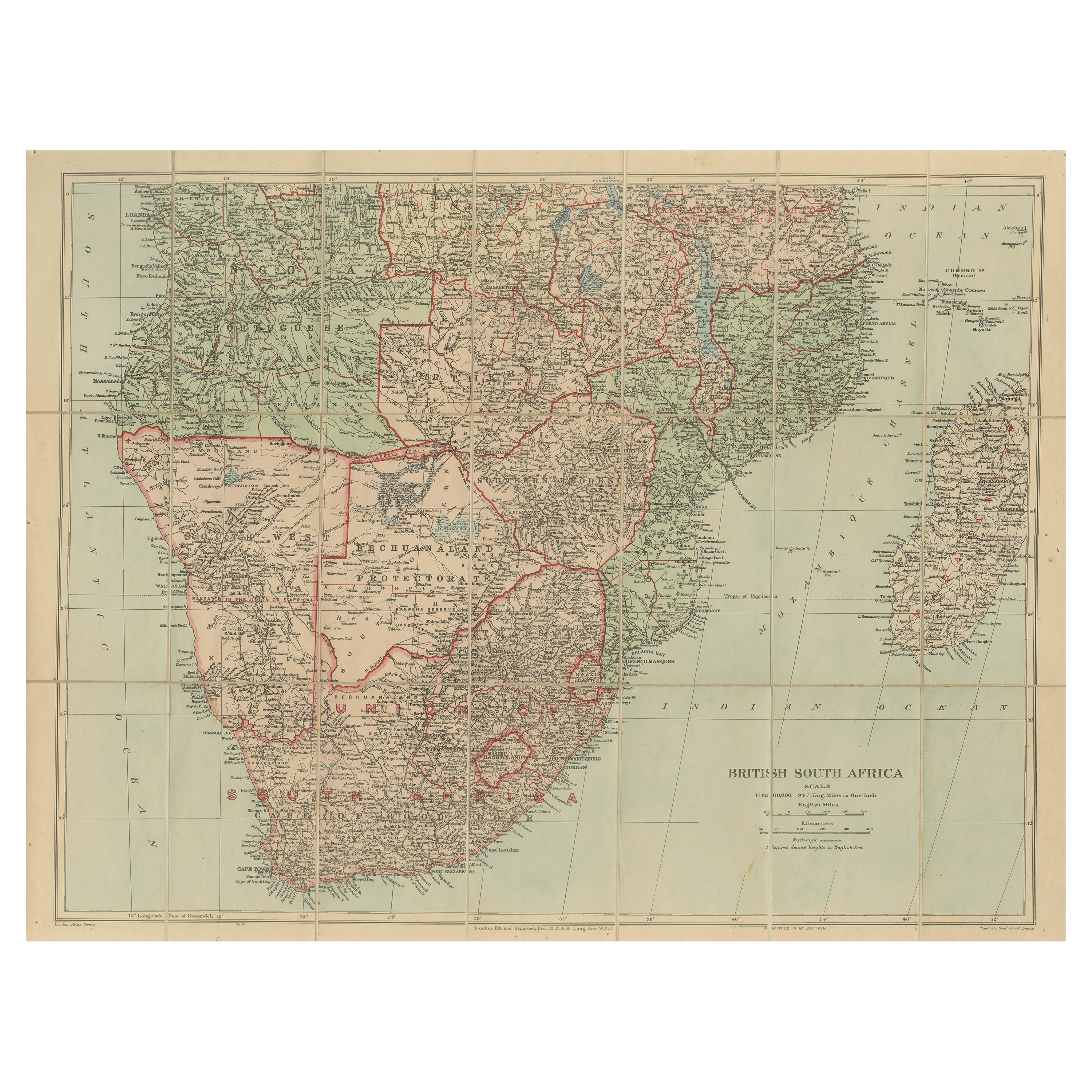
Antique Map of British South Africa – Colonial Territories
Railways, c.1920s
Located in Langweer, NL
Antique Map of British South Africa – Colonial Territories & Railways, c.1920s
This large and detailed folding map depicts British South Afric...
Category
Early 20th Century English Maps
Materials
Paper
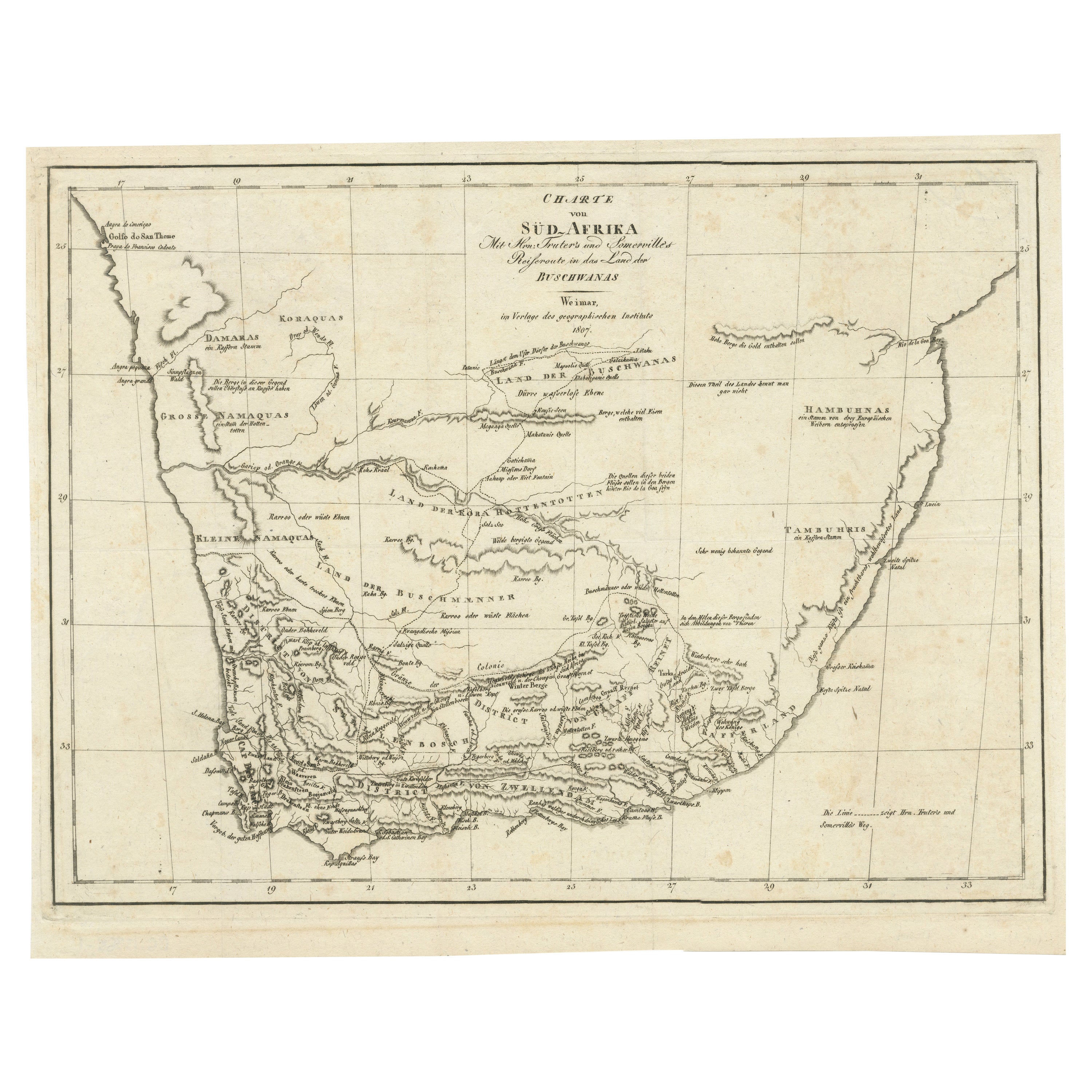
Antique Map of South Africa showing the Travels of Truter and Somerville
Located in Langweer, NL
Antique map titled 'Charte von Süd-Afrika'. Original antique map of South Africa showing the travels of Truter and Somerville. Published ci...
Category
Antique Early 19th Century Maps
Materials
Paper
$402 Sale Price
20% Off
Antique Map of Southern Africa by Levasseur, 1875
Located in Langweer, NL
Antique map titled 'Afrique Méridionale'. Large map of Southern Africa. This map originates from 'Atlas de Géographie Moderne Physique et Politique' b...
Category
Antique Late 19th Century French Maps
Materials
Paper

Antique Maps of North-West and South Africa, 1903, Colonial Borders and Terrain
Located in Langweer, NL
Title: Antique Maps of North-West and South Africa, 1903, Colonial Borders and Terrain
Description:
This double-plate antique map, featuring "N.W. Africa: Morocco, Algeria & Tunis" ...
Category
Early 20th Century Maps
Materials
Paper
You May Also Like
Large Original Vintage Map of South Africa, circa 1920
Located in St Annes, Lancashire
Great map of South Africa
Original color.
Good condition / repair to a minor edge tear middle bottom
Published by Alexander Gross
Unframed.
...
Category
Vintage 1920s English Edwardian Maps
Materials
Paper

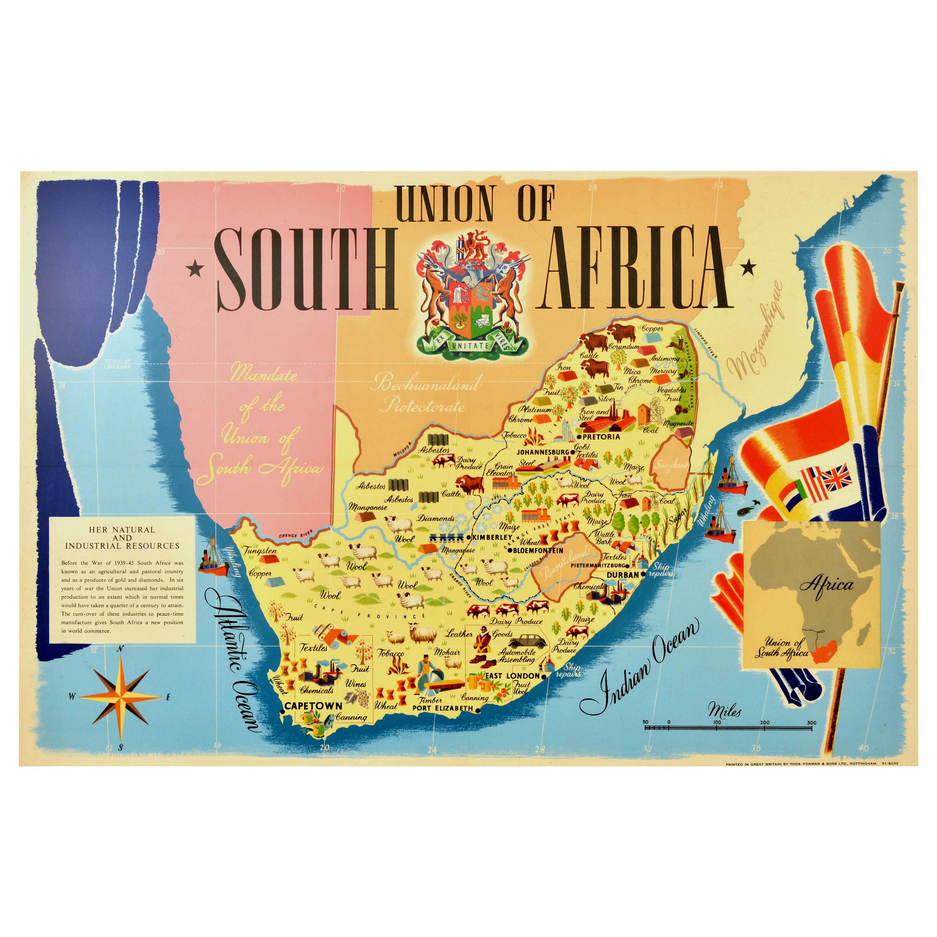
Original Vintage Poster Union Of South Africa Map Natural
Industrial Resources
Located in London, GB
Original vintage illustrated map poster for the Union of South Africa Her Natural and Industrial Resources featuring colourful images of the main cities including Cape Town, Pretoria...
Category
Vintage 1940s British Posters
Materials
Paper
Original Antique Map of Africa by Dower, circa 1835
Located in St Annes, Lancashire
Nice map of Africa
Drawn and engraved by J.Dower
Published by Orr & Smith. C.1835
Unframed.
Free shipping
Category
Antique 1830s English Maps
Materials
Paper

Large Original Antique Map of Africa. C.1900
Located in St Annes, Lancashire
Fabulous map of Africa
Original color.
Engraved and printed by the George F. Cram Company, Indianapolis.
Published, C.1900.
Unframed.
Free shipping.
Category
Antique 1890s American Maps
Materials
Paper

Original Antique Map of South Africa, Arrowsmith, 1820
Located in St Annes, Lancashire
Great map of South Africa.
Drawn under the direction of Arrowsmith.
Copper-plate engraving.
Published by Longman, Hurst, Rees, Orme and Br...
Category
Antique 1820s English Maps
Materials
Paper

Map of Africa - Original Etching by C. Brue - 1820
Located in Roma, IT
Map of Africa is an original etching realized by C.Brue in 1820.
The print comes from the Series "Atlas Universal" PL. 31.
The state of preservation of the artwork is good except f...
Category
1820s Modern Figurative Prints
Materials
Etching
