Items Similar to Large Framed Map of the Mediterranean


Want more images or videos?
Request additional images or videos from the seller
1 of 7
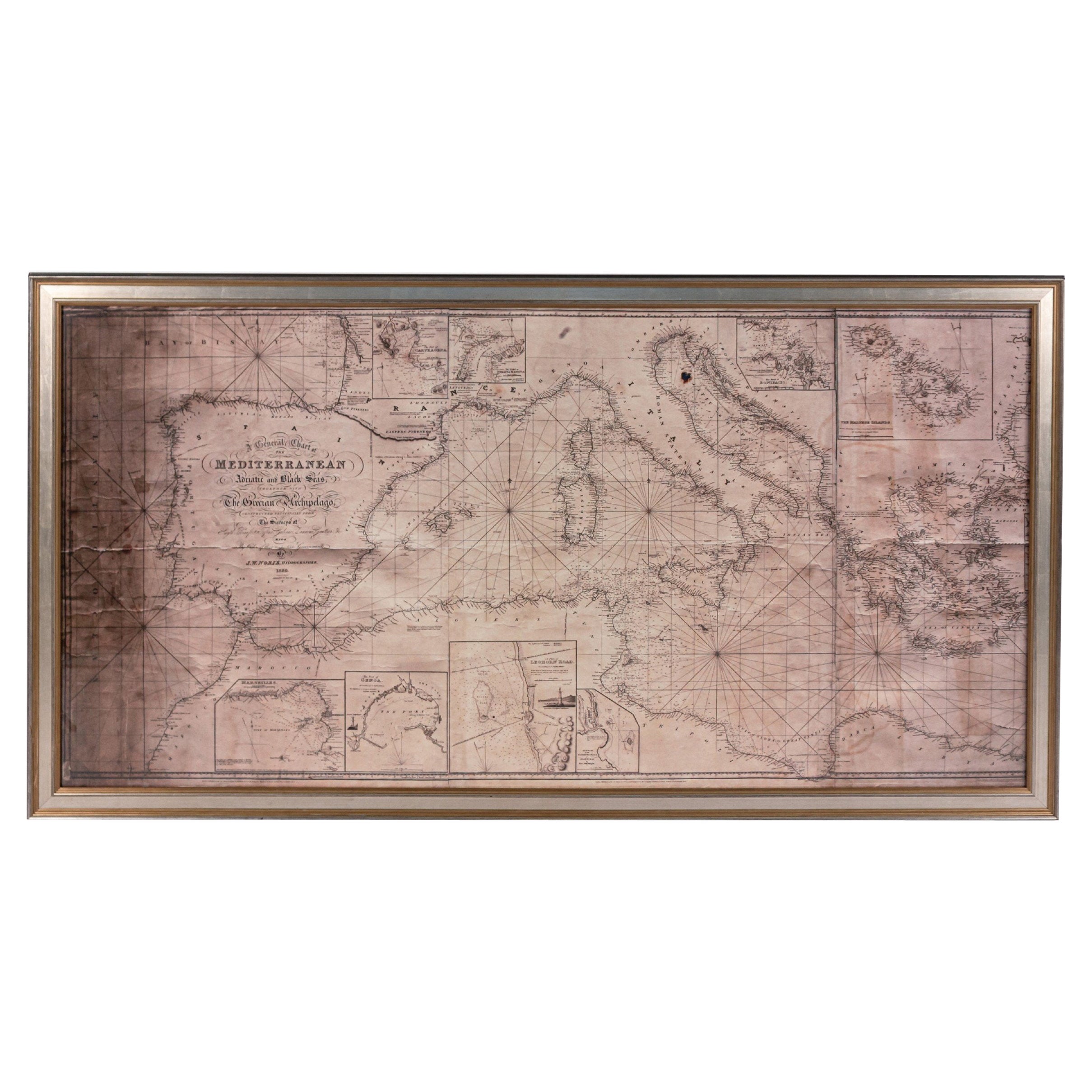
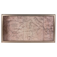
Large Framed Map of the Mediterranean
$4,500
£3,410.05
€3,929.69
CA$6,364.24
A$6,844.21
CHF 3,659.61
MX$82,539.21
NOK 46,278.29
SEK 42,165.48
DKK 29,363.47
About the Item
Large map/chart chart of The Mediterranean and the Grecian Archipelago showing Italy, Sardinia, Corsica, part of France, etc. in a black frame
- Dimensions:Height: 36 in (91.44 cm)Width: 67 in (170.18 cm)Depth: 0.75 in (1.91 cm)
- Style:Mid-Century Modern (Of the Period)
- Place of Origin:
- Period:
- Date of Manufacture:Mid-20th Century
- Condition:
- Seller Location:Queens, NY
- Reference Number:Seller: 0623481stDibs: LU977947923282
About the Seller
4.9
Recognized Seller
These prestigious sellers are industry leaders and represent the highest echelon for item quality and design.
Platinum Seller
Premium sellers with a 4.7+ rating and 24-hour response times
Established in 1939
1stDibs seller since 2013
1,054 sales on 1stDibs
Typical response time: <1 hour
- ShippingRetrieving quote...Shipping from: Long Island City, NY
- Return Policy
More From This Seller
View AllLarge Framed Map of the Mediterranean
Located in Queens, NY
Large map/chart chart of The Mediterranean and the Grecian Archipelago showing Italy, Sardinia, Corsica, part of France, etc. in a black frame.
Category
20th Century French Mid-Century Modern Maps
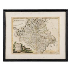
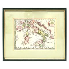
Italian Neo-Classic Framed Print of a Regional Map of Italy
Located in Queens, NY
Italian Neo-classic style print of a regional map of Italy in a black painted wooden frame.
Category
Antique 19th Century Italian Neoclassical Prints
Materials
Paint
Italian Neo-Classic Map of Italy
Located in Queens, NY
Italian Neo-classic style framed print of map of Italy
Category
20th Century Italian Neoclassical Paintings
Materials
Paper
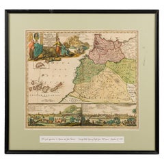
Framed Print of an Antique German Map of Morocco
Located in Queens, NY
Antique German map (print) of Morocco (circa 1728) featuring a central map above two city views depicted below and an upper scenic cartouche featur...
Category
Mid-20th Century German Biedermeier Paintings
Materials
Wood
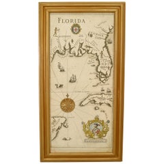
Mid-Century Modern Florida Gulf Coast Map
Located in Queens, NY
Mid-Century Modern (Italian) map print depicting 19th century Gulf Coast areas of Florida with crests and medallions in gold frames. (Companion piece: GRS118A)
Condition: Good; Wear...
Category
20th Century Italian Mid-Century Modern Paintings
Materials
Paper
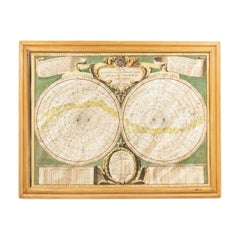
Italian Renaissance Celestial Map
Located in Queens, NY
Italian Renaissance style framed print of celestial map depicting stars and heavens (dated 1700 and inscribed Marco Bembo)
Category
Antique Early 18th Century Italian Renaissance Maps
You May Also Like
1970s Framed Antique Map of Italy 1746 Original
Located in Nuernberg, DE
An extraordinary original antique map, framed in the 1970s by Brehm Nuremberg, Germany, showing Italy. Map is dated 1746 and approx. 7 ¼" wide and 5 ¾" high in viewable size. Framed ...
Category
Vintage 1970s Decorative Art
Materials
Glass, Wood
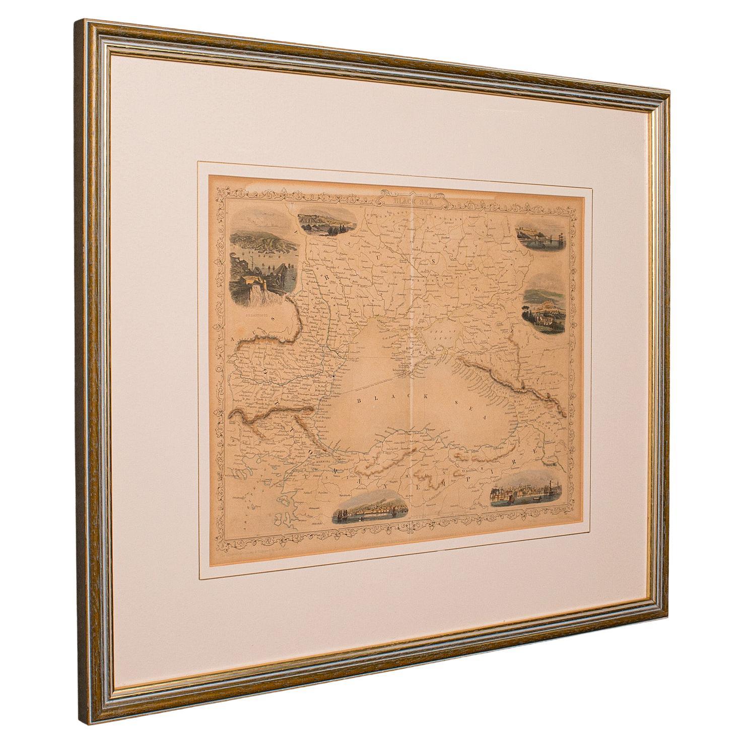
Antique Lithography Map, Black Sea, English, Framed, Cartography, Victorian
Located in Hele, Devon, GB
This is an antique lithography map of the Black Sea region. An English, framed atlas engraving of cartographic interest by John Rapkin, dating to the early Victorian period and later...
Category
Antique Mid-19th Century British Early Victorian Maps
Materials
Wood

Antique Lithography Map, West Africa, English, Framed, Cartography, Victorian
Located in Hele, Devon, GB
This is an antique lithography map of Western Africa. An English, framed atlas engraving of cartographic interest by John Rapkin, dating to the early Victorian period and later, circ...
Category
Antique Mid-19th Century British Early Victorian Maps
Materials
Wood

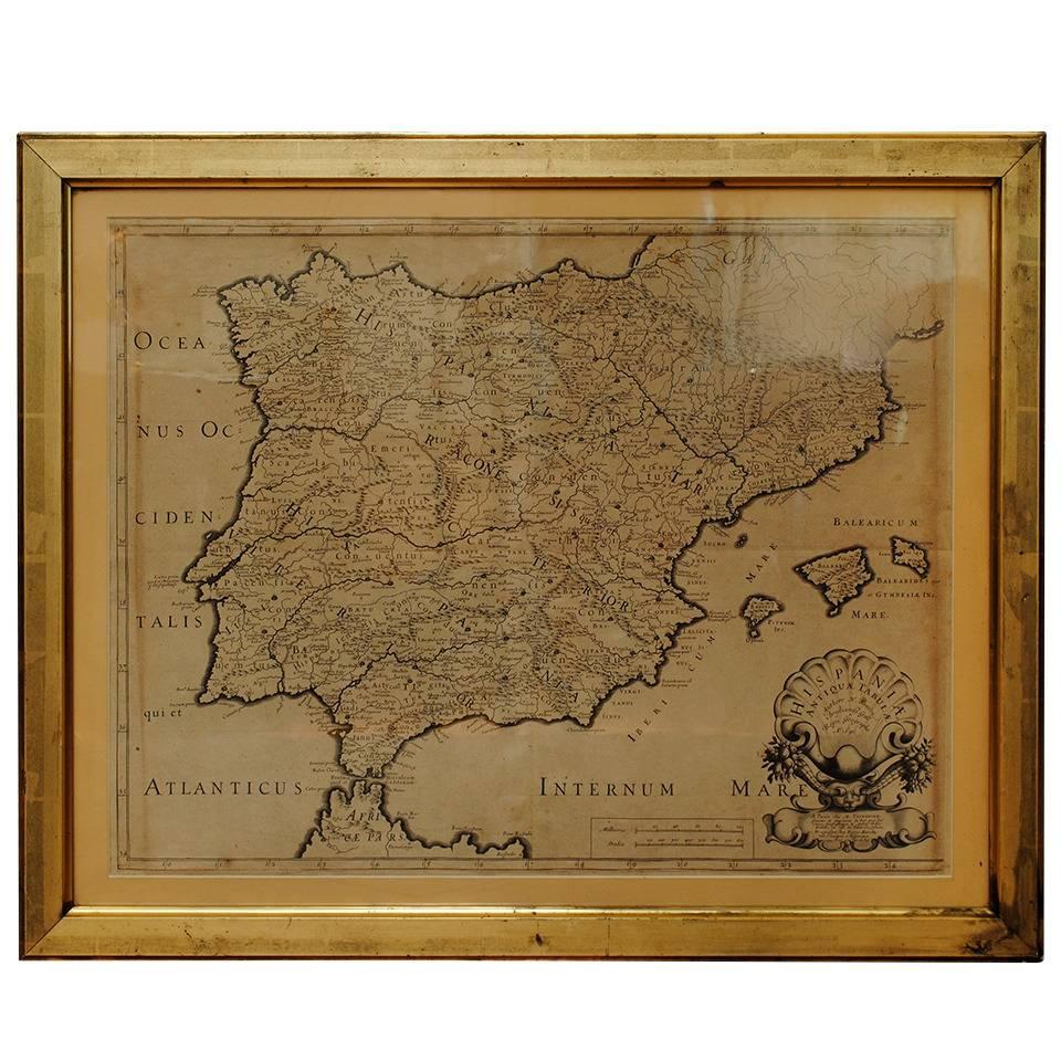
17th Century Lithograph Framed Map of Spain
Located in Atlanta, GA
In giltwood frame, dated 1652.
Category
Antique 18th Century and Earlier Spanish Baroque Prints
Materials
Ink, Paper

Italy, Sicily, Sardinia, Corsica and Dalmatian Coast: A 17th Century Dutch Map
By Theodorus Danckerts
Located in Alamo, CA
This hand colored 17th century Dutch map entitled "Novissima et Accuratissima totius Italiae Corsicae et Sardiniae Descriptio" by Theodore Danckerts depicts the Italian Peninsula in ...
Category
Antique Late 17th Century Dutch Maps
Materials
Paper

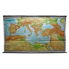
Vintage Mural Map Mediterranean Sea Near East Countries Rollable Wall Chart
Located in Berghuelen, DE
A large countrycore pull-down map showing the countries surrounding the Mediterranean Sea, published by Westermann. Colorful print on paper reinforced with canvas.
Measurements:
Width 269 cm (105.91 inch)
Height 149 cm (58.66 inch)
The measurements shown refer just to the canvas and do not include the poles.
Background information on the history of school wall charts:
The idea to upgrade every day school life by using pictures...
Category
Vintage 1970s German Country Prints
Materials
Canvas, Wood, Paper