Items Similar to Late 20th Century Educational Geographic Map - Australasia


Want more images or videos?
Request additional images or videos from the seller
1 of 8
Late 20th Century Educational Geographic Map - Australasia
$197.79
£145
€168.42
CA$272.50
A$297.20
CHF 157.44
MX$3,563.01
NOK 2,005.04
SEK 1,833.46
DKK 1,258.28
About the Item
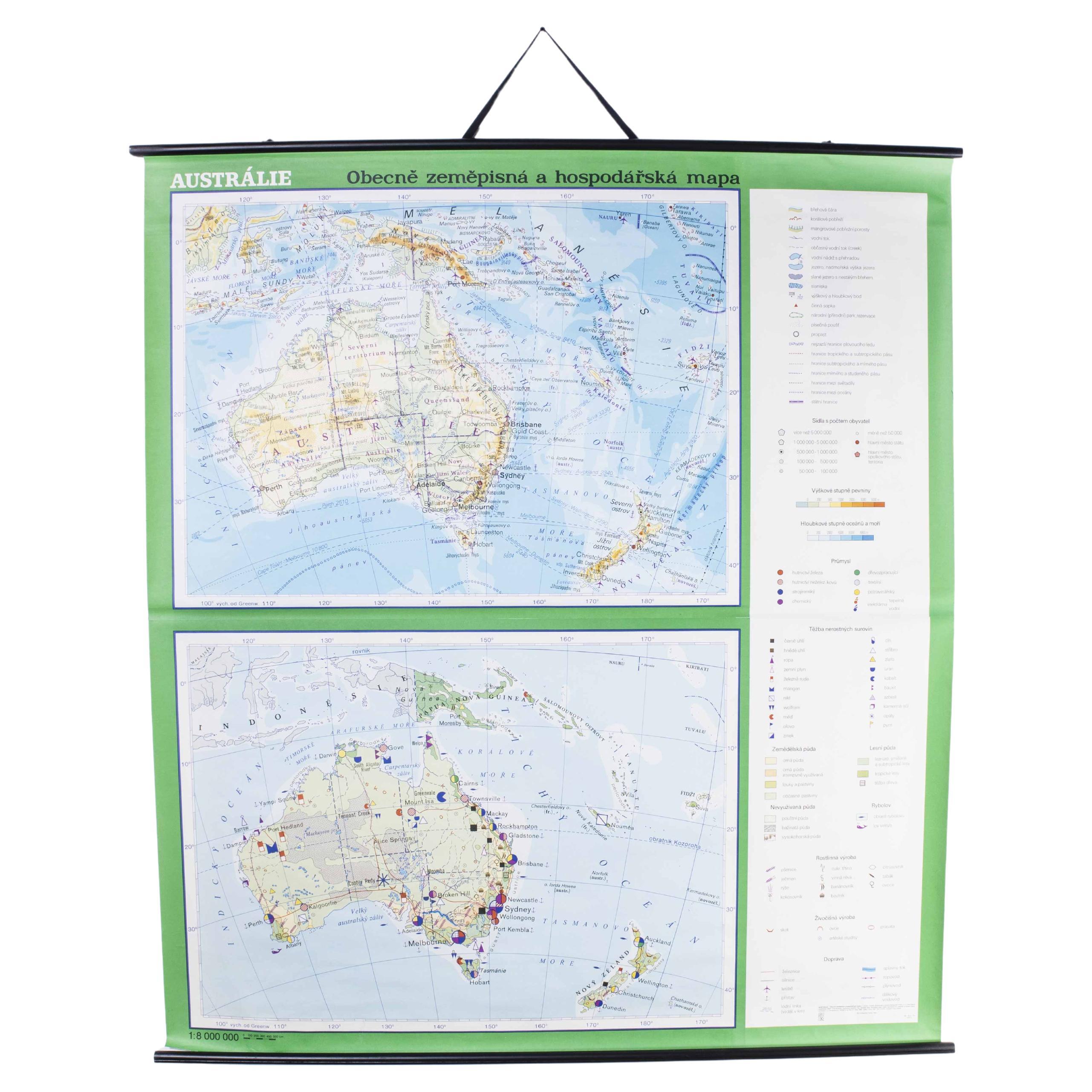
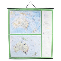
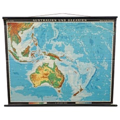
Late 20th Century Educational Geographic Map – Australasia
Late 20th Century Educational Geographic Map – Australasia. Good quality roll up school educational geographic map from the Czech republic. The map is printed on a cotton canvas that has been sealed with a clear lacquer.
WORKSHOP REPORT
Our workshop team inspect every product and carry out any needed repairs to ensure that everything leaves us serviced and maintained ready for many more years of life. All of our vintage products show the rich beauty and history of their life with the knocks and bumps of many years of use and we try to minimise restoration to keep every piece as original as possible.
Date: Late 20th Century
Maker: Industrial Production - Czech
Dimensions: L 1 x W 212 x H 161 cm
- Dimensions:Height: 63.39 in (161 cm)Width: 83.47 in (212 cm)Depth: 0.4 in (1 cm)
- Materials and Techniques:
- Place of Origin:
- Period:
- Date of Manufacture:Late 20th Century
- Condition:Refinished. Wear consistent with age and use.
- Seller Location:Hook, GB
- Reference Number:Seller: 1728.191stDibs: LU4494237887162
About the Seller
4.7
Vetted Professional Seller
Every seller passes strict standards for authenticity and reliability
Established in 2017
1stDibs seller since 2019
504 sales on 1stDibs
Typical response time: 19 hours
- ShippingRetrieving quote...Shipping from: Hook, United Kingdom
- Return Policy
More From This Seller
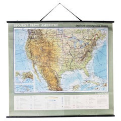
View AllLate 20th Century Educational Geographic Map - Australia Topography And Economy
Located in Hook, Hampshire
Late 20th Century Educational Geographic Map – Australia Topography And Economy
Late 20th Century Educational Geographic Map – Australia Topography And Economy. Good quality roll up ...
Category
Late 20th Century Czech Posters
Materials
Cotton
Late 20th Century Educational Geographic Map - South African Topography (1728.5)
Located in Hook, Hampshire
Late 20th Century Educational Geographic Map – South African Topography (1728.5)
Late 20th Century Educational Geographic Map – South African Topograp...
Category
Late 20th Century Czech Posters
Materials
Cotton
Late 20th Century Educational Geographic Map - South African Topography (1728.4)
Located in Hook, Hampshire
Late 20th Century Educational Geographic Map – South African Topography (1728.4)
Late 20th Century Educational Geographic Map – South African Topograp...
Category
Late 20th Century Czech Posters
Materials
Cotton
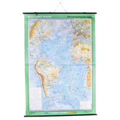
Late 20th Century Educational Geographic Map - Atlantic Currents
Located in Hook, Hampshire
Late 20th Century Educational Geographic Map – Atlantic Currents
Late 20th Century Educational Geographic Map – Atlantic Currents. Good quality roll up school educational geographic ...
Category
Late 20th Century Czech Posters
Materials
Cotton
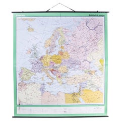
Late 20th Century Educational Geographic Map - European Countries
Located in Hook, Hampshire
Late 20th Century Educational Geographic Map – European Countries
Late 20th Century Educational Geographic Map – European Countries. Good quality roll up s...
Category
Late 20th Century Czech Posters
Materials
Cotton
Late 20th Century Educational Geographic Map - South Asia Topography
Located in Hook, Hampshire
Late 20th Century Educational Geographic Map – South Asia Topography
Late 20th Century Educational Geographic Map – South Asia Topography. Good quality roll up school educational geo...
Category
Late 20th Century Czech Posters
Materials
Cotton
You May Also Like
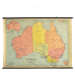
Vintage Mural Map Rollable Wall Chart Poster Australia New Zealand Indonesia
Located in Berghuelen, DE
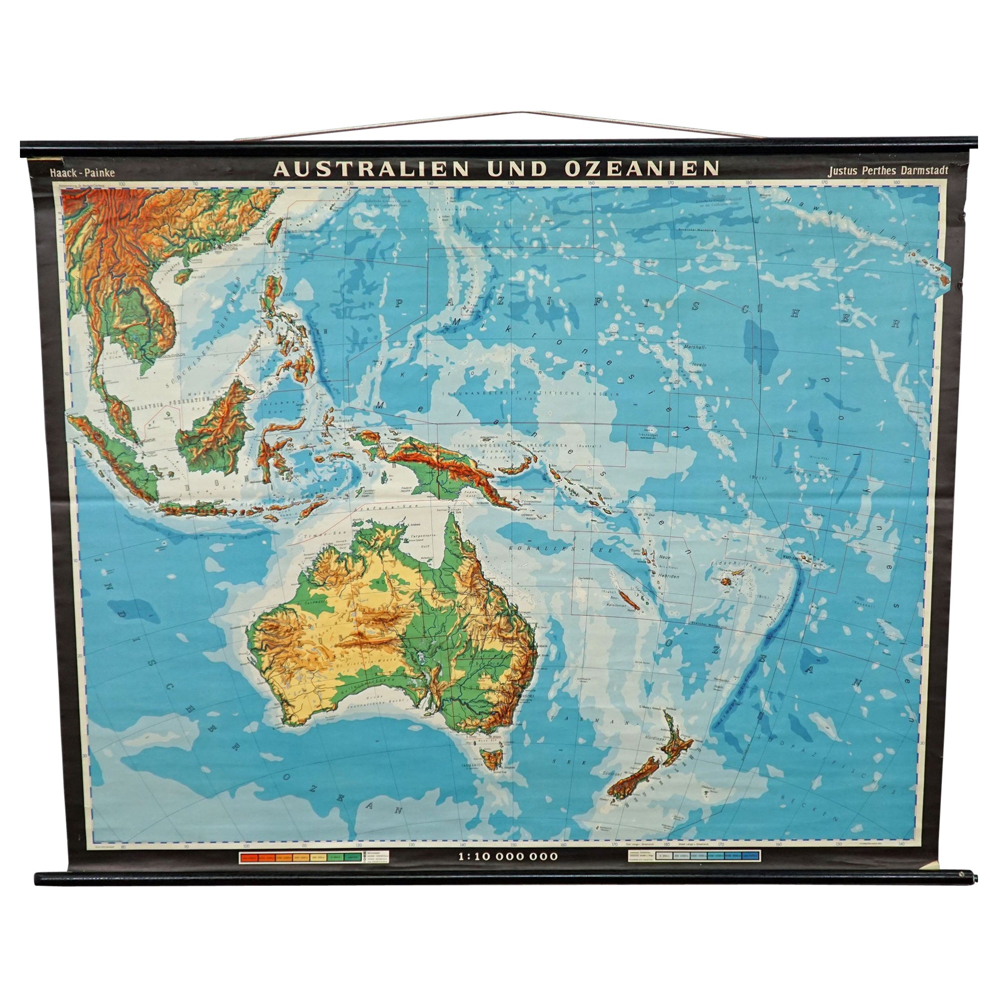
Vintage Mural Map Rollable Wall Chart Poster Australia New Zealand Indonesia
The vintage pull-down map shows Australia and Oceania, published by Haack-Painke Justus Perthes Darmstadt. Colorful print on paper reinforced with canvas.
This wallchart is a wonderful holiday memory decoration item.
Measurements:
Width 122 cm (48.03 inch)
Height 100 cm (39.37 inch)
The measurements shown refer just to the canvas and do not include the poles.
Background information on the history of school wall charts:
The idea to upgrade every day school life by using pictures was supported in the late 18th century by Johann Bernhard Basedow. In 1774 he published a four-volume book "Elementarwerk" which combined pictures, text and information with merely hundred copperplates. Modern printing methods enabled the spread from rich private schools to rural grade schools...
Category
Vintage 1970s German Country Posters
Materials
Canvas, Wood, Paper
Map Mural Rollable Poster Vintage Wall Chart Australia New Zealand Polynesia
Located in Berghuelen, DE
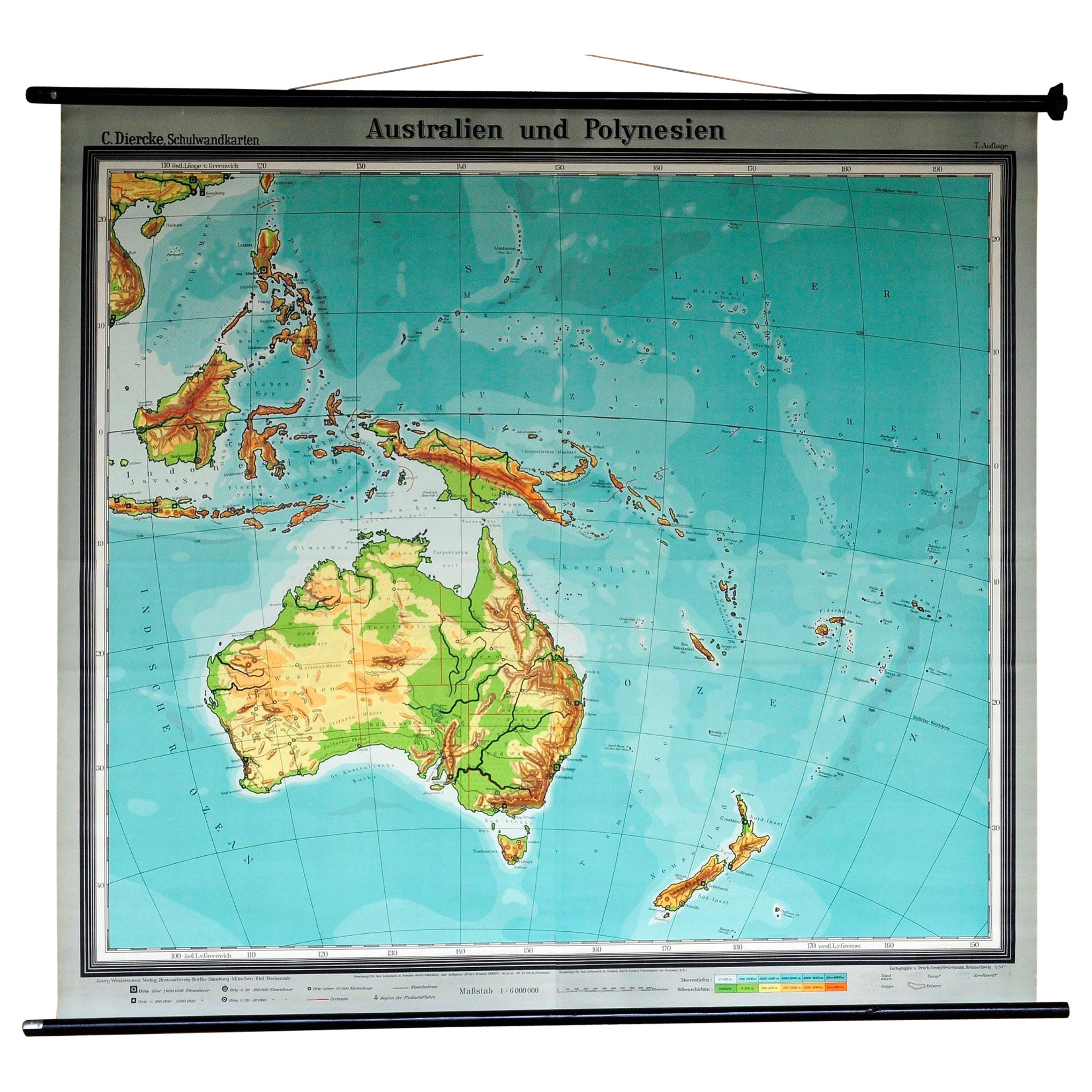
Map Mural Rollable Poster Vintage Wall Chart Australia New Zealand Polynesia
A beautiful vintage school map illustrating the popular region of Aust...
Category
Vintage 1970s German Country Posters
Materials
Canvas, Wood, Paper

Antique Vintage Australia Wall Map By W
A K Johnston
By W.
A.K. Johnston
Located in Stockbridge, GB
Vintage Australia Wall Map By W & A K Johnston
A vintage school pull down wall map of Australia. The map has a wooden hanging pole at the top...
Category
Mid-20th Century British Schoolhouse Posters
Materials
Canvas, Wood
Vintage Wall Chart of Australia, 1949
Located in Langweer, NL
Vintage wall chart of Australia and surroundings. Published by R. Bos and K. Zeeman, 1949.
Category
Mid-20th Century Prints
Materials
Paper

$718 Sale Price
25% Off
Vintage Australia Map, Framed, Historic 19th Century Cartography Interest, 1988
Located in Hele, Devon, GB
This is a vintage Australia map. A late 20th century reproduction of John Tallis’ original 1850 steel engraving, produced to mark the 1988 Australian Bicentennial.
Fascinating repro...
Category
1990s Australian Victorian Maps
Materials
Glass, Paper

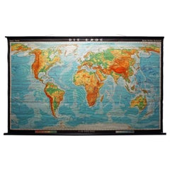
Vintage Mural World Map Earth Poster Pull-Down Wall Chart Poster Print
Located in Berghuelen, DE
A large decorative world map – named our earth, impressive wall chart decoration, published by Justus Perthes. Colorful print on paper reinforced with canvas.
Measurements:
Width 210 cm (82.68 inch)
Height 126,50cm (49.80 inch)
The measurements shown refer just to the canvas and do not include the poles.
Background information on the history of school wall charts:
The idea to upgrade every day school life by using pictures was supported in the late 18th century by Johann Bernhard Basedow. In 1774 he published a four-volume book "Elementarwerk" which combined pictures, text and information with merely hundred copperplates. Modern printing methods enabled the spread from rich private schools to rural grade schools. From 1820-1836 the oldest mentioned series of wall charts were published with the range of six booklets including 63 large sized charts...
Category
Vintage 1970s German Country Prints
Materials
Canvas, Wood, Paper
More Ways To Browse
Canadian Pacific Vintage Travel Posters
Cannes Film Festival Poster
Ceylon Poster Vintage
Cinderella Poster
Claudine Auger
Creature From The Black Lagoon Poster
Funny Face Poster
Get Carter Poster
Horse Racing Posters
Jamie Reid Sex Pistols
Japanese Tatekan
La Dolce Vita Poster
Mad Max Poster
Milk Poster
Milton Glaser Dylan Poster Original
Movie Posters Indiana
Niki Lauda
Nurburgring Poster