Items Similar to Late 20th Century Educational Geographic Map - Earths Lithosphere

Want more images or videos?
Request additional images or videos from the seller
1 of 8
Late 20th Century Educational Geographic Map - Earths Lithosphere
$130.83
£95
€111.12
CA$178.97
A$194.77
CHF 103.25
MX$2,343.29
NOK 1,309.54
SEK 1,198.14
DKK 830.18
About the Item
Late 20th Century Educational Geographic Map – Earths Lithosphere
Late 20th Century Educational Geographic Map – Earths Lithosphere. Good quality roll up school educational geographic map from the Czech republic. The map is printed on a cotton canvas that has been sealed with a clear lacquer.
WORKSHOP REPORT
Our workshop team inspect every product and carry out any needed repairs to ensure that everything leaves us serviced and maintained ready for many more years of life. All of our vintage products show the rich beauty and history of their life with the knocks and bumps of many years of use and we try to minimise restoration to keep every piece as original as possible.
Date: Late 20th Century
Maker: Industrial Production - Czech
Dimensions: L 1 x W 170 x H 112 cm
- Dimensions:Height: 44.1 in (112 cm)Width: 66.93 in (170 cm)Depth: 0.4 in (1 cm)
- Materials and Techniques:
- Place of Origin:
- Period:
- Date of Manufacture:Late 20th Century
- Condition:Refinished. Wear consistent with age and use.
- Seller Location:Hook, GB
- Reference Number:Seller: 1728.131stDibs: LU4494237881082
About the Seller
4.7
Vetted Professional Seller
Every seller passes strict standards for authenticity and reliability
Established in 2017
1stDibs seller since 2019
506 sales on 1stDibs
Typical response time: 21 hours
- ShippingRetrieving quote...Shipping from: Hook, United Kingdom
- Return Policy
More From This Seller
View AllLate 20th Century Educational Geographic Map - South African Topography (1728.5)
Located in Hook, Hampshire
Late 20th Century Educational Geographic Map – South African Topography (1728.5)
Late 20th Century Educational Geographic Map – South African Topograp...
Category
Late 20th Century Czech Posters
Materials
Cotton
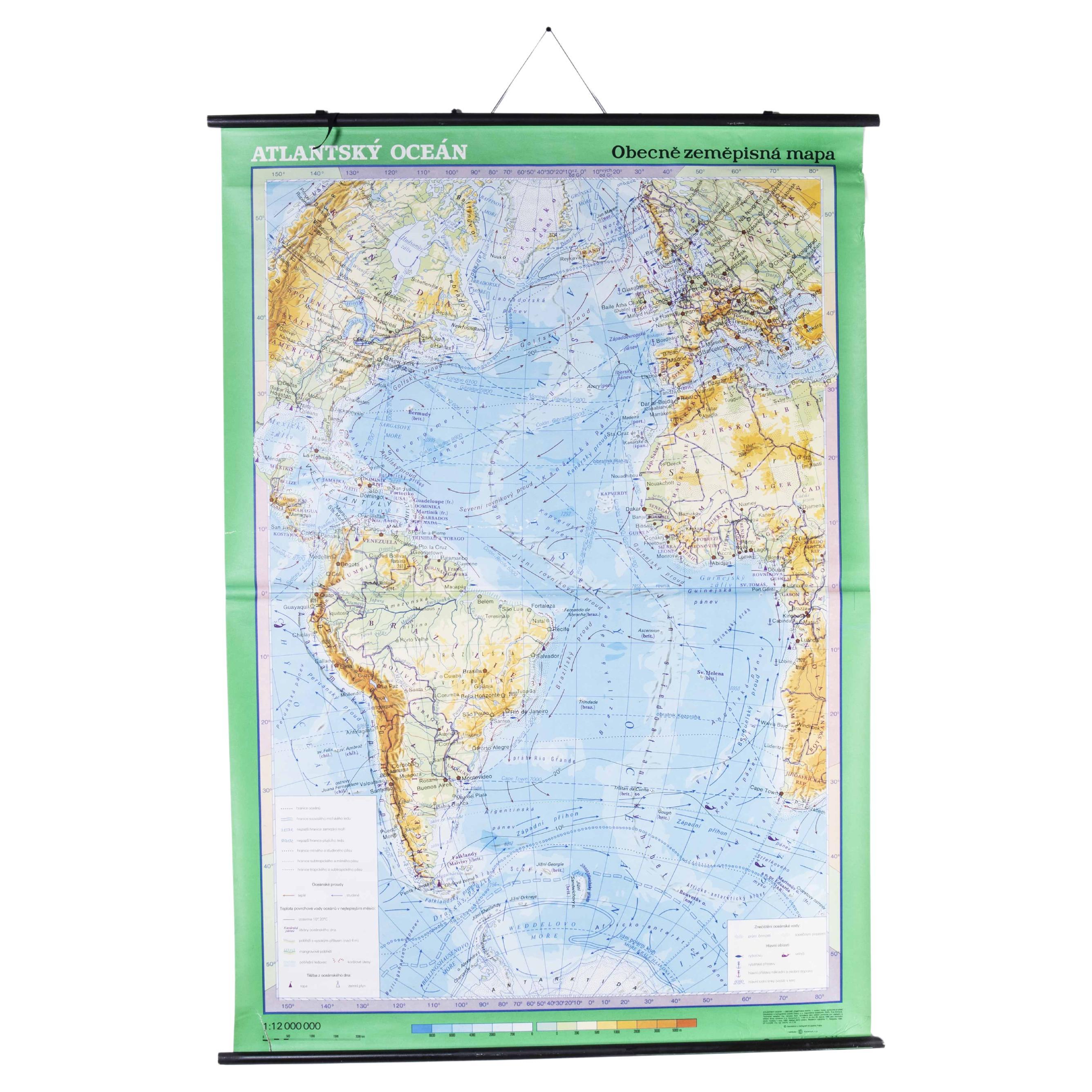
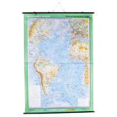
Late 20th Century Educational Geographic Map - Atlantic Currents
Located in Hook, Hampshire
Late 20th Century Educational Geographic Map – Atlantic Currents
Late 20th Century Educational Geographic Map – Atlantic Currents. Good quality roll up school educational geographic ...
Category
Late 20th Century Czech Posters
Materials
Cotton
Late 20th Century Educational Geographic Map - South African Topography (1728.4)
Located in Hook, Hampshire
Late 20th Century Educational Geographic Map – South African Topography (1728.4)
Late 20th Century Educational Geographic Map – South African Topograp...
Category
Late 20th Century Czech Posters
Materials
Cotton
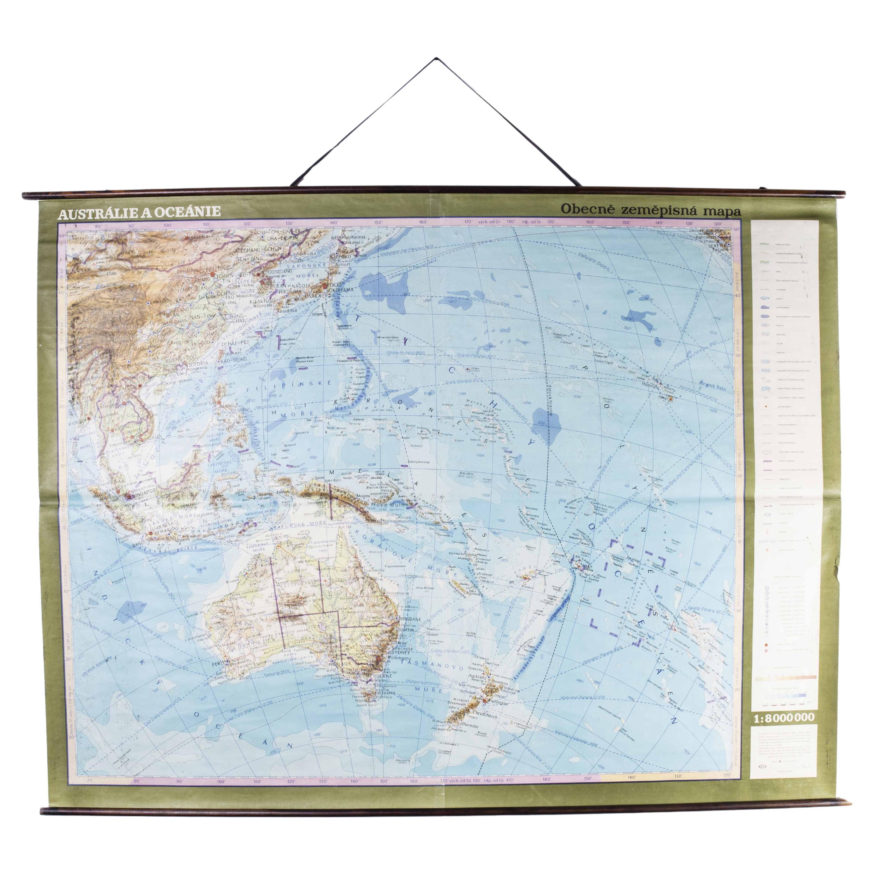
Late 20th Century Educational Geographic Map - Australasia
Located in Hook, Hampshire
Late 20th Century Educational Geographic Map – Australasia
Late 20th Century Educational Geographic Map – Australasia. Good quality roll up school educational geographic map from the...
Category
Late 20th Century Czech Posters
Materials
Cotton

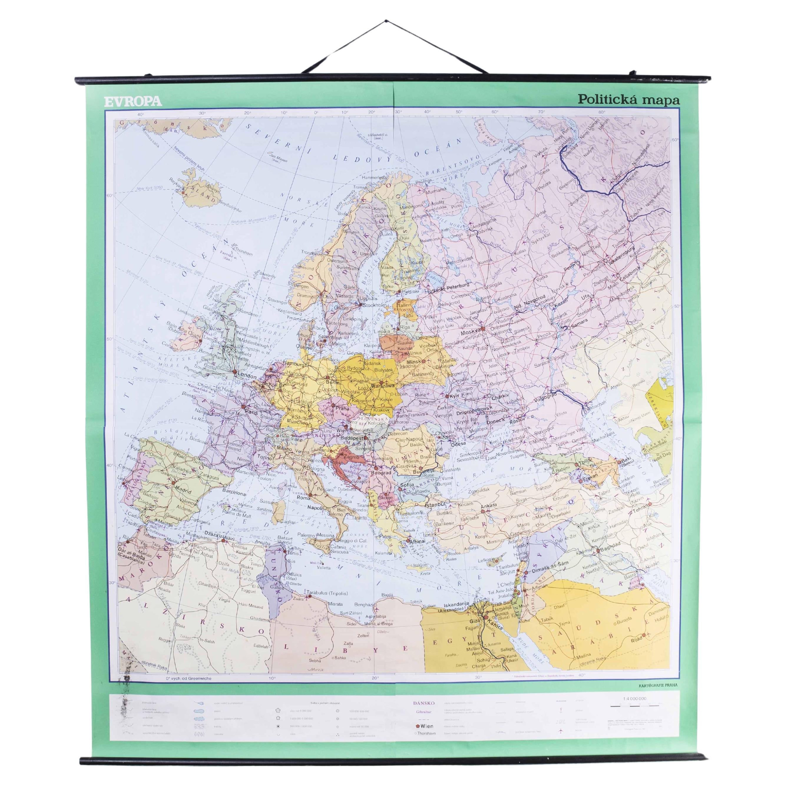
Late 20th Century Educational Geographic Map - European Countries
Located in Hook, Hampshire
Late 20th Century Educational Geographic Map – European Countries
Late 20th Century Educational Geographic Map – European Countries. Good quality roll up s...
Category
Late 20th Century Czech Posters
Materials
Cotton

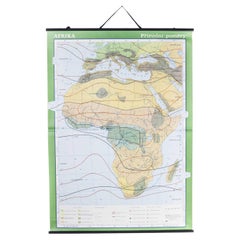
Late 20th Century Educational Geographic Map - African Climate
Located in Hook, Hampshire
Late 20th Century Educational Geographic Map – African Climate
Late 20th Century Educational Geographic Map – African Climate. Good quality roll up school educational geographic map ...
Category
Late 20th Century Czech Posters
Materials
Cotton
You May Also Like
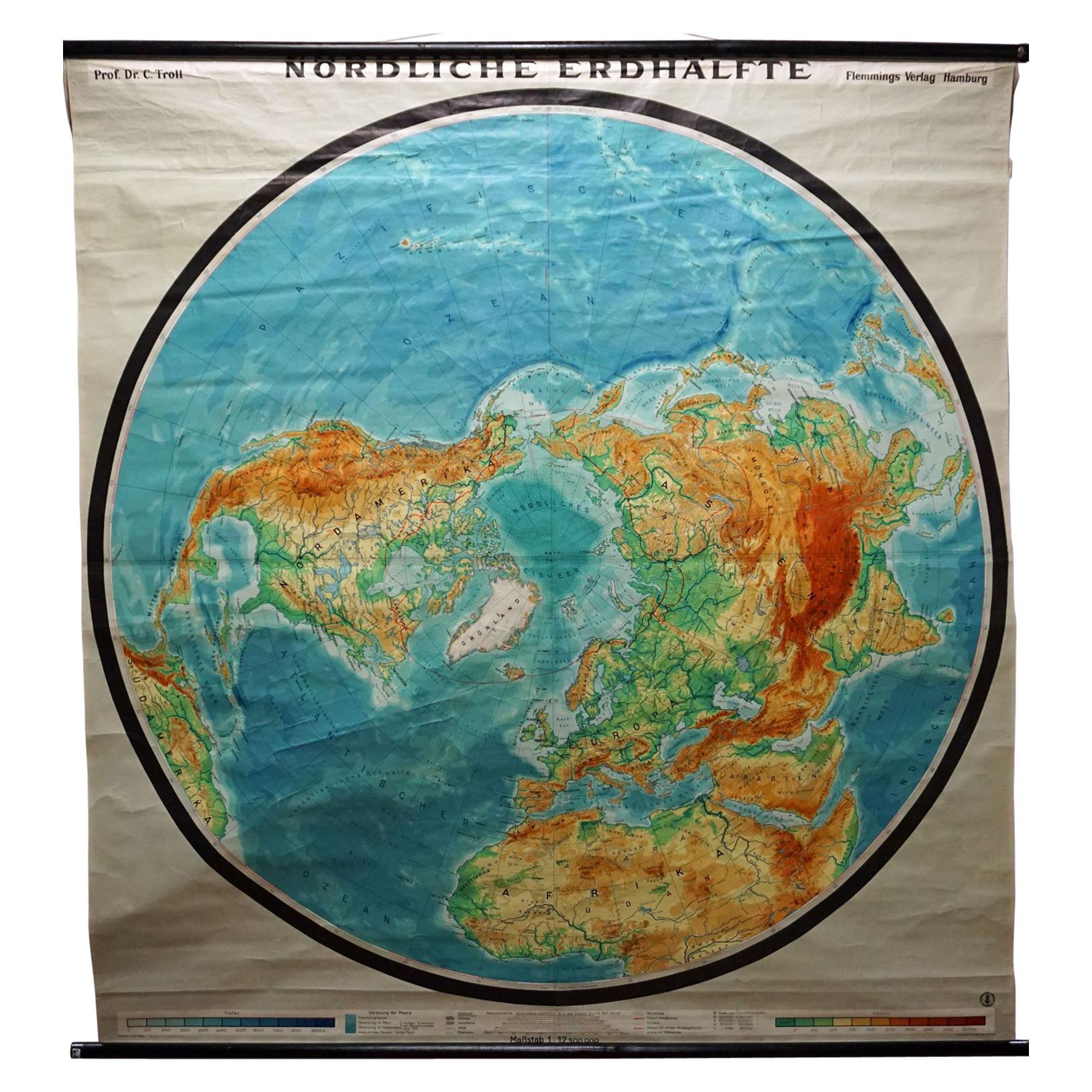
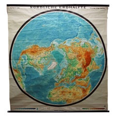
Northern Hemisphere of the Earth Rollable Map Vintage Wall Chart World Mural
Located in Berghuelen, DE
A great pull-down map or vintage wall chart illustrating the northern hemisphere of the earth. Published by Prof. Dr. C. Troll, Flemmings Verlag Ha...
Category
Mid-20th Century German Country Prints
Materials
Canvas, Wood, Paper
World Relief Map
Located in Antwerp, BE
Large world relief map.
Measures: Width 232 cm.
Height 158 cm.
Category
Mid-20th Century German Mid-Century Modern Maps
Materials
Acrylic

$2,161
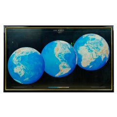
1990 Triple Perspective Planet Earth Map Framed Poster
Located in New York, NY
This decorative poster features a map of the Earth with a unique triple perspective view. It is enclosed in a black plastic frame, and the glass covering the poster is still intact. ...
Category
1990s American Posters
Materials
Glass, Plastic, Paper
Map of France, globe / Planisphere “Le Monde Politique”, National Geographic Ins
By French House
Garden
Located in Valladolid, ES
Outstanding 19th-century French map designed and published by the French National Geographic Institute following the Aïtoff Wagner cartographic projection, a type of projection used...
Category
Vintage 1960s French Mid-Century Modern Prints
Materials
Crystal
$430 Sale Price
69% Off
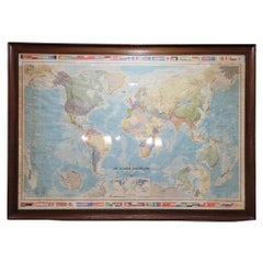
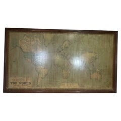
8 Foot Framed World Map by Philips
Located in Norwell, MA
1951 map of the world by George Philip and Son. Large beautiful map as it was in 1951. Nice patina mounted to a sturdy wood frame. Overall good condition. Very large in size. 90" W x...
Category
Vintage 1950s North American Maps
Materials
Paper
Huge Europe and Asia Vintage Wall Map
Located in San Diego, CA
A huge Europe and Asia vintage wall map, circa 1950s. The map is in fair vintage condition and measures 78"W x 73"H". #2863
Category
Mid-20th Century American Maps
Materials
Paper
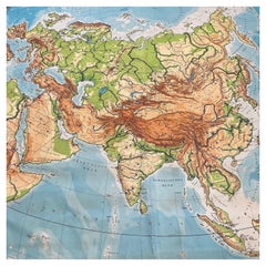
$380 Sale Price
20% Off
More Ways To Browse
Canadian Pacific Vintage Travel Posters
Cannes Film Festival Poster
Ceylon Poster Vintage
Cinderella Poster
Claudine Auger
Creature From The Black Lagoon Poster
Funny Face Poster
Get Carter Poster
Horse Racing Posters
Jamie Reid Sex Pistols
Japanese Tatekan
La Dolce Vita Poster
Mad Max Poster
Milk Poster
Milton Glaser Dylan Poster Original
Movie Posters Indiana
Niki Lauda
Nurburgring Poster