Items Similar to 1749 Jacques Nicolas Bellin Map of the Great Wall of China Near Kiang-nan fu


Want more images or videos?
Request additional images or videos from the seller
1 of 6
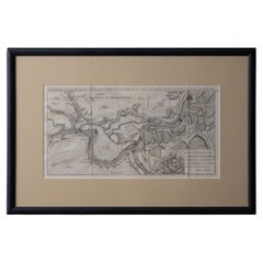
1749 Jacques Nicolas Bellin Map of the Great Wall of China Near Kiang-nan fu
$143.74
$179.6820% Off
£107.49
£134.3620% Off
€120
€15020% Off
CA$198.04
CA$247.5520% Off
A$215.99
A$269.9920% Off
CHF 114.42
CHF 143.0220% Off
MX$2,589.40
MX$3,236.7520% Off
NOK 1,457.15
NOK 1,821.4420% Off
SEK 1,332.46
SEK 1,665.5720% Off
DKK 914.45
DKK 1,143.0620% Off
About the Item
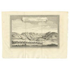
This original antique image is an historical map by Jacques Nicolas Bellin, depicting the Great Wall of China as it was understood in the mid-18th century.
The map includes French text.
The title of the map, "Plan de Long-men-hien. Près de la grande muraille, dépendant de Kiang-nan fu." translates to "Map of Long-men-hien. Near the great wall, depending on Kiang-nan fu."
The text below, "Plan d'une Partie de la Grande Muraille Du côté de Kiang-ning-fu. Construite par D'anciens Planteurs de Guerre," translates to "Map of a Part of the Great Wall On the side of Kiang-ning-fu. Built by Ancient War Planters."
The map showcases the detailed topography around segments of the Great Wall and labels various sections and nearby locations. At the time, European knowledge of China was still limited and often filtered through the accounts of missionaries and traders, which makes Bellin's work a significant early attempt to systematically chart such a remote and iconic structure as the Great Wall.
- Dimensions:Height: 9.97 in (25.3 cm)Width: 7.05 in (17.9 cm)Depth: 0 in (0.02 mm)
- Materials and Techniques:Paper,Engraved
- Period:1750-1759
- Date of Manufacture:1754
- Condition:Good. General age-related toning and/or occasional minor defects from handling. Please study scan carefully.
- Seller Location:Langweer, NL
- Reference Number:Seller: BG-13600-491stDibs: LU3054338425102
About the Seller
5.0
Recognized Seller
These prestigious sellers are industry leaders and represent the highest echelon for item quality and design.
Platinum Seller
Premium sellers with a 4.7+ rating and 24-hour response times
Established in 2009
1stDibs seller since 2017
2,791 sales on 1stDibs
Typical response time: <1 hour
- ShippingRetrieving quote...Shipping from: Langweer, Netherlands
- Return Policy
More From This Seller
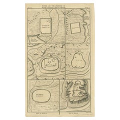
View AllAntique Map of Cities of the Province of Shanxi in China, 1749
By Jacques-Nicolas Bellin
Located in Langweer, NL
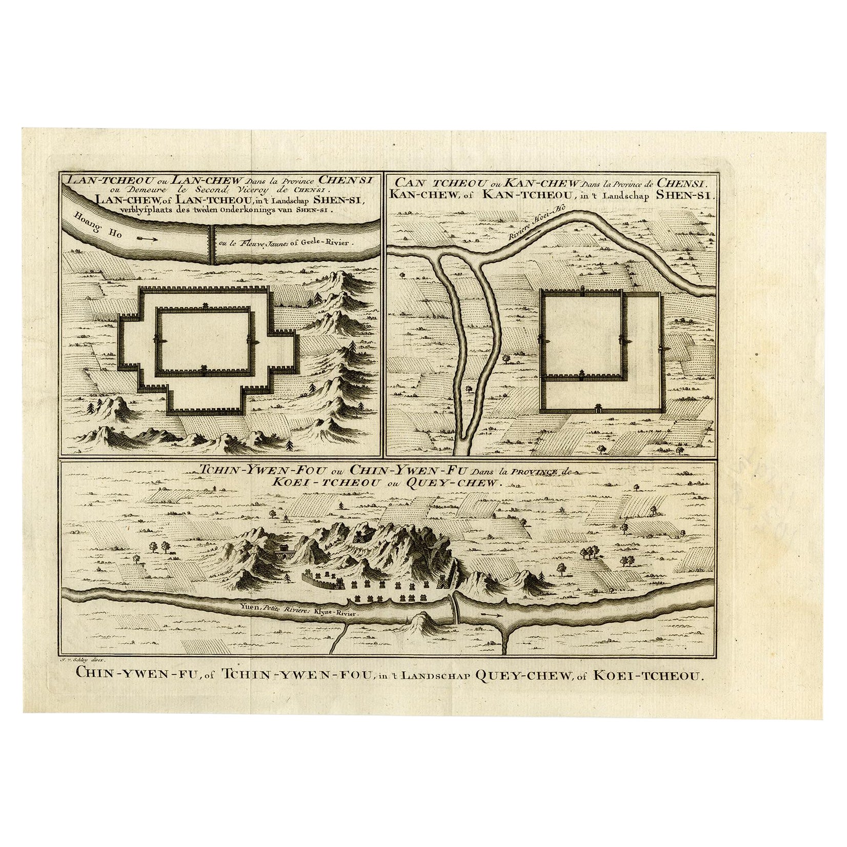
Antique print titled: 'Lan-Tcheou ou Lan-Chew dan la province Chensi; Can Tcheou ou Kan-Chew dan la province de Chensi; Tchin-Ywe-Fou ou Chin-Ywen-Fu dans la province de Koei-Tcheou ...
Category
Antique 18th Century Maps
Materials
Paper

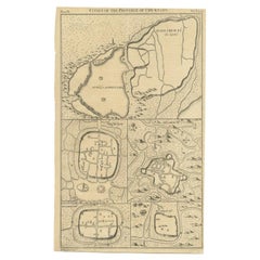
Antique Map of Three Chinese Cities in Chensi and Koei Tcheou, c.1758
Located in Langweer, NL
Antique map titled 'Lan-Tcheou ou Lan-Chew dan la province Chensi; Can Tcheou ou Kan-Chew dan la province de Chensi; Tchin-Ywe-Fou ou Chin-Ywen-Fu dans la province de Koei-Tcheou ou Quey-chew.' Three plans of old Chinese cities...
Category
Antique 18th Century Maps
Materials
Paper

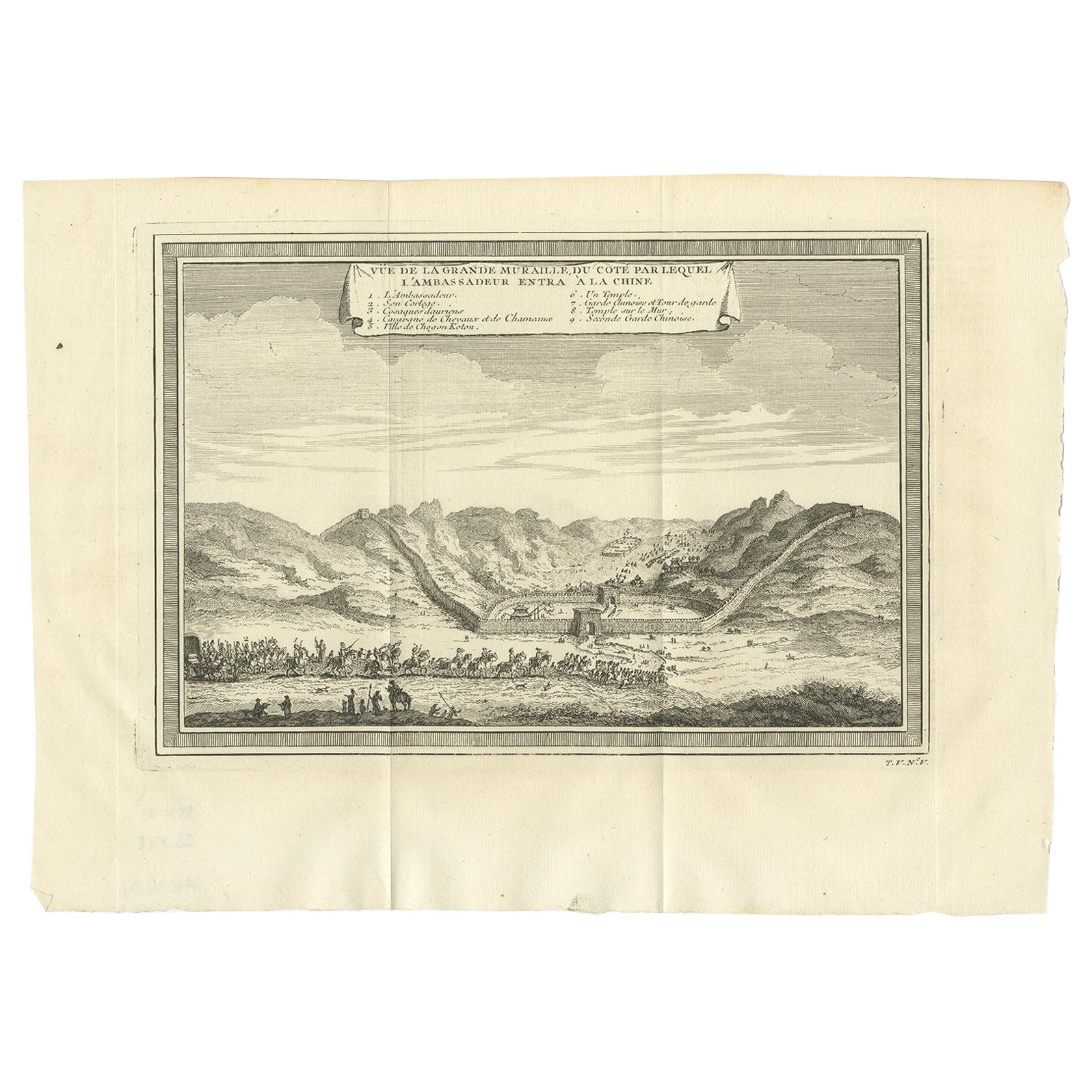
Antique Print of the Great Wall of China, 1746
Located in Langweer, NL
Antique print titled 'Vüe de la Grande Muraille, de Coté par lequel l'Ambassadeur entra à la Chine'. View of the Great Wall of China, where the...
Category
Antique 18th Century Prints
Materials
Paper
$220 Sale Price
20% Off
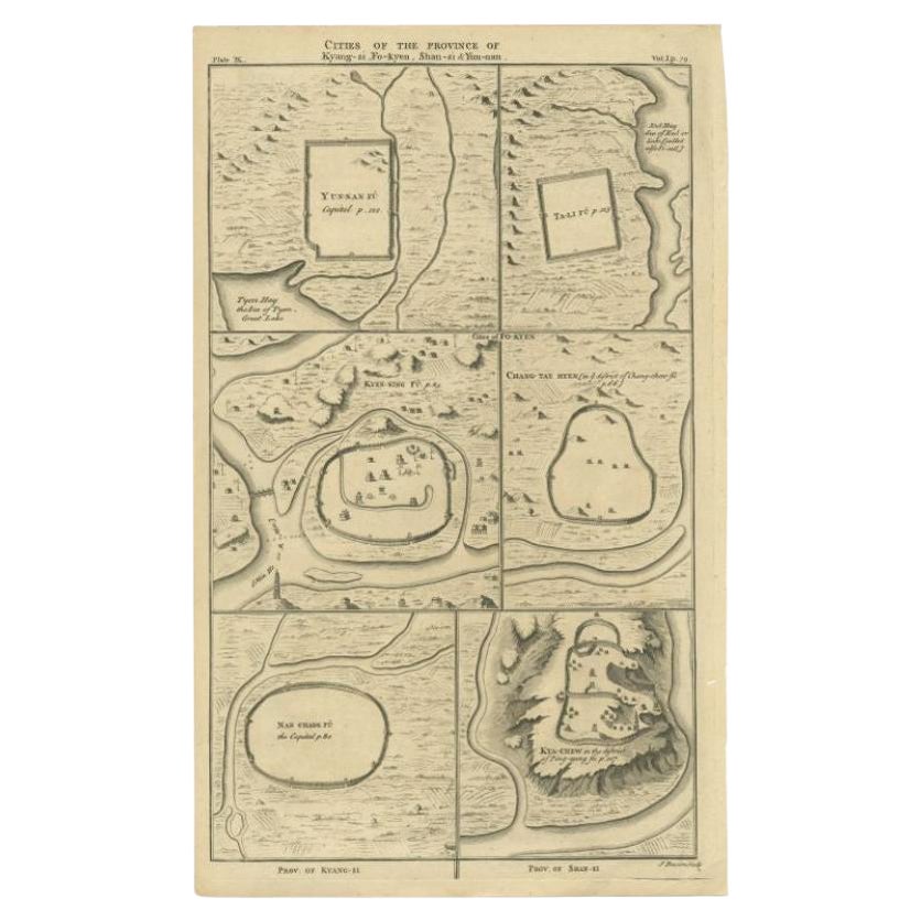
Antique Map of the Cities of the Qing Dynasty Provinces in China, 1738
Located in Langweer, NL
Antique print titled 'Cities of the Province of Kyang-si, Fo-kyen, Shan-Si & Yun-nan'. Old map depicting four walled cities of the Chinese Qing dynasty provinces Yunnan, Shanxi, Fuji...
Category
Antique 18th Century Maps
Materials
Paper
$249 Sale Price
20% Off
Antique Map of Cities of the Province of Che-Kyang in China, 1738
Located in Langweer, NL
Antique print China titled 'Cities of the Province of Che-Kyang'. Old map depicting four walled cities of the Chinese Qing dynasty province of Che-Kiang (modern day CHEKIANG): Hang C...
Category
Antique 18th Century Maps
Materials
Paper
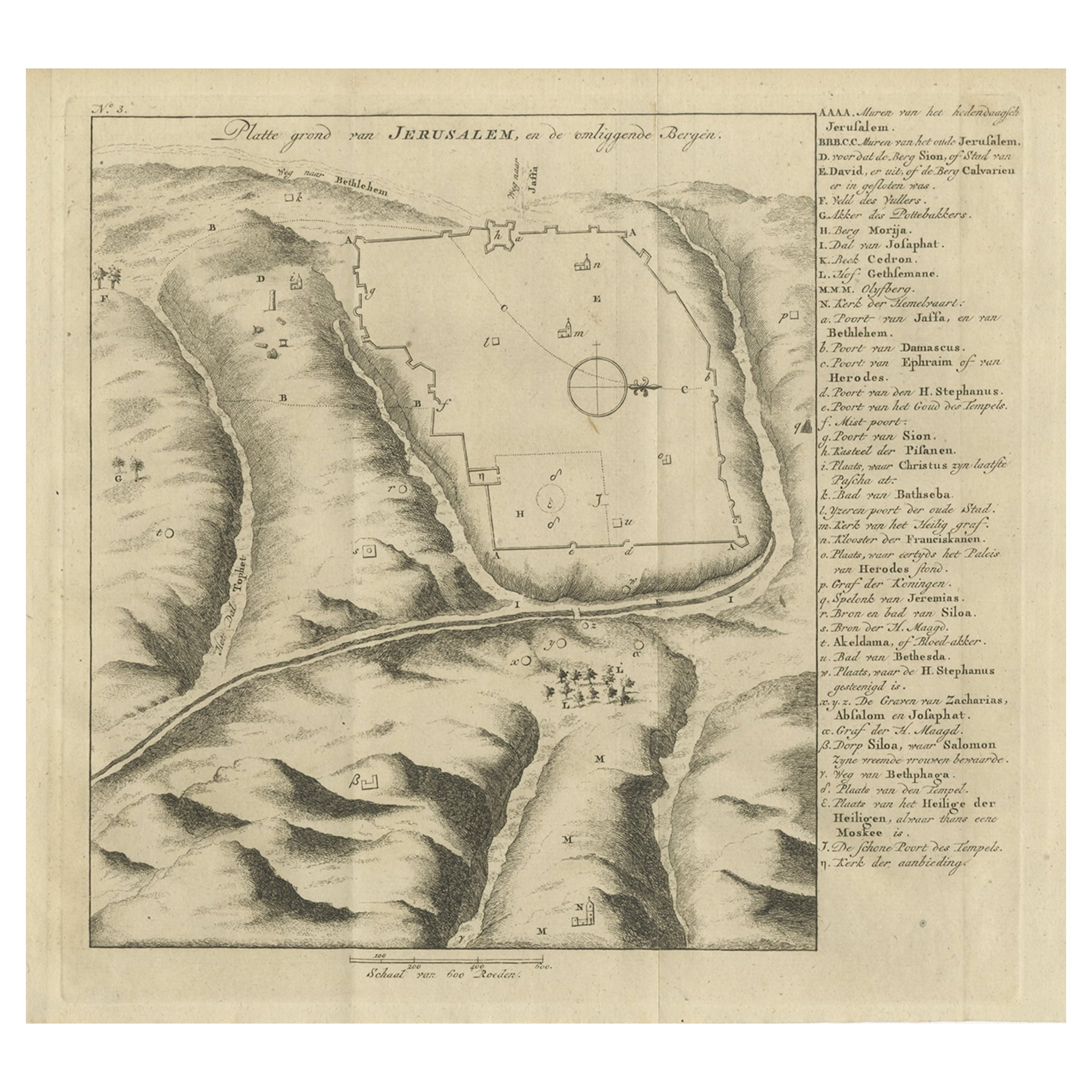
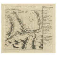
Antique Engraving of a Map or Plan of Jerusalem and Surrounding Mountains, 1773
Located in Langweer, NL
Antique map titled 'Platte grond van Jerusalem, en de omliggende Bergen'. Plan of the city of Jerusalem, with surrounding mountains. Originates from the first Dutch editon of an inte...
Category
Antique 18th Century Maps
Materials
Paper
You May Also Like
1657 Janssonius Map of Vermandois and Cappelle, Ric. A-004
Located in Norton, MA
1657 Janssonius map of
Vermandois and Cappelle
Ric.a004
Description: Antique map of France titled 'Descriptio Veromanduorum - Gouvernement de la Cappelle'. Two detailed maps o...
Category
Antique 17th Century Unknown Maps
Materials
Paper

1640 Joan Bleau Map Entitled"Diocecese de rheims et le pais de rethel, " Eic.a011
Located in Norton, MA
1640 Joan Bleau map entitled
"Diocecese de rheims et le pais de rethel,"
Ric.a011
OAN BLAEU
Diocecese de Rheims, et le pais de Rethel.
Handcolored engraving, c.1640.
...
Category
Antique 17th Century Dutch Maps
Materials
Paper

Battle of Grocka Campaign Map, 1753 - James Oglethorpe, John Lindsay, Henry Köpp
Located in Savannah, GA
A campaign map of the Battle of Grocka, 1753.
Drawn and engraved by Henry Köpp for the journals of John Lindsay, 20th Earl of Crawford and dedicated to James Oglethorpe.
sight:...
Category
Antique 1750s British Prints
Materials
Glass, Wood, Paper
Antique French Map of Asia Including China Indoneseia India, 1783
Located in Amsterdam, Noord Holland
Very nice map of Asia. 1783 Dedie au Roy.
Additional information:
Country of Manufacturing: Europe
Period: 18th century Qing (1661 - 1912)
Condition: Overall Condition B (Good Used)...
Category
Antique 18th Century European Maps
Materials
Paper

$486 Sale Price
40% Off
1654 Joan Blaeu Map the Sutherland, Scotland, Entitled "Southerlandia, "Ric0007
Located in Norton, MA
1654 Joan Blaeu map of the
Sutherland, Scotland, entitled
"Southerlandia,"
Hand Colored
Ric0007
Description:
Lovely map centered on Sedan and D...
Category
Antique 17th Century Dutch Maps
Materials
Paper

1627 Hondius Map "La Principaute d
Orange et Comtat de Ve", Ric.0003
Located in Norton, MA
1627 Hondius map entitled
"La Principaute d'Orange et Comtat de Venaissin,"
Original Hand-Colored
Description: From Johannes Janssonius's Atlantis Maioris Appendix of 1630.
...
Category
Antique 17th Century Unknown Maps
Materials
Paper

More Ways To Browse
Antique Smoking Set
Antique Solingen
Antique Stable Door
Antique Staffordshire Cows
Antique Teapoy
Antique Wedgwood Dishes
Antique Wood Beams
Arabia Finland Kaj Franck
Arabic Plates
Art Deco Automobile
Art Deco Lizard
Art Nouveau Horn
Arte Vetraria Muranese (AVEM) On Sale
Ashford Marble
Ashley Wood
Asian Coins
Astronomical Clock
Austrian Pug