Items Similar to 1875 Daily Graphic Newspaper, Eastern Question Cartoon Map, Complete 12 Pages
Want more images or videos?
Request additional images or videos from the seller
1 of 9
1875 Daily Graphic Newspaper, Eastern Question Cartoon Map, Complete 12 Pages
$852.07
£636.73
€720
CA$1,186.47
A$1,274.98
CHF 684.10
MX$15,018.52
NOK 8,601.83
SEK 7,857.71
DKK 5,488.62
About the Item
1875 Daily Graphic Newspaper, Eastern Question Cartoon Map, Complete 12 Pages
This rare and complete issue of The Daily Graphic, dated Saturday, December 4, 1875, is offered here in its original 12-page newspaper format, exactly as issued. The Daily Graphic was the first successful illustrated daily newspaper in the United States and a pioneer in visual journalism, known for its high-quality engravings and ambitious political imagery.
The highlight of this issue is the full-page political cartoon map titled Turkey Gobblers After Their Rations, a powerful allegorical depiction of the so-called Eastern Question. In this striking image, the weakening Ottoman Empire is portrayed as a carcass labeled “Turkey in Europe” and “Turkey in Asia,” surrounded by the competing imperial powers of the late 19th century. Russia appears as a crowned bear advancing from the Black Sea, Austria-Hungary as a double-headed eagle reaching toward the Balkans and the Danube, and Great Britain as a lion dominating Egypt and the Suez Canal, underscoring British control of vital trade routes to India. The composition is both satirical and highly informative, functioning as an early form of geopolitical infographic.
Published just prior to the Russo-Turkish War of 1877–1878, this issue captures contemporary anxieties about imperial expansion, diplomacy, and the imminent collapse of Ottoman control in southeastern Europe. Political cartoon maps of this kind are increasingly sought after, not only by collectors of antique maps and newspapers, but also by historians and interior designers drawn to their bold symbolism and graphic clarity.
Unlike loose or trimmed examples, this offering preserves the complete newspaper, including all accompanying articles, editorials, and illustrations from the same day. Complete issues of The Daily Graphic are considerably scarcer than single extracted plates, as these newspapers were intended for daily use and were rarely preserved intact.
This is an exceptional opportunity to acquire a landmark piece of 19th-century illustrated journalism that combines political satire, cartographic imagery, and historical relevance in its original published context.
Condition
Complete 12-page newspaper. Overall good condition for a daily paper of this age. Light age toning throughout, with expected softness to the paper. Minor edge wear and small handling marks consistent with original use. The pages are clean, legible, and well-preserved, with no major losses or repairs.
Framing tips
For display, the central cartoon page can be floated and framed using a wide ivory or light grey mat with UV-protective glass, while the remaining pages are best preserved flat in an archival portfolio or custom clamshell box. Alternatively, the full newspaper can be professionally encapsulated in a museum-style frame to emphasize its integrity as a complete historical document.
Technique: Wood engraving (illustrated newspaper printing)
Maker: The Daily Graphic, New York, 1875
- Dimensions:Height: 20.28 in (51.5 cm)Width: 13.98 in (35.5 cm)Depth: 0.08 in (2 mm)
- Materials and Techniques:
- Place of Origin:
- Period:
- Date of Manufacture:1875
- Condition:Complete 12-page newspaper. Overall good condition for a daily paper of this age. Light age toning throughout, with expected softness to the paper. Minor edge wear and small handling marks consistent with original use. The pages are clean.
- Seller Location:Langweer, NL
- Reference Number:Seller: BG-138641stDibs: LU3054348265042
About the Seller
5.0
Recognized Seller
These prestigious sellers are industry leaders and represent the highest echelon for item quality and design.
Platinum Seller
Premium sellers with a 4.7+ rating and 24-hour response times
Established in 2009
1stDibs seller since 2017
2,834 sales on 1stDibs
Typical response time: 1 hour
- ShippingRetrieving quote...Shipping from: Langweer, Netherlands
- Return Policy
More From This Seller
View All1877 Satirical Map of the Eastern War: Europe
s Powers as Caricatured Characters
Located in Langweer, NL
Title: 1877 Caricature Map of the Eastern War - "Carte de la Guerre en Orient" by H. Demare
Description: This 1877 satirical map, titled "Carte de la Guerre en Orient," was publis...
Category
Antique 1870s French Maps
Materials
Paper

$1,751 Sale Price
20% Off
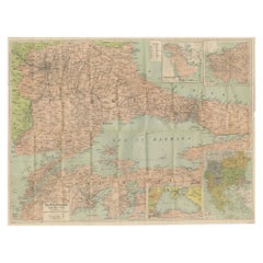
Daily Telegraph War Map 1877 – Ottoman Empire, Balkans
Constantinople Antique
Located in Langweer, NL
Daily Telegraph War Map 1877 – Ottoman Empire, Balkans & Constantinople Antique Map
This large lithographed folding map was published as War Map No. 7 by The Daily Telegraph, London...
Category
Antique 1870s English Maps
Materials
Paper
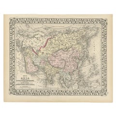
Antique Map of Asia Showing Its Political Divisions, 1874
Located in Langweer, NL
Antique map titled 'Map of Asia showing its Gt. Political Divisions and also the various routes of Travel between London & India, China & Japan & c'. This map covers from the Arabian...
Category
Antique 19th Century Maps
Materials
Paper
WWI Satirical Cartoon Map:
Kill That Eagle
by J.H. Amschewitz, 1914
Located in Langweer, NL
This fascinating serio-comic map was created by John Henry Amschewitz and published in December 1914, at the beginning of WWI.
Amschewitz was a British born artist who was unable to enlist for war service due to an injury he sustained while working on a mural project in Liverpool. Instead Amschewitz focused on his interests in art and theater, themes which are apparent in this map and even the title itself: European Revue.
The eagle refers of course to Germany, which has its claw on Marianne's bayonet, while its other claw is being pulled by the Russian bear...
Category
Vintage 1910s Maps
Materials
Paper

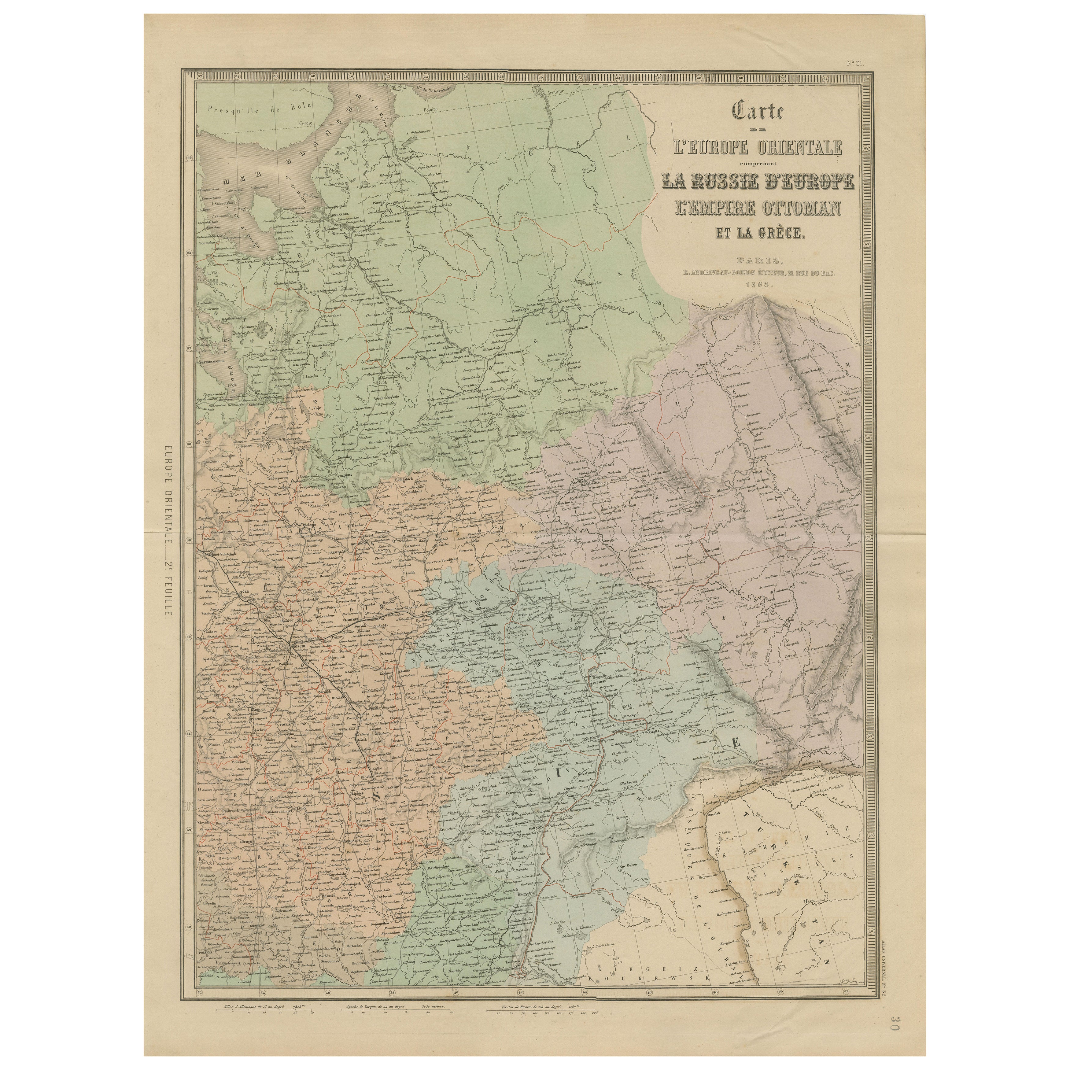
Antique Map of Eastern Europe – Russia, Ottoman Empire
Greece, 1868
Located in Langweer, NL
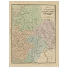
Antique Map of Eastern Europe – Russia, Ottoman Empire and Greece by Andriveau-Goujon, 1868
This detailed antique map titled “Carte de l’Europe Orientale, la Russie d’Europe, l’Empi...
Category
Antique Mid-19th Century French Maps
Materials
Paper
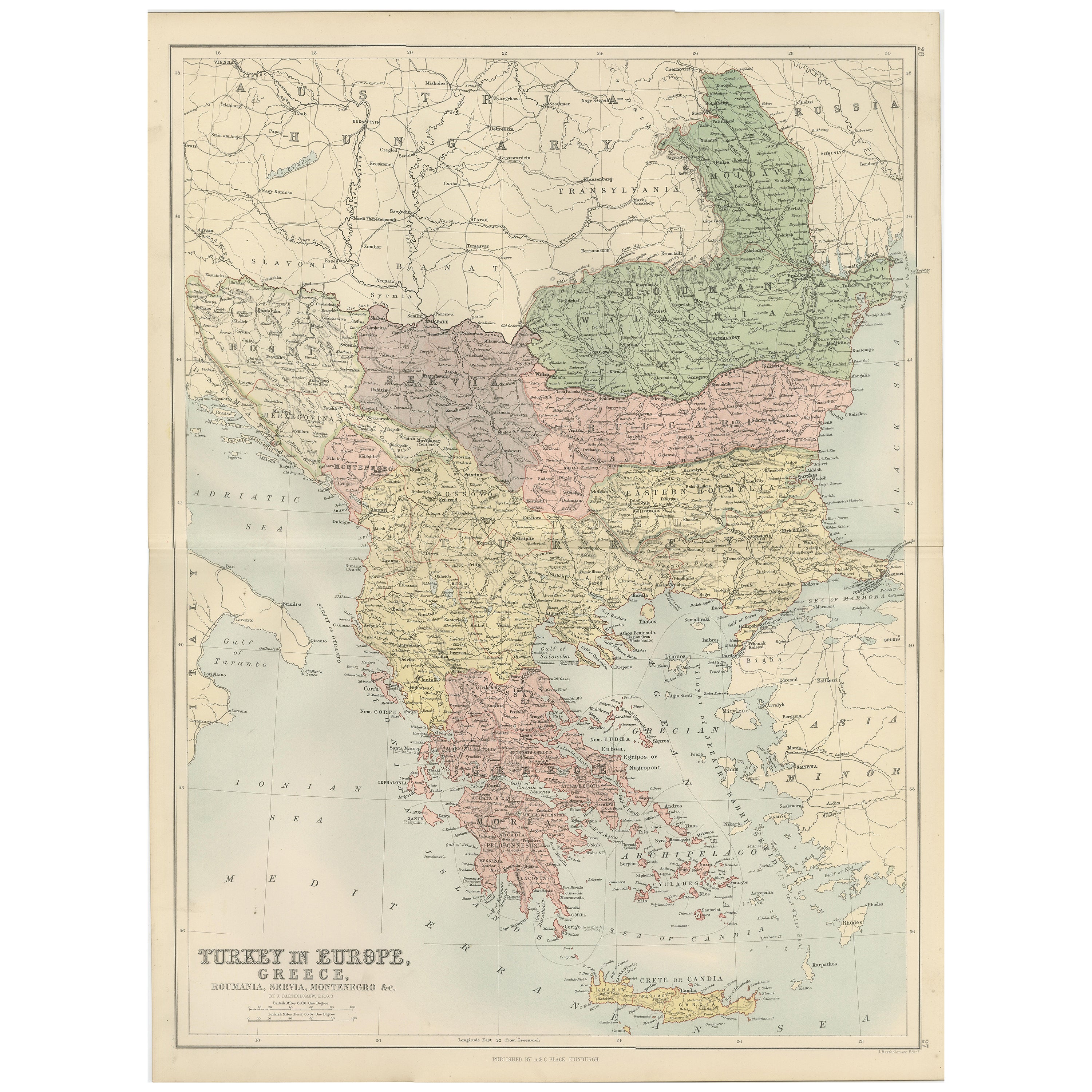
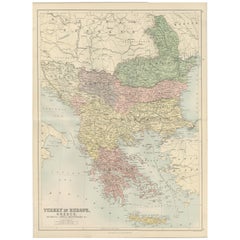
Antique Map of Turkey in Europe, Greece and the Balkans – Black’s Atlas, 1884
Located in Langweer, NL
Antique Map of Turkey in Europe, Greece and the Balkans – Black’s Atlas, 1884
Description:
This finely engraved and hand-colored political map, titled “Turkey in Europe, Greece, Rou...
Category
Antique 1880s Scottish Maps
Materials
Paper
You May Also Like
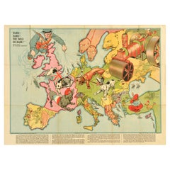
Original Antique World War One Poster Hark The Dogs Do Bark WWI Dogs Of War
Located in London, GB
Original Antique World War One poster - Hark! Hark! The dogs do bark! With note by Walter Emanuel - featuring a serio-comic map of Europe at war with military soldier caricature portraits and some countries represented by dogs with Russia as a bear, a Royal Navy sailor holding leashes on warships crossing to the continent, a British bulldog seen biting German dachshund in a pickelhaube hat, a French poodle in a Phrygian cap, an Austria-Hungarian mongrel being stung by a Serbian wasp, a Swiss mountain climber, a Turk with a French bulldog, a Greek with a knife, a Spanish bullfighter, a Dutchman smiling, an Italian holding a pistol gun with the Russian Tsar...
Category
Vintage 1910s British Posters
Materials
Paper
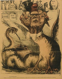
Le Journaliste - Original Chromolithograph - 1901/02
Located in Roma, IT
Le Journaliste is an original chromolithograph, realized between 1901-1902.
This artwork is from L'Assiette au Beurre an illustrated French weekly satirical periodical illustrated b...
Category
Early 1900s Figurative Prints
Materials
Lithograph
Russia, Western and Southern Part. Century Atlas antique vintage map
Located in Melbourne, Victoria
'The Century Atlas. Russia, Western and Southern Part'
Original antique map, 1903.
Inset map tilted 'St Petersburg and Environs'.
Central fold as issued. Map name and number printe...
Category
Early 20th Century Victorian More Prints
Materials
Lithograph

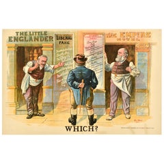
Original Antique General Election Propaganda Poster Which? Tom Merry 1900
Located in London, GB
Original antique general election propaganda poster featuring artwork by the British cartoonist and political satirist Tom Merry (William Mecham; 1853-1902), depicting the well-dress...
Category
Antique Early 1900s British Posters
Materials
Paper
The News - Lithograph - 19th century
Located in Roma, IT
The News is a print realized by an Anonymous artist in the 19th century.
Lithograph on paper.
Good conditions.
Category
19th Century Surrealist Figurative Prints
Materials
Lithograph
Original Antique Map of North America by Dower, circa 1835
Located in St Annes, Lancashire
Nice map of North America
Drawn and engraved by J.Dower
Published by Orr & Smith. C.1835
Unframed.
Free shipping
Category
Antique 1830s English Maps
Materials
Paper
