Items Similar to 1896 Chart of the New Haven Harbor


Want more images or videos?
Request additional images or videos from the seller
1 of 20
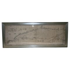
1896 Chart of the New Haven Harbor
$595
£453.82
€516.80
CA$836.16
A$911.95
CHF 483.09
MX$10,932.94
NOK 6,152.39
SEK 5,625.90
DKK 3,860.98
About the Item
New Haven Harbor Chart published May 1896 by the United States Coast and geodetic survey. This chart is also a map of the land around the harbor and etc., loaded with detail. Nicely framed.
Weight: 16 lbs.
Overall Dimensions: 43"H x 32"D
Made: Papua
Material: Paper
Date: 1896
- Dimensions:Height: 43 in (109.22 cm)Width: 32 in (81.28 cm)Depth: 3 in (7.62 cm)
- Materials and Techniques:
- Place of Origin:
- Period:
- Date of Manufacture:1896
- Condition:
- Seller Location:Norwell, MA
- Reference Number:Seller: 83091stDibs: LU1741235627122
About the Seller
5.0
Gold Seller
Premium sellers maintaining a 4.3+ rating and 24-hour response times
Established in 1967
1stDibs seller since 2015
430 sales on 1stDibs
Typical response time: 8 hours
- ShippingRetrieving quote...Shipping from: Norwell, MA
- Return Policy
More From This Seller
View AllCopy of 1901 Chart of Boston Harbor
Located in Norwell, MA
Later copy after an original Boston Harbor chart by George Eldridge of Vineyard Haven and Boston. Detailed chart of Boston Harbor from the Neponset River in Quincy south down to Kimb...
Category
Vintage 1910s North American Prints
Materials
Paper

Mariners charts of Massachusett Long Island by George Eldridge 1901
Located in Norwell, MA
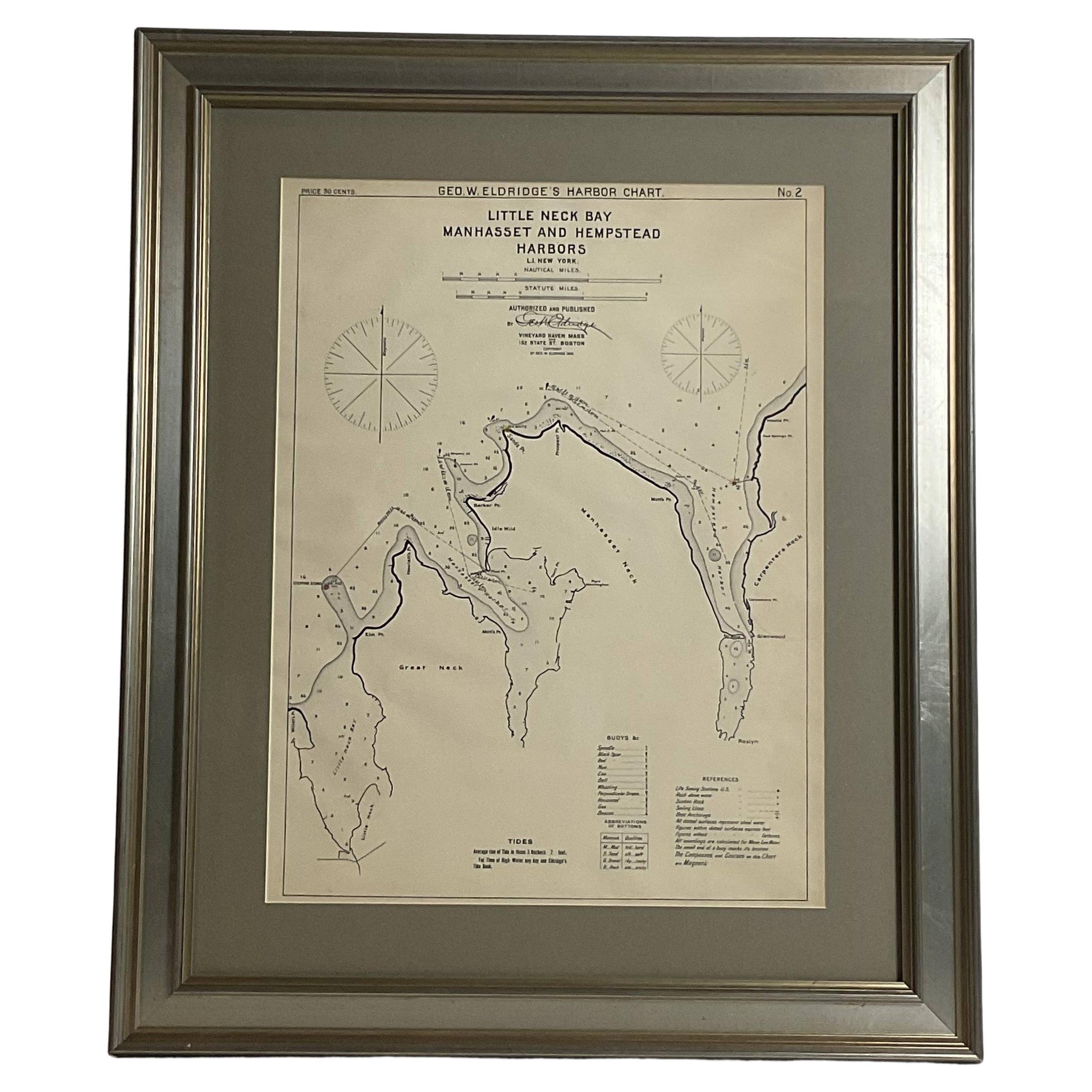
Nautical Chart showing the harbor and local waters of the Little Neck Bay, Manhasset and Hempstead Harbors. The chart displays depths, buoys, lighthouses, etc., Shown is Manhasset Ne...
Category
Antique Early 1900s North American Prints
Materials
Paper

1905 Chart of Long Island Sound by Eldridge
Located in Norwell, MA
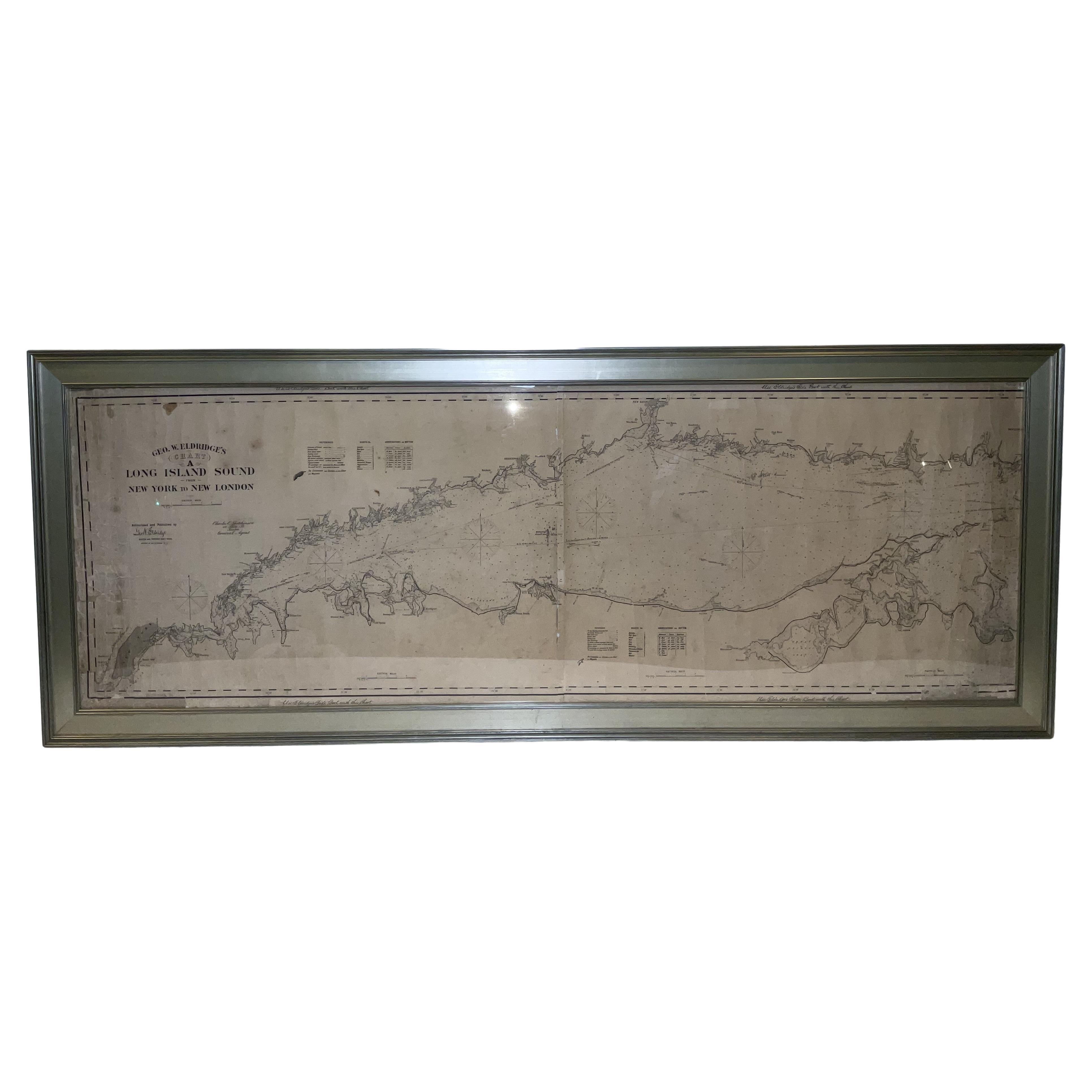
Original chart of Long Island Sound by George Eldridge, date-stamped 1905. Also includes the seller's name, Ships Chandler Charles C. Hutchinson, 152 State St., Boston, General Agent...
Category
Antique Early 1900s North American Prints
Materials
Paper
1898 Chart of Boston Bay
Located in Norwell, MA
Original 1898 chart showing Massachusetts Bay with the coast from Cape Ann to Cape Cod. This is a U.S. Navy Geodetic survey chart. All towns are noted along the coast. Framed with gl...
Category
Antique 1890s Nautical Objects
Materials
Paper

$1,495
Mariners Chart of Marion Massachussets by George Eldridge 1901
Located in Norwell, MA
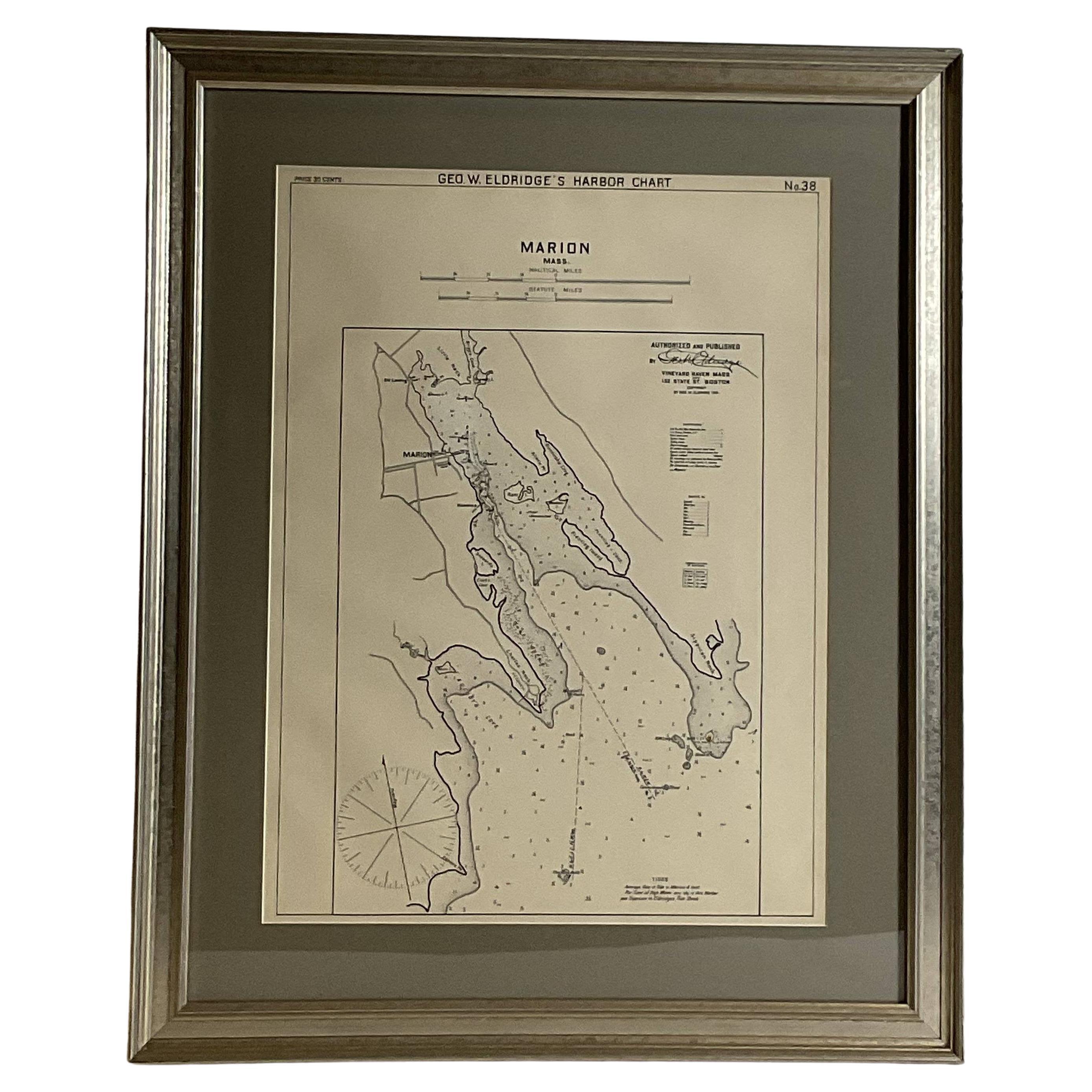
Nautical chart showing the harbor and local waters of Marion Harbor., The chart displays depth, buoys, lighthouses, etc., Shown are Planting Island, Ram Island, Sippican Neck, Little...
Category
Antique Early 1900s North American Prints
Materials
Paper

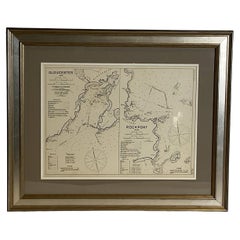
Mariners Chart of Gloucester and Rockport by George Eldridge 1910
Located in Norwell, MA
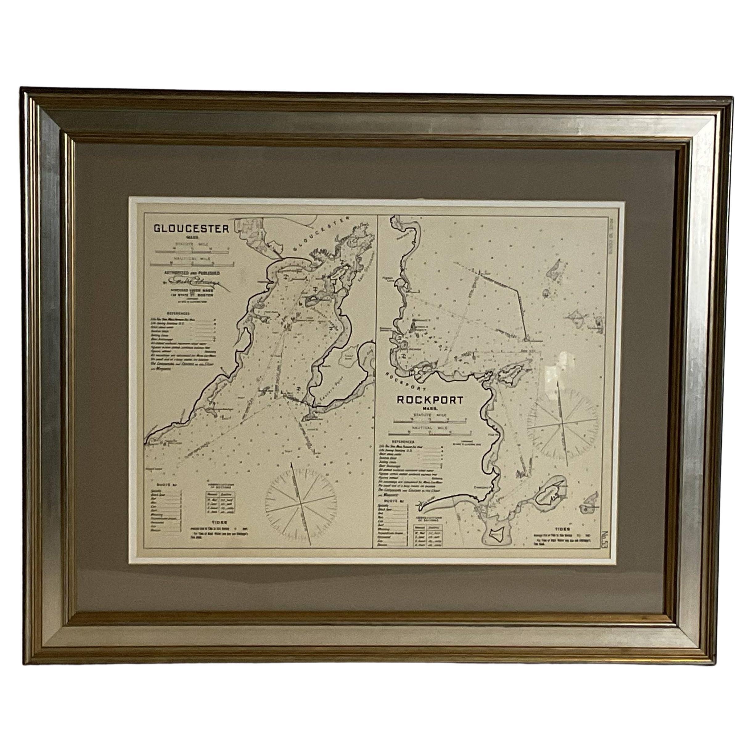
Nautical chart showing the harbor and local water. The chart display depths buoys, lighthouses, etc., This chart shows Eastern Point, Rocky Neck, Stage head, Thatcher Island, Sandy B...
Category
Vintage 1910s North American Prints
Materials
Paper
You May Also Like
Chart of the Harbour of Liverpool
Located in Cheshire, GB
PL Burdett A Chart of the Harbour of Liverpool hand coloured. Encased in an ebonised frame.
Dimensions
Height 23.5 Inches
Width 28 Inches
Depth 1 Inches
Category
Early 20th Century British Maps
Materials
Paper

$627 Sale Price
20% Off
Large U.S. Coast and Geodetic Survey Chart A of the Atlantic Coast, 1877
Located in Nantucket, MA
Large U.S. Coast and Geodetic Survey Chart A of the Atlantic Coast, 1877, re-issued in February 1881, a printed paper laid down on linen navigational chart of the U.S. Atlantic coast...
Category
Antique 1880s American Other Maps
Materials
Linen

19th Century Chart of New England Coast, 1847
By U.S. Government
Located in Nantucket, MA
19th Century Chart of New England Coast: the U.S. Coast Survey Sketch A - Section 1, a triangulation chart showing the progress of the survey and details along the New England coas...
Category
Antique 1840s American Other Maps
Materials
Paper

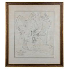
Silas Holman Map of Harvard
Located in Savannah, GA
A framed historic map of Harvard, as surveyed in 1831 by Silas Holman, reproduced circa 1920s.
frame: 29 by 32 inches
Category
Vintage 1920s Other Prints
Materials
Glass, Wood, Paper
1776 Navigational chart/map of the Delaware bay and river including Philadelphia
Located in Philadelphia, PA
JOSHUA FISHER
(AMERICAN, EIGHTEENTH CENTURY)
A Chart of Delaware Bay and River, 1776
Printed for John Bennet and Robert Sayer, London
Engraving on pape...
Category
1770s Realist Landscape Prints
Materials
Paper, Engraving

Scarce U.S. Coast Survey Map Depicting Entrance to San Francisco Bay Dated 1856
Located in San Francisco, CA
A fine example of the 1856 U.S. Coast lithographic survey nautical chart of the entrance to San Francisco bay and the city. Published in 1856 by the Office of the Coast Survey the of...
Category
Antique Mid-19th Century American Maps
Materials
Paper

$780 Sale Price
47% Off
More Ways To Browse
Antique Gold Knobs
Antique Hammer Heads
Antique Hand Painted Japanese China
Antique Laughing Buddha
Antique Mahogany Wood Stain
Antique Mechanical Clocks
Antique Odd Fellows
Antique Opium Pipe
Antique Porcelain Snuff Bottles
Antique Satsuma Bowl
Antique Silver Bud Vase
Antique Silver Bud Vases
Antique Spice Tower
Antique Sprinkler
Antique Teak Trunk
Antique Tiger Maple Furniture
Antique Towel Bar
Antique Wedgewood Wedgwood