Items Similar to Ancient National Atlas of France with Marengo

Want more images or videos?
Request additional images or videos from the seller
1 of 14
Ancient National Atlas of France with Marengo
$960.80
£711.70
€800
CA$1,314.61
A$1,430.40
CHF 757.38
MX$17,208.68
NOK 9,617.02
SEK 8,798.90
DKK 6,096.65
About the Item
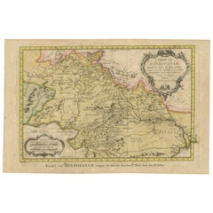
Ancient National Atlas of France with the department of Marengo: a rare French etching dated 1806.
ST/178.
- Dimensions:Height: 17.13 in (43.5 cm)Width: 24.02 in (61 cm)Depth: 0.04 in (1 mm)
- Style:Other (In the Style Of)
- Materials and Techniques:Paper,Engraved
- Place of Origin:
- Period:
- Date of Manufacture:1806
- Condition:
- Seller Location:Alessandria, IT
- Reference Number:Seller: ST/1781stDibs: LU1379244493932
About the Seller
4.8
Vetted Professional Seller
Every seller passes strict standards for authenticity and reliability
Established in 1984
1stDibs seller since 2015
389 sales on 1stDibs
Typical response time: 4 hours
- ShippingRetrieving quote...Shipping from: Alessandria, Italy
- Return Policy
More From This Seller
View AllGeographical Antique Map of Principality of Monaco
By Bruno Santini
Located in Alessandria, Piemonte
ST/609 - Interesting antique color map of Monaco Principality in French language : "Carte qui contient le Principauté de Piémont, le Monferrat et la comté de...
Category
Antique Late 18th Century Italian Other Maps
Materials
Paper

Old Horizontal Map of England
By Tasso
Located in Alessandria, Piemonte
ST/520 - Old rare Italian map of England, dated 1826-1827 - by Girolamo Tasso, editor in Venise, for the atlas of M.r Le-Sage.
Category
Antique Early 19th Century Italian Other Prints
Materials
Paper

Antique Map of Principality of Monaco
By Antonio Vallardi Editore
Located in Alessandria, Piemonte
ST/619 - "Old Geographical Atlas of Italy - Topographic map of ex-Principality of Monaco" -
ediz Vallardi - Milano -
A somewhat special edition ---
Category
Antique Late 19th Century Italian Other Prints
Materials
Paper

Geographical Map of Italy
Located in Alessandria, Piemonte
BOLIS Publishing House - Bergamo.
A beautiful large map of Italy, on paper but suitably reinforced to preserve it correctly. The maps were usually p...
Category
Mid-20th Century Italian Other Prints
Materials
Paper

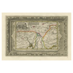
Map "Estuary- Mouth of the Thames"
Located in Alessandria, Piemonte
ST/426 - Antique French Map of the estuary of the Thames, map dated 1769 -
"Mape of the entrance of the Thames. Designed by filing of Navy cards fo...
Category
Antique Mid-18th Century French Other Prints
Materials
Paper

Ancient Valenza Jewelry City Etching
Located in Alessandria, Piemonte
Ancient etching from 1707 representing VALENZA, the Italian city in the province of Alessandria, famous throughout the world for its gold processing any jewelry factories.
Author of ...
Category
Antique Early 18th Century Italian Other Prints
Materials
Paper
You May Also Like
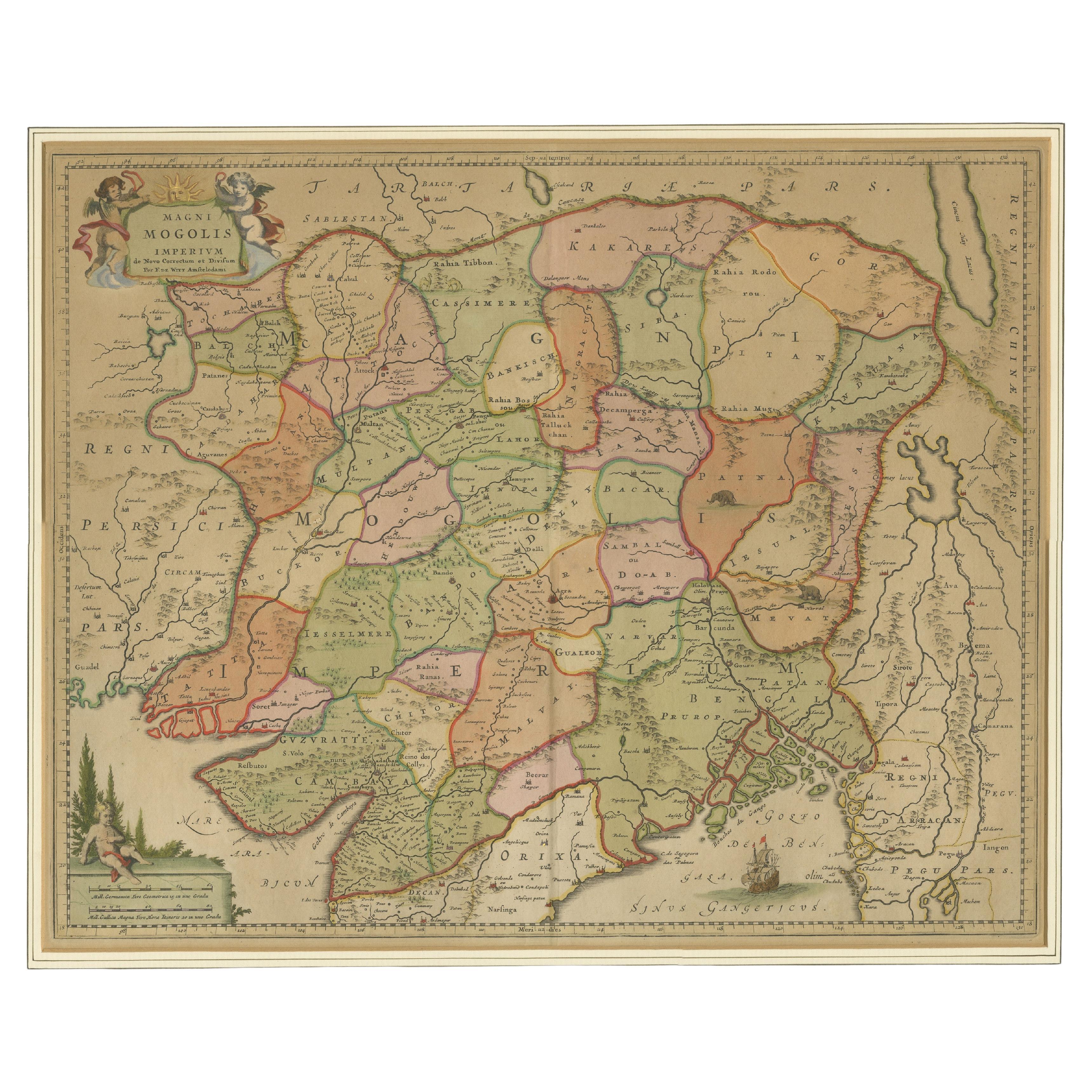
Antique Map of the Empire of the Great Mogul
Located in Langweer, NL
Antique map titled 'Magni Mogolis Imperium'. This map depicts the Empire of the Great Mogul in northern India including the region from Iran to Burma. The Indus and Ganges Rivers are...
Category
Antique Late 17th Century Maps
Materials
Paper
$922 Sale Price
20% Off
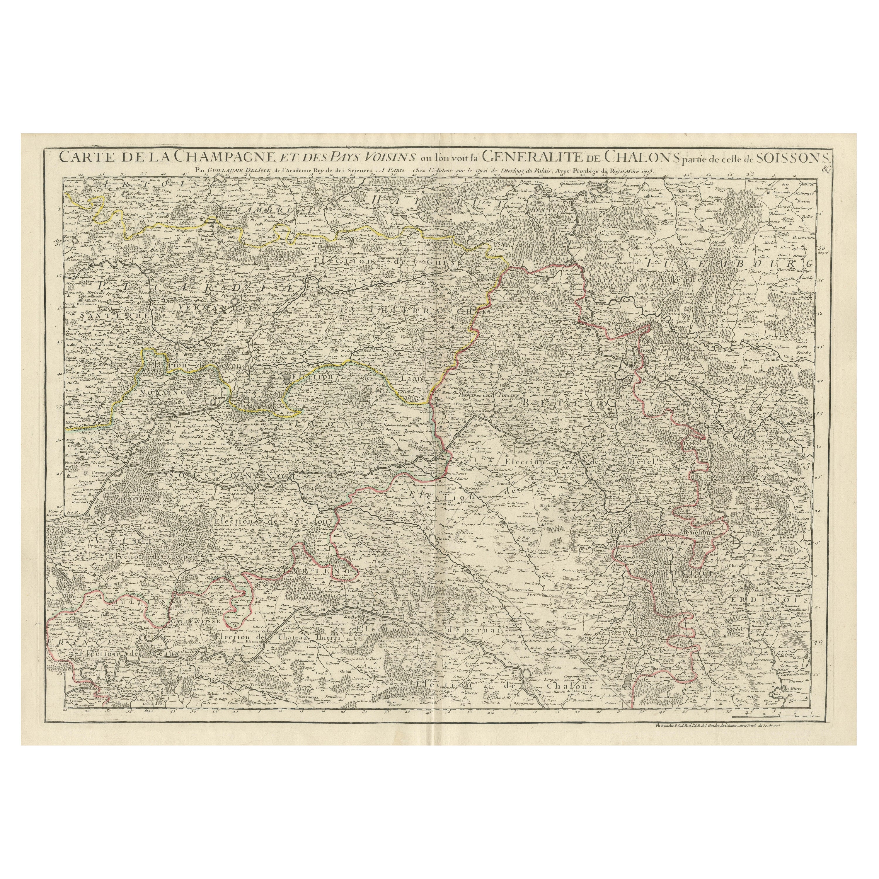
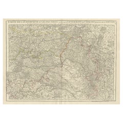
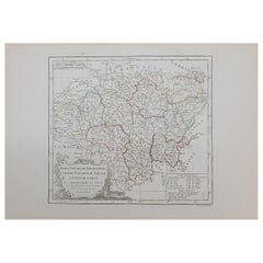
Antique Map of Champagne and surrounding Regions, France
Located in Langweer, NL
Antique map titled 'Carte de la Champagne et des Pays Voisins (..)'. Detailed map of Champagne and surrounding regions of Chalons and Soissons, Reims,...
Category
Antique Mid-18th Century Maps
Materials
Paper
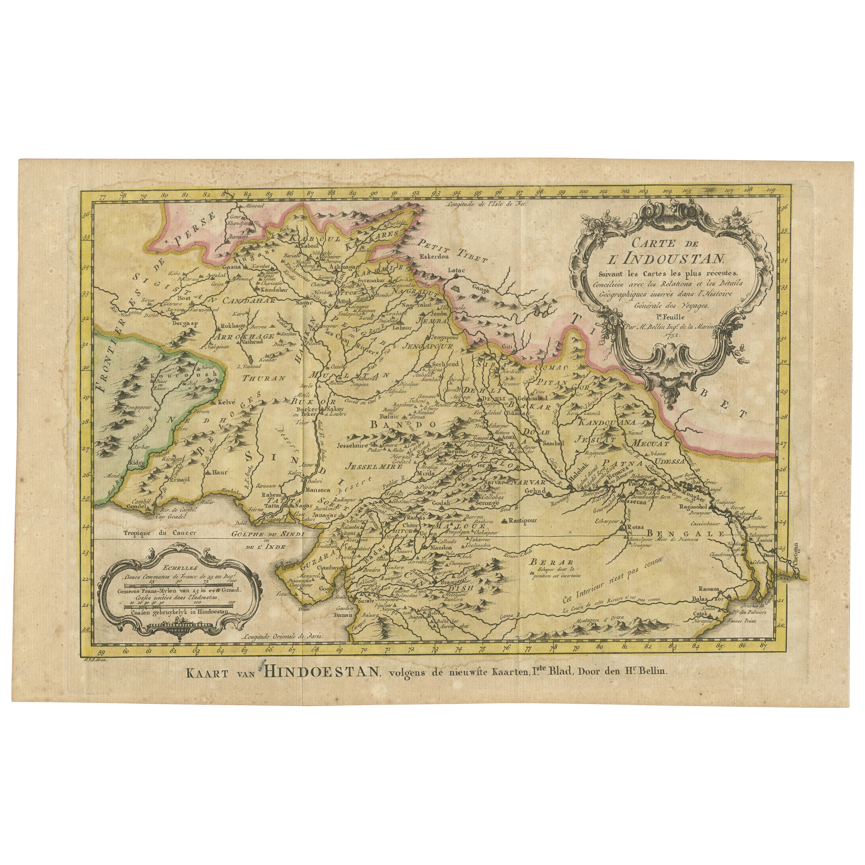
Original Antique Map of Northern India
By Jakob van der Schley
Located in Langweer, NL
Antique map titled 'Carte de l'Indoustan (..) - Kaart van Hindoestan (..)'. Original antique map of northern India. This map originates from 'His...
Category
Antique Mid-18th Century Maps
Materials
Paper
$211 Sale Price
20% Off
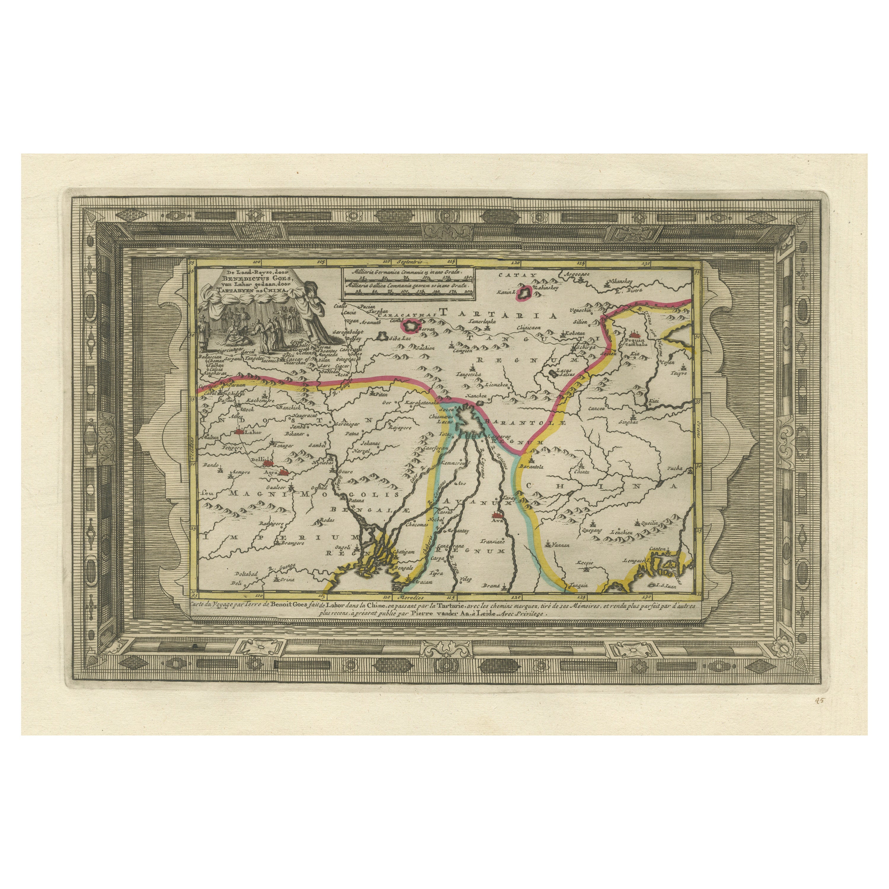
Benedictus Goes’ Route – Antique Map of Tartary to China by Van der Aa, 1714
Located in Langweer, NL
Benedictus Goes’ Route – Antique Map of Tartary to China by Van der Aa, 1714
This fascinating antique map titled De Land-Reyse door Benedictus Goes, van Lahor gedaan, door Tartaryen...
Category
Antique Early 18th Century Dutch Maps
Materials
Paper
$518 Sale Price
20% Off
Antique Map of Algeria and the French Colonies, 1875
Located in Langweer, NL
Antique map titled 'Algérie et Colonies Francaises'. Large map of Algeria and the French Colonies. This map originates from 'Atlas de Géographie Moderne Physique et Politique' by A. ...
Category
Antique Late 19th Century French Maps
Materials
Paper

$312 Sale Price
35% Off
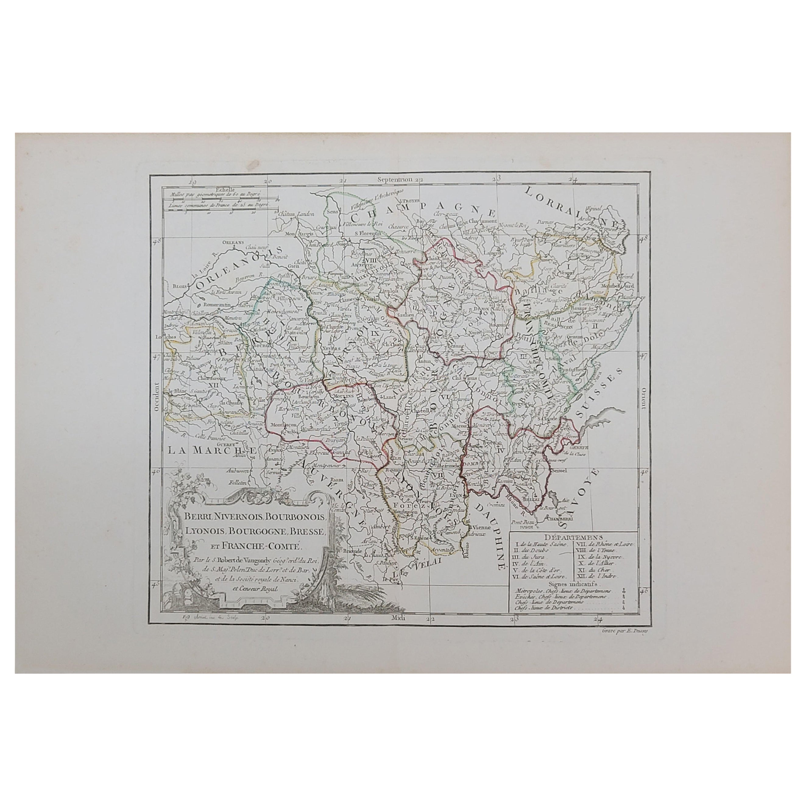
1762 Berri, Nivernois Bourbonois, Lyonois, Bourgogine, Bresse, et, Franche - Com
Located in Norton, MA
1762 Vaugondy map, entitled
"Berrl Nivernois Bourbonois Lyonois, Bourgone, Bresse, Et Franche-Comte,"
Ric.b003
About this Item
A fine Copperplate Engraving with original han...
Category
Antique 18th Century Unknown Maps
Materials
Paper
More Ways To Browse
Terracotta Cat
Thayer Coggin Burl Wood
Thomas Webb Crystal
Tiffany Bronze Clock
Tiffany French Clock
Tiger Maple Drawers
Toucan Mexican
Tyra Lundgren Carolina
Used Article Furniture
Used Furniture Bolton
Used Smoking Pipes
Victor Prouve
Victorian Murano Glass
Vintage 4 Panel Asian Screens
Vintage Air Force Planes
Vintage Barbell
Vintage Burl Wood Chest
Vintage Cat Statue