Items Similar to Antique Chart of the Church Accommodation of the United States by Walker, 1874

Want more images or videos?
Request additional images or videos from the seller
1 of 5
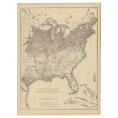
Antique Chart of the Church Accommodation of the United States by Walker, 1874
$358.40
£267.85
€300
CA$494.43
A$541.56
CHF 285.13
MX$6,463.32
NOK 3,633.73
SEK 3,321.78
DKK 2,286.64
About the Item
Antique chart titled 'Chart showing the ratio of church accommodation to the total population over 10 years of age with the proportion of such church accommodation furnished by each of the largest four denominations within each state and by each of the largest eight denominations within the United States'. This chart shows the church accommodation for each state of America. Originates from 'Statistical Atlas of the United States based on the results of the ninth census 1870 (..)' by Francis A. Walker.
- Dimensions:Height: 21.66 in (55 cm)Width: 16.15 in (41 cm)Depth: 0.02 in (0.5 mm)
- Materials and Techniques:
- Period:
- Date of Manufacture:1874
- Condition:General age-related toning, minor wear. Blank verso, please study image carefully.
- Seller Location:Langweer, NL
- Reference Number:Seller: BG-11875-11stDibs: LU3054319781192
About the Seller
5.0
Recognized Seller
These prestigious sellers are industry leaders and represent the highest echelon for item quality and design.
Platinum Seller
Premium sellers with a 4.7+ rating and 24-hour response times
Established in 2009
1stDibs seller since 2017
2,806 sales on 1stDibs
Typical response time: 1 hour
- ShippingRetrieving quote...Shipping from: Langweer, Netherlands
- Return Policy
More From This Seller
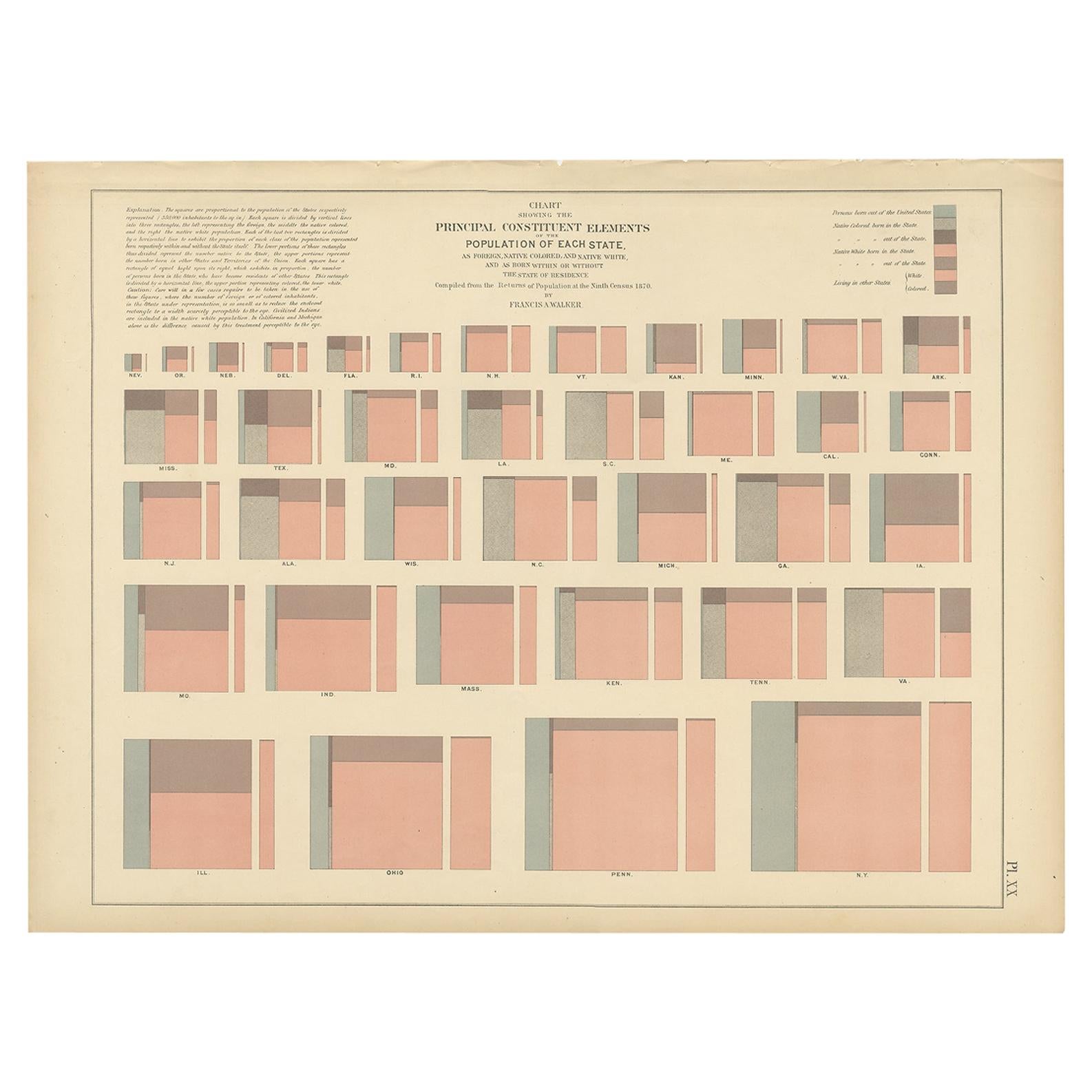
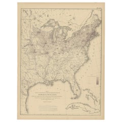
View AllAntique Chart of the Population of the United States by Walker
1874
Located in Langweer, NL
Antique chart titled 'Chart showing the principal constitutional elements of the population of each state, as foreign, native, colored, and native white, and as born within or withou...
Category
Antique Late 19th Century Prints
Materials
Paper
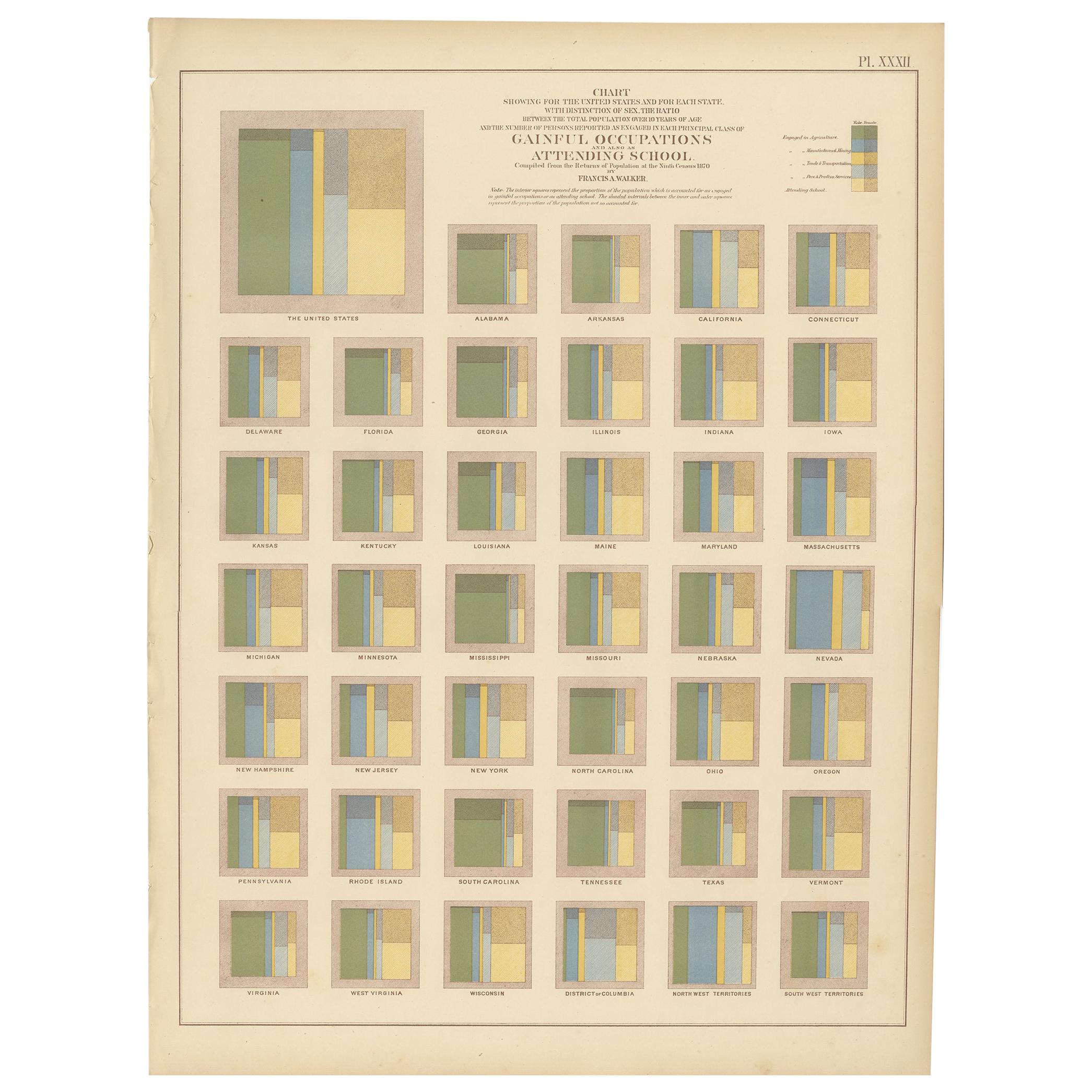
Antique Chart of Occupations and School Attendance of the United States, 1874
Located in Langweer, NL
Antique chart titled 'Chart showing for the United States and for each state with distinction of sex, the ratio between the total population over 10 years of age and the number of pe...
Category
Antique Late 19th Century Prints
Materials
Paper
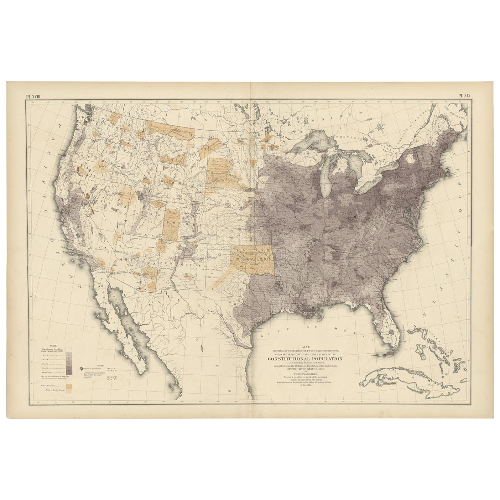
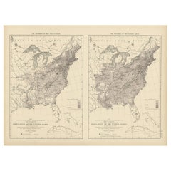
Antique Chart of the US Population in 1870, published in 1874
Located in Langweer, NL
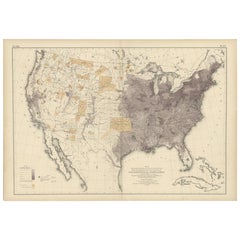
Antique chart titled 'Map showing, in five degrees of density, the distribution, within the territory of the United States, of the constitutional population, i.e., excluding Indians ...
Category
Antique Late 19th Century Maps
Materials
Paper
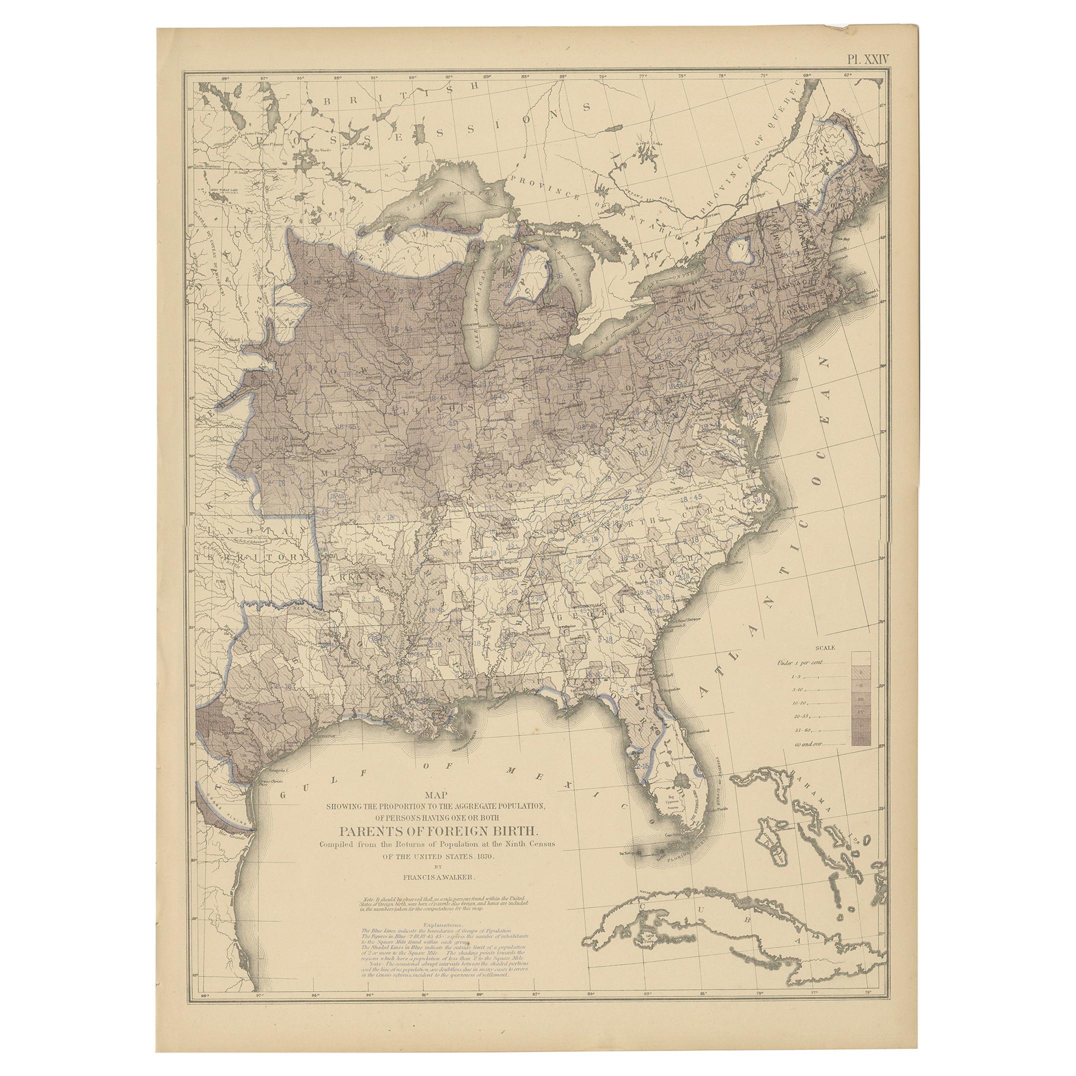
Antique Chart of the US Foreign Parentage Proportion in 1870,
1874
Located in Langweer, NL
Antique chart titled 'Map showing the proportion to the aggregate population, of persons having one or both parents of foreign birth. Compiled from the returns of population at the n...
Category
Antique Late 19th Century Maps
Materials
Paper
Pl. 25 Antique Chart of the US Foreign Population in 1870,
1874
Located in Langweer, NL
Antique chart titled 'Map showing five degrees of density the distribution of the foreign population within the territory of the United States east of the 100th Meridian. Compiled fr...
Category
Antique Late 19th Century Maps
Materials
Paper
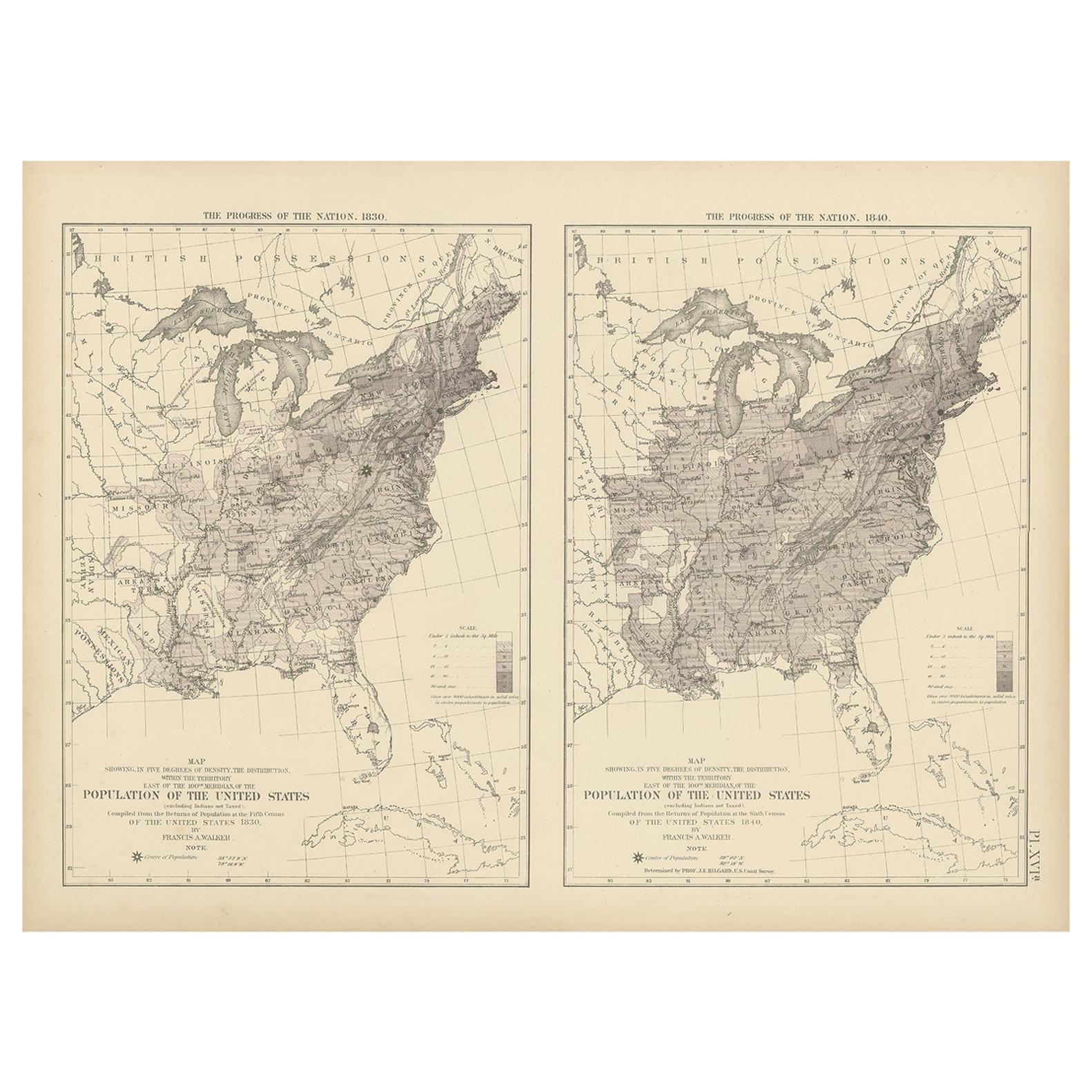
Pl. 16A Antique Chart of the US Population 1830-1840 by Walker, 1874
Located in Langweer, NL
Antique chart titled 'Map showing, in five degrees of density, the distribution, within the territory east of the 100th Meridian, of the population of the United States, excluding In...
Category
Antique Late 19th Century Maps
Materials
Paper
You May Also Like
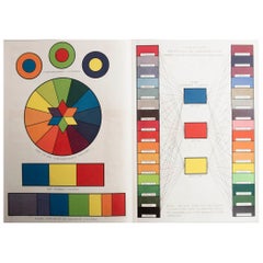
Original Antique Print of A Colour Chart . C.1900
Located in St Annes, Lancashire
Great image of a colour chart
Unframed.
Chromo-lithograph
Published, C.1900
The measurement is the paper size of the print
Free shipping.
Category
Antique Early 1900s English Folk Art Prints
Materials
Paper
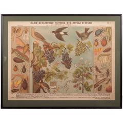
19th Century Antique German School, Teaching Chart, Poster
Located in Vienna, AT
Antique wall chart depicting in Russian language printed, end of the 19th century.
Good original condition, new frame with green passe-partout and ...
Category
Antique 1890s Russian Posters
Materials
Glass, Wood, Paper
$590 Sale Price
57% Off
"The United States from the Latest Authorities" Antique Wall Map, 1835
Located in Colorado Springs, CO
This is a 1835 map of “The United States from the Latest Authorities” by Ezra Strong. A hand-colored engraved wall map of the eastern half of the United States, this map has a large inset of the "Oregon District" and several engraved city views and two portraits.
The primary map extends to Mexico Texas and the Missouri Territory, showing the course of the Missouri River to Ft. Mandan and Old Ft. Mandan, and noting many forts along the river. The territories to the east of Missouri Territory are separately delineated as Sioux District and Huron District. The western details of the map are very good for a map of this time period, with many Native American settlements, villages, forts and other details noted.
The map is bordered with vignettes of Boston, New York, Philadelphia, Hartford, Cincinnati, and Baltimore. Each vignette notes the date settled, primary settler, and the population as of 1830. Two portraits of LaFayette and George Washington are presented in full length with related biographical information.
A large inset map at lower right shows the Oregon District, centered on the Columbia River and extending to the Rocky Mountains. This is one of the earliest commercial appearances of a separate map of Oregon...
Category
Antique 1830s American Maps
Materials
Paper

1842 Wall Map of the United States by J. H. Young, Published by S. A. Mitchell
Located in Colorado Springs, CO
Presented is an 1842 hanging “Map of the United States,” engraved by J. H. Young and published by Samuel Augustus Mitchell, Philadelphia. This is a beautiful example of the rare 1842...
Category
Antique 1840s American Maps
Materials
Paper

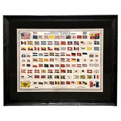
"Johnson
s New Chart of National Emblems" Engraving by A. J. Johnson, 1870
Located in Colorado Springs, CO
Presented is a hand-colored engraving of “Johnson's New Chart of National Emblems.” This print was created for “Johnson's New Illustrated Family Atlas of the World,” published by A.J...
Category
Antique 1870s American Victorian Prints
Materials
Paper
Framed 1839 Hand Colored Map of the United States
Located in Stamford, CT
Framed hand colored map of the United States of America from 1839. Newly framed in a giltwood frame.
Category
Antique 1830s American American Classical Maps
Materials
Giltwood, Paper, Glass

More Ways To Browse
Chinese Emperor Print
Edouard Travies
Equestrian Engraving
Flying Squirrel
French Matting
Grey Partridge
H Alken
Muramasa Kudo
Reverse Glass Print
Sea Of Galilee
Snipe A Bird
Vintage Wooden Pencils
Vintage Zoological Prints
Vivant Denon
Antique Religious Lithographs
Barbary Lion
Botanical Chart
Curtis Botanical Prints