Items Similar to Antique Genealogy Chart of the Duchy of Brunswick-Luneburg, Germany, 1732
Want more images or videos?
Request additional images or videos from the seller
1 of 5
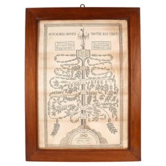
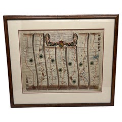
Antique Genealogy Chart of the Duchy of Brunswick-Luneburg, Germany, 1732
$229.86
$287.3220% Off
£171.89
£214.8720% Off
€192
€24020% Off
CA$316.73
CA$395.9220% Off
A$345.55
A$431.9320% Off
CHF 182.96
CHF 228.7120% Off
MX$4,140.63
MX$5,175.7920% Off
NOK 2,330.16
NOK 2,912.7020% Off
SEK 2,130.76
SEK 2,663.4520% Off
DKK 1,462.31
DKK 1,827.8820% Off
About the Item
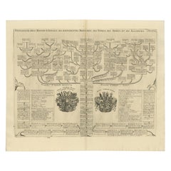
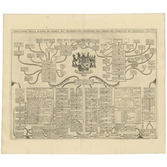
Antique print titled 'Carte Genealogique de la Maison de Brunsuick-Lunebourg'. Genealogy of the Duchy of Brunswick-Luneburg. With coats of arms of the Elector of Hannover and the Duchy of Brunswick-Wolfenbuttel. This print orginates from 'Atlas Historique'.
The Duchy of Brunswick (German: Herzogtum Braunschweig) was a historical German state. Its capital was the city of Brunswick (Braunschweig). It was established as the successor state of the Principality of Brunswick-Wolfenbüttel by the Congress of Vienna in 1815. In the course of the 19th-century history of Germany, the duchy was part of the German Confederation, the North German Confederation and from 1871 the German Empire. It was disestablished after the end of World War I, its territory incorporated into the Weimar Republic as the Free State of Brunswick. (Source: wikipedia)
Artists and Engravers: Henri Abraham Chatelain (1684-1743), his father Zacharie Chatelain (d.1723) and Zacharie Junior (1690-1754), worked as a partnership publishing the Atlas Historique.
Condition: Very good, general age-related toning. Please study image carefully.
Date: 1732
Overall size: 52.1 x 43.2 cm.
Image size: 0.001 x 48 x 35.9 cm.
We also offer thousands of antique prints covering fields of interest as diverse as architecture, natural history, religion, ethnology and many more. Antique prints have long been appreciated for both their aesthetic and investment value. They were the product of engraved, etched or lithographed plates. These plates were handmade out of wood or metal, which required an incredible level of skill, patience and craftsmanship. Whether you have a house with Victorian furniture or more contemporary decor an old engraving can enhance your living space.
- Dimensions:Height: 17.01 in (43.2 cm)Width: 20.52 in (52.1 cm)Depth: 0 in (0.01 mm)
- Materials and Techniques:
- Period:
- Date of Manufacture:1732
- Condition:
- Seller Location:Langweer, NL
- Reference Number:Seller: BG-019441stDibs: LU3054325964372
About the Seller
5.0
Recognized Seller
These prestigious sellers are industry leaders and represent the highest echelon for item quality and design.
Platinum Seller
Premium sellers with a 4.7+ rating and 24-hour response times
Established in 2009
1stDibs seller since 2017
2,792 sales on 1stDibs
Typical response time: <1 hour
- ShippingRetrieving quote...Shipping from: Langweer, Netherlands
- Return Policy
More From This Seller
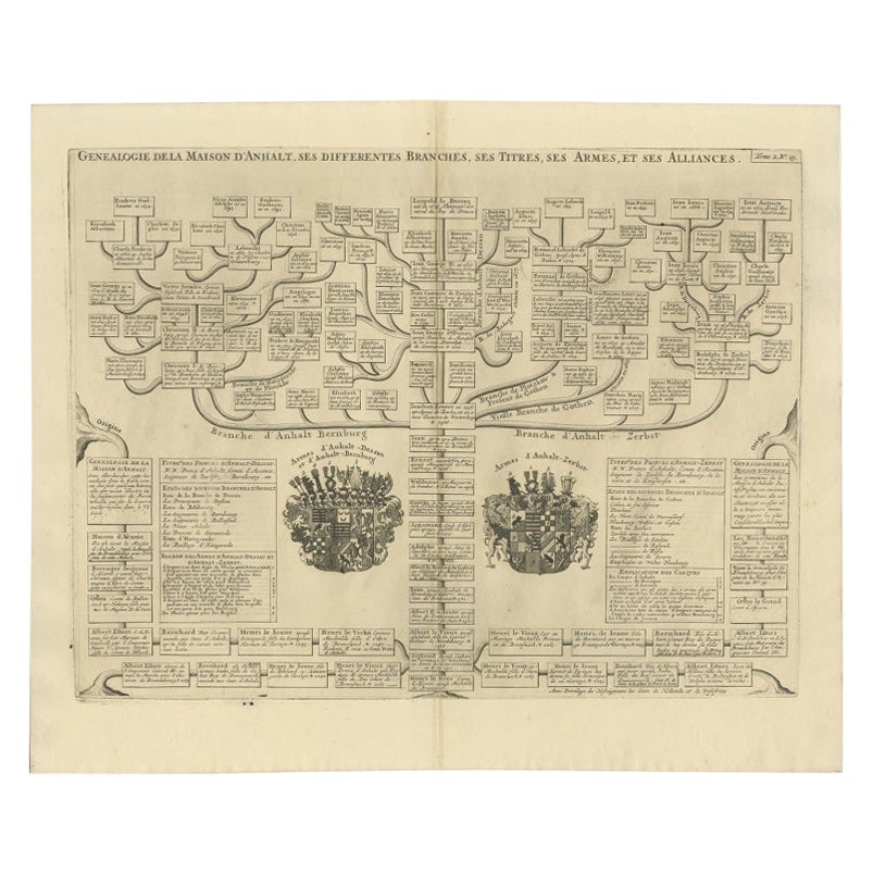
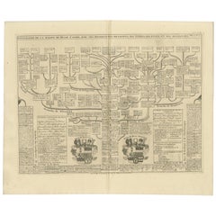
View AllAntique Genealogy Chart of the Duchy of Anhalt Dessau, Bernburg and Zerbst, 1732
Located in Langweer, NL
Antique print titled 'Genealogie de la Maison d'Anhalt'. Chart of the genealogy of the house of the Duchy of Anhalt. Two coats of arms, on the left Anhalt-...
Category
Antique 18th Century Prints
Materials
Paper
$172 Sale Price
20% Off
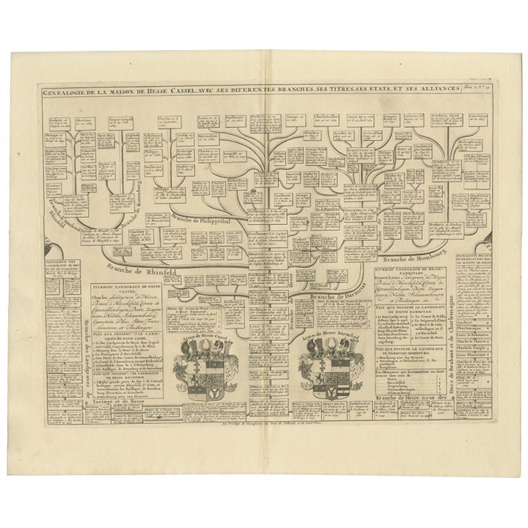
Antique Genealogy Chart of the Landgraviate Hessen-Kassel, Germany, 1732
Located in Langweer, NL
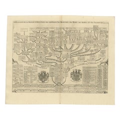
Antique print titled 'Genealogie de la Maison de Hesse Cassel'. Chart of the genealogy of the Landgraviate Hessen-Kassel / Hesse-Cassel. This includes the coats of arms of both Hesse-Cassel and Hesse-Darmstadt. This print orginates from 'Atlas Historique'.
The Landgraviate of Hesse-Kassel (German: Landgrafschaft Hessen-Kassel), spelled Hesse-Cassel during its entire existence, was a state in the Holy Roman Empire that was directly subject to the Emperor. The state was created in 1567 when the Landgraviate of Hesse was divided upon the death of Philip I, Landgrave of Hesse. His eldest son William IV inherited the northern half of the Landgraviate and the capital of Kassel. The other sons received the Landgraviate of Hesse-Marburg, the Landgraviate of Hesse-Rheinfels and the Landgraviate of Hesse-Darmstadt.
During the Napoleonic reorganisation of the Empire in 1803, the Landgrave of Hesse-Kassel was elevated to an Electorate and Landgrave William IX became an Imperial Elector. Many members of the Hesse-Kassel House served in the Danish military gaining high ranks and power in the Oldenburg realm due to the fact that many Landgraves were married to Danish princesses...
Category
Antique 18th Century Prints
Materials
Paper
$249 Sale Price
20% Off
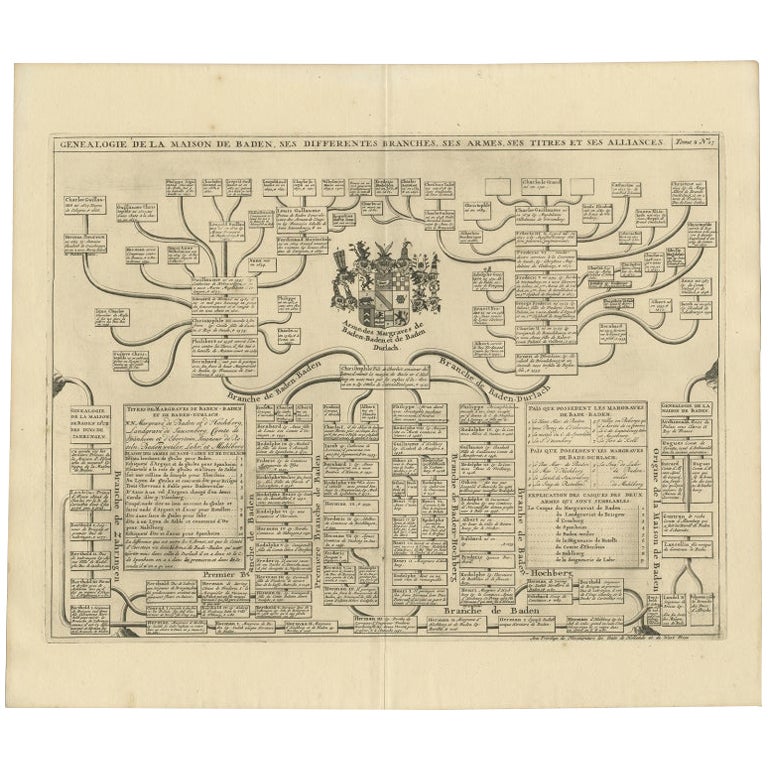
Antique Genealogy Chart of the Margraviates and Baden-Durlach, Germany, 1732
Located in Langweer, NL
Antique print titled 'Genealogie de la Maison de Baden (..)'. Chart of the genealogy of the Margraviates Baden-Baden and Baden-Durlach. This print orginates from 'Atlas Historique'. ...
Category
Antique 18th Century Prints
Materials
Paper
$268 Sale Price
20% Off
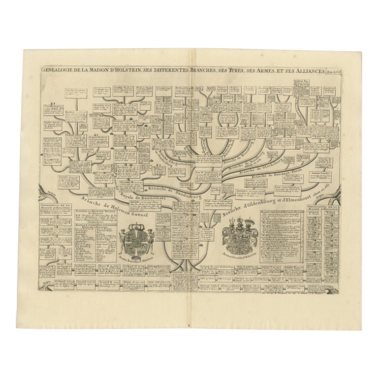
Antique Genealogy Chart of the House of Holstein, 1732
Located in Langweer, NL
Antique print titled 'Carte Genealogique d'Holstein (..)'. Genealogical chart of the house Holstein. Shows both the ducal and the royal arms of the House (the ducal arms with keyed l...
Category
Antique 18th Century Prints
Materials
Paper
$229 Sale Price
20% Off
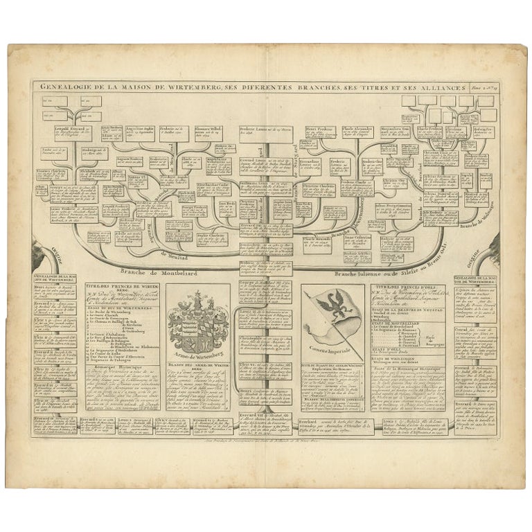
Antique Genealogy Chart of the House of Wurttemberg in Germany, 1732
Located in Langweer, NL
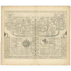
Antique print titled 'Genealogie de la Maison de Wirtemberg (..)'. Genealogy of the House Wurttemberg. This print orginates from 'Atlas Historique'.
The House of Württemberg is a...
Category
Antique 18th Century Prints
Materials
Paper
$249 Sale Price
20% Off
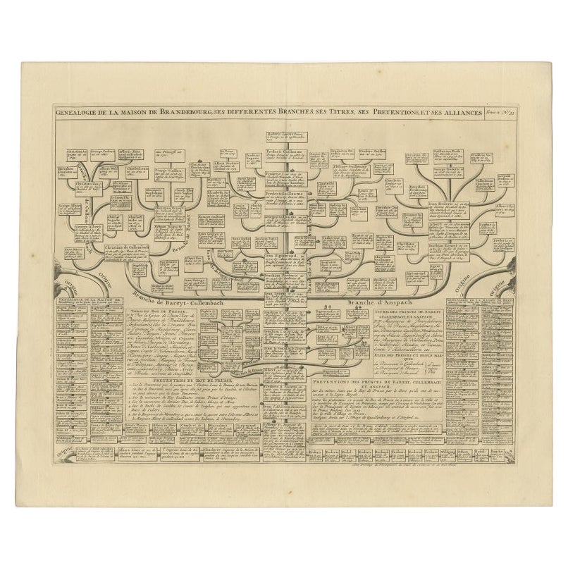
Old Genealogy Chart of the Rulers of Margraviate Brandenburg in Germany, 1732
Located in Langweer, NL
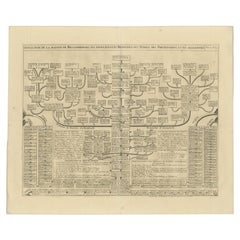
Antique print titled 'Genealogie de la Maison de Brandebourg (..)'. Genealogy of the rulers of the Margraviate Brandenburg. This print orginates from 'Atlas Historique'.
The Margraviate of Brandenburg (German: Markgrafschaft Brandenburg) was a major principality of the Holy Roman Empire from 1157 to 1806 that played a pivotal role in the history of Germany and Central Europe. Brandenburg developed out of the Northern March founded in the territory of the Slavic Wends. It derived one of its names from this inheritance, the March of Brandenburg (Mark Brandenburg). Its ruling margraves were established as prestigious prince-electors in the Golden Bull...
Category
Antique 18th Century Prints
Materials
Paper
$229 Sale Price
20% Off
You May Also Like
The Genealogy of Jesus, print on Italian paper from 1820.
Located in Milan, IT
A paper print depicting the genealogy of Jesus, his family tree, with the charm of a time machine reconstructs the genealogy of Christ's ancestors, as per the Gospel according to Mat...
Category
Antique Early 19th Century Italian Religious Items
Materials
Glass, Fruitwood, Paper
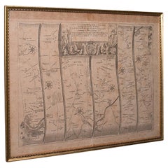
Antique Road Map, London to Hythe, Kent, English, Cartography, John Ogilby, 1675
Located in Hele, Devon, GB
This is an antique Road Map from London to Hythe, Kent. An English, cartographic atlas excerpt by John Ogilby, dating to the late 17th century with later frame, circa 1675
A superb ...
Category
Antique 17th Century British Queen Anne Maps
Materials
Glass, Paper
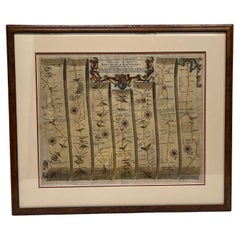
John Ogilby Oxford to Salisbury Road Map #83 Circa 1675
By John Ogilby
Located in Atlanta, GA
John Ogilby (Scottish, 1600-1676). - Circa 1675
This map is part of his Britannica publication and is #83.
"The road map was first popularised by John Ogilby (1600-1676), Scotsm...
Category
Antique 17th Century Scottish Regency Decorative Art
Materials
Burl, Paper
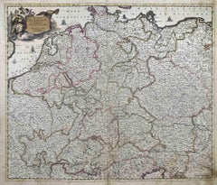
Accuratissima Germaniae Tabula - Etching by Frederick de Wit - 1680ca
By Frederick de Wit
Located in Roma, IT
This double-page etching with contemporary coloring, entitled Accuratissima Germaniae Tabula [...], was realized by the cartographer Frederick de Wit for the famous Atlas published i...
Category
1680s Modern Figurative Prints
Materials
Etching
John Ogilby Oxford to Salisbury Road Map #82 Circa 1675
By John Ogilby
Located in Atlanta, GA
John Ogilby (Scottish, 1600-1676). - Circa 1675
This map is part of his Britannica publication and is #82.
"The road map was first popularised by John Ogilby (1600-1676), Scotsm...
Category
Antique 17th Century Scottish French Provincial Decorative Art
Materials
Burl
1627 Hondius Map "La Principaute d
Orange et Comtat de Ve", Ric.0003
Located in Norton, MA
1627 Hondius map entitled
"La Principaute d'Orange et Comtat de Venaissin,"
Original Hand-Colored
Description: From Johannes Janssonius's Atlantis Maioris Appendix of 1630.
...
Category
Antique 17th Century Unknown Maps
Materials
Paper

More Ways To Browse
Tugomir Huberger
Van Gogh Cafe Terrace
Vanity Fair Original Print
Vasarely Griffon
Vintage Paris Map Framed
Vintage Wall Registers
1940s French Prints
1961 Picasso Exhibition
Aaa Lithograph
Alexander Wilson Birds
Antique Painting Pompeii
Arman Boom Boom
Audubon Havell Edition
Audubon Havell
Aurelia In A Red Bonnet
Avi Kiriaty
Bernard Munch
Bjorn Wiinblad Lithograph