Items Similar to Antique Map of London by Thomas Moule and William Schmollinger


Want more images or videos?
Request additional images or videos from the seller
1 of 7
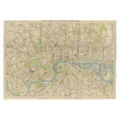
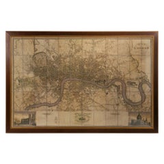
Antique Map of London by Thomas Moule and William Schmollinger
$325
£246.28
€283.81
CA$459.64
A$494.30
CHF 264.31
MX$5,961.17
NOK 3,342.32
SEK 3,045.28
DKK 2,120.70
About the Item
Decorative engraved map of London by William Schmollinger for Moule's English County maps. Hand colored. Circa 1830's.
- Dimensions:Height: 12 in (30.48 cm)Width: 13.5 in (34.29 cm)Depth: 0.5 in (1.27 cm)
- Materials and Techniques:
- Place of Origin:
- Period:
- Date of Manufacture:1830 s
- Condition:Wear consistent with age and use.
- Seller Location:Rochester, NY
- Reference Number:Seller: 63081stDibs: LU1585245299212
About the Seller
5.0
Vetted Professional Seller
Every seller passes strict standards for authenticity and reliability
Established in 1979
1stDibs seller since 2015
549 sales on 1stDibs
Typical response time: 1 hour
- ShippingRetrieving quote...Shipping from: Rochester, NY
- Return Policy
More From This Seller
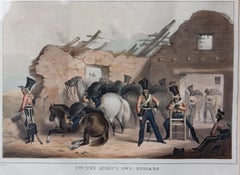
View All19th Century Hussar Soldiers London "Marching Order"
Located in Rochester, NY
19th century British lithograph of Hussar soldiers. William Spooner publisher.
Category
Antique 19th Century English Prints
Materials
Paper
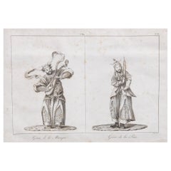
French Orientalist Engraving GENIUS OF MUSIC
GENIUS OF PEACE 1808 DE GUIGNES
Located in Rochester, NY
Antique engraved plate showing the genius of Fire and the genius of Peace, drawn by Chrétien Louis de Guignes (1759-1845), copper engraved by Jacques Eustache Deseve or De Seve (1790...
Category
Antique Early 19th Century French Prints
Materials
Paper
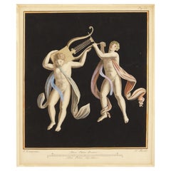
Three 18th Century Colored Engravings of Herculaneum Frescos by Nicola Fiorillo
Located in Rochester, NY
Set ancient Roman frescos from the series "Antiquities of Herculaneum", an original etching on paper by Nicola Fiorillo in the 18th Century. Three hand colored copper engravings of classical roman. Each print is matted in a custom made silk mat that matches the clothing. Engraving with two figures measures 21.25" x 18.25". The other two prints measure 20.5" x 16.5". Size includes mat.
# greek Pompeii Grand tour
Category
Antique 18th Century European Prints
Materials
Silk, Paper
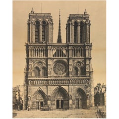
Mammoth Photograph of Notre Dame
Located in Rochester, NY
Grand tour 19th century photograph of Notre Dame Cathedral, late 19th century. Matted. Unframed.
Category
Antique 19th Century Grand Tour Photography
Materials
Paper
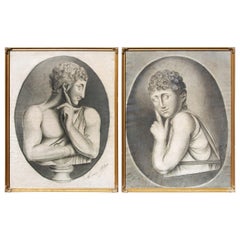
Early 19th Century, French, Salon Portrait Drawings, a Pair
Located in Rochester, NY
Pair of antique classical French salon drawings. Charcoal on paper. Illegibly signed. In giltwood frames, early 19th century.
Category
Antique Early 19th Century European Drawings
Materials
Giltwood, Paper
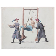
Antique Hand Colored Print of Chinese Life
Located in Rochester, NY
Early 19th century hand colored engraving of Chinese life. Original print from "The punishments of China" illustrated by twenty-two engravings by Mason, George Henry; Dadley, J. P. P...
Category
Antique Early 19th Century Prints
Materials
Paint, Paper
You May Also Like
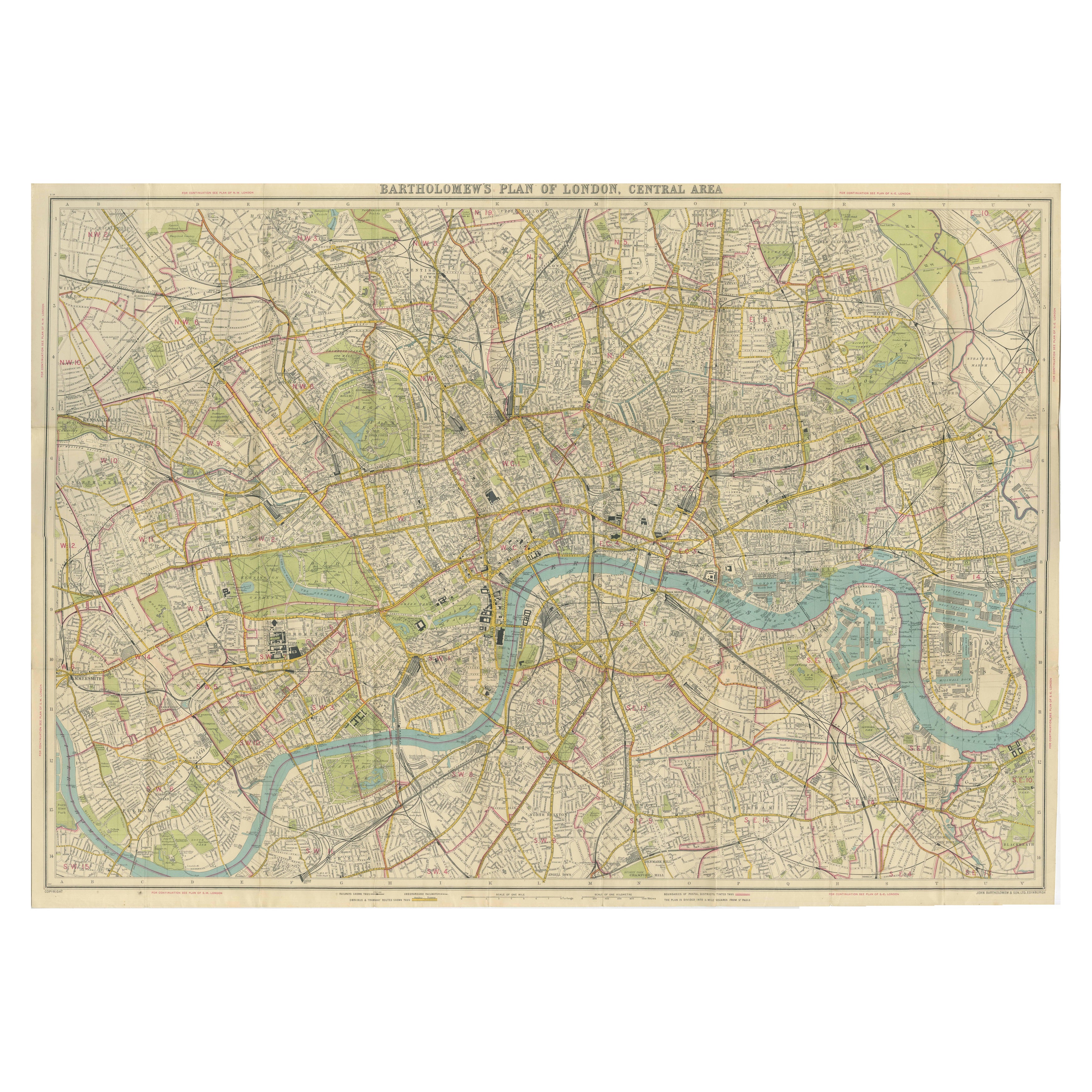
Vintage Map of London – Bartholomew’s Plan of Central London, c.1929
Located in Langweer, NL
London Central Map c.1929 – Bartholomew Antique City Plan
This detailed city plan, titled “Bartholomew’s Plan of London, Central Area,” was published by John Bartholomew & Son, Edin...
Category
Early 20th Century Scottish Maps
Materials
Paper
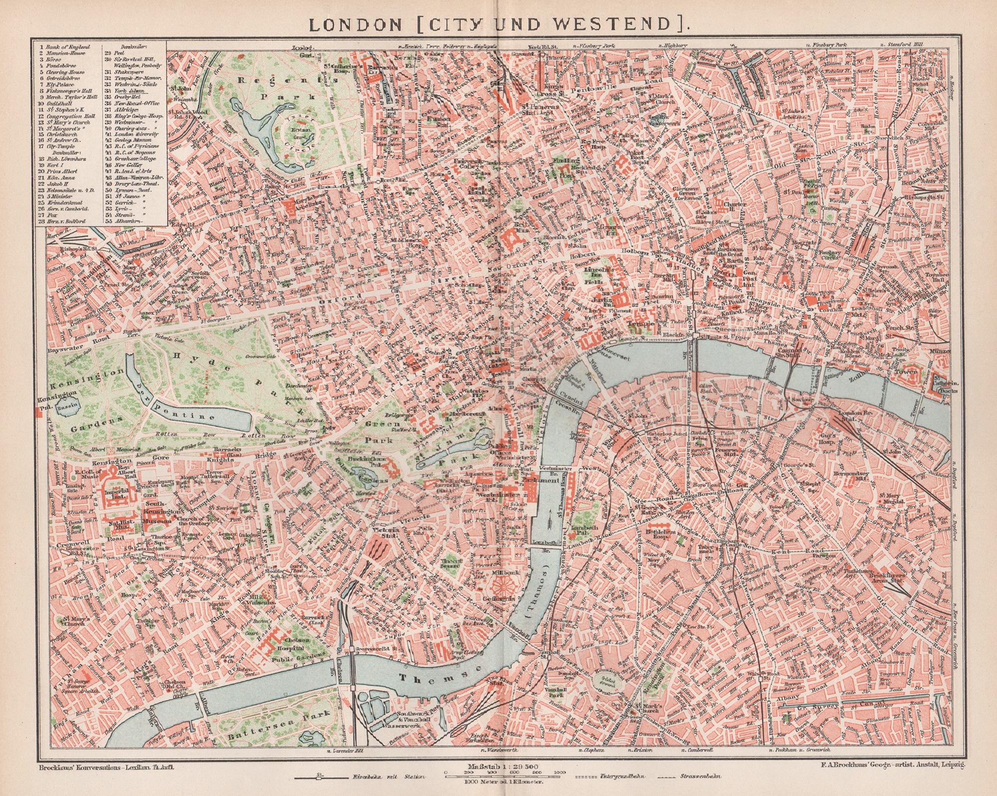
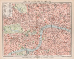
London, City and West End. Antique Map City Plan Chromolithograph, circa 1895
Located in Melbourne, Victoria
'London (City Und Westend)'
Colour lithograph. 1895.
250mm by 305mm (sheet).
Late 19th century German lithograph plan of London, City and West End.
Central vertical fold.
Category
Late 19th Century Victorian More Prints
Materials
Lithograph
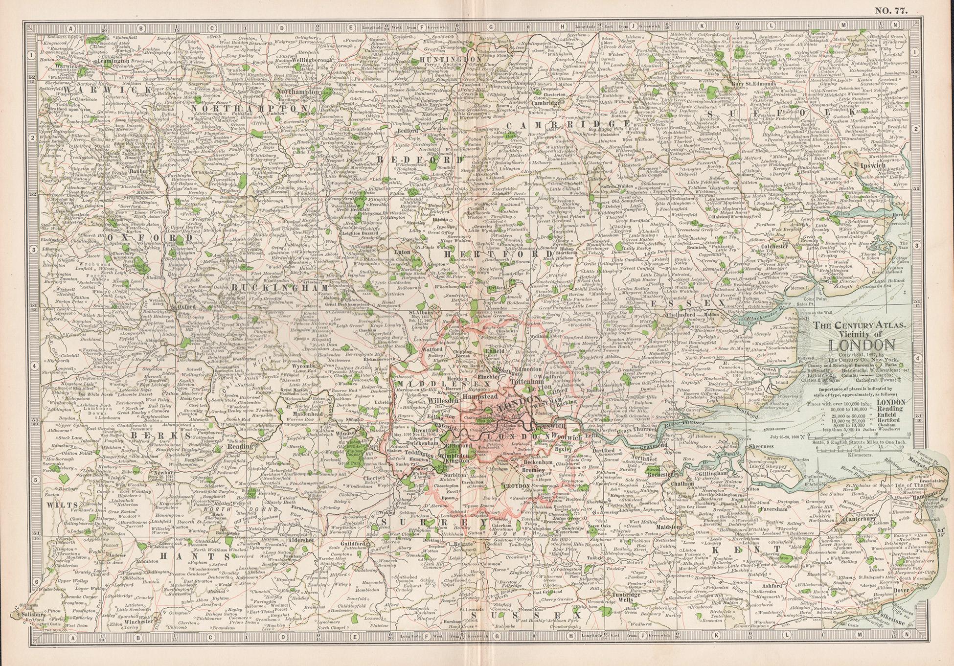
Vicinity of London, England, United Kingdom. Century Atlas antique map
Located in Melbourne, Victoria
'The Century Atlas. Vicinity of London, England, United Kingdom.'
Original antique map, 1903.
Central fold as issued. Map name and number printed on the reverse corners.
Sheet 29.5...
Category
Early 20th Century Victorian More Prints
Materials
Lithograph

Antique Map of the City of London by Balbi
1847
Located in Langweer, NL
Antique map titled 'London'. Original antique map of the city of London. This map originates from 'Abrégé de Géographie (..)' by Adrien Balbi. Published 1847.
Category
Antique Mid-19th Century Maps
Materials
Paper

$190 Sale Price
20% Off
Large Scale Map of the London Metropolis
Located in Dallas, TX
The product is a large scale map of the London Metropolis, specifically focusing on the city in intricate detail. It would be a valuable collectible for those interested in maps and ...
Category
Mid-20th Century English Maps
Materials
Paper
Antique Map of London by Tirion
1754
Located in Langweer, NL
Antique map titled 'Kaart van Londen enz. en van het naby gelegen land ruim een Uur gaans rondsom dezelve Stad; getrokken uit de groote gemeeten Kaart van Hr. John Rocque'. In the se...
Category
Antique Mid-18th Century Maps
Materials
Paper
