Items Similar to Antique Map of the Royal Botanic Garden
Arboretum Kew in London, England


Want more images or videos?
Request additional images or videos from the seller
1 of 10
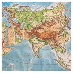
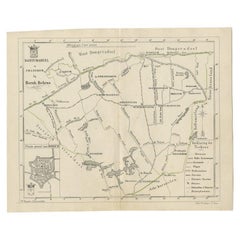
Antique Map of the Royal Botanic Garden
Arboretum Kew in London, England
$900
$1,20025% Off
£685.65
£914.2025% Off
€782.49
€1,043.3225% Off
CA$1,264.71
CA$1,686.2825% Off
A$1,378.31
A$1,837.7525% Off
CHF 729.88
CHF 973.1725% Off
MX$16,555.01
MX$22,073.3525% Off
NOK 9,240.40
NOK 12,320.5425% Off
SEK 8,495.64
SEK 11,327.5225% Off
DKK 5,844.33
DKK 7,792.4425% Off
About the Item
A very nice antique map of the Royal Botanic Garden
Arboretum in London, England, circa 1880s. The map itself measures 12" x 16" and is professionally framed in a nice black frame with red mat measuring 18" x 22".
- Dimensions:Height: 22 in (55.88 cm)Width: 18 in (45.72 cm)Depth: 1 in (2.54 cm)
- Materials and Techniques:
- Place of Origin:
- Period:
- Date of Manufacture:1880s
- Condition:Wear consistent with age and use. Minor fading.
- Seller Location:San Diego, CA
- Reference Number:1stDibs: LU936612148551
About the Seller
4.9
Platinum Seller
Premium sellers with a 4.7+ rating and 24-hour response times
Established in 2000
1stDibs seller since 2012
4,443 sales on 1stDibs
Typical response time: <1 hour
- ShippingRetrieving quote...Shipping from: San Diego, CA
- Return Policy
More From This Seller
View AllVintage "View of the Center of Paris Taken from the Air" Lithograph Map
Located in San Diego, CA
A very stylish "View of the Center of Paris Taken from the Air" lithograph map published by the Paris Ministry of Tourism, circa early 1950s. The piece measures 27" x 43" and shows...
Category
20th Century French Mid-Century Modern Prints
Materials
Paper

$680 Sale Price
20% Off
Huge Europe and Asia Vintage Wall Map
Located in San Diego, CA
A huge Europe and Asia vintage wall map, circa 1950s. The map is in fair vintage condition and measures 78"W x 73"H". #2863
Category
Mid-20th Century American Maps
Materials
Paper
$380 Sale Price
20% Off
Antique Map of California as an Island "The 5 Californias" by Robert de Vaugondy
Located in San Diego, CA
A very nice and rare antique map entitled "Carte de la Californie Suivant" (The 5 Californias), by Didier Robert de Vaugondy of Paris, circa 1772. The map itself measures 15.5" x 13...
Category
Antique Mid-19th Century American Maps
Materials
Paper

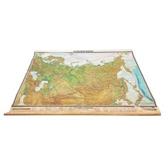
Massive Vintage Wall Map of the Soviet Union
Sowjetunion
by Karl Wenschow
By Denoyer-Geppert
Located in San Diego, CA
A massive vintage wall map of the Soviet Union (Sowjetunion) published by Karl Wenschow in Munich, Germany, circa 1950s. The map was distributed by De...
Category
Mid-20th Century American Maps
Materials
Paper, Wood
$540 Sale Price
20% Off
Antique Steel Engraving Yale College
State House Lithograph 1830
Located in San Diego, CA
Incredible antique lithograph of Yale College
State House in New Haven, Connecticut by artist Alexander Jackson Davis (1803-1892). This piece was engraved by Fenner Sears Co. ...
Category
Antique 1830s American Mid-Century Modern Paintings and Screens
Materials
Wood, Paper
Al Kaufman Framed Original Signed
Numbered Etching with COA 75/300
Located in San Diego, CA
Original 1970's etching by Listed artist Al Kaufman , framed in glass and oak with COA signed an numbered Sandalwood title.
Category
20th Century American American Classical Prints
Materials
Glass, Oak, Paper
You May Also Like
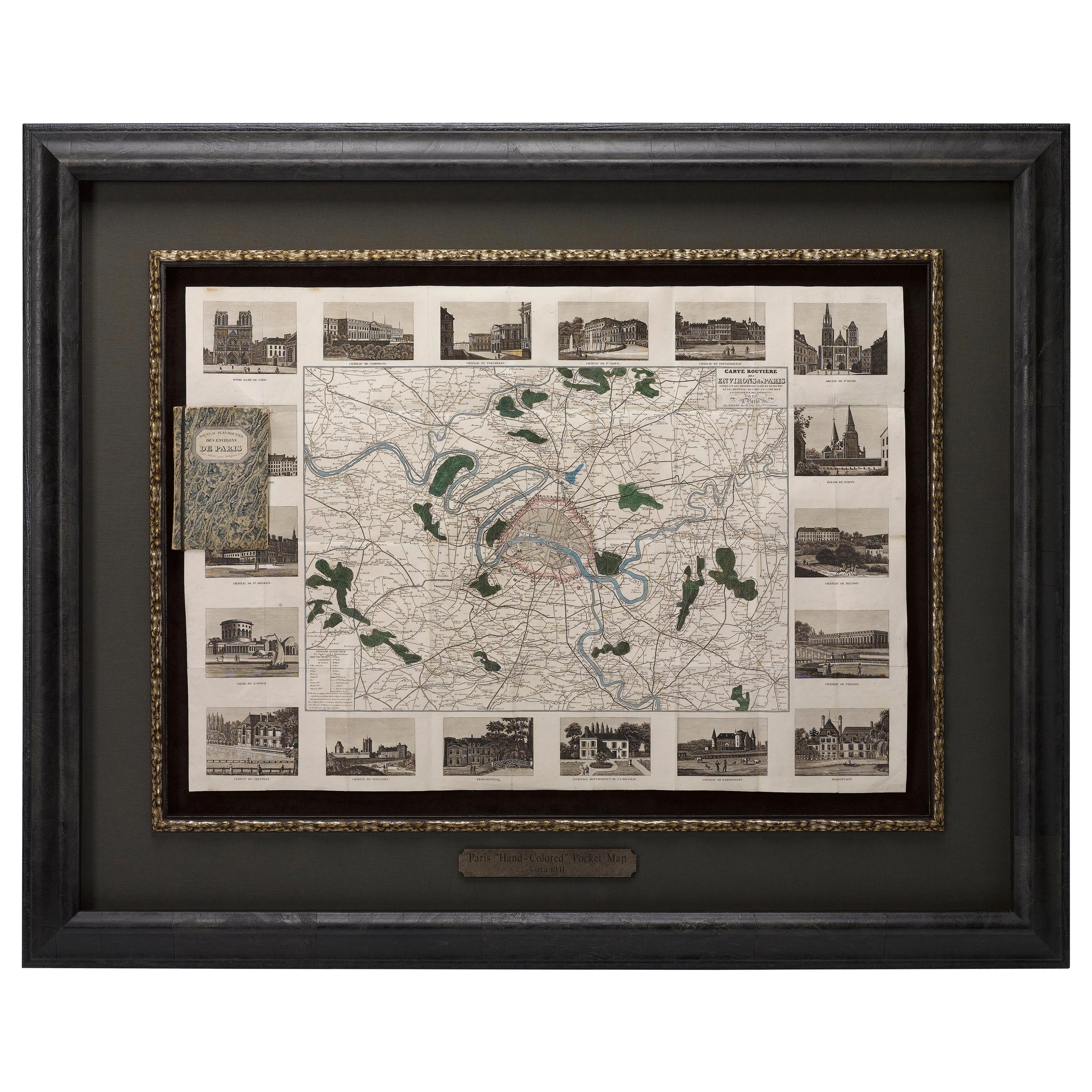
Antique Map of Paris, "Carte Routiere des Environs de Paris" 1841
Located in Colorado Springs, CO
This beautiful hand-colored road map of Paris was published in 1841. The map shows Paris and the surrounding area in a folding pocket map. Organized and detailed for travelers, this ...
Category
Antique 1840s French Maps
Materials
Paper

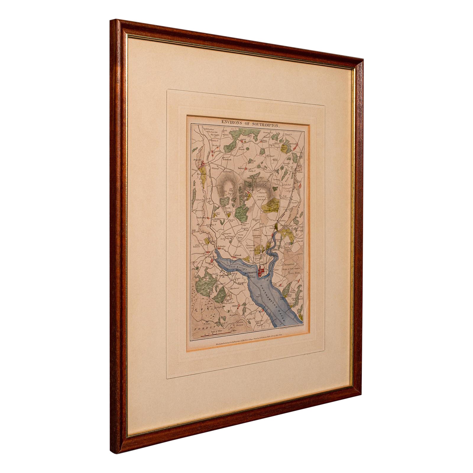
Antique Lithography Map, Environs of Southampton, English, Framed, Victorian
Located in Hele, Devon, GB
This is an antique lithography map 'The Environs of Southampton'. An English, framed town engraving of cartographic interest by John James Dower, dating to the Victorian period and ...
Category
Antique Late 19th Century British Victorian Maps
Materials
Wood

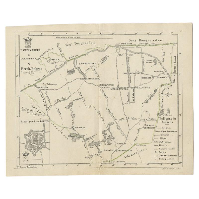
Antique Map of the Dutch Dantumadeel Township, 1861
Located in Langweer, NL
Antique map titled 'Gemeente Dantumadeel'. Old map depicting the Dantumadeel township including cities and villages like Birdaard, Roodkerk, Veenwouden, Dantumawoude and Dokkum. This...
Category
Antique 19th Century Maps
Materials
Paper
$124 Sale Price
20% Off
Antique County Map, Berkshire, English Framed Lithograph, Cartography, Victorian
Located in Hele, Devon, GB
This is an antique lithography map of Berkshire. An English, framed atlas engraving of cartographic interest, dating to the mid 19th century and later.
Superb lithography of Berksh...
Category
Antique Mid-19th Century British Victorian Maps
Materials
Paper

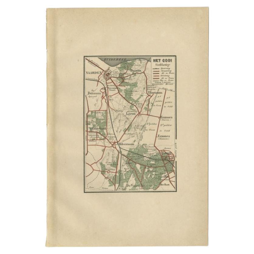
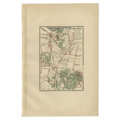
Antique Map of the Gooi Region by Craandijk, 1884
Located in Langweer, NL
Antique map titled 'Het Gooi'. Old map of the region of Hilversum also including cities and villages like Naarden, Laren, Blaricum, Eemnes and Baarn. This map orginates from 'Atlas b...
Category
Antique 19th Century Maps
Materials
Paper
Rare 18th C. Newport Map
Located in Sandwich, MA
Rare 18th C, Map titled "A plan of the town of Newport in the province of Rhode Island". Earliest printed plan of Newport, published for the use of the British just prior to their o...
Category
Antique 1770s American Maps
Materials
Paper

$19,500 / item
More Ways To Browse
Prints Of Men Fashion
St Hilaire
Vintage Fichu
Vintage Vargas Prints
Antique Cat Prints
Francesco Bartolozzi
J Harrison
Neoclassical Architectural Prints
Antique Architecture Book
Antique Fish Engravings
Antique Furniture Lebanon
Antique Hospital Furniture
Antique Nautical Prints
Antique Rabbit Print
Antique Reptile Print
Antique Whale Print
Black Mountain College
Black Stork