Items Similar to Antique Plan of the City of Damietta Egypt by C. Niebuhr, 1774


Want more images or videos?
Request additional images or videos from the seller
1 of 5
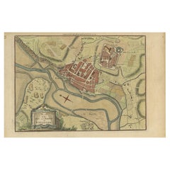
Antique Plan of the City of Damietta Egypt by C. Niebuhr, 1774
$216.22
£160.04
€180
CA$295.92
A$322.23
CHF 170.48
MX$3,885.96
NOK 2,169.04
SEK 1,982.96
DKK 1,371.20
About the Item
Antique print titled 'Grundris der Stadt Damiât'. This print originates from 'Reisebeschreibung nach Arabien und andern umliegenden Ländern' by C. Niebuhr, 1774.
- Dimensions:Height: 10.48 in (26.6 cm)Width: 8.27 in (21 cm)Depth: 0.02 in (0.5 mm)
- Materials and Techniques:
- Period:
- Date of Manufacture:1774
- Condition:Some staining. Please study image carefully.
- Seller Location:Langweer, NL
- Reference Number:Seller: BG-094811stDibs: LU3054310071221
About the Seller
5.0
Recognized Seller
These prestigious sellers are industry leaders and represent the highest echelon for item quality and design.
Platinum Seller
Premium sellers with a 4.7+ rating and 24-hour response times
Established in 2009
1stDibs seller since 2017
2,819 sales on 1stDibs
Typical response time: 1 hour
- ShippingRetrieving quote...Shipping from: Langweer, Netherlands
- Return Policy
More From This Seller
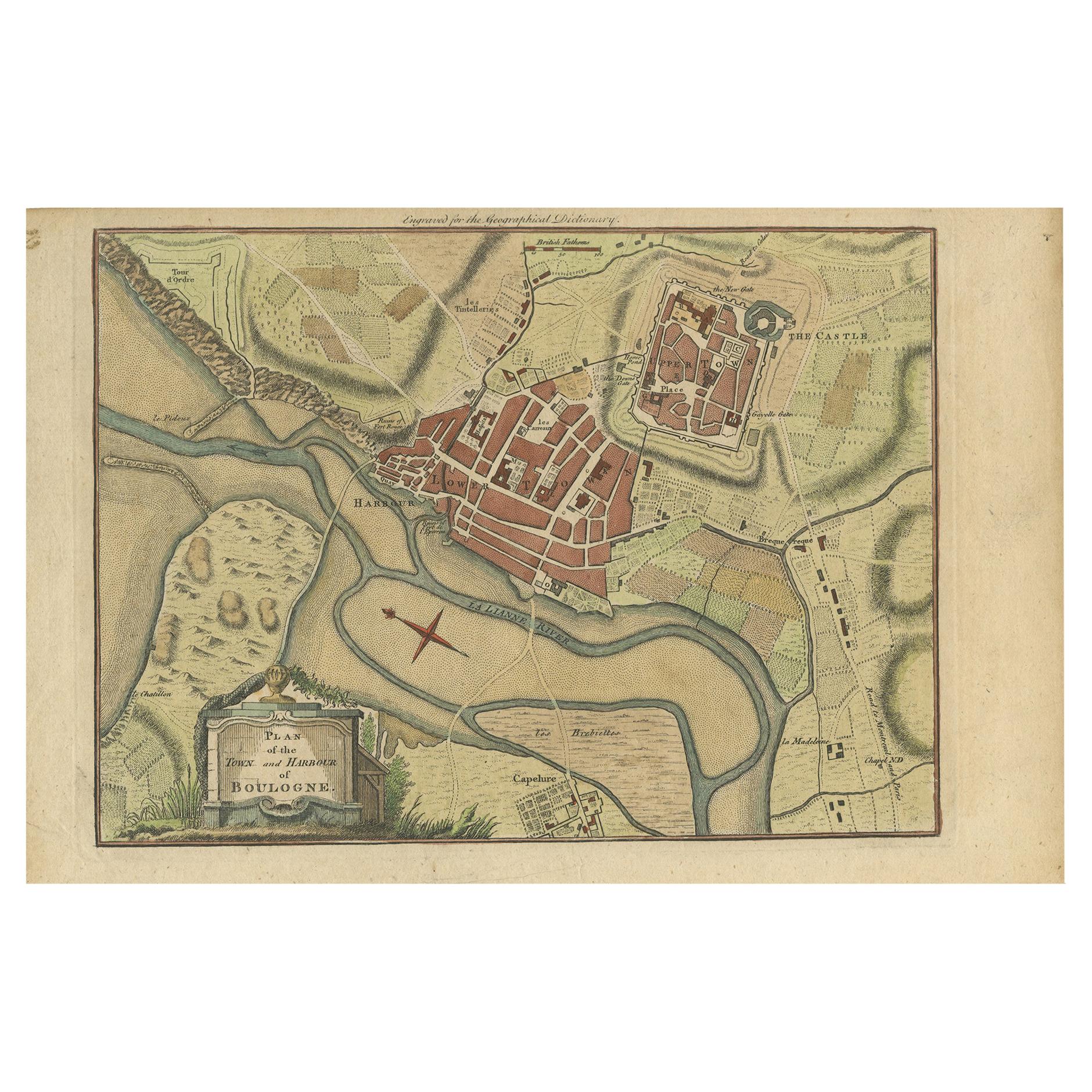
View AllAntique Plan of the Town and Harbour of Boulogne-sur-Mer by Barrow
c.1760
Located in Langweer, NL
Antique map titled 'Plan of the Town and Harbour of Boulogne'. Original antique plan of the town and harbour of Boulogne-sur-Mer, France. This map originates from John Barrow...
Category
Antique Mid-18th Century Maps
Materials
Paper
$144 Sale Price
20% Off
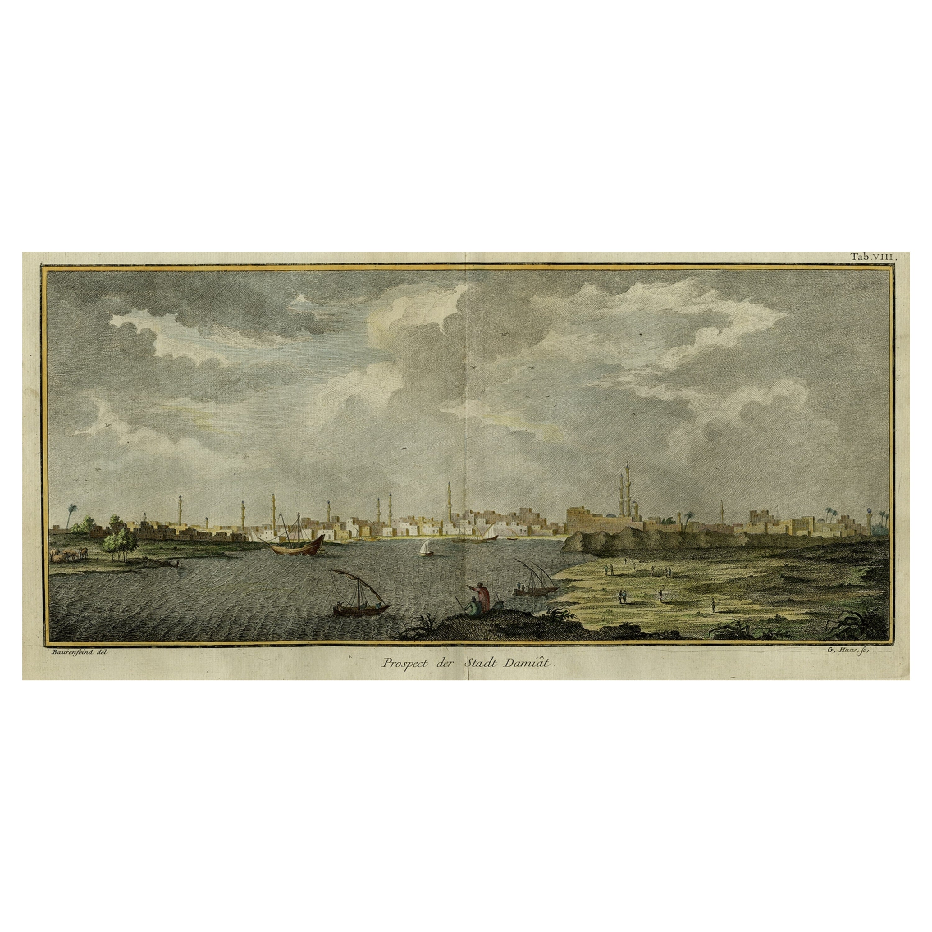
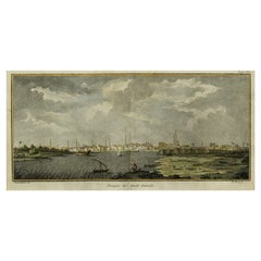
Original Antique View of the City of Damietta, Egypt, 1774
Located in Langweer, NL
Antique print, titled: 'Prospect der Stadt Damiat.' - Tab VIII.
View of the city of Damietta, Egypt. From 'Reisebeschreibung von Arabien und anderen umliegenden Landern (1774-1778)...
Category
Antique 1770s Prints
Materials
Paper
$355 Sale Price
20% Off
Antique Map of Batavia by Van Schley
c.1750
Located in Langweer, NL
Antique map titled 'Batavia'. Original antique map of Batavia, Jakarta, Indonesia. This print originates from the Dutch edition of Prevost's 'Histoire Generale des Voyages' (Paris 17...
Category
Antique Mid-18th Century Prints
Materials
Paper
$432 Sale Price
20% Off
Antique Map of Boulogne-sur-Mer by Bellin
1764
Located in Langweer, NL
Antique map titled 'Plan de la Ville de Boulogne'. Original antique map of Boulogne-sur-Mer, France. This map originates from 'Le petit atlas maritime: recueil de cartes et plans des...
Category
Antique Mid-18th Century Maps
Materials
Paper

$144 Sale Price
20% Off
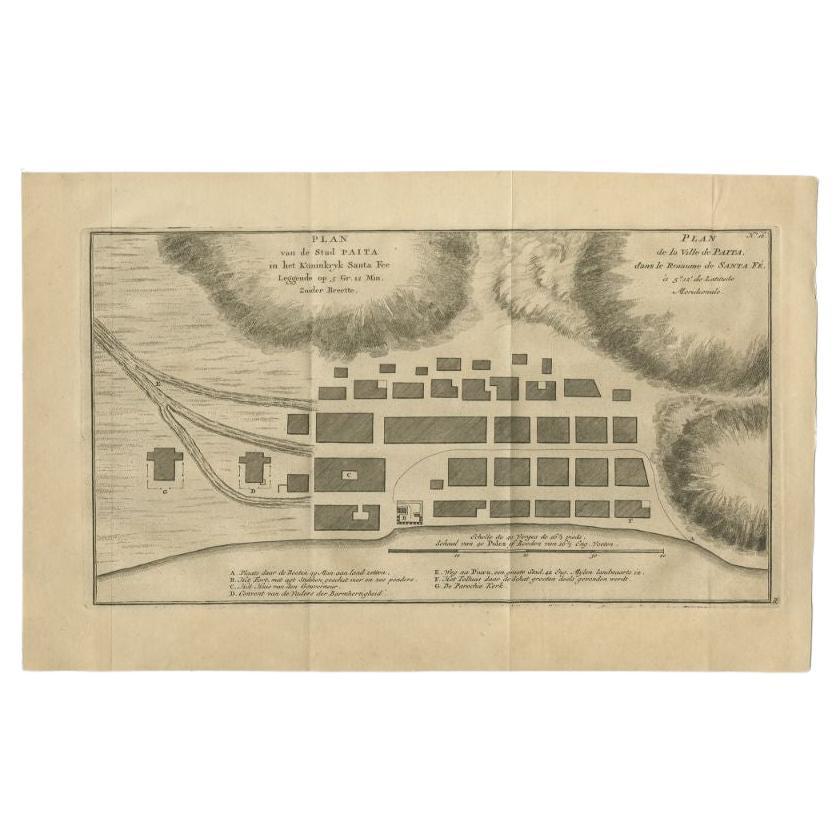
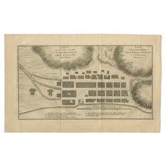
Antique Plan of the City of Paita in Peru, by Anson, 1749
Located in Langweer, NL
Antique map titled 'Plan van de Stad Paita in het Koninkryk Santa Fee (..) - Plan de la Ville de Paita (..)'. Original antique plan of the city of Paita, Peru. This map originates fr...
Category
Antique 18th Century Maps
Materials
Paper
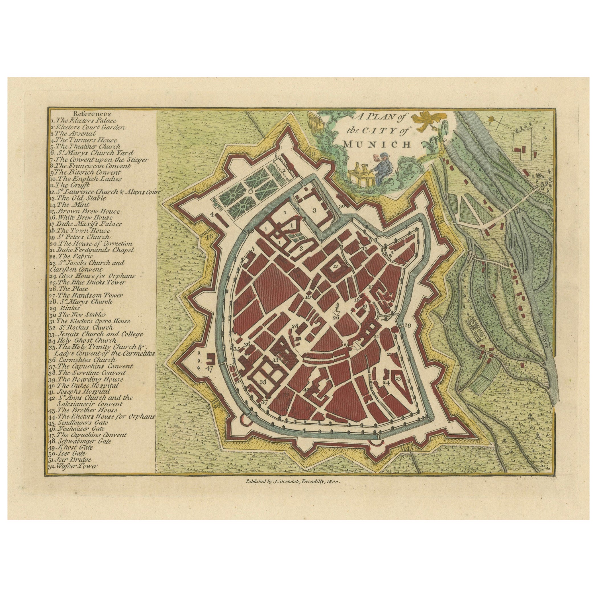
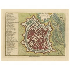
Original Antique Map of Munich, Germany by J. Stockdale, 1800
Located in Langweer, NL
Title: Vintage Map of Munich, Germany by J. Stockdale, 1800
This vintage map, titled "A Plan of the City of Munich," was published by J. Stockdale in Piccadilly, London, in 1800. Th...
Category
Antique Early 1800s Maps
Materials
Paper
You May Also Like
Original Antique Map or City Plan of Geneva, Switzerland. Circa 1835
Located in St Annes, Lancashire
Nice map of Geneva
Drawn and engraved by J.Dower
Published by Orr & Smith. C.1835
Unframed.
Free shipping
Category
Antique 1830s English Maps
Materials
Paper

Original Antique Map or City Plan of Madrid, Spain. Circa 1835
Located in St Annes, Lancashire
Nice map of Madrid
Drawn and engraved by J.Dower
Published by Orr & Smith. C.1835
Unframed.
Free shipping
Category
Antique 1830s English Maps
Materials
Paper

Antique Town Plan Map, Poole, English, Framed Cartography, Georgian, Circa 1780
Located in Hele, Devon, GB
This is an antique town plan map of Poole in Dorset. An English, framed atlas engraving, dating to the 18th century and later.
Fascinating cartography with annotated streets and pl...
Category
Antique Late 18th Century British George III Maps
Materials
Glass, Wood, Paper

Framed 1731 Color Engraving, Map of Rotterdam by Matthaus Seutter, "Roterodami"
Located in Bridgeport, CT
"Roterodami". Seutter (1678-1757) was an important German 18th century map maker. Bird's eye view of the city above with full details, neoclassi...
Category
Antique 18th Century European Renaissance Maps
Materials
Glass, Wood, Paper

Large Original Antique Folding Map of Manchester, England, Dated 1793
Located in St Annes, Lancashire
Superb map of Manchester and Salford
Folding map. Printed on paper laid on to the original canvas
Unframed.
Published by C. Laurent, 1793.
Free shippi...
Category
Antique 1790s English Georgian Maps
Materials
Canvas, Paper

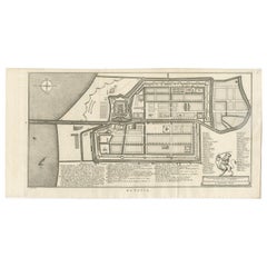
Map Of The City Of Geneva, Framed Engraving, Late 18th Century
Located in MARSEILLE, FR
Beautiful engraving representing the city of Geneva corrected in 1775 and 1793
The engraving also presents inserts with the evolution of the city, the plan of ancient Geneva and ...
Category
Antique Late 18th Century Swiss Louis XV Prints
Materials
Paper

More Ways To Browse
Paradise Bird Print
Achille Comte
Antique Chainmail
Antique Native American Prints
Antique Print Engraving Paris
Butterfly Engraving
Irish Prints Of Ireland
Sandwich Islands
Sea Shell Prints
French Botanical Prints
Funeral Antique
Pair Botanical Prints
Antique Palm Prints
Dutch Navy
Italian 19th Century Engravings
Les Lalanne
Serigraph 1980s
Antique Bat Print