Items Similar to Antique Plan of the Residence of the Mayor of Amsterdam by H. de Leth circa 1732
Want more images or videos?
Request additional images or videos from the seller
1 of 5
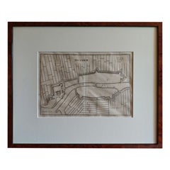
Antique Plan of the Residence of the Mayor of Amsterdam by H. de Leth circa 1732
$573.22
£428.32
€480
CA$790.68
A$866.16
CHF 455.91
MX$10,337.86
NOK 5,811.74
SEK 5,312.81
DKK 3,657.22
About the Item
Antique print titled 'Plattegrond van de Hofstede en het huis te Spyk. Behorende de Edelen van Grootambacht. Heere en Mr. Ian van de Poll Burgermeester der stad Amsterdam'. Rare plan of the Residence of the Mayor of Amsterdam (the Netherlands). Dutch and French text in cartouche.
- Dimensions:Height: 18.63 in (47.3 cm)Width: 19.1 in (48.5 cm)Depth: 0.79 in (2 cm)
- Materials and Techniques:
- Period:
- Date of Manufacture:1732
- Condition:Great condition, unique frame included. Please study image carefully.
- Seller Location:Langweer, NL
- Reference Number:1stDibs: LU3054310287603
About the Seller
5.0
Recognized Seller
These prestigious sellers are industry leaders and represent the highest echelon for item quality and design.
Platinum Seller
Premium sellers with a 4.7+ rating and 24-hour response times
Established in 2009
1stDibs seller since 2017
2,809 sales on 1stDibs
Typical response time: 1 hour
- ShippingRetrieving quote...Shipping from: Langweer, Netherlands
- Return Policy
More From This Seller
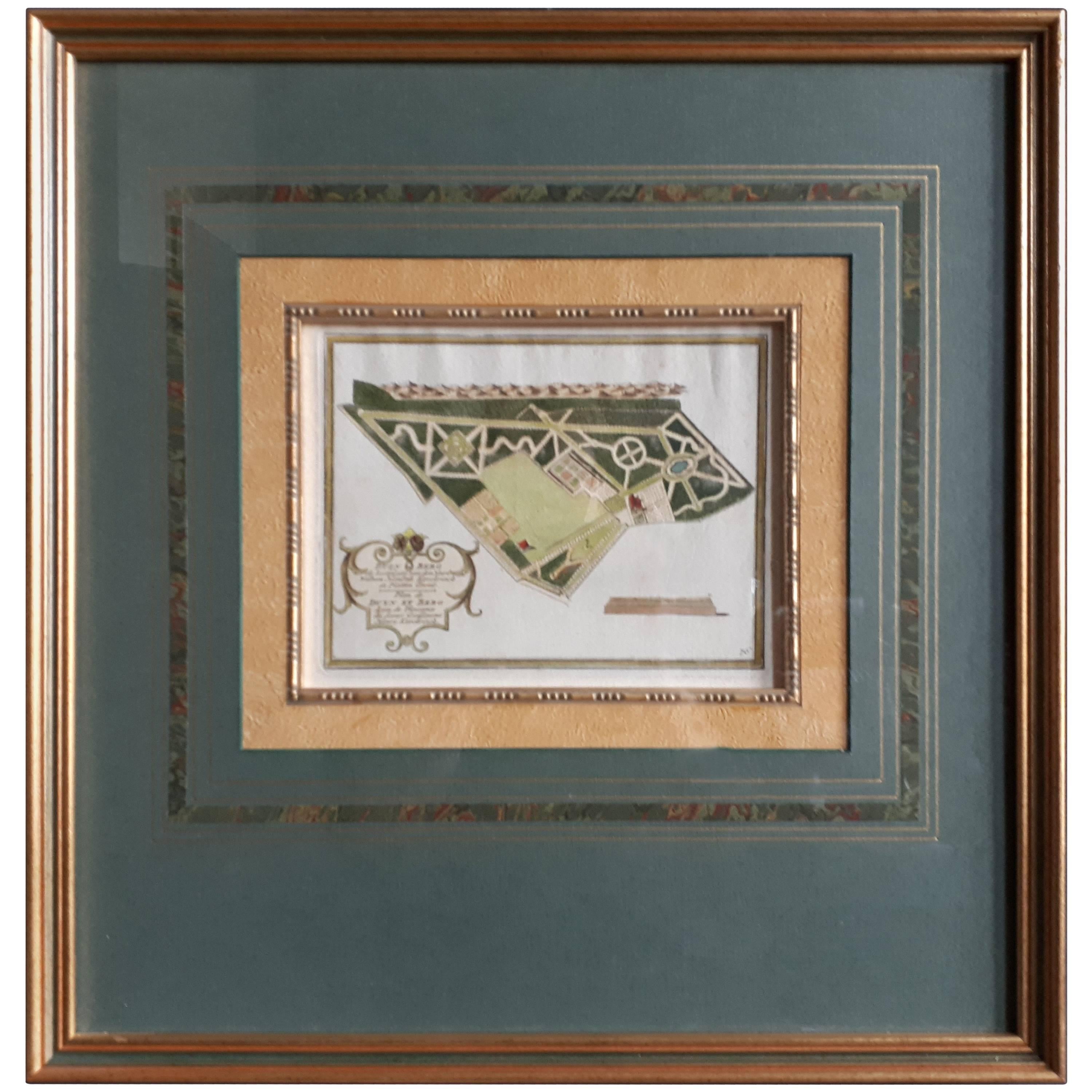
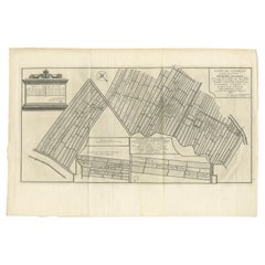
View AllAntique Plan of Duin en Berg
the Netherlands
by H. de Leth circa 1732
Located in Langweer, NL
Antique plan titled 'Beschrijving Duin en Berg, de Lustplaets van den Heere Wilhem Hendrik Kerckrinck in Platten Gront'. Decorative cartouche with Dutch and French text. This plan or...
Category
Antique Mid-18th Century Prints
Materials
Paper
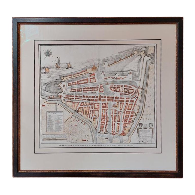
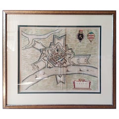
Antique City Plan of Rotterdam in Frame, ca.1850
Located in Langweer, NL
Antique map titled 'Grondkaart der stad Rotterdam (..)'. Original antique city plan of Rotterdam, the Netherlands. Published circa 1850.
Artists...
Category
Antique 19th Century Prints
Materials
Paper

$620 Sale Price
20% Off
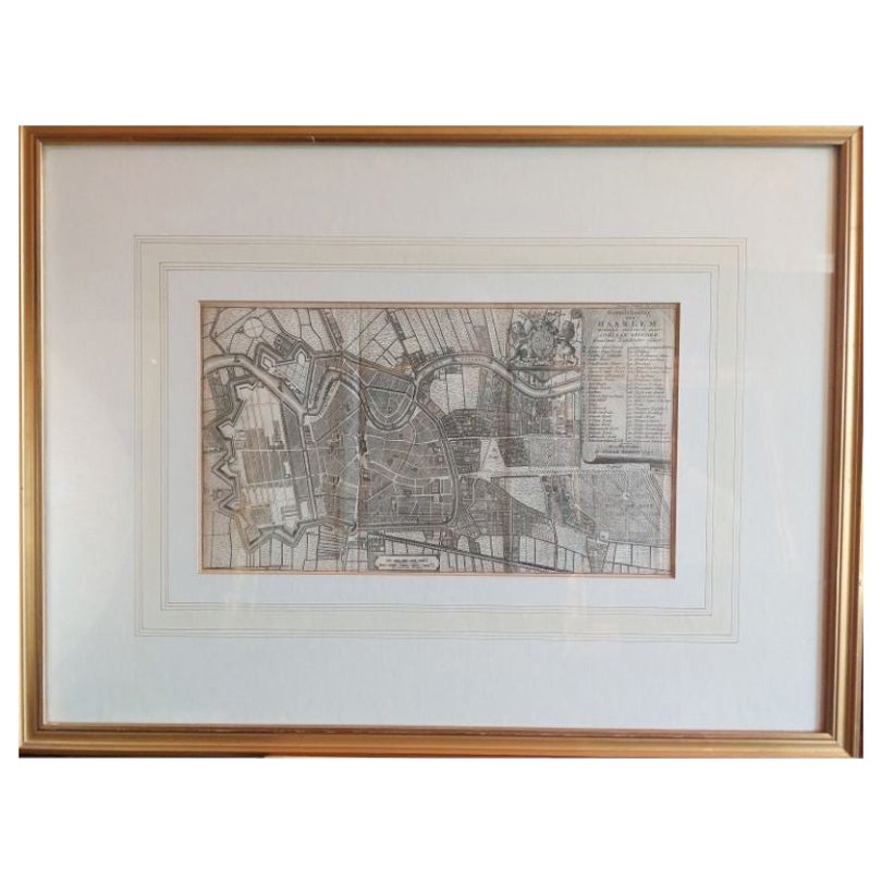
Antique Map of the City of Haarlem by Tirion, 1742
By Isaak Tirion
Located in Langweer, NL
Antique map titled 'Grondtekening van Haarlem (..)'. Original antique map of the city of Haarlem, the Netherlands. Published by I. Tirion, 1742.
Artists and Engravers: Isaak Tirio...
Category
Antique 18th Century Maps
Materials
Paper
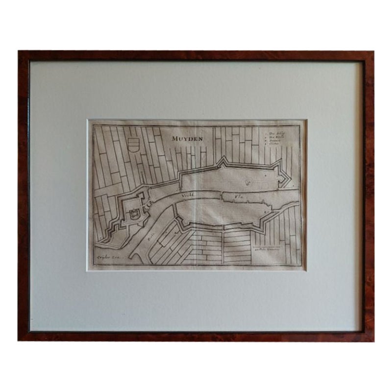
Antique Map of the City of Muiden by Merian, 1659
Located in Langweer, NL
Antique map titled 'Muyden'. Original antique map of the city of Muiden, the Netherlands. This map originates from 'Topographia Germania Inferioris' by C. Merian. Published 1659.
...
Category
Antique 17th Century Maps
Materials
Paper
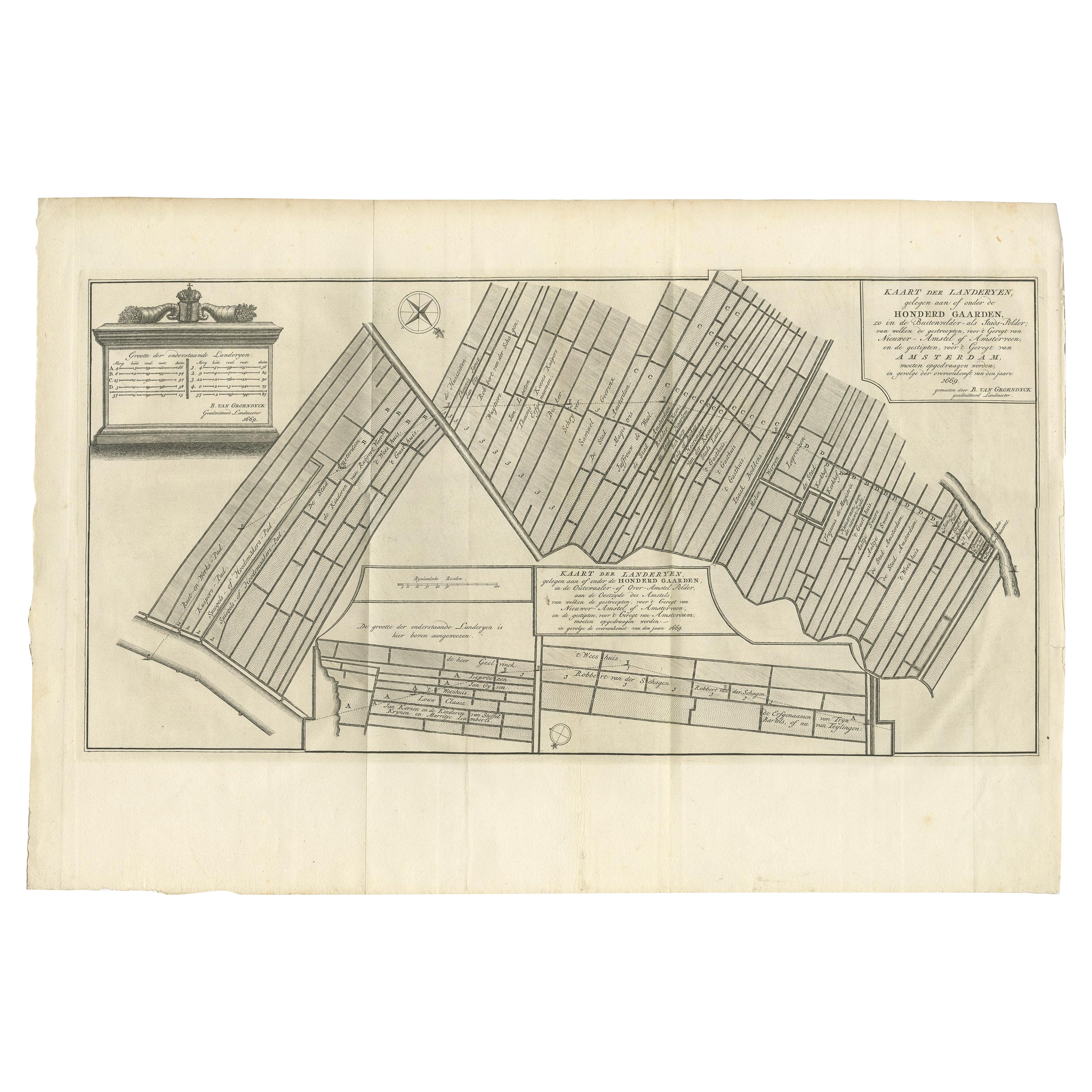
Antique Map Showing Estates of 1669 in Amsterdam, Published in c.1767
Located in Langweer, NL
Antique map titled 'Kaart der landeryen, gelegen aan of onder de honderd gaarden, zo in de Buitenvelder- als Stads-polder; van welken de gestreepten, voor 't geregt van Nieuwer-Amste...
Category
Antique 18th Century Maps
Materials
Paper
Antique Map of the City of Grave by Blaeu, 1649
Located in Langweer, NL
Antique map titled 'Grave'. Original antique map of the city of Grave, the Netherlands. Published by J. Blaeu, 1649.
Artists and Engravers: Joan Blaeu (23 September 1596 - 28 May...
Category
Antique 17th Century Maps
Materials
Paper
$668 Sale Price
20% Off
You May Also Like
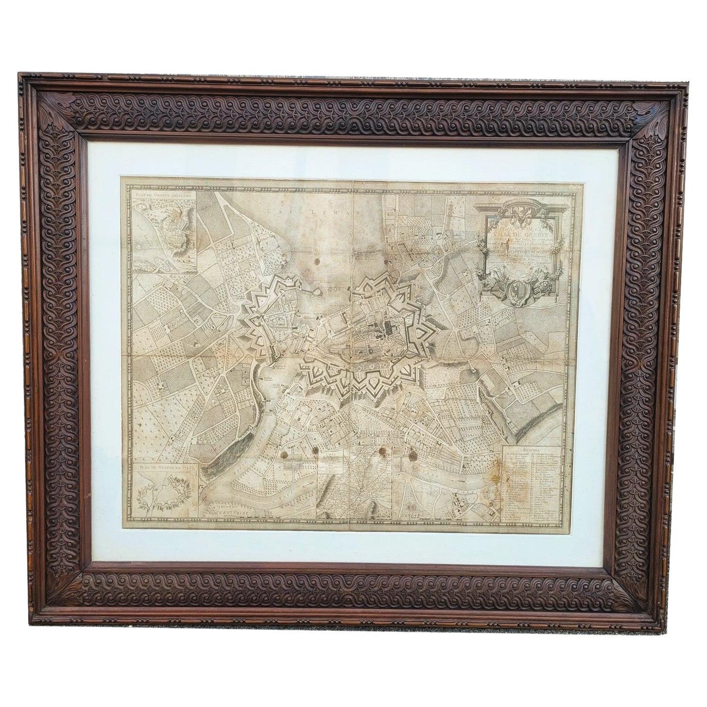
Map Of The City Of Geneva, Framed Engraving, Late 18th Century
Located in MARSEILLE, FR
Beautiful engraving representing the city of Geneva corrected in 1775 and 1793
The engraving also presents inserts with the evolution of the city, the plan of ancient Geneva and ...
Category
Antique Late 18th Century Swiss Louis XV Prints
Materials
Paper

Mid-18th Century Hand Drawn English Farm Map on Vellum, circa 1740s
Located in San Francisco, CA
Mid-18th century hand drawn English farm map on Vellum circa 1740s
Henry Maxted & Isaac Terry, Surveyors.
A Map of a Farm in the Parish of Blean in the County of KENT: Belonging to Mrs Elizabeth Hodgson circa 1743.
A beautiful hand drawn map...
Category
Antique Mid-18th Century English Maps
Materials
Lambskin

Plan of Paris, France, by A. Vuillemin, Antique Map, 1845
Located in Colorado Springs, CO
This large and detailed plan of Paris was published by Alexandre Vuillemin in 1845. The map conveys a wonderful amount of information and is decorated throughout with pictorial vigne...
Category
Antique 1840s American Maps
Materials
Paper

1748 Map of Richmond Upon Thames by John Roque
Located in Gloucestershire, GB
A 1748 map of Richmond-Upon-Thames by famed surveyor and cartographer, John Roque. Placed in a simple black and gilt frame. The map is in fair condition but there are small sections ...
Category
Antique Mid-18th Century English Maps
Materials
Wood, Paper

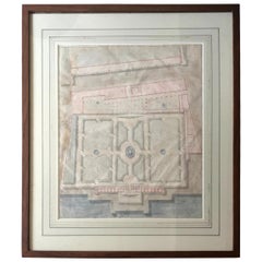
Palazzo Andrea Doria, Genoa Landscape Watercolour
Located in New York, NY
Watercolor Landscape Study of the Palazzo Andrea Doria, Genoa. Antique French architectural study of the plan and gardens of the Doria Palace in Genoa, en...
Category
Antique Early 19th Century French Drawings
Materials
Paper
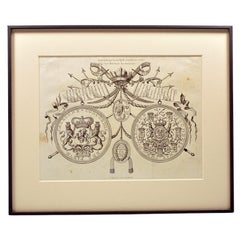
Engraving of the medal and decoration of the Sea Battle of Doggersbank 1781
Located in UTRECHT, UT
Engraving of the commemorative medal and decoration of the Sea Battle of Doggersbank 1781, by Noach van der Meer
After an earlier print by Jacobus Buys.
Published in Beschrijving...
Category
Antique 1780s Dutch Drawings
Materials
Paper
More Ways To Browse
Paradise Bird Print
Achille Comte
Antique Chainmail
Antique Native American Prints
Antique Print Engraving Paris
Butterfly Engraving
Irish Prints Of Ireland
Sandwich Islands
Sea Shell Prints
French Botanical Prints
Funeral Antique
Pair Botanical Prints
Antique Palm Prints
Dutch Navy
Italian 19th Century Engravings
Les Lalanne
Serigraph 1980s
Antique Bat Print