Items Similar to Antique Roman Battle Plan of a Camp by Duncan, c.1753
Want more images or videos?
Request additional images or videos from the seller
1 of 6
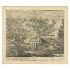
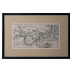
Antique Roman Battle Plan of a Camp by Duncan, c.1753
$277.90
$347.3720% Off
£207.81
£259.7620% Off
€232
€29020% Off
CA$382.87
CA$478.5920% Off
A$417.58
A$521.9720% Off
CHF 221.20
CHF 276.5120% Off
MX$5,006.17
MX$6,257.7120% Off
NOK 2,817.16
NOK 3,521.4620% Off
SEK 2,576.09
SEK 3,220.1120% Off
DKK 1,767.93
DKK 2,209.9220% Off
About the Item
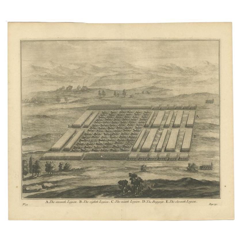
Antique battle map showing a plan of a camp. With detailed legend explaining the various elements of the print. This print most likely originates from an edition of 'The Commentaries of Caesar, Translated into English. To Which is Prefixed a Discourse Concerning The Roman Art of War' by William Duncan.
Artists and Engravers: Engravings by T. Baptist and D. Stoopendaal.
Condition: Very good, general age-related toning. Split on folding line, please study image carefully.
Date: c.1753
Overall size: 47.5 x 41 cm.
Image size: 39 x 33 cm.
Antique prints have long been appreciated for both their aesthetic and investment value. They were the product of engraved, etched or lithographed plates. These plates were handmade out of wood or metal, which required an incredible level of skill, patience and craftsmanship. Whether you have a house with Victorian furniture or more contemporary decor an old engraving can enhance your living space. We offer a wide range of authentic antique prints for any budget.
- Dimensions:Height: 16.15 in (41 cm)Width: 18.71 in (47.5 cm)Depth: 0 in (0.01 mm)
- Materials and Techniques:
- Period:
- Date of Manufacture:circa 1753
- Condition:Condition: Very good, general age-related toning. Split on folding line, please study image carefully.
- Seller Location:Langweer, NL
- Reference Number:Seller: BG-11861-31stDibs: LU3054329685502
About the Seller
5.0
Recognized Seller
These prestigious sellers are industry leaders and represent the highest echelon for item quality and design.
Platinum Seller
Premium sellers with a 4.7+ rating and 24-hour response times
Established in 2009
1stDibs seller since 2017
2,791 sales on 1stDibs
Typical response time: <1 hour
- ShippingRetrieving quote...Shipping from: Langweer, Netherlands
- Return Policy
More From This Seller
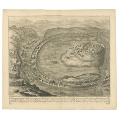
View AllAntique Roman Battle Print of the Camp Defence by Duncan, c.1753
Located in Langweer, NL
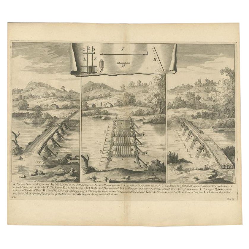
Antique battle map showing the various defence elements of a camp. With detailed legend explaining the various elements of the print. This print mo...
Category
Antique 18th Century Prints
Materials
Paper
$226 Sale Price
34% Off
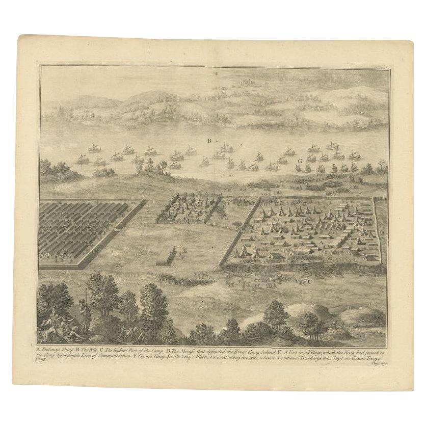
Antique Roman Battle Print of Ptolemy
s Camp by Duncan, c.1753
Located in Langweer, NL
Antique battle map showing Ptolemy's Camp. With detailed legend explaining the various elements of the print. This print most likely originates fro...
Category
Antique 18th Century Prints
Materials
Paper
$226 Sale Price
34% Off
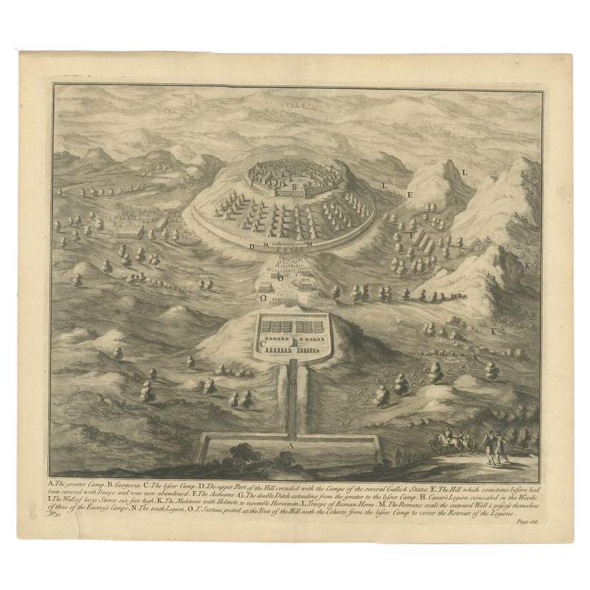
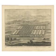
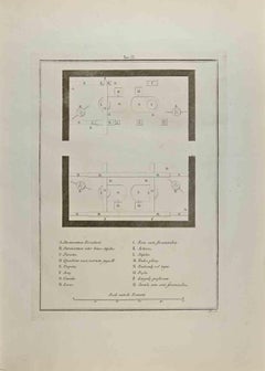
Antique Roman Battle Print of the Greater and Lesser Camp by Duncan, c.1753
Located in Langweer, NL
Antique battle map showing the greater and lesser camp. With detailed legend explaining the various elements of the print. This print most likely originates from an edition of 'The C...
Category
Antique 18th Century Prints
Materials
Paper
$277 Sale Price
20% Off
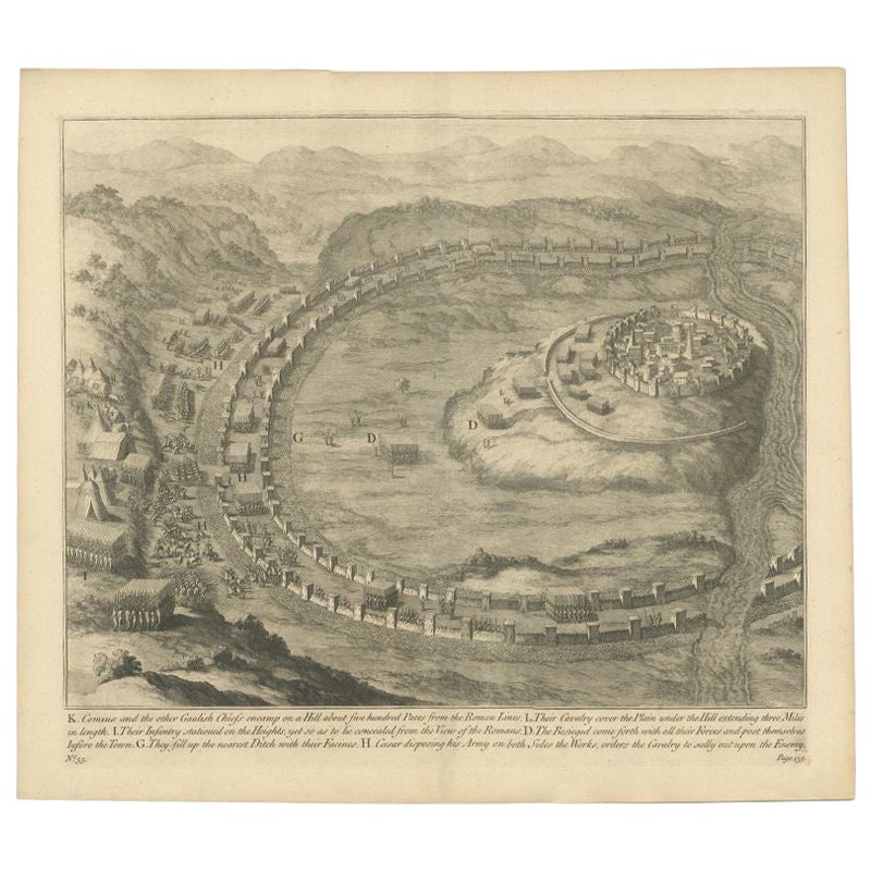
Antique Roman Battle Print of Comius
s Camp by Duncan, c.1753
Located in Langweer, NL
Antique battle map of Comius's camp on a hill. With detailed legend explaining the various elements of the print. This print most likely originates...
Category
Antique 18th Century Prints
Materials
Paper
$277 Sale Price
20% Off
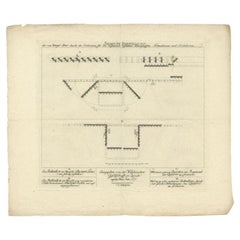
Antique Roman Battle Print of the Seventh Legion by Duncan, ca.1753
Located in Langweer, NL
Antique battle map of various legions. With detailed legend explaining the various elements of the print. This print most likely originates from an edition of 'The Commentaries of Ca...
Category
Antique Mid-18th Century Dutch Prints
Materials
Paper
$277 Sale Price
20% Off
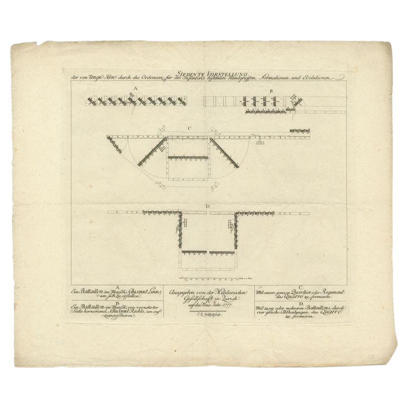
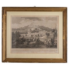
Antique Military Print: Infantry Training in Zurich, 18th Century
Located in Langweer, NL
This antique military print, titled 'Siebente Vorstellung', is part of a series published by the 'Militarischen Gesellschaft in Zurich' in the 1...
Category
Antique 18th Century Prints
Materials
Paper
$277 Sale Price
20% Off
You May Also Like
Battle of Grocka Campaign Map, 1753 - James Oglethorpe, John Lindsay, Henry Köpp
Located in Savannah, GA
A campaign map of the Battle of Grocka, 1753.
Drawn and engraved by Henry Köpp for the journals of John Lindsay, 20th Earl of Crawford and dedicated to James Oglethorpe.
sight:...
Category
Antique 1750s British Prints
Materials
Glass, Wood, Paper
Battles of Montebello and Casteggio in Antique Frame
Located in Alessandria, Piemonte
Antique French print of Battles of Montebello and Casteggio in antique frame. Under the print there is the whole description in French language.
"Painted by Naudet - Lebeau sculpsit ...
Category
Antique Early 19th Century French Neoclassical Prints
Materials
Fruitwood, Paper
Old Map Depicting the Entire Earth
s Surface Divided into Six Parts France 1850
Located in Milan, IT
Map depicting the entire earth's surface divided into six parts which depicts the position of peoples on Earth based on the assumption that it is impossible for each people to have t...
Category
Antique Mid-19th Century French Maps
Materials
Glass, Wood, Paper

Architectural Roman Map - Etching by Vincenzo Scarpati - 18th Century
Located in Roma, IT
Architectural Roman Map from "Antiquities of Herculaneum" is an etching on paper realized by Vincenzo Scarpati in the 18th Century.
Signed on the plate.
Go...
Category
18th Century Old Masters Figurative Prints
Materials
Etching

Map - Etching by Nicola Fiorillo - 18th Century
Located in Roma, IT
Map from "Antiquities of Herculaneum" is an etching on paper realized by Nicola Fiorillo in the 18th Century.
Signed on the plate.
Good conditions with some folding and foxing.
Th...
Category
18th Century Old Masters Figurative Prints
Materials
Etching
Mid-18th Century Hand Drawn English Farm Map on Vellum, circa 1740s
Located in San Francisco, CA
Mid-18th century hand drawn English farm map on Vellum circa 1740s
Henry Maxted & Isaac Terry, Surveyors.
A Map of a Farm in the Parish of Blean in the County of KENT: Belonging to Mrs Elizabeth Hodgson circa 1743.
A beautiful hand drawn map...
Category
Antique Mid-18th Century English Maps
Materials
Lambskin

More Ways To Browse
Architectural Charcoal
Art Deco Cabinet Pulls
Art Deco Tazza
Art Nouveau Seal
Biedermeier Drawer Chest
Black Ebonized Chest
Blue Lacquer Drawers
Bombay Company
Brass Cup Holder
Brass Dolphin Table
Bronze Foo Lions
Bronze Gong
Bronze Portico Clock
Calligraphy Scroll
Cartouche Marble
Carved Gargoyle
Celadon Dish
Ceramic Birds Chinese