1 of 9
Early 18th Century Map of London
$2,800List Price
About the Item
- Creator:John Senex (Designer)
- Dimensions:Height: 23 in (58.42 cm)Width: 27 in (68.58 cm)Depth: 1 in (2.54 cm)
- Style:George I (Of the Period)
- Place of Origin:
- Period:1720-1729
- Date of Manufacture:1720
- Condition:Wear consistent with age and use.
- Seller Location:Kilmarnock, VA
- Reference Number:1stDibs: LU888613769672
Authenticity Guarantee
In the unlikely event there’s an issue with an item’s authenticity, contact us within 1 year for a full refund. DetailsMoney-Back Guarantee
If your item is not as described, is damaged in transit, or does not arrive, contact us within 7 days for a full refund. Details24-Hour Cancellation
You have a 24-hour grace period in which to reconsider your purchase, with no questions asked.Vetted Professional Sellers
Our world-class sellers must adhere to strict standards for service and quality, maintaining the integrity of our listings.Price-Match Guarantee
If you find that a seller listed the same item for a lower price elsewhere, we’ll match it.Trusted Global Delivery
Our best-in-class carrier network provides specialized shipping options worldwide, including custom delivery.You May Also Like
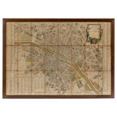
18th Century Map of Paris
Located in Washington, DC
18th century map of Paris.
Category
Antique Late 18th Century French Prints
Materials
Glass, Wood, Paper
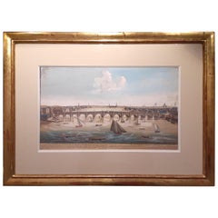
18th Century Etching of Westminster Bridge, London
Located in Montreal, Quebec
18th century etching of Westminster Bridge, London, giltwood frame, marked 1753, hand-colored.
Dimensions (framed): 24” W x 17.5” H x 0.5” D
...
Category
Antique Mid-18th Century French Prints
Materials
Paper, Wood
Antique Copper Engraved Map of Germany in the Early 18th Century, c.1740
Located in Langweer, NL
Antique map Germany titled 'Allemagne'.
Rare miniature map of Germany and surroundings. Also depicting the Baltic Sea and the Gulf of Venice. S...
Category
Antique 18th Century Maps
Materials
Paper
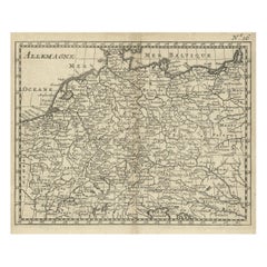
$179
H 6.11 in W 6.89 in D 0 in
Early 18th Century Map of Denmark in Old Coloring, Published in 1706
Located in Langweer, NL
Denmark. Schenk (Petrus), Dania Regnum Ducatus Holsatia. et Slesvicum Insulae Danicae et Provinciae Jutia Scania etc. Amsterdam, 1706, engraved reticulated map on thick paper with co...
Category
Antique Early 1700s Maps
Materials
Paper
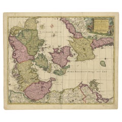
$680 Sale Price
20% Off
H 19.3 in W 23.23 in D 0 in
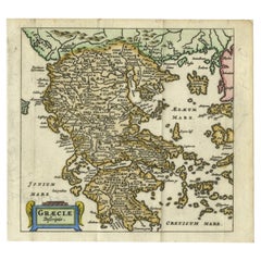
Charming 18th Century Miniature Map of Greece, 1685
Located in Langweer, NL
Antique map titled 'Graeciae Descriptio.' Charming miniature map of Greece from the pocket atlas 'Introductionis in Universam Geographiam tam Veterem qu...
Category
Antique 17th Century Maps
Materials
Paper
Small Early 18th Century Map of Banten Bay on the Island Java, Indonesia, c.1725
Located in Langweer, NL
A small early 18th century map of Banten Bay showing the islands of Pulo Dua and Pulo Batto together with soundings within the Bay and profiles of hills on the islands published by C...
Category
Antique 1720s Maps
Materials
Paper
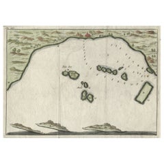
$210 Sale Price
20% Off
H 6.3 in W 8.59 in D 0 in
Antique 18th Century Map of the Province of Pensilvania
Pennsylvania State
Located in Philadelphia, PA
A fine antique of the colony of Pennsylvania.
Noted at the top of the sheet as a 'Map of the province of Pensilvania'.
This undated and anonymous map is thought to be from the Gentleman's Magazine, London, circa 1775, although the general appearance could date it to the 1760's.
The southern boundary reflects the Mason-Dixon survey (1768), the western boundary is placed just west of Pittsburgh, and the northern boundary is not marked.
The map has a number of reference points that likely refer to companion text and appear to be connected to boundaries. The western and southern boundaries are marked Q, R, S, for example. A diagonal line runs from the Susquehanna R to the Lake Erie P. A broken line marked by many letters A, B, N, O, etc., appears in the east.
There are no latitude or longitude markings, blank verso.
Framed in a shaped contemporary gilt wooden frame and matted under a cream colored matte.
Bearing an old Graham Arader Gallery...
Category
Antique 18th Century British American Colonial Maps
Materials
Paper

$1,250
H 10.25 in W 13.25 in D 0.5 in
Map Of The City Of Geneva, Framed Engraving, Late 18th Century
Located in MARSEILLE, FR
Beautiful engraving representing the city of Geneva corrected in 1775 and 1793
The engraving also presents inserts with the evolution of the city, the plan of ancient Geneva and ...
Category
Antique Late 18th Century Swiss Louis XV Prints
Materials
Paper

18th Century Hand Colored Map of Spain and Portugal by Visscher
By Nicolaes Visscher II
Located in Alamo, CA
This is an early 18th century map of Spain and Portugal, with attractive original hand-coloring, entitled "Hispaniae et Portugalliae Regna per Nicolaum Visscher cum Privilegio Ordinu...
Category
Antique Early 18th Century Dutch Maps
Materials
Paper

Scandinavia
Portions of Eastern Europe: 18th Century Hand-Colored Homann Map
By Johann Baptist Homann
Located in Alamo, CA
An early 18th century hand-colored copper-plate map entitled "Regni Sueciae in omnes suas Subjacentes Provincias accurate divisi Tabula Generalis" by Johann Baptist Homann (1663-1724...
Category
Antique Early 18th Century German Maps
Materials
Paper

$975
H 20.75 in W 23.5 in D 0.07 in
Still Thinking About These?
All Recently ViewedMore Ways To Browse
Linocut Prints
Ruins Engravings
Statue Engraving
Used Furniture Waterloo
Wall Geese
Antique Cream Can
Antique Cream Cans
Antique Prints Of Dogs
English Country Prints
Henri Matisse Wood
Opium Poppy
Pinup Girl Vintage
Set Of Nine Prints
Used Furniture In Hawaii
Antique Engraving Tools
Antique Hedgehog
Antique Tafel
English Garden Prints