Items Similar to Framed World Map print showing double hemisphere dating to 1642 originally, New


Want more images or videos?
Request additional images or videos from the seller
1 of 6
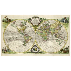
Framed World Map print showing double hemisphere dating to 1642 originally, New
$338.56
£249
€290.68
CA$468.76
A$509.46
CHF 273.02
MX$6,185.73
NOK 3,427.64
SEK 3,178.62
DKK 2,171.04
About the Item
This is a digitally remastered World Map Conjuring up the golden age of exploration, from an original 1642 double hemisphere map of the world. It includes pictorial relief illustrations and detailed notations from Marco Polo, most notably the place name ‘Terra Australis Incognita’.
Originally hand-coloured to define the continents, it’s embellished with allegorical spandrel vignettes representing celestial hemispheres, North and South Poles, sailing ships and sea monsters. Full of fascinating detail, it shows the world as it was understood in the 17th century, complete with inaccuracies such as North America extending to an oddly shaped Japan.
The print is made using archival methods for the highest quality and durability and framed with sustainable wood. All elements are hand cut, printed and assembled in Britain to create a picture of distinction with minimal carbon footprint.
Framed ready to hang.
- Dimensions:Height: 19.69 in (50 cm)Width: 27.56 in (70 cm)Depth: 1.58 in (4 cm)
- Style:Charles II (In the Style Of)
- Materials and Techniques:
- Place of Origin:
- Period:
- Date of Manufacture:2023
- Production Type:New Custom(Current Production)
- Estimated Production Time:1-2 weeks
- Condition:New Item. Please see description for available sizes.
- Seller Location:Lincoln, GB
- Reference Number:Seller: TA -Map of the World 1642 - 50x70cm1stDibs: LU990335164732
This Listing : 70 x 50cm
About the Seller
5.0
Platinum Seller
Premium sellers with a 4.7+ rating and 24-hour response times
Established in 1993
1stDibs seller since 2013
1,425 sales on 1stDibs
Typical response time: <1 hour
Associations
LAPADA - The Association of Arts
Antiques Dealers
- ShippingRetrieving quote...Shipping from: Lincoln, United Kingdom
- Return Policy
More From This Seller
View AllSet of TWO Tropical Plants Framed Prints from 19thC originals, New
Located in Lincoln, Lincolnshire
These are a set of TWO new, digitally remastered, framed coloured rectangular prints of Tropical Pants; one with Plants used for Food and the other with Plants used for Clothing, da...
Category
2010s British Victorian Prints
Materials
Glass, Wood, Paper
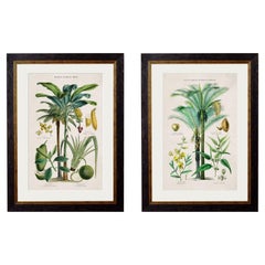
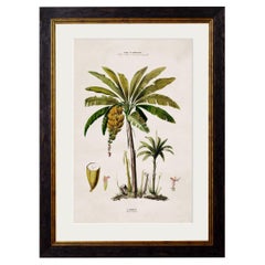
South American Banana Palm Tree Framed Print from C 1843 Study, New
Located in Lincoln, Lincolnshire
This is a digitally remastered print of a Banana Palm referenced from a French print dating to circa 1843
Prints of this style were originally printed in black and white and then ...
Category
2010s British American Colonial Prints
Materials
Glass, Wood, Paper
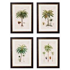
Set of FOUR Framed Prints of South American Palm Trees from 1843 originals, New
Located in Lincoln, Lincolnshire
These are a set of FOUR digitally remastered prints of South American Palm Trees, hand coloured and framed, originally from French drawings, Circa 1843.
Prints of this style were o...
Category
2010s British Victorian Prints
Materials
Glass, Wood, Paper
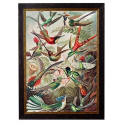
Hummingbirds framed Print from original by Ernst Haeckel Circa 1904, New
By Ernst Heinrich Haeckel
Located in Lincoln, Lincolnshire
This stunning print of Hummingbirds references a beautiful print from the 1900s by Ernst Haeckel as per similar pieces; reference Sea anemones and Mosses from Ernst Haeckels Kunstfor...
Category
2010s British Edwardian Prints
Materials
Glass, Wood, Paper
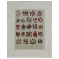
Mounted Print of National Coats of Arms by Tiffany
Co. from 1895 Encyclopedia
Located in Lincoln, Lincolnshire
This is a very good coloured Lithograph Print of National Coats Of Arms.
The print is mounted all ready for framing.
The external measurements of the mount are 12 W x 15 H and t...
Category
Antique Late 19th Century American Prints
Materials
Paper
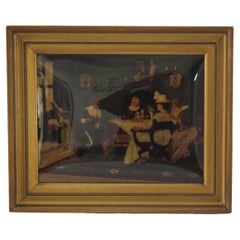
J H Schroder Crystoleum Picture German Signed, Dated 1899
By Josef Schröder
Located in Lincoln, Lincolnshire
This is a very good Crystoleum picture in its original gilt frame, by J H Schroder, a German artist. (Johann Heinrich Schröder (German, 1757-1812))
The p...
Category
Antique Late 19th Century German Edwardian Paintings
Materials
Glass, Wood
You May Also Like
Antique Map of the Eastern Hemisphere in Frame,
circa 1683
Located in Langweer, NL
Antique map titled 'Climats selon les Anciens'. Miniature map of the Eastern Hemisphere showing the climatic regions. This map originates from 'Description de l'Univers' by A.M. Mall...
Category
Antique Late 17th Century Maps
Materials
Paper

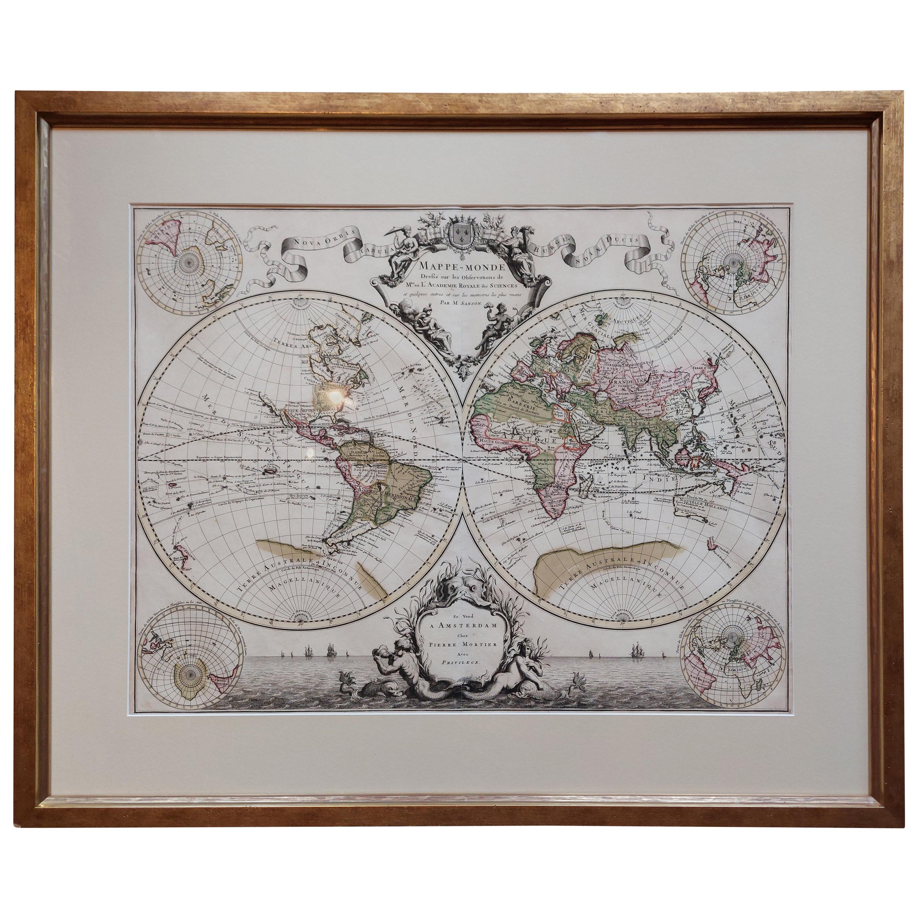
Original Antique Hand-colored World Map with or without Frame,
1696
Located in Langweer, NL
Antique world map titled 'Mappe-Monde dressee sur les Observations de Mrs. de l'Academie Royale des Sciences (..)'. Beautiful original antique world map...
Category
Antique Late 17th Century French Maps
Materials
Paper

$4,276 Sale Price
20% Off
Antique World Map by P. Schenk
1706
By Peter Schenk
Located in Langweer, NL
Antique map titled 'Diversa Orbis Terrae. Visu Incedente per Coluros Tropicorum, Ambos Ejus Polos, et Parciularis Sphaerae Zenith, in Planum Orthographica Projectio (..) Plat Ontwerp van verscheyde Aert-klooten (..)'. One of the earliest Dutch World Maps to focus on a more modern cartographic style, based on Carel Allard's map of 1696. This map represented a noteworthy shift from the traditional decorative Dutch 17th century maps where the margins would be full of classical mythological...
Category
Antique Early 18th Century Maps
Materials
Paper

$5,132 Sale Price
20% Off
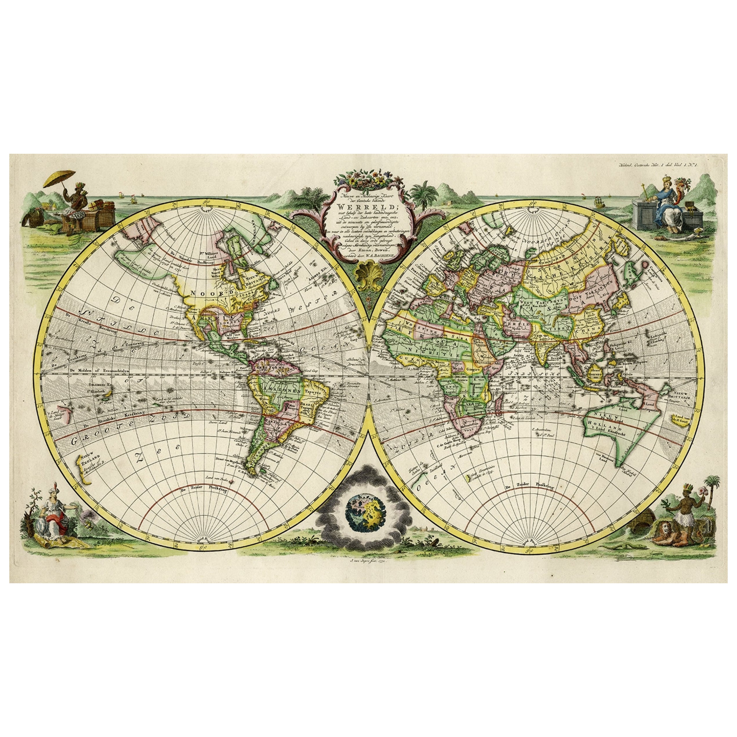
Rare Original Double Hemisphere World Map with Allegorical Figures, 1785
Located in Langweer, NL
Antique map titled 'Nieuwe en Naukeurige Kaart der Gantsche bekende Werreld.'
A double hemisphere world map. Four allegorical figures in the c...
Category
Antique 1780s Maps
Materials
Paper
$2,803 Sale Price
20% Off
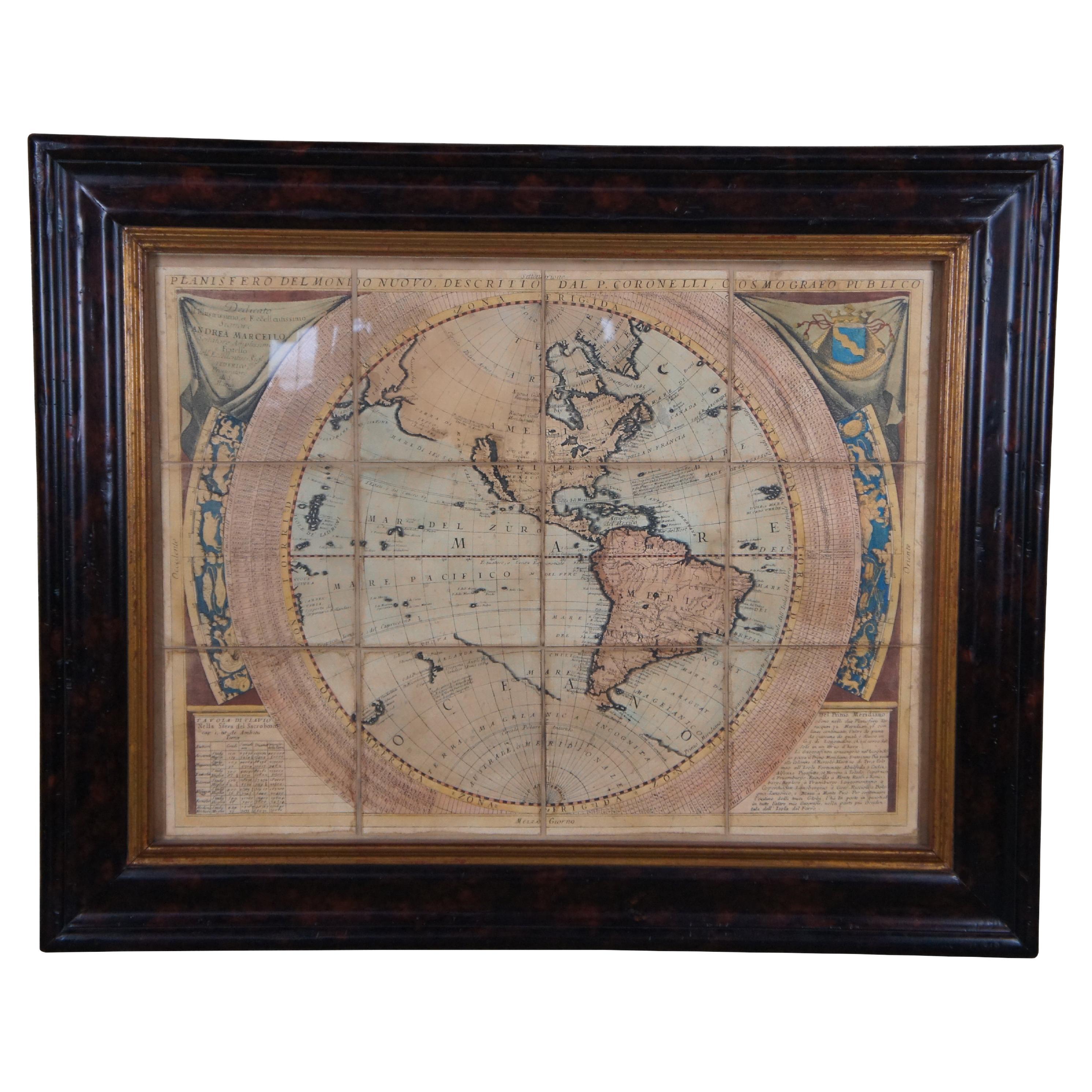
Vincenzo Coronelli
s Colored Map of the New World Western Hemisphere Framed 47"
By Vincenzo Coronelli
Located in Dayton, OH
A Framed Reproduction of Coronelli's Map of the New World, Attributed to Trevor James Company. The map shows the Western Hemisphere including the discoveries made by Abel Tasman in A...
Category
20th Century Maps
Materials
Paper

$945 Sale Price
30% Off
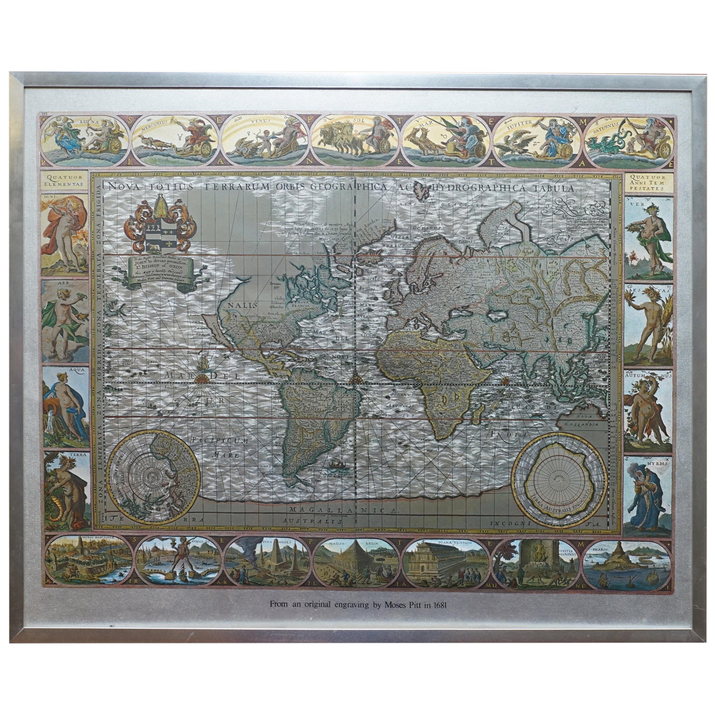
Silver Leaf Foil Wall World Map Engraving Based on the Original Moses Pitt, 1681
Located in West Sussex, Pulborough
We are delighted to offer for sale this lovely antique style pictorial silver leaf foil world map taken from and original engraving my Moses Pitt, 1681
This is a very interesting ...
Category
20th Century English Modern Maps
Materials
Silver Leaf

More Ways To Browse
Framed World Map
Used Horse Drawn Wagons
Van Braam
Vanity Round Mirror
Vincent De Paul
Vintage Applique Patterns
Vintage Horse Bridle
Vintage Montgomery Wards
Water Cooler
Whimsical Teapot
Wood Carving With Silver Inlay
Woodblock Triptych
Wooden Base Silver
Wooden Horse Head
Yixing Teapot
12th Century Sculpture
16th Century Wood Chest
1800s American Furniture