Items Similar to Geological Map of Africa by A.K. Johnston – Mountains and Valleys 1852


Want more images or videos?
Request additional images or videos from the seller
1 of 10
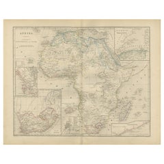
Geological Map of Africa by A.K. Johnston – Mountains and Valleys 1852
$310.83per item
£231.98per item
€260per item
CA$428.76per item
A$469per item
CHF 246.94per item
MX$5,599.34per item
NOK 3,147.28per item
SEK 2,879.01per item
DKK 1,980.77per item
Quantity
About the Item
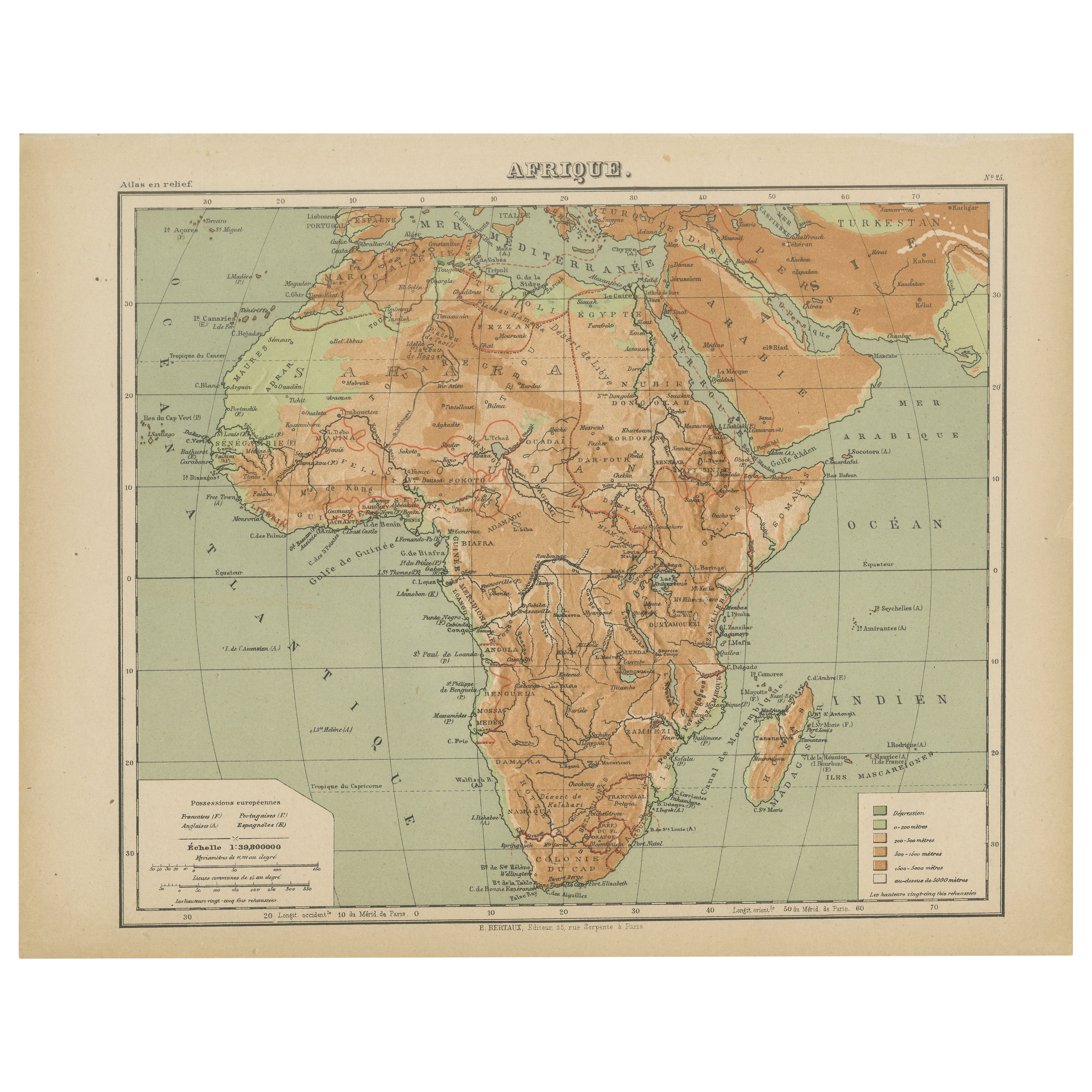
Geological Map of Africa by A.K. Johnston – Mountains and Valleys 1852
This antique map titled "The Mountains, Table Lands, Plains
Valleys of Africa" was produced by the distinguished Scottish cartographer Alexander Keith Johnston and published in 1852 by William Blackwood
Sons, Edinburgh and London. Issued as Plate 7 in Johnston’s seminal work *The Physical Atlas of Natural Phenomena*, it represents one of the earliest and most influential attempts to visualize Africa’s topography through scientific cartography.
This map presents a detailed physical overview of the African continent, using subtle coloration and shading to depict mountain ranges, elevated tablelands, deserts, and low-lying river basins. Unlike political maps of the period, it forgoes country borders in favor of a focus on natural geography. Earth-toned shades indicate elevation—yellow and tan for deserts and plains, green for coastal lowlands, and brown for highlands and mountain systems.
Prominent physical features such as the Atlas Mountains, Ethiopian Highlands, the Mountains of the Moon, Table Mountain, the Sahara Desert, and the Great Rift Valley are clearly labeled. River systems including the Nile, Niger, Congo, and Zambezi are also traced with scientific accuracy. This map offers an insightful view of Africa's geologic and climatic structure before many interior regions had been fully charted by European explorers.
A.K. Johnston (1804–1871), who served as Geographer in Ordinary to Queen Victoria in Scotland, was a pioneer in thematic cartography. His *Physical Atlas* was the first of its kind to translate complex natural data into visual form, combining scientific precision with artistic presentation. This map stands out not only for its geographical value but for its restrained beauty and clarity—qualities that made Johnston’s atlases widely respected by scientists, educators, and collectors alike.
This print is a valuable addition to collections focused on African geography, scientific history, or antique educational material, and it remains aesthetically appealing for decorative use.
Condition and framing tips:
Very good condition with light age toning and faint edge wear. The engraved detail is sharp, and the original hand coloring remains clean and vivid. Frame in black or dark oak with a cream or soft sand-colored mat to highlight the warm earth tones and emphasize the elegant cartographic lines. Suitable for a library, office, or academic space.
- Dimensions:Height: 10.79 in (27.4 cm)Width: 13.59 in (34.5 cm)Depth: 0.01 in (0.2 mm)
- Materials and Techniques:
- Place of Origin:
- Period:
- Date of Manufacture:1852
- Condition:Very good condition. Light overall toning near the margins. The paper remains strong and well-preserved. Folding line as issued.
- Seller Location:Langweer, NL
- Reference Number:Seller: BG-13207-71stDibs: LU3054345386642
About the Seller
5.0
Recognized Seller
These prestigious sellers are industry leaders and represent the highest echelon for item quality and design.
Platinum Seller
Premium sellers with a 4.7+ rating and 24-hour response times
Established in 2009
1stDibs seller since 2017
2,809 sales on 1stDibs
Typical response time: 1 hour
- ShippingRetrieving quote...Shipping from: Langweer, Netherlands
- Return Policy
More From This Seller
View AllAfrica Map with Egypt
South Africa Insets – Nieuwe Hand-Atlas, 1876
Located in Langweer, NL
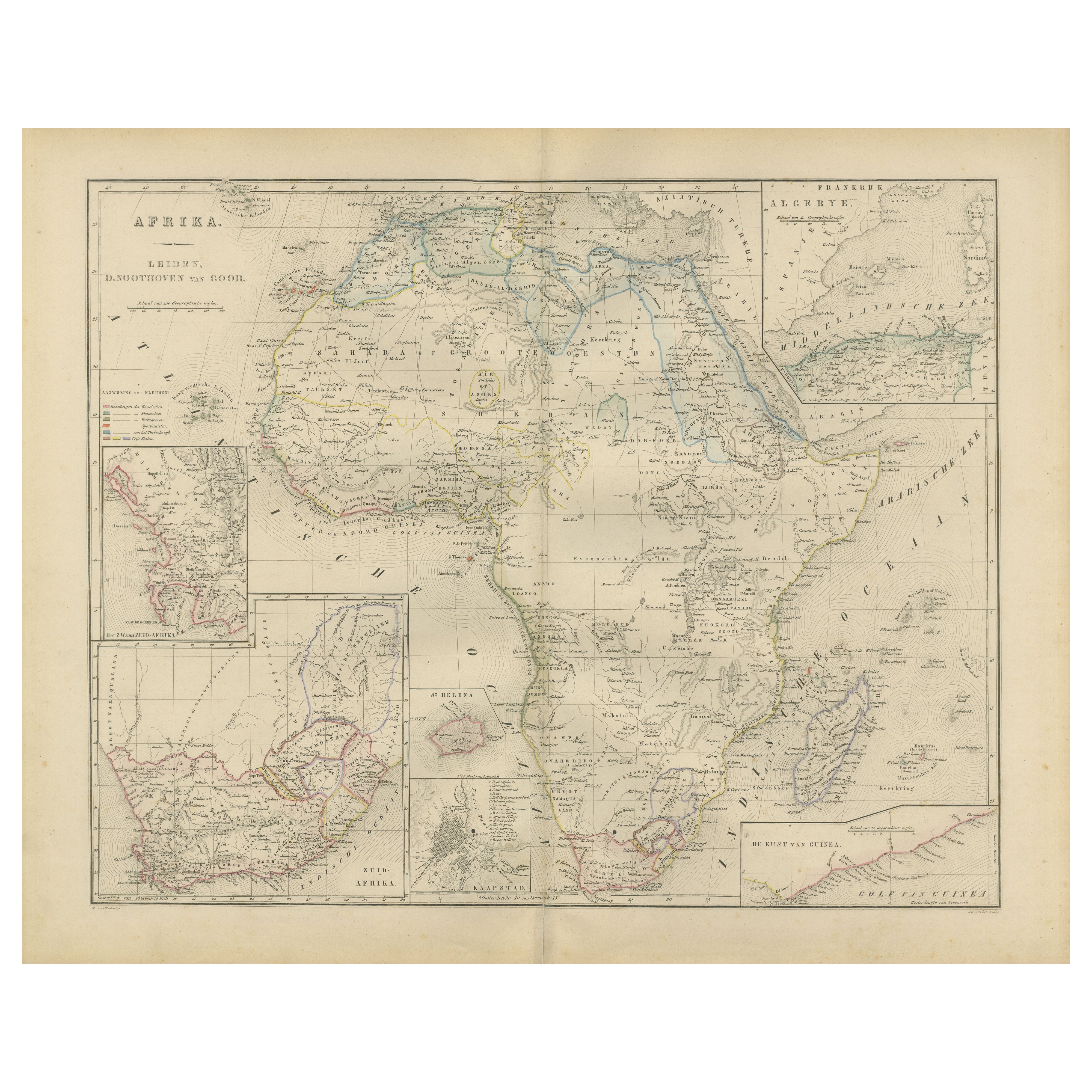
Africa Map with Egypt & South Africa Insets – Nieuwe Hand-Atlas, 1876
This 19th-century map titled “Afrika,” published in 1876 in the Nieuwe Hand-Atlas der Aarde in haren Tegenwoord...
Category
Antique 1870s Dutch Maps
Materials
Paper
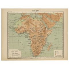
Relief Atlas Map of Africa by Hachette – Antique c.1883 French Map
Located in Langweer, NL
Antique Map of Africa – Relief Atlas Map by Hachette, circa 1880
Description:
This is an attractive antique map titled “Afrique,” published by Hachette...
Category
Antique Late 19th Century Maps
Materials
Paper
Antique Map of Africa, Highlighting Colonial Divisions, Geographic Features 1903
Located in Langweer, NL
Title: Antique Map of Africa, 1903, Highlighting Colonial Divisions and Geographic Features
Description: This antique map, titled "Africa," was engraved and published in 1903 by W. ...
Category
Early 20th Century Maps
Materials
Paper

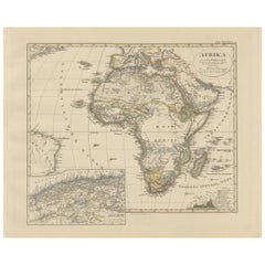
Colorfull Antique Map of Africa with Algeria Inset – Stieler Atlas 1858
Located in Langweer, NL
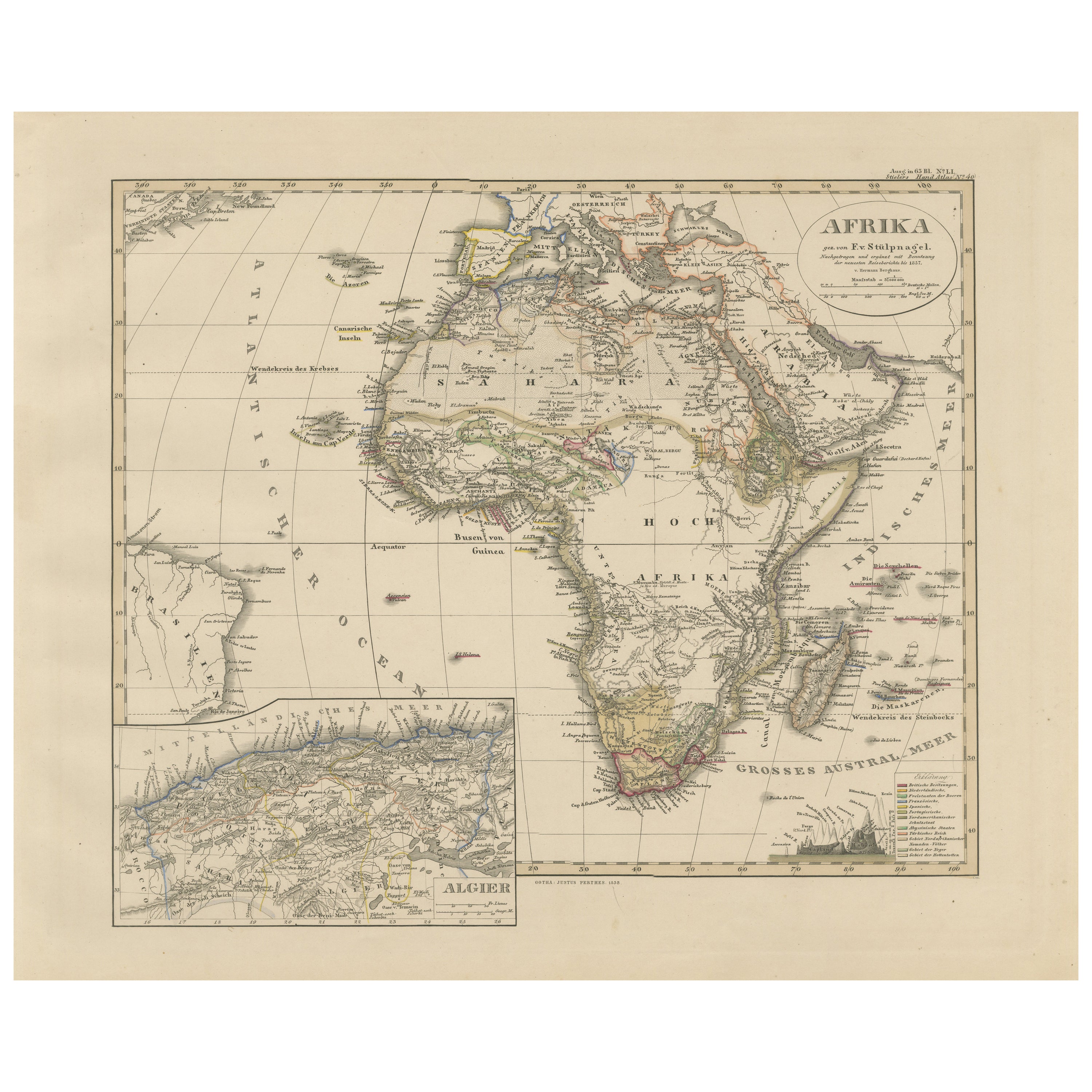
Antique Map of Africa with Algeria Inset – Stieler Atlas 1858
This antique map of Africa, engraved by F. von Stülpnagel and published by Justus Perthes in 1858, is a finely detailed...
Category
Antique Mid-19th Century German Maps
Materials
Paper
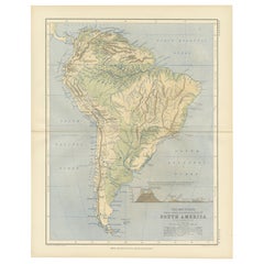
Geological Map of South America by A.K. Johnston – Mountains and Valleys 1852
Located in Langweer, NL
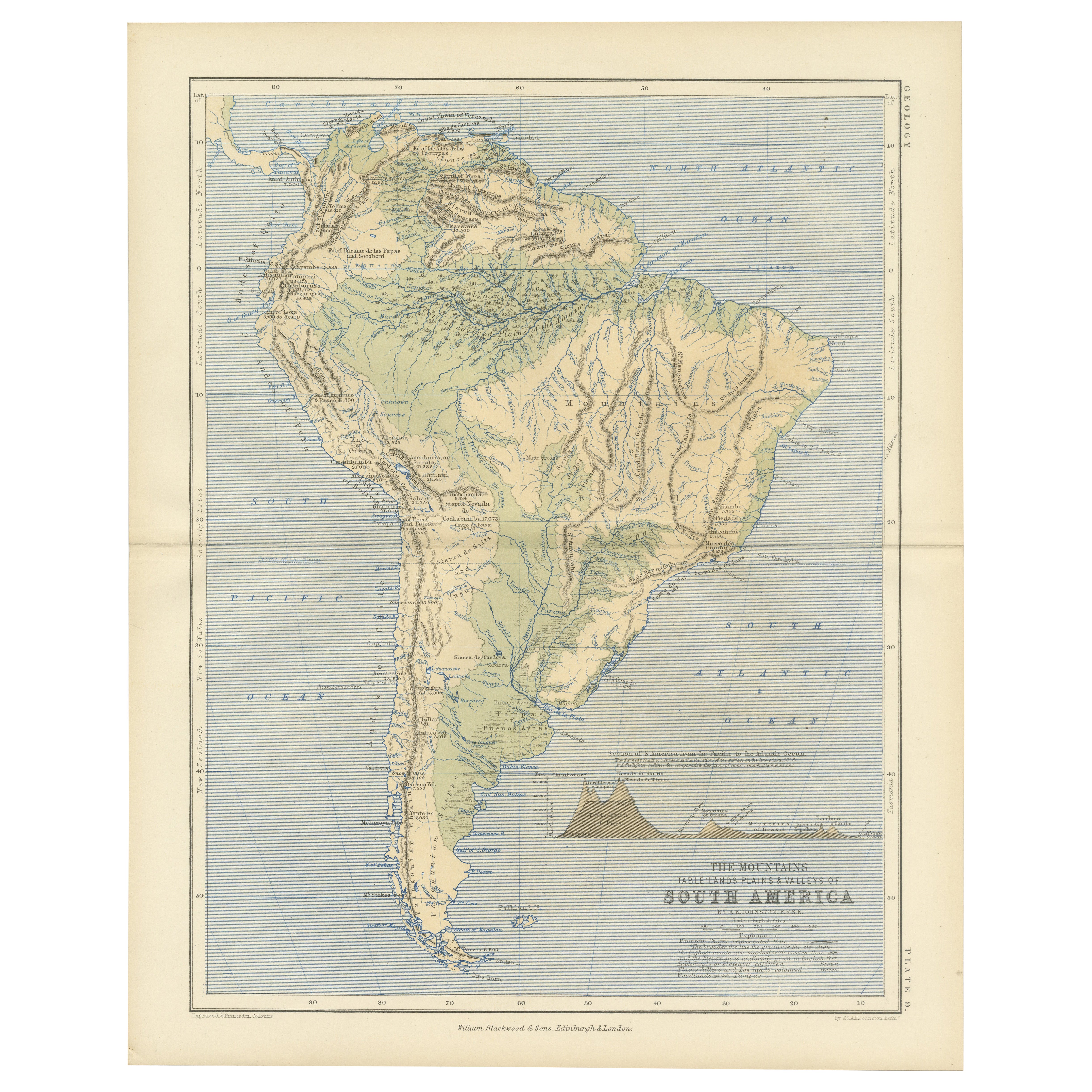
Geological Map of South America by A.K. Johnston – Mountains and Valleys 1852
This antique map titled "The Mountains, Table Lands, Plains & Valleys of South America" was produced by...
Category
Antique Mid-19th Century Scottish Prints
Materials
Paper
Antique Map of Africa by Lapie, 1842
Located in Langweer, NL
Antique map titled 'Carte d'Afrique'. Map of Africa. This map originates from 'Atlas universel de géographie ancienne et moderne (..)' by Pierre M. Lapie...
Category
Antique Mid-19th Century Maps
Materials
Paper

You May Also Like
Original Antique Map of Africa by Dower, circa 1835
Located in St Annes, Lancashire
Nice map of Africa
Drawn and engraved by J.Dower
Published by Orr & Smith. C.1835
Unframed.
Free shipping
Category
Antique 1830s English Maps
Materials
Paper

Large Original Antique Map of Africa. C.1900
Located in St Annes, Lancashire
Fabulous map of Africa
Original color.
Engraved and printed by the George F. Cram Company, Indianapolis.
Published, C.1900.
Unframed.
Free shipping.
Category
Antique 1890s American Maps
Materials
Paper

Africa. North-East Part. Century Atlas antique vintage map
Located in Melbourne, Victoria
'The Century Atlas. Africa. North-East Part'
Original antique map, 1903.
Inset map of 'Nile Delta and Suez Canal'.
Central fold as issued. Map name and nu...
Category
Early 20th Century Victorian More Prints
Materials
Lithograph

Africa. Southern Part. Century Atlas antique vintage map
Located in Melbourne, Victoria
'The Century Atlas. Africa. Southern Part'
Original antique map, 1903.
Inset maps of 'Cape Town', 'Johannesburg' and 'Ladysmith'.
Central fold as issued. Map name and number printe...
Category
Early 20th Century Victorian More Prints
Materials
Lithograph

Africa. Central. Century Atlas antique vintage map
Located in Melbourne, Victoria
'The Century Atlas. Africa. Central'
Inset map of 'Madagascar'.
Original antique map, 1903.
Central fold as issued. Map name and number printed on the reverse corners.
Sheet 29.5cm...
Category
Early 20th Century Victorian More Prints
Materials
Lithograph

Map of Africa - Original Etching by C. Brue - 1820
Located in Roma, IT
Map of Africa is an original etching realized by C.Brue in 1820.
The print comes from the Series "Atlas Universal" PL. 31.
The state of preservation of the artwork is good except f...
Category
1820s Modern Figurative Prints
Materials
Etching

More Ways To Browse
Bronze Black Panthers
Bronze Chinoiserie Clock
Bronze Marly Horses
Bronze Singing Bowl
Bronze Sparrow
Brutalist Horse
Brutalist Zodiac
Buddha Head On Black Stand
Buffalo Horn Furniture
Bugatti Sculpture
Buncheong Ceramics
Cabinets Anglo Indian Rosewood
Carrera Dining Table
Carved Bone Elephants
Carved Censer
Carved Indian Chest
Carved Jade Figure
Carved Shell Cabinet