Items Similar to Geological Map of South America by A.K. Johnston – Mountains and Valleys 1852


Want more images or videos?
Request additional images or videos from the seller
1 of 10
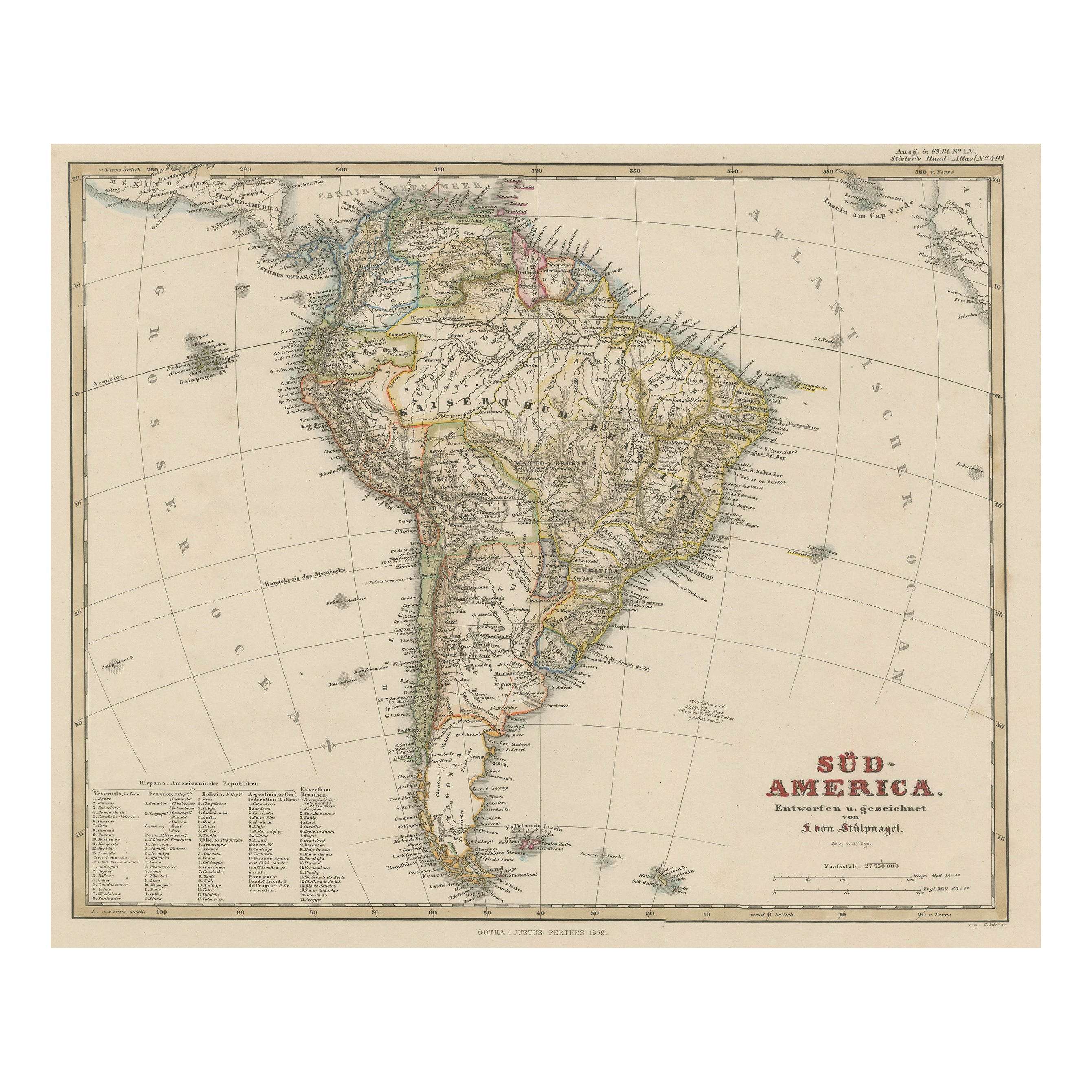
Geological Map of South America by A.K. Johnston – Mountains and Valleys 1852
$310.50per item
£232.01per item
€260per item
CA$428.28per item
A$469.17per item
CHF 246.95per item
MX$5,599.67per item
NOK 3,148.03per item
SEK 2,877.77per item
DKK 1,981per item
Quantity
About the Item
Geological Map of South America by A.K. Johnston – Mountains and Valleys 1852
This antique map titled "The Mountains, Table Lands, Plains
Valleys of South America" was produced by Alexander Keith Johnston and published in 1852 by William Blackwood
Sons in Edinburgh and London. It is Plate 9 from Johnston’s groundbreaking work *The Physical Atlas of Natural Phenomena*, a pioneering 19th-century publication that helped popularize thematic mapping and scientific cartography.
The map provides a physical representation of South America’s terrain, highlighting the dramatic topography of the Andes Mountains along the continent’s Pacific coast and the vast lowlands of the Amazon and La Plata river basins. Using subtle hand coloring, the map distinguishes mountain ranges, highland plateaus, valleys, and plains, rather than political borders. Light tan indicates elevated regions, green is used for valleys and lowland areas, while blue lines trace major rivers and coastlines.
Key natural features are clearly labeled, including the Cordillera of the Andes, the Brazilian Highlands, the Pampas, Patagonia, and Tierra del Fuego. The Amazon River and its tributaries dominate the northern interior, while a small inset diagram at lower right provides a vertical section showing comparative mountain heights across the continent from the Pacific to the Atlantic.
This map is of special interest due to its emphasis on natural geography over colonial divisions, which was a progressive perspective for the time. Johnston’s work sought to explain the physical world through data visualization, making it useful not only to geographers and scientists, but also to educators, students, and policymakers of the mid-19th century.
Alexander Keith Johnston (1804–1871), Geographer in Ordinary to Queen Victoria in Scotland, was renowned for his clarity, scientific rigor, and contribution to thematic mapping. His *Physical Atlas* is widely considered one of the most important scientific atlases ever published.
Condition and framing tips:
Very good condition with only minor age toning and faint foxing near the edges. The printed area remains clean and sharp.
Frame with a warm wood or black frame and use a cream, pale green, or light blue mat to enhance the natural hues and fine linework. Ideal for display in a study, office, or educational setting.
- Dimensions:Height: 13.59 in (34.5 cm)Width: 10.79 in (27.4 cm)Depth: 0.01 in (0.2 mm)
- Materials and Techniques:
- Place of Origin:
- Period:
- Date of Manufacture:1852
- Condition:Very good condition. Light overall toning near the margins. The paper remains strong and well-preserved. Folding line as issued.
- Seller Location:Langweer, NL
- Reference Number:Seller: BG-13207-91stDibs: LU3054345387912
About the Seller
5.0
Recognized Seller
These prestigious sellers are industry leaders and represent the highest echelon for item quality and design.
Platinum Seller
Premium sellers with a 4.7+ rating and 24-hour response times
Established in 2009
1stDibs seller since 2017
2,809 sales on 1stDibs
Typical response time: 1 hour
- ShippingRetrieving quote...Shipping from: Langweer, Netherlands
- Return Policy
More From This Seller
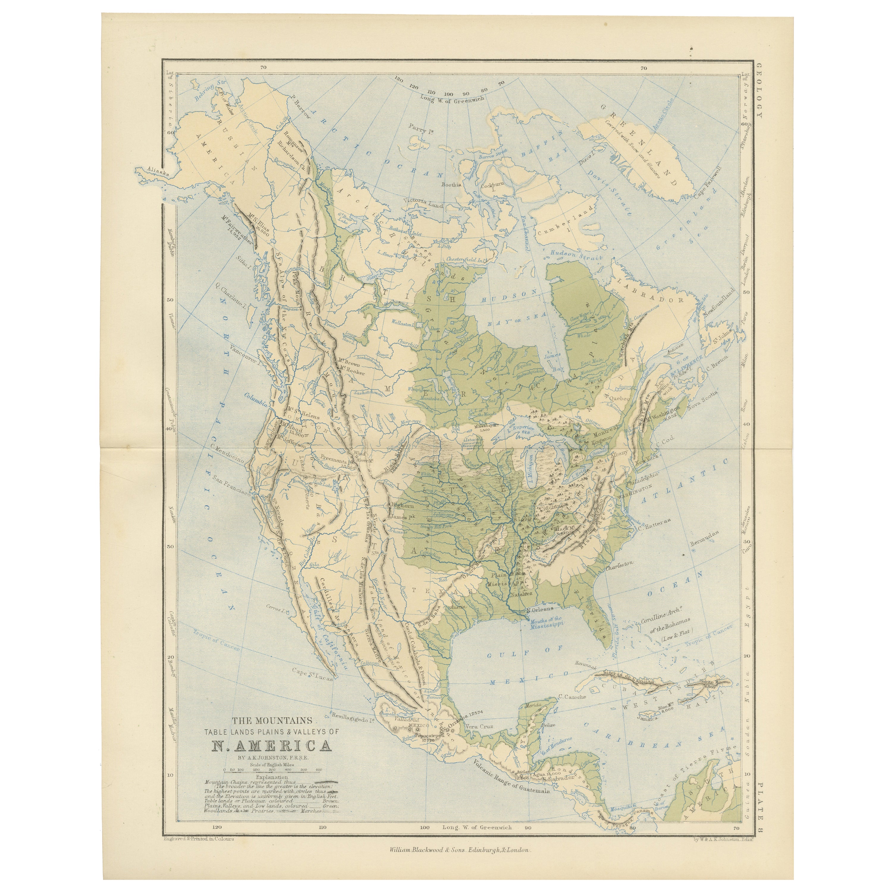
View AllGeological Map of North America by A.K. Johnston – Mountains and Valleys 1852
Located in Langweer, NL
Geological Map of North America by A.K. Johnston – Mountains and Valleys 1852
This finely detailed and beautifully shaded antique map titled "The Mountains, Table Lands, Plains & Va...
Category
Antique Mid-19th Century Scottish Prints
Materials
Paper
Antique Map of South America ‘North’ by A.K. Johnston, 1865
Located in Langweer, NL
Antique map titled 'South America, Northern Sheet'. Depicting Guiana, Ecuador, Brazil, Bolivia the Amazones and more. This map originates from the ‘Royal Atlas of Modern Geography’ b...
Category
Antique Mid-19th Century Maps
Materials
Paper

Antique Map of South America by W. G. Blackie, 1859
Located in Langweer, NL
Antique map titled 'South America'. Original antique map of South America. This map originates from ‘The Imperial Atlas of Modern Geography’. Published by W. G. Blackie, 1859.
Category
Antique Mid-19th Century Maps
Materials
Paper

$238 Sale Price
20% Off
Antique Map of South America by Johnston, 1844
Located in Langweer, NL
Antitique map titled 'South America'. Beautiful original antique map of South America. This map originates from 'The National Atlas of His...
Category
Antique 19th Century Maps
Materials
Paper

$186 Sale Price
20% Off
Antique Map of South America, c.1840
Located in Langweer, NL
Antique map titled 'South America'. Original, antique map depicting South America. With outline coloring. Source unknown, to be determined. Artists and Engravers: Anonymous.
Artist:...
Category
Antique 19th Century Maps
Materials
Paper

$69 Sale Price
20% Off
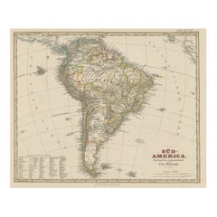
Antique Map of South America with Many Details, ca.1859
Located in Langweer, NL
Original antique map titled 'Süd-America'. Beautiful old map of South America, with many details and legend.
This map originates from Stielers Handatlas, published circa 1859. St...
Category
Antique Mid-19th Century Maps
Materials
Paper
$554 Sale Price
20% Off
You May Also Like
South America, Eastern Part. Century Atlas antique vintage map
Located in Melbourne, Victoria
'The Century Atlas. South America. Eastern Part'
Original antique map, 1903.
Inset map 'Rio de Janeiro and Vicinity'.
Central fold as issued. Map name and number printed on the rev...
Category
Early 20th Century Victorian More Prints
Materials
Lithograph

South America, North-West Part. Century Atlas antique vintage map
Located in Melbourne, Victoria
'The Century Atlas. South America, North-West Part'
Original antique map, 1903.
Central fold as issued. Map name and number printed on the reverse corners.
Sheet 40cm by 29.5cm.
Category
Early 20th Century Victorian More Prints
Materials
Lithograph

Charte von Sud-America (Map of South America) - Etching with Hand-Drawn Outlines
Located in Soquel, CA
Map of south America, engraved by Franz Pluth (Czech, 1800-1871), from the book "Neueste Länder - und Völkerkunde, ein geographisches Lesebuch für alle Stände" by Linder, F. L. (Prag...
Category
1820s Other Art Style More Prints
Materials
Paper, Printer s Ink, Etching

Antique Map of South America in Roma Frame
Located in Malibu, CA
Antique map of South America. Displayed in a new Roma frame with museum quality matting. Custom frame in platinum. No print date, but cert...
Category
Antique Late 19th Century Victorian Prints
Materials
Hardwood, Paper

Carte du Bresil, antique 1860s engraved map of Brazil
Located in Melbourne, Victoria
'Carte du Bresil'
Engraving with original outline colouring, circa 1860, by Alexandre Vuillemin, published in Paris.
31cm by 41cm (sheet)
21.5cm by 31.5cm (image)
Category
Late 19th Century Victorian More Prints
Materials
Lithograph

Original Antique Map of The Western Hemisphere by Dower, circa 1835
Located in St Annes, Lancashire
Nice map of the Western Hemisphere
Drawn and engraved by J.Dower
Published by Orr & Smith. C.1835
Unframed.
Free shipping
Category
Antique 1830s English Maps
Materials
Paper

More Ways To Browse
Bronze Black Panthers
Bronze Chinoiserie Clock
Bronze Marly Horses
Bronze Singing Bowl
Bronze Sparrow
Brutalist Horse
Brutalist Zodiac
Buddha Head On Black Stand
Buffalo Horn Furniture
Bugatti Sculpture
Buncheong Ceramics
Cabinets Anglo Indian Rosewood
Carrera Dining Table
Carved Bone Elephants
Carved Censer
Carved Indian Chest
Carved Jade Figure
Carved Shell Cabinet