Items Similar to Ground Plan of Shwemawdaw Pagoda – Great Temple at Pegu, circa 1800

Want more images or videos?
Request additional images or videos from the seller
1 of 10
Ground Plan of Shwemawdaw Pagoda – Great Temple at Pegu, circa 1800
$336.30
£249.34
€280
CA$462
A$504.34
CHF 265.54
MX$6,041.46
NOK 3,396.20
SEK 3,100.79
DKK 2,133.50
About the Item
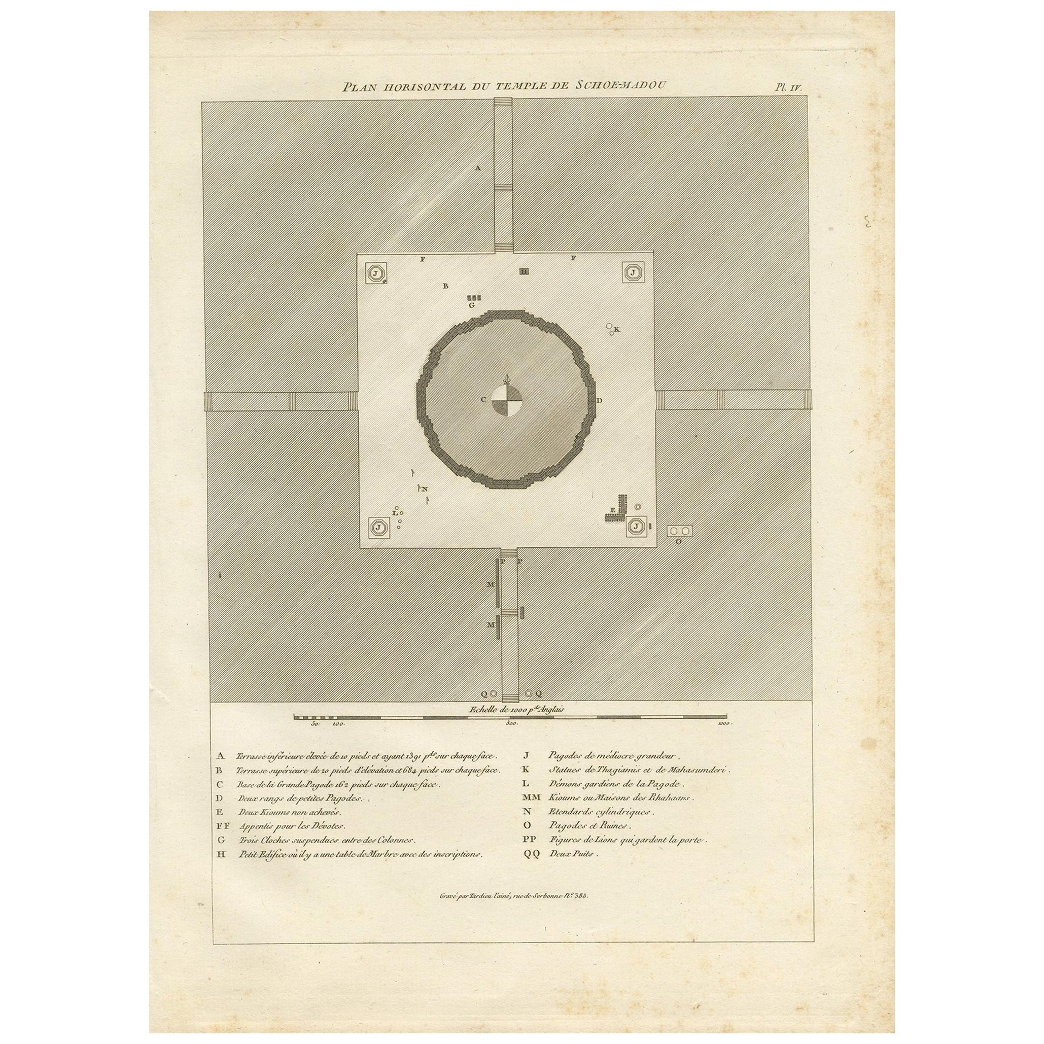
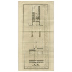
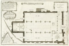
Architectural Plan of the Shwemawdaw Pagoda – Ground Plan of the Great Temple at Pegu, circa 1800
This rare and finely executed Dutch engraving titled “Grondteekening van den Sjoemadoe Praw” (“Ground Plan of the Shwemawdaw Pagoda”) offers a precise architectural layout of one of Burma’s most important religious monuments. Created circa 1800, this plan accompanied a series of prints based on European travel accounts such as that of Michael Symes, the British envoy to the Burmese court in 1795.
The map presents a detailed bird’s-eye view of the sacred complex at Pegu (modern-day Bago), with the central stupa of the Shwemawdaw dominating the circular enclosure. The pagoda is surrounded by meticulously rendered features: entrance gates, stairways, shrines, walls, guardian figures, and other monastic structures. The four cardinal directions are marked, and the layout is carefully labeled with alphabetical references.
At the bottom of the sheet, a comprehensive **“Uitlegging”** (Explanation) provides a key to 18 architectural and ritual features, including:
* A: The central pagoda with its massive bell-shaped form
* B–C: Altar stairs and inner enclosures
* F–H: Shrines, altars, and the statues of gods
* L: Lion-shaped guardians at the base
* N: Small golden shrines placed around the terrace
* QQ: Open shrines accessible to pilgrims
The plan not only reveals the structure’s grandeur and organization but also demonstrates the European fascination with documenting and rationalizing foreign religious architecture using Enlightenment methods of geometry and surveying. Such a detailed drawing would have greatly appealed to European readers and collectors interested in Eastern architecture, religion, and imperial geography.
Condition: Good condition with a strong plate impression. Original folds as issued. Slight toning along folds and edges, minor creasing, and one small paper edge loss at lower left (not affecting the image or text). Full margins preserved.
Framing tips: Ideal for float-mounting in a large frame to showcase the full sheet and explanatory legend. Use a neutral-toned mat and dark wood or black frame to enhance the clarity and technical precision of the drawing.
Technique: Copper engraving
Maker: Anonymous Dutch engraver, after British sources (possibly Symes or Dalrymple), circa 1800
- Dimensions:Height: 12.13 in (30.8 cm)Width: 9.45 in (24 cm)Depth: 0 in (0.02 mm)
- Materials and Techniques:Paper,Engraved
- Place of Origin:
- Period:
- Date of Manufacture:circa 1800
- Condition:Condition: Good condition with a strong plate impression. Original folds as issued. Slight toning along folds and edges, minor creasing, and one small paper edge loss at lower left (not affecting the image or text). Full margins preserved.
- Seller Location:Langweer, NL
- Reference Number:Seller: BG-11645-1-111stDibs: LU3054346161972
About the Seller
5.0
Recognized Seller
These prestigious sellers are industry leaders and represent the highest echelon for item quality and design.
Platinum Seller
Premium sellers with a 4.7+ rating and 24-hour response times
Established in 2009
1stDibs seller since 2017
2,811 sales on 1stDibs
Typical response time: 1 hour
- ShippingRetrieving quote...Shipping from: Langweer, Netherlands
- Return Policy
More From This Seller
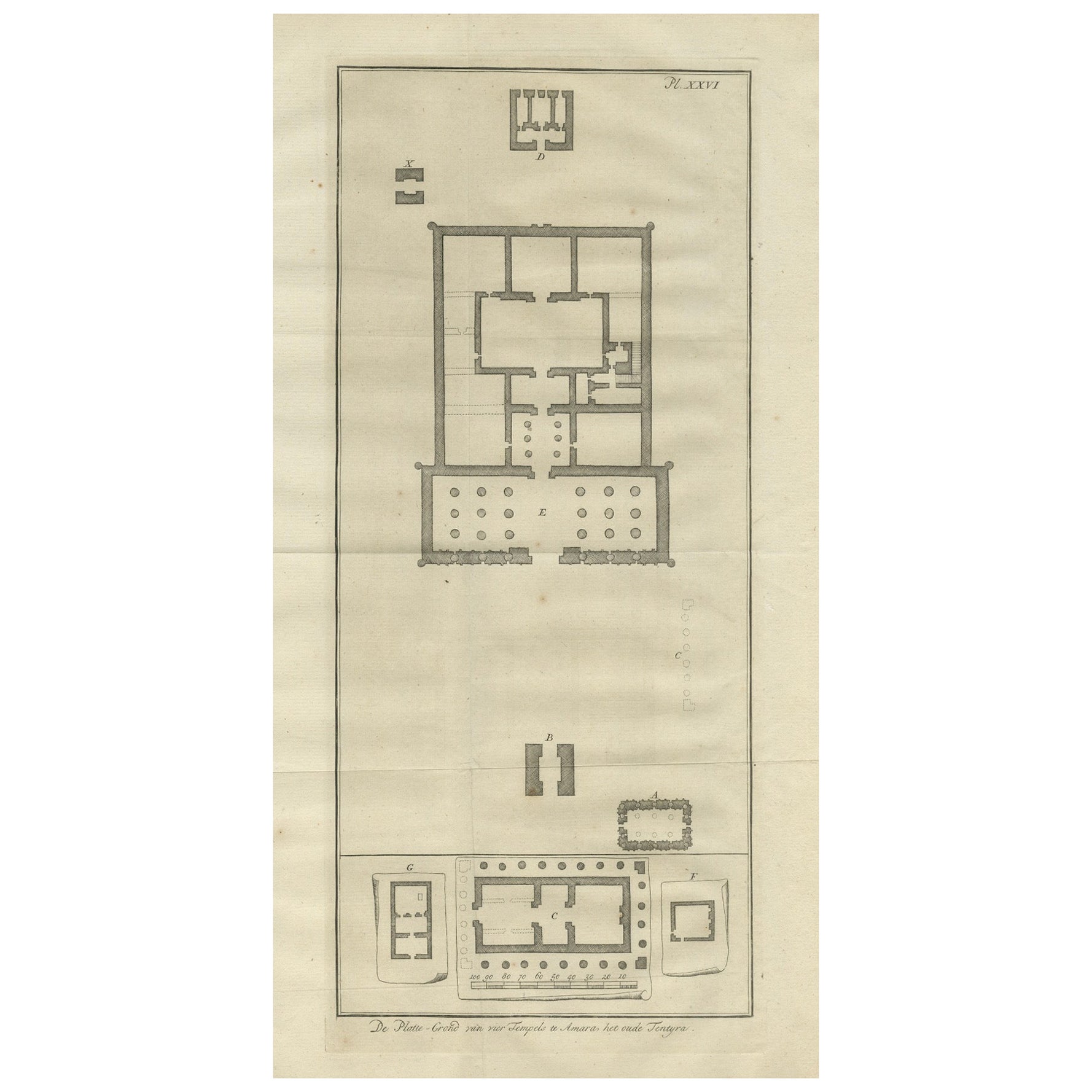
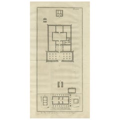
View AllAncient Temple Plans at Amara and Tentyra – Egyptian Architecture c.1710
Located in Langweer, NL
Ancient Temple Plans at Amara and Tentyra – Egyptian Architecture c.1710
Description:
This early 18th-century architectural engraving, titled "De Platte-Grond van vier Tempels te Am...
Category
Antique Early 18th Century Dutch Prints
Materials
Paper
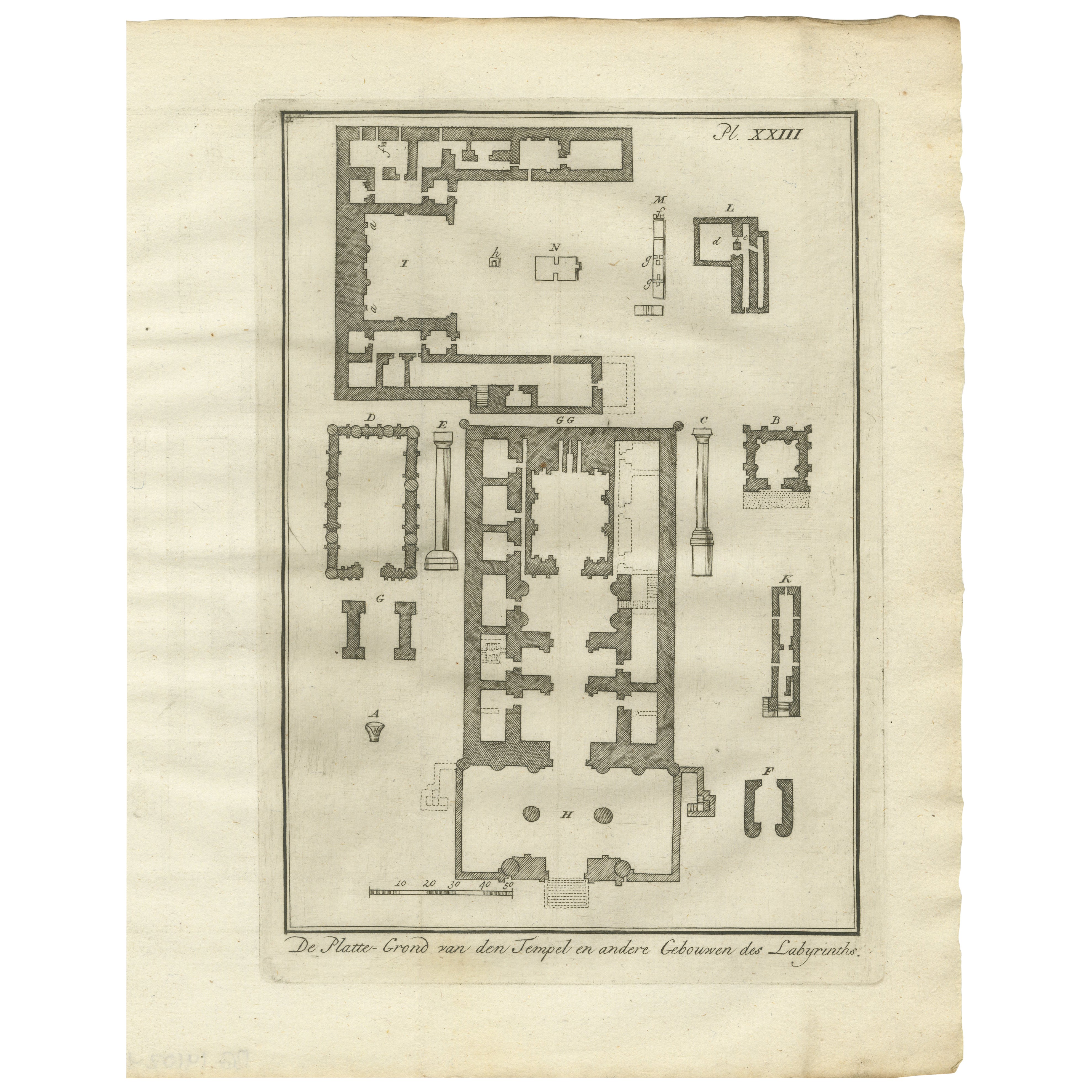
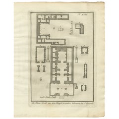
Temple and Buildings of the Labyrinth, Hawara – Floor Plan Engraving, Egypt 1776
Located in Langweer, NL
Title: Temple and Buildings of the Labyrinth at Hawara – Floor Plan Engraving, Egypt 1776
Description:
This 1776 architectural engraving presents a detailed floor plan of the legend...
Category
Antique Late 18th Century Dutch Prints
Materials
Paper
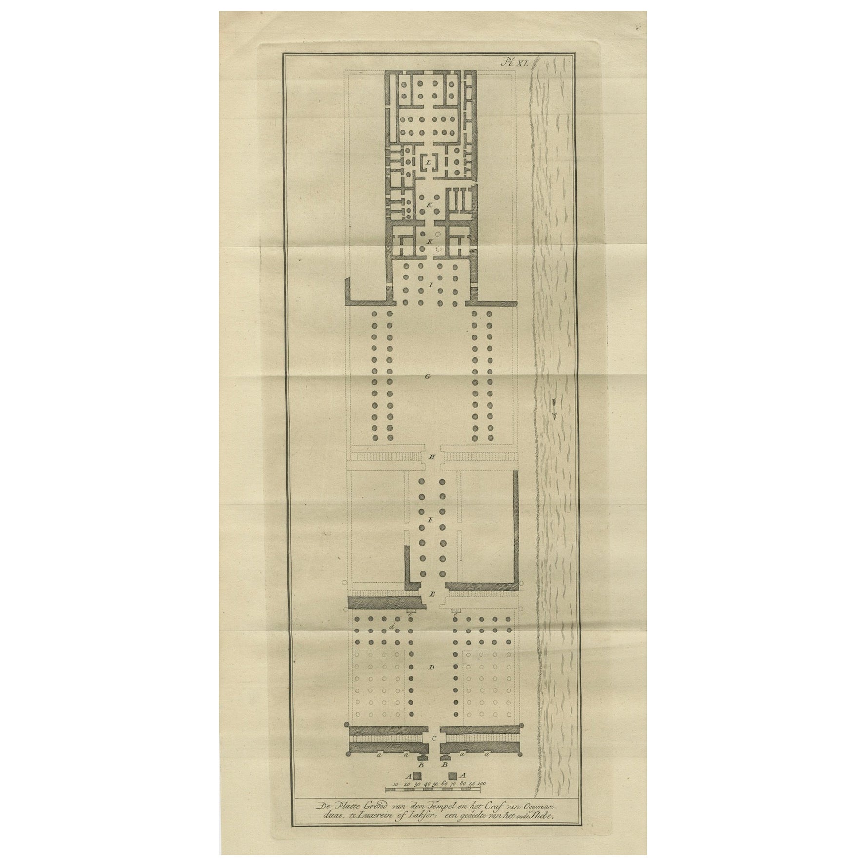
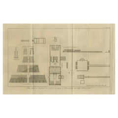
Temple of Jupiter in Thebes – Floor Plan and Gate Elevations, circa 1710
Located in Langweer, NL
Temple of Jupiter in Thebes – Floor Plan and Gate Elevations, circa 1710
This precise architectural engraving, titled "Platte-Grond en Doorsnede des Tempels van Jupiter te Thebe, en...
Category
Antique Early 18th Century Dutch Prints
Materials
Paper
Floor Plan of the Temple of Amun at Luxor – Ancient Thebes, c.1710
Located in Langweer, NL
Floor Plan of the Temple of Amun at Luxor – Ancient Thebes, c.1710
Description:
This antique architectural engraving presents a detailed floor plan of the famous Temple of Amun in L...
Category
Antique Early 18th Century Dutch Prints
Materials
Paper
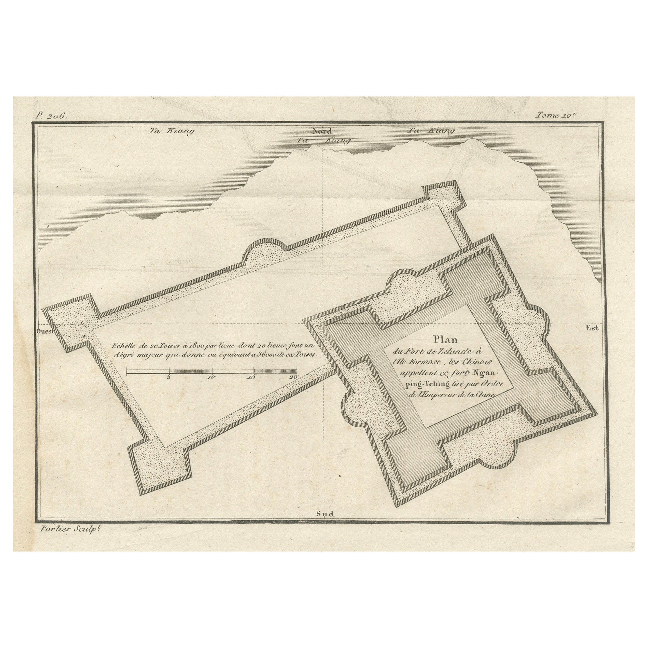
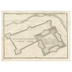
Plan of the Dutch Fort in Formosa – Antique French Jesuit Engraving, ca.1790
Located in Langweer, NL
Plan of the Dutch Fort in Formosa – Antique French Jesuit Engraving by Portier, c.1790
This antique French engraving by Portier, produced around 1790, shows a detailed plan of the D...
Category
Antique Late 18th Century French Maps
Materials
Paper
Original Antique Engraving of a Burmese Temple, ca.1800
Located in Langweer, NL
Antique print titled 'Plan Horisontal du Temple de Schoe-Madou'. Plan of a Burmese temple. This print originates from 'Relation de l'Ambassade Anglaise, envoyée en 1795 dans le Royau...
Category
Antique Early 19th Century Prints
Materials
Paper
You May Also Like
Floor plan of St Albans Cathedral (1810), engraving by James Basire
Located in London, GB
James Basire & John Carter
Floor plan of St Albans Cathedral
Engraving
61 x 95 cm
This engraving was originally published by the Society of Antiquaries of London, an organisation ...
Category
1810s Realist Landscape Prints
Materials
Engraving
The plan of St. Martin
s Church, St. Martin in the Fields
By George Vertue
Located in Middletown, NY
London: Society of Antiqauries London, 1744. Engraving on buff wove paper with a large heraldic watermark with Strasbourg lily with a crown and shied and the letters LVG, 9 1/2 x 14 ...
Category
Mid-18th Century English School Landscape Prints
Materials
Engraving, Handmade Paper
Architectural Roman Map - Etching by Vincenzo Scarpati - 18th Century
Located in Roma, IT
Architectural Roman Map from "Antiquities of Herculaneum" is an etching on paper realized by Vincenzo Scarpati in the 18th Century.
Signed on the plate.
Go...
Category
18th Century Old Masters Figurative Prints
Materials
Etching

Map - Etching by Nicola Fiorillo - 18th Century
Located in Roma, IT
Map from "Antiquities of Herculaneum" is an etching on paper realized by Nicola Fiorillo in the 18th Century.
Signed on the plate.
Good conditions with some folding and foxing.
Th...
Category
18th Century Old Masters Figurative Prints
Materials
Etching
Plan of the Park, Garden and Plantations of Goodwood, 18th century engraving
By Colen Campbell
Located in Melbourne, Victoria
Plan of the Park, Garden and Plantations of Goodwood in Sussex the Seat of his Grace the Duke of Richmond and Lenox &c
Copper-line engraving with later hand-colouring by Hendrik Hul...
Category
18th Century English School Landscape Prints
Materials
Engraving
Map of Palace of Diocletian- Lithograph - 1862
Located in Roma, IT
Uses and Customs - Map of Diocletian's Palace is a lithograph on paper realized in 1862.
The artwork belongs to the Suite Uses and customs of all the peoples of the universe: " Hist...
Category
1860s Modern Figurative Prints
Materials
Lithograph
More Ways To Browse
Wall Shrine
Japanese Root Wood
Japanese Scroll Flower
Japanese Shell Art
Japanese Sword Furniture
Jean Roger Paris
Jiaqing Porcelain
Karl Muller
Kodak Vintage
Lane Cedar Chest
Large Block Prints
Large Ceramic Cat
Large Chinese Foo Dogs
Large Giraffe Sculpture
Large Menorah
Lattice Dining Table
Le Nid
Leaping Gazelle