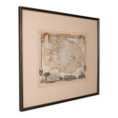
Items Similar to Mid 19th Century Pair of Framed English Maps of Oxford and Cambridge


Want more images or videos?
Request additional images or videos from the seller
1 of 5
Mid 19th Century Pair of Framed English Maps of Oxford and Cambridge
$1,875per set
£1,430.12per set
€1,628.56per set
CA$2,634.95per set
A$2,873.78per set
CHF 1,522.33per set
MX$34,452.54per set
NOK 19,387.78per set
SEK 17,728.68per set
DKK 12,166.94per set
About the Item
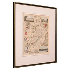
This pair of maps featuring Oxford and Cambridge is beautifully preserved in custom black wood frames. These hand-drawn maps showcase exquisite lettering and a remarkable level of detail, exemplifying the art of mapmaking from the period. Each piece not only serves as a historical artifact but also as a striking decorative element for any space interested in academic heritage or vintage cartography.
England, circa 1860
Dimensions: 19W x 1.5D x 15.5H
- Dimensions:Height: 15.5 in (39.37 cm)Width: 19 in (48.26 cm)Depth: 1.5 in (3.81 cm)
- Sold As:Set of 2
- Style:Victorian (Of the Period)
- Materials and Techniques:
- Place of Origin:
- Period:
- Date of Manufacture:1860
- Condition:Wear consistent with age and use.
- Seller Location:Los Angeles, CA
- Reference Number:Seller: U0105061stDibs: LU79725598613
About the Seller
4.7
Gold Seller
Premium sellers maintaining a 4.3+ rating and 24-hour response times
Established in 1989
1stDibs seller since 2004
226 sales on 1stDibs
Typical response time: 2 hours
- ShippingRetrieving quote...Shipping from: West Hollywood, CA
- Return Policy
More From This Seller
View AllAntique Framed Pen and Ink on Fabric Map of Cornwall from Early 19th Century
Located in Los Angeles, CA
This English fabric map of Cornwall, rendered in pen-and-ink, showcases exquisite hand-drawn details and charming faded sepia tones. Encased in a classic frame, this piece elegantly ...
Category
Antique Early 19th Century English Drawings
Materials
Walnut, Fabric

Map of Rome
Located in Los Angeles, CA
A beautifully reproduced antique map of Rome. A work of remarkable lithographic skill and artistry, the work features a delicate yet bold latin he...
Category
2010s American Victorian Drawings
Materials
Wood, Paper
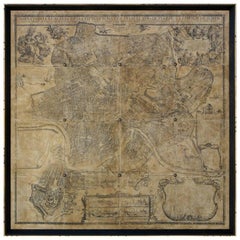
$2,875 / item
Four Reproduction Vintage Panels of Air France World Map
Located in Los Angeles, CA
Reproduction of a beautiful green and blue mid-century Air France world map on four individual panels. The charming illustrations evoke an era of international jet-set style. May be ...
Category
21st Century and Contemporary French Prints
Materials
Wood, Paper
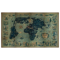
Four Reproduction Vintage Panels of Air France World Map
Located in Los Angeles, CA
Reproduction of beautiful blue and green mid-century Air France world map on four individual panels. The charming illustrations evoke an era of international jet-set style. May be pu...
Category
21st Century and Contemporary French Prints
Materials
Paper, Wood

"Australia News From Home" Print in Gilt Frame
Located in Los Angeles, CA
This "Australia News From Home" lithograph by the celebrated English printmaker George Baxter exemplifies his mastery of color printing. Mounted in a tasteful gilt beveled frame and ...
Category
Antique 1840s English Prints
Materials
Wood

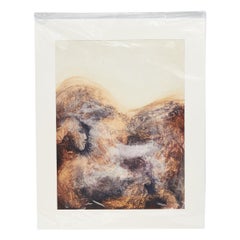
Early 20th Century Watercolor Painting from England
Located in Los Angeles, CA
This English watercolor painting offers a dreamlike vista, employing a deeply earthy color palette of ruddy browns, smoky charcoals, and creamy bone whites. The abstract landscape sw...
Category
Antique Early 1900s English Edwardian Paintings
Materials
Paper
You May Also Like
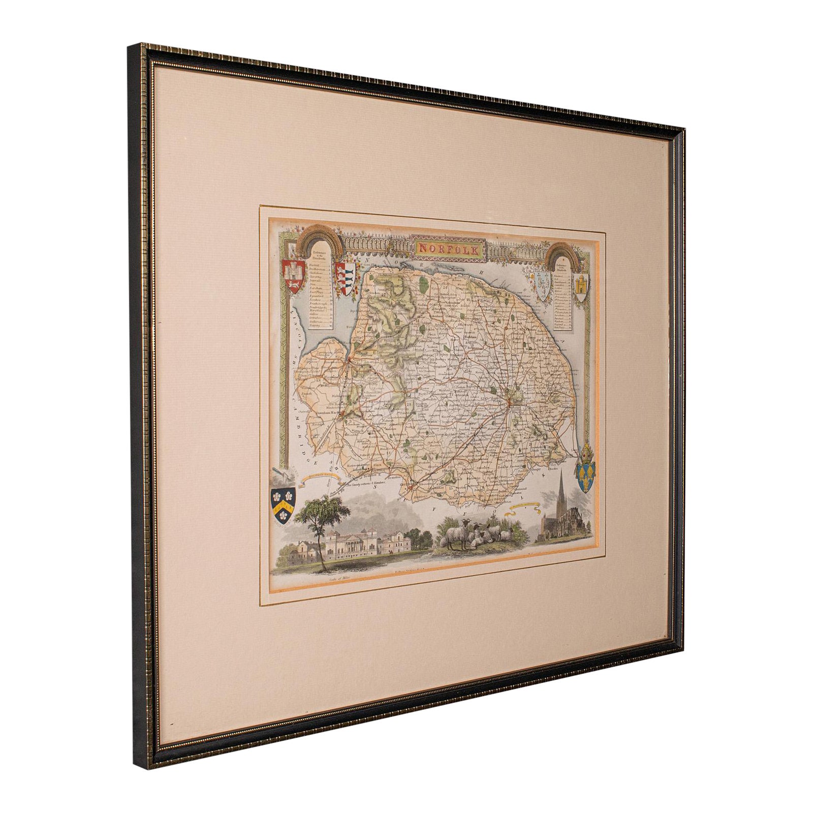
Antique County Map, Norfolk, English, Framed Lithography, Cartography, Victorian
Located in Hele, Devon, GB
This is an antique lithography map of Norfolk. An English, framed atlas engraving of cartographic interest, dating to the mid 19th century and later.
Superb lithography of Norfolk a...
Category
Antique Mid-19th Century British Victorian Maps
Materials
Glass, Wood
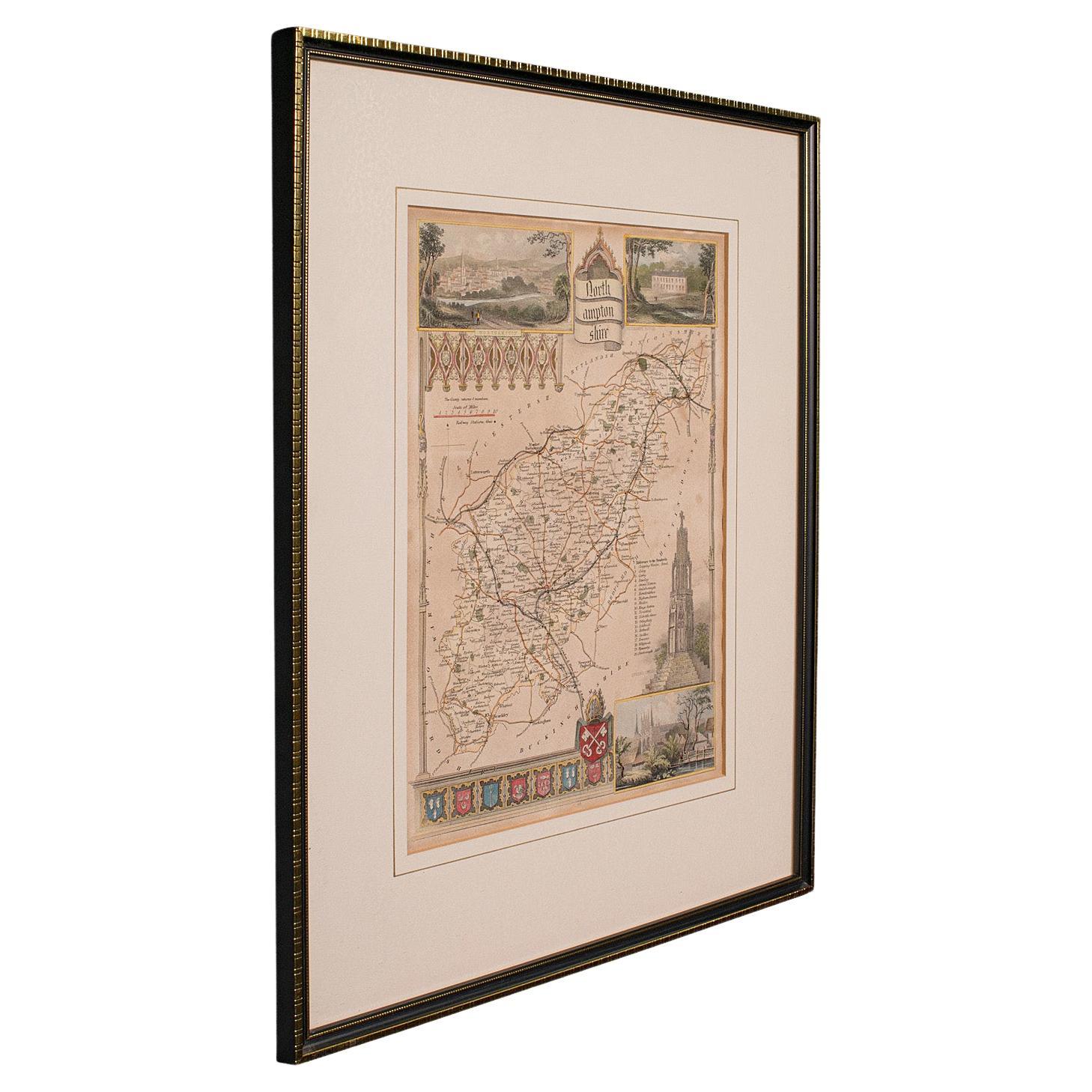
Antique Lithography Map, Northamptonshire, English, Framed Cartography, C.1860
Located in Hele, Devon, GB
This is an antique lithography map of Northamptonshire. An English, framed atlas engraving of cartographic interest, dating to the mid 19th century...
Category
Antique Mid-19th Century British Victorian Maps
Materials
Wood

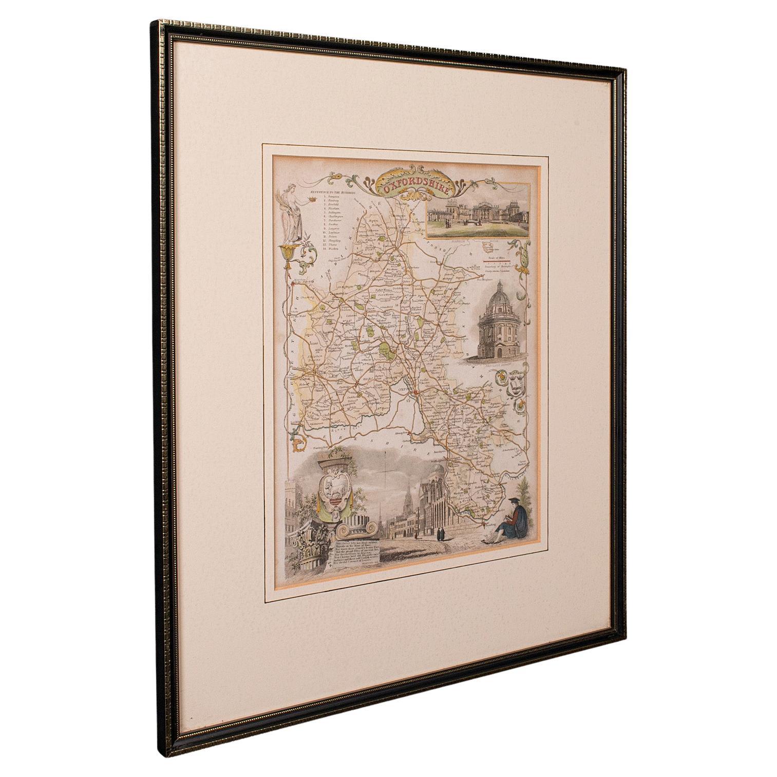
Antique County Map, Oxfordshire, English, Framed Cartography Interest, Victorian
Located in Hele, Devon, GB
This is an antique lithography map of Oxfordshire. An English, framed atlas engraving of cartographic interest, dating to the mid 19th century and later.
Superb lithography of Oxfo...
Category
Antique Mid-19th Century British Mid-Century Modern Maps
Materials
Wood

Antique Lithography Map, Gloucestershire, English, Framed Engraving, Cartography
Located in Hele, Devon, GB
This is an antique lithography map of Gloucestershire. An English, framed atlas engraving of cartographic interest, dating to the mid 19th century ...
Category
Antique Mid-19th Century British Victorian Maps
Materials
Wood

Antique Lithography Map, Hertfordshire, English, Framed Engraving, Cartography
Located in Hele, Devon, GB
This is an antique lithography map of Hertfordshire. An English, framed atlas engraving of cartographic interest, dating to the mid 19th century an...
Category
Antique Mid-19th Century British Victorian Maps
Materials
Wood

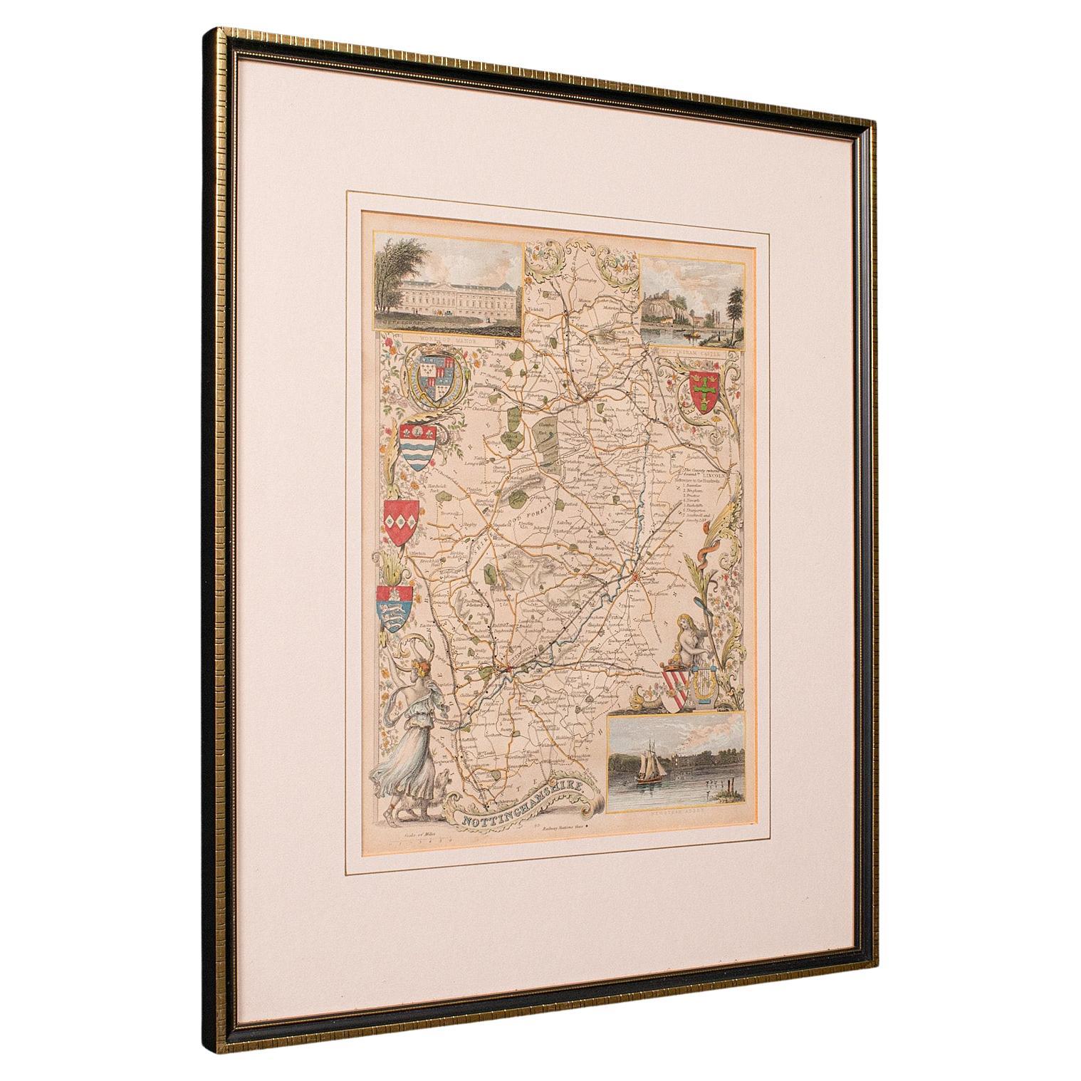
Antique Nottinghamshire Map, English, Framed, Cartographic Interest, Victorian
Located in Hele, Devon, GB
This is an antique lithography map of Nottinghamshire. An English, framed atlas engraving of cartographic interest, dating to the mid 19th century and later.
Superb lithography of ...
Category
Antique Mid-19th Century British Victorian Maps
Materials
Wood
More Ways To Browse
Linen Towel
Lion Head Cabinet
Lion Sculpture Pair French
Lobster Shell
Lucite Pyramid
Mahogany Chest Of Drawers With Key Hole
Mahogany Wellington Chest
Majolica Albarello
Majolica Lion
Majolica Pheasant
Manuscript Leaf
Marble Sample
Marly Horse Sculptures
Meeks Furniture
Mercedes Benz Vintage Cars
Mesa Silver
Metal Canisters Vintage
Mexican Bull