Items Similar to Original Antique Print of Limbourg in present day Belgium, Published circa 1580
Want more images or videos?
Request additional images or videos from the seller
1 of 8
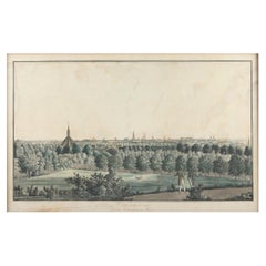
Original Antique Print of Limbourg in present day Belgium, Published circa 1580
$842.50
$1,053.1320% Off
£630.70
£788.3820% Off
€704
€88020% Off
CA$1,159.81
CA$1,449.7620% Off
A$1,267.90
A$1,584.8720% Off
CHF 670.78
CHF 838.4720% Off
MX$15,172.46
MX$18,965.5720% Off
NOK 8,534.66
NOK 10,668.3320% Off
SEK 7,812.62
SEK 9,765.7720% Off
DKK 5,363.61
DKK 6,704.5220% Off
About the Item
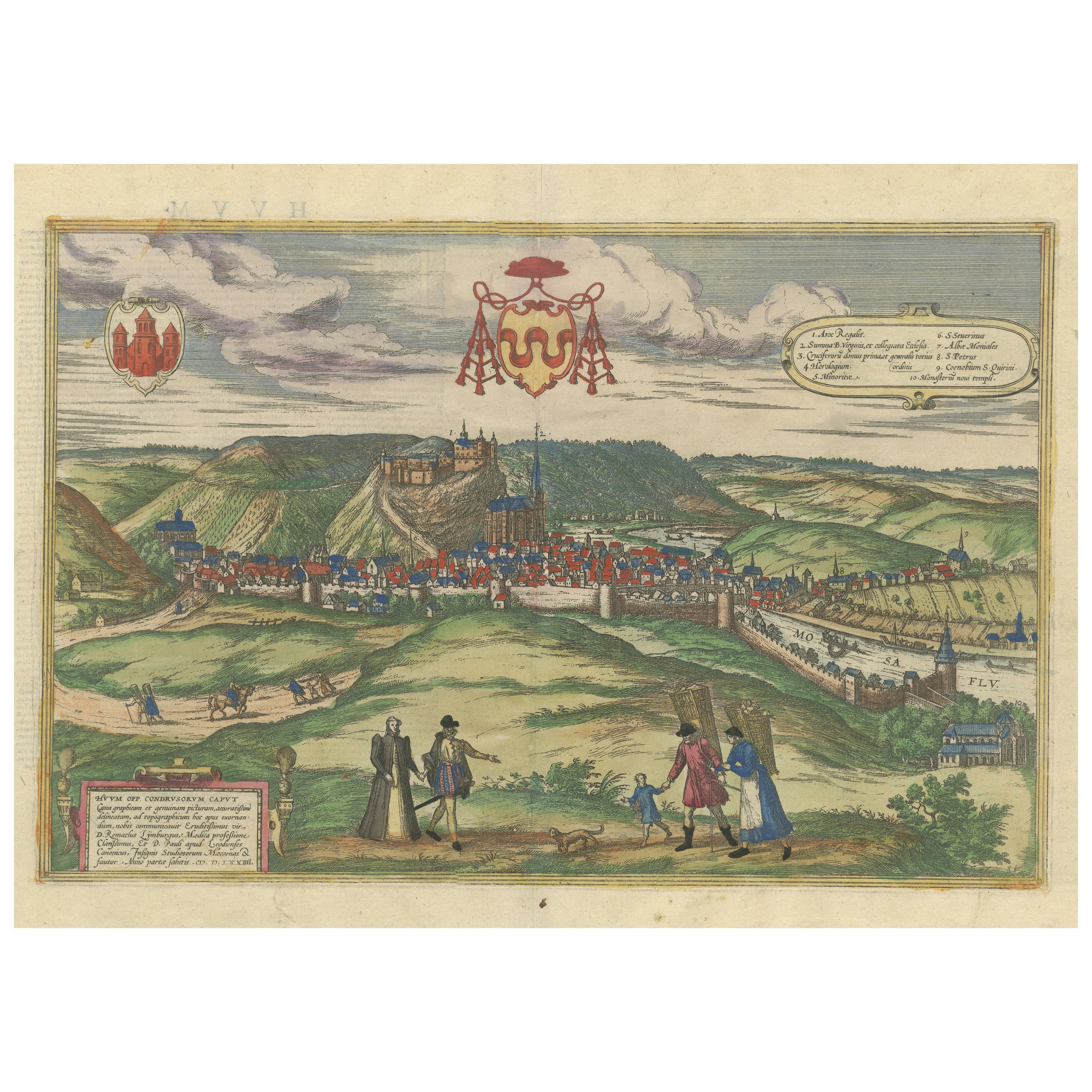
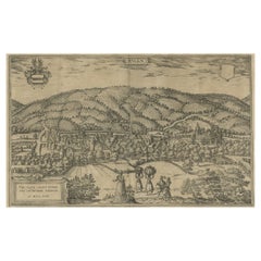
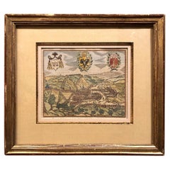
Antique print titled 'Lympurch - Limburgum Oppidum (..)'. Attractive bird’s eye view of Limbourg in present day Belgium. Limbourg (or Limburg) is a city and municipality of Wallonia located in the province of Liège, Belgium.
This print originates from 'Civitates Orbis Terrarum, ...' Part 2. Köln, 1575-1612. The Civitates Orbis Terrarum, or the "Braun
Hogenberg", is a six-volume town atlas and the most excellent book of town views and plans ever published: 363 engravings, sometimes beautifully coloured. It was one of the best-selling works in the last quarter of the 16th century.
- Dimensions:Height: 16.23 in (41.2 cm)Width: 20.2 in (51.3 cm)Depth: 0.02 in (0.5 mm)
- Materials and Techniques:Paper,Engraved
- Period:
- Date of Manufacture:c.1580
- Condition:Original/contemporary hand coloring. Original folding line. General age-related toning. Minor wear, Latin text on verso. Please study image carefully.
- Seller Location:Langweer, NL
- Reference Number:Seller: BG-13526-11stDibs: LU3054338209802
About the Seller
5.0
Recognized Seller
These prestigious sellers are industry leaders and represent the highest echelon for item quality and design.
Platinum Seller
Premium sellers with a 4.7+ rating and 24-hour response times
Established in 2009
1stDibs seller since 2017
2,792 sales on 1stDibs
Typical response time: <1 hour
- ShippingRetrieving quote...Shipping from: Langweer, Netherlands
- Return Policy
More From This Seller
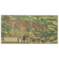
View AllOriginal Antique Print of Huy in present day Belgium, Published circa 1580
Located in Langweer, NL
Antique print titled 'Huum Opp. Condrusorum Caput (..)'. Attractive bird’s eye view of Huy in present day Belgium. The view shows the city from the northeast. Huy, a municipality of ...
Category
Antique 16th Century Prints
Materials
Paper
$842 Sale Price
20% Off
Free Shipping
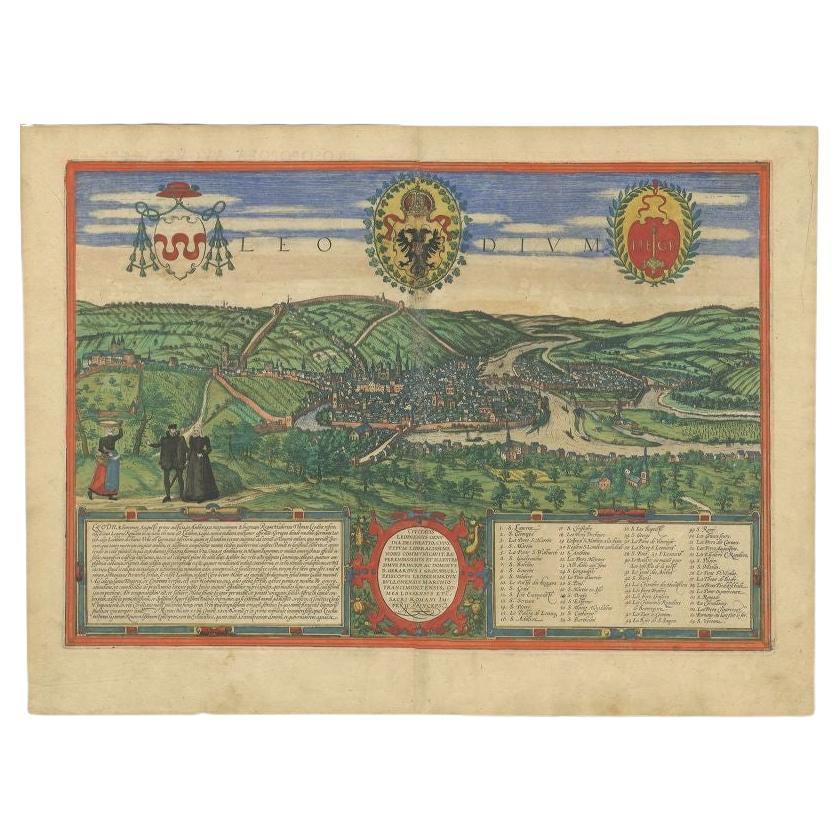
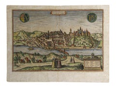
Antique Print of Liège / Luik in Belgium by Braun
Hogenberg, 1575
Located in Langweer, NL
Antique print titled 'Leodium'. View of Liège / Luik, Belgium with surrounding hills and the city wall. With text explaining the origins of Liège, a cartouche expressing thanks to th...
Category
Antique 16th Century Prints
Materials
Paper
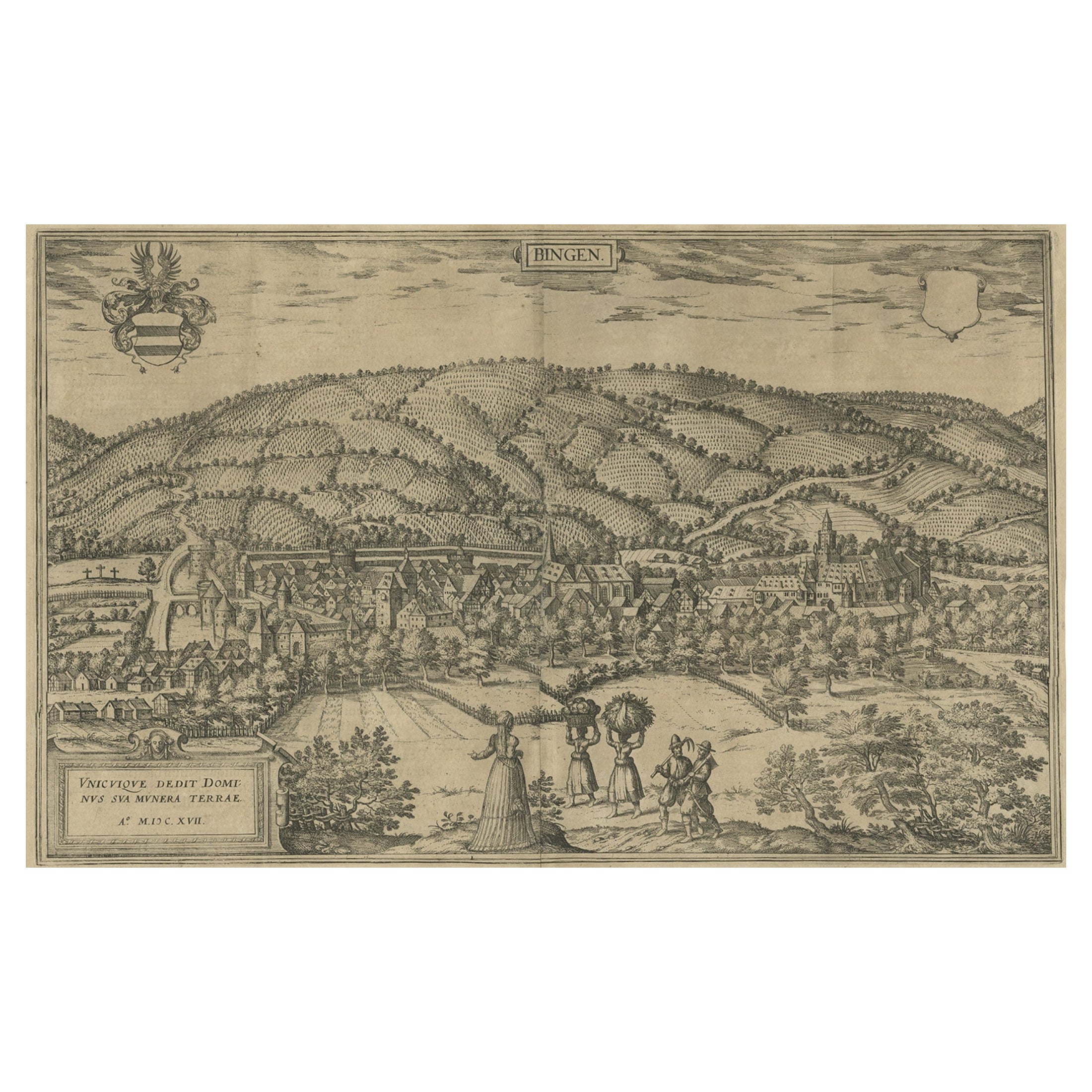
Antique Print of Büdingenin Germany by Braun
Hogenberg, 1617
Located in Langweer, NL
Antique map titled 'Bingen'. Bird's eye-view of Büdingen, Germany. The view shows a city surrounded by vineyards and well fortified with walls and moats. On the right is the castle w...
Category
Antique 17th Century Prints
Materials
Paper
$277 Sale Price
20% Off
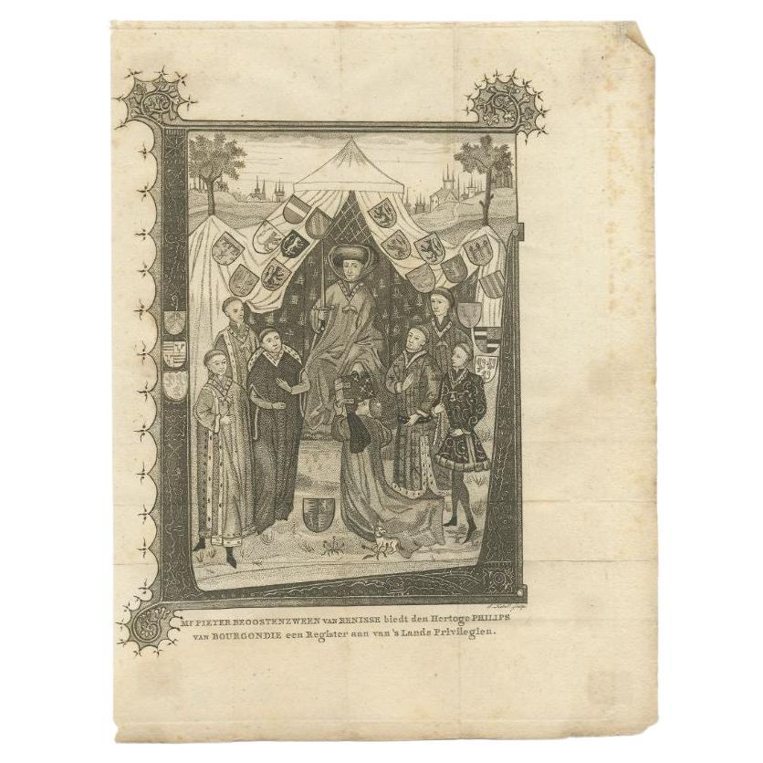
Antique Print of the Duke Philips of Burgundy, circa 1795
Located in Langweer, NL
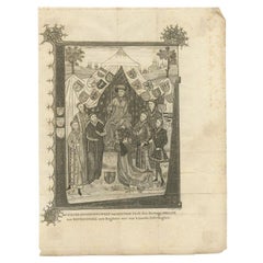
Antique print titled 'Mr. Pieter Beoostenzween van Renisse biedt den hertoge Philips van Bourgondie een register aan vans lands Privilegien'. This print originates from 'H. Wijn, Byv...
Category
Antique 18th Century Prints
Materials
Paper
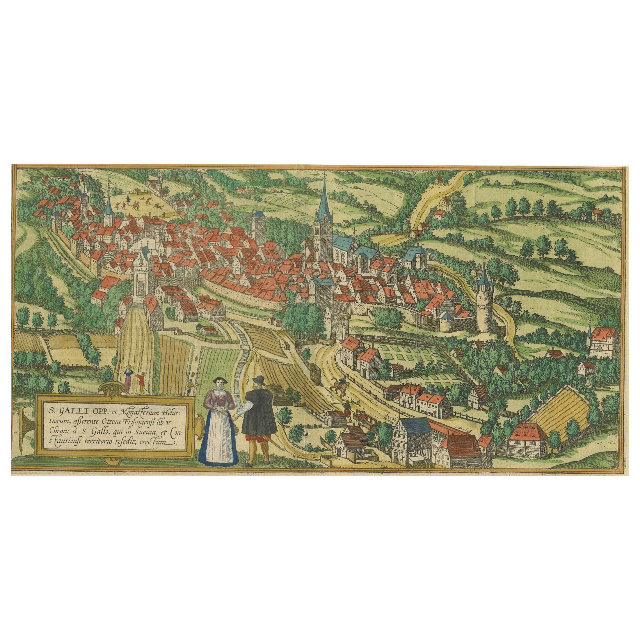
Engraving of St. Gallen and its Monastery, from Civitates Orbis Terrarum (1575)
Located in Langweer, NL
Description of the Engraving: Braun & Hogenberg’s "S. Galli Opp. et Monasterium Heluetiorum" from Civitates Orbis Terrarum (1575)
This is an original, hand-colored copper engraving ...
Category
Antique 16th Century Maps
Materials
Paper
$660 Sale Price
20% Off
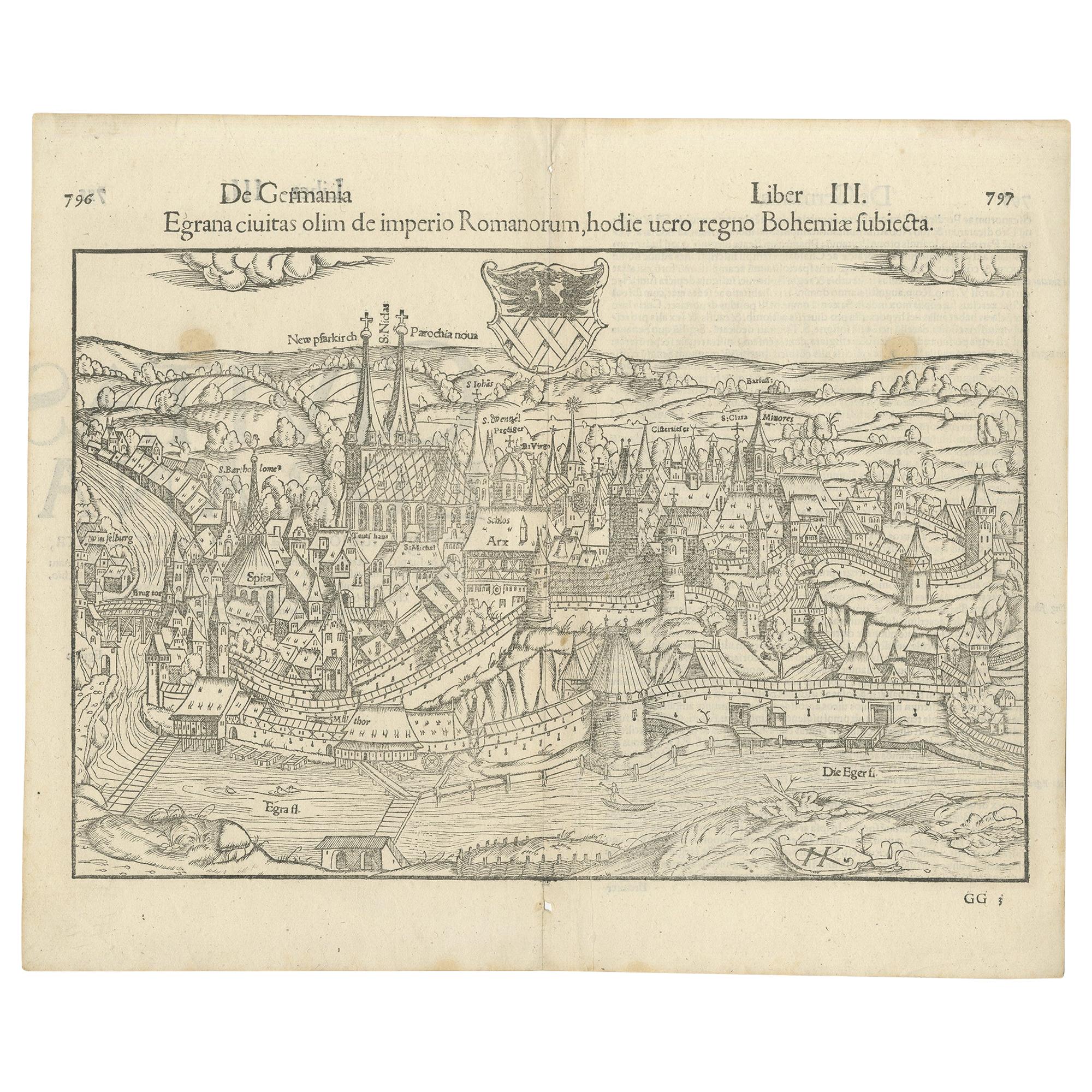
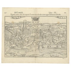
Antique Print with a View of the City of Eger
Cheb
by Münster
1554
Located in Langweer, NL
Antique print titled 'Egrana civitas olim de imperio Romanorum (..)'. Important early view of the walled town of Eger, or Cheb, in the Czech Republic, including the city's coat of ar...
Category
Antique 16th Century Prints
Materials
Paper
$382 Sale Price
20% Off
You May Also Like
Early 19th Century Framed Lithograph of a Work by Sebastian Munster
1488-1522
Located in Dallas, TX
Early 19th century framed lithograph of a work by Sebastian Munster (1488-1522) is a new printing using the original woodcut dating to the 16th centu...
Category
Antique Early 19th Century Swiss Renaissance Revival Prints
Materials
Paper
The Duchy Of Luxembourg - Jacques Surhon De Mons - 1551 - édouard Kutter Edition
Located in BARSAC, FR
Engraving representing the map of the Duchy of Luxembourg in 1551, after Jacques Surhon de Mons 20th century edition from Edouard Kutter editions in Luxembourg
In its luxurious o...
Category
Mid-20th Century Luxembourgish Medieval Prints
Materials
Paper
Canterbury: An Original 16th C. Framed Hand-colored Map by Braun
Hogenberg
By Franz Hogenberg
Located in Alamo, CA
This is a framed 16th century map and city view of Canterbury, England entitled "Cantuarbury" by Braun & Hogenburg, from their famous landmark atlas of city views 'Civitates Orbis Terrarum' (Atlas of the Cities of the World), which was first published in Cologne, Germany in 1572. The map of Canterbury was first published in 1588. It depicts a detailed birdseye view of the completely walled and fortified city of Canterbury, with its cathedral the most prominent feature. The coat of arms of England, Canterbury, and the Archbishop of Canterbury are included.
This beautifully hand-colored map is presented in a gold-colored wood frame with a beaded inner trim and a paprika-colored mat that highlights details in the map. The frame measures 18.75" high by 22.25" wide by 0.875" deep. There is a central vertical fold, as issued. The map is in excellent condition.
Braun and Hogenberg's 'The Civitates Orbis Terrarum' was the second atlas of maps ever published and the first atlas of cities and towns of the world. It is one of the most important books published in the 16th century. Most of the maps in the atlas were engraved by Franz Hogenberg and the text, with its descriptions of the history and additional factual information of the cities, was written by a team of writers and edited by Georg Braun. The work contained 546 bird-eye views and map views of cities and towns from all over the world. It gave graphic representation of the main features of the illustrated cities and towns, including the buildings and streets. Although the ordinary buildings are stylized, the principal buildings are reproduced from actual drawings created on location. The principal landmarks and streets can still be recognized today. In addition, the maps often include the heraldic arms of the city, the nature of the surrounding countryside, the important rivers, streams and harbors, even depicting stone bridges, wooden pontoons, flat-bottomed ferries, ships and working boats, wharves and jetties, as well as land-based activities, including horsemen, pedestrians, wagons, coaches, and palanquins. Small vignettes are often included which illustrate the trade, occupations and habits of the local inhabitants, such as agriculture, paper-making and textiles, as well as local forms of punishment, such as gibbets, wheels, floggings etc. Large figures dressed in their local costume are often presented out of proportion in the foreground. The aim of the authors was to give as much information as possible in a pleasing visual form. They succeeded in creating maps that were both informative and decorative works of art. The atlas is a wonderful glimpse of life in medieval Europe.
Georg Braun (1541-1622) was German Catholic...
Category
16th Century Old Masters Landscape Prints
Materials
Engraving

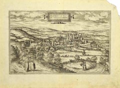
View of Blanmont - Etching by G. Braun and F. Hogenberg - Late 16th Century
By Franz Hogenberg
Located in Roma, IT
This map of Blanmont is an original etching realized by George Braun and Franz Hogenberg as part of the famous Series "Civitates Orbis Terrarum".
The “Civitates Orbis Terrarum” (At...
Category
16th Century Figurative Prints
Materials
Etching
Map of Meissen - Etching by George Braun - Late 16th Century
By Franz Hogenberg
Located in Roma, IT
This map of Meissen is an original etching realized by George Braun and Franz Hogenberg as part of the famous Atlas "Civitates Orbis Terrarum".
The s...
Category
16th Century Old Masters Figurative Prints
Materials
Etching
Hand Colored Copperplate Engraving of Copenhagen, Denmark
Located in Kastrup, DK
Hand-colored copperplate engraving depicting an interesting old view of Copenhagen seen from Frederiksberg Castle Gardens, approximate. 1790-1800.
Framed in a mahogany frame from sam...
Category
Antique Late 18th Century Danish Louis XVI Prints
Materials
Glass, Mahogany, Paper
More Ways To Browse
Yukimi Lanterns
17th Century Pearl
18th Century Russian Icon
1920s Wicker Furniture
1968 Desk
1970s Mirrored Bar
19th Century Damask Chairs
4 Panel Asian Silk Screens
4 Panel Japanese Wall Art
70s Mexican
Adoration Shepherds
African Ebony Wood
Air Du Temps Nina Ricci
Alder Root
Alfredo Barbini Bird
American Federal Chest
Ancient Chinese Ceramics
Antique Bell Stand