1 of 7
Rare Hudson New York Aerial Map, 1923
$2,750List Price
About the Item
- Dimensions:Height: 27.5 in (69.85 cm)Width: 41.5 in (105.41 cm)Depth: 1 in (2.54 cm)
- Period:
- Date of Manufacture:1923
- Condition:Wear consistent with age and use.
- Seller Location:North Beninngton, VT
- Reference Number:1stDibs: LU100099885781
Authenticity Guarantee
In the unlikely event there’s an issue with an item’s authenticity, contact us within 1 year for a full refund. DetailsMoney-Back Guarantee
If your item is not as described, is damaged in transit, or does not arrive, contact us within 7 days for a full refund. Details24-Hour Cancellation
You have a 24-hour grace period in which to reconsider your purchase, with no questions asked.Vetted Professional Sellers
Our world-class sellers must adhere to strict standards for service and quality, maintaining the integrity of our listings.Price-Match Guarantee
If you find that a seller listed the same item for a lower price elsewhere, we’ll match it.Trusted Global Delivery
Our best-in-class carrier network provides specialized shipping options worldwide, including custom delivery.You May Also Like
1872 Map of Hudson, Union and Essex Counties, New Jersey
Located in Savannah, GA
A hand-colored topographical map of New Jersey’s Hudson, Union and Essex Counties from the Atlas of New Jersey by F.W. Beers, published in 1872.
sight 15 by 22½ inches
frame 20 by...
Category
Antique 1870s American Prints
Materials
Glass, Wood, Paper

Antique Map of New York by Johnson
1872
Located in Langweer, NL
Antique map titled 'Johnson's New York'. Original map showing New York, with an inset map of Long Island. This map originates from 'Johnson's New Il...
Category
Antique Late 19th Century Maps
Materials
Paper

City of Albany, New York, Hudson River View – Antique Engraving, 1827
Located in Langweer, NL
City of Albany, New York, Hudson River View – Antique Engraving, 1827
This finely detailed early 19th-century engraving titled City of Albany, in the State of New York presents a pa...
Category
Antique 1720s British Prints
Materials
Paper

$310
H 7.72 in W 9.85 in D 0.01 in
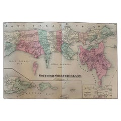
Antique Map Long Island, Southold, Shelter Island, Orient, New York
By Beers Atlas Co.
Located in Sag Harbor, NY
Antique map of Long Island, Southold, Shelter Island, Orient, Great details, Names of homes, Roads and Businesses in 1870. Unframed. This is...
Category
Antique Mid-19th Century American Early Victorian Prints
Materials
Paper
$1,180 Sale Price
20% Off
Free Shipping
H 15.5 in W 24 in D 0.01 in
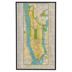
Mid-Century Map of New York, Framed in Black Lacquered Wood
Located in Barcelona, ES
Mid-Century Map of New York, Framed in Black Lacquered Wood
Beautiful mid-century printed map of New York, showcasing the city’s iconic grid and urban layout with vintage charm and ...
Category
Vintage 1950s American Mid-Century Modern Prints
Materials
Paper
$1,671 Sale Price
20% Off
H 29.14 in W 17.13 in D 0.6 in
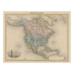
Antique Map of North America with Vignette of the Statue of Liberty, New York
Located in Langweer, NL
Antique map titled 'Amérique du Nord'. Original antique map of North America. Meticulous information from the new Alaska Territory and through the Caribbean Windward Islands. Very go...
Category
Antique Late 19th Century Maps
Materials
Paper
$439 Sale Price
20% Off
Free Shipping
H 15.44 in W 20.4 in D 0.02 in
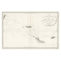
Uncommon Rare Map Showing The Louisiade Archipelago, Papua New Guinea, ca.1798
Located in Langweer, NL
Antique map titled 'Carte de la Partie Septentrionale de l'Archipel de la Louisiade'.
Uncommon map showing the area around the Louisiade Archipelago, named for Louis XV by Louis ...
Category
Antique 1790s Maps
Materials
Paper
$802 Sale Price
20% Off
H 22.84 in W 33.47 in D 0 in
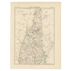
Antique Map of New Hampshire
Located in Langweer, NL
Antique map titled 'New Hampshire'. Original antique map of New Hampshire, United States. This print originates from 'Encyclopaedia Britan...
Category
Antique Late 19th Century Maps
Materials
Paper
Antique Map of New Jersey
Located in Langweer, NL
Antique map titled 'Colton's New Jersey'. This rare hand colored map of New Jersey is a copper plate engraving dating to 1855. Produced by the import...
Category
Antique Mid-19th Century Maps
Materials
Paper

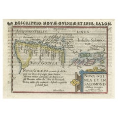
Rare Original Miniature Map of Papua New Guinea and the Salomon Islands, 1600
Located in Langweer, NL
Very handsome original old coloured copper engraving of Papua and the Solomon Island. Title of the map 'Descriptio Novae Guneae et Inss. Salom.
On the reverse text in Latin.
Ve...
Category
Antique Early 1600s Maps
Materials
Paper
$644
H 4.73 in W 7.09 in D 0 in
Still Thinking About These?
All Recently ViewedMore Ways To Browse
Map Of Ny
Vintage Furniture Wellington
Vintage Horse Decor
Vintage Ivory Tusk
Vintage Manhattan Glass
Vintage Metal Spring Chair
Wagner Opera
Wagon Train
Watch Cabinet
Wedgwood Etruria
Whale Sign
White Fluted Columns
White Henredon
Wire Kitchen Cabinet
Wire Sculpture Large
Wood Horse Stand
Wood Kaleidoscope
Wood Swan Table