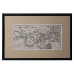
Items Similar to Set of 8 Battle Plans, Rivoli, Arcole, Mantua, Marengo, Hohenlinden, 1852
Want more images or videos?
Request additional images or videos from the seller
1 of 10
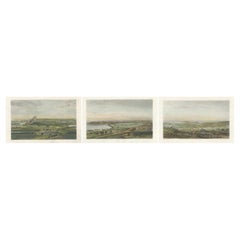
Set of 8 Battle Plans, Rivoli, Arcole, Mantua, Marengo, Hohenlinden, 1852
$384.32per set
$480.40per set20% Off
£284.68per set
£355.85per set20% Off
€320per set
€400per set20% Off
CA$525.85per set
CA$657.31per set20% Off
A$572.16per set
A$715.20per set20% Off
CHF 302.95per set
CHF 378.69per set20% Off
MX$6,883.47per set
MX$8,604.34per set20% Off
NOK 3,846.81per set
NOK 4,808.51per set20% Off
SEK 3,519.56per set
SEK 4,399.45per set20% Off
DKK 2,438.66per set
DKK 3,048.33per set20% Off
About the Item
Set of 8 battle plans including battle plans of Rivoli, Arcole, Mantua, Marengo and Hohenlinden. These prints originate from 'Atlas to Alison's history of Europe: constructed and arranged under the direction of Sir Archibald Alison (..)' by W.
A.K. Johnston. Published 1852.
- Dimensions:Height: 7.09 in (18 cm)Width: 9.06 in (23 cm)Depth: 0.02 in (0.5 mm)
- Sold As:Set of 8
- Materials and Techniques:
- Period:
- Date of Manufacture:1852
- Condition:The plan of Mantua is double, but different outline coloring. General age-related toning, minor wear. Blank verso. Please study images carefully.
- Seller Location:Langweer, NL
- Reference Number:Seller: BG-12209-95 + 71stDibs: LU3054321408042
About the Seller
5.0
Recognized Seller
These prestigious sellers are industry leaders and represent the highest echelon for item quality and design.
Platinum Seller
Premium sellers with a 4.7+ rating and 24-hour response times
Established in 2009
1stDibs seller since 2017
2,816 sales on 1stDibs
Typical response time: 1 hour
- ShippingRetrieving quote...Shipping from: Langweer, Netherlands
- Return Policy
More From This Seller
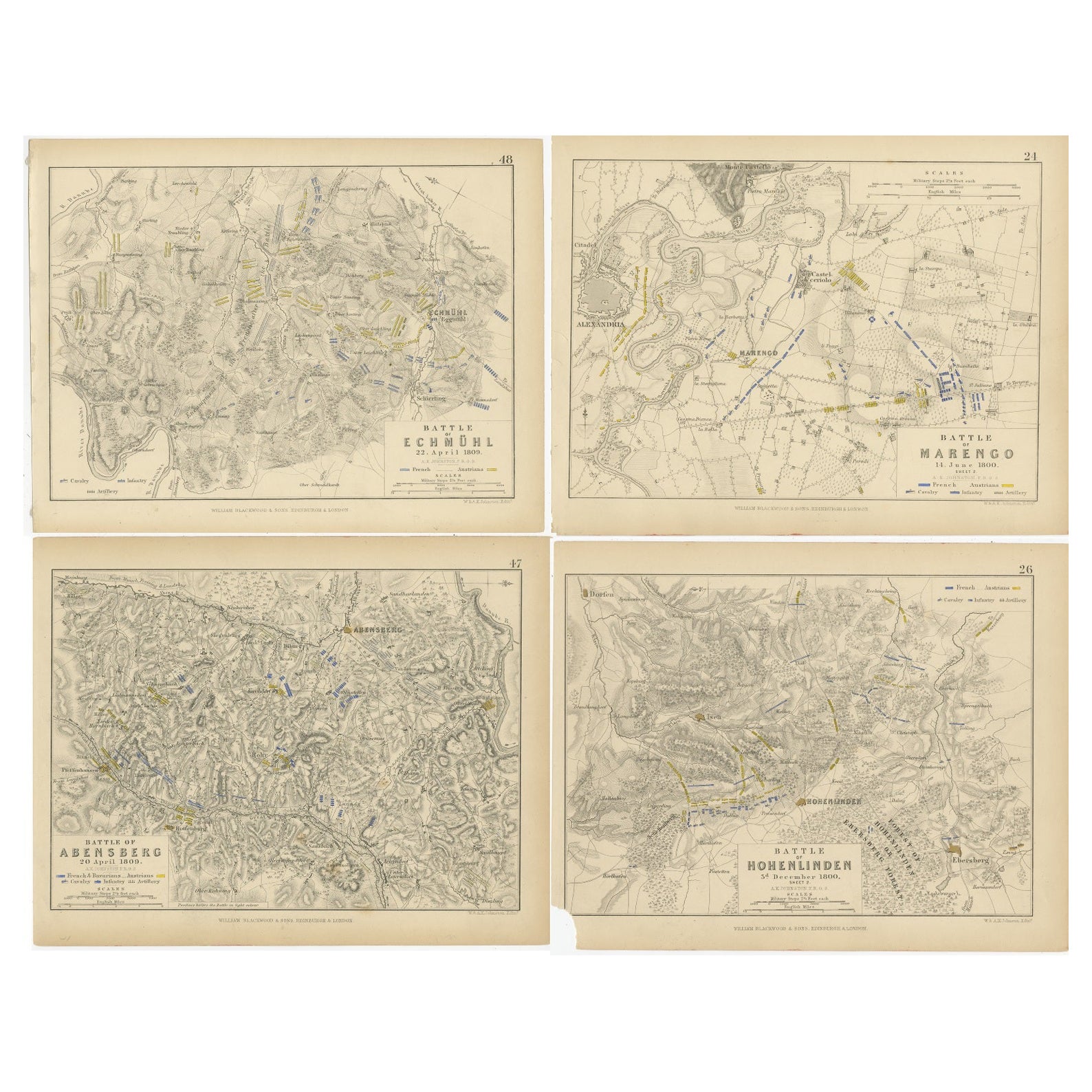
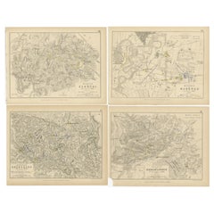
View AllFour Antique Battle Plans of Echmühl, Hohenlinden, Abensberg and Marengo, 1852
Located in Langweer, NL
Set of 4 antique battle plans. Included are:
1) Battle of Hohenlinden 3d. December 1800
2) Battle of Echmühl 22. April 1809
3) Battle of Arensberg 20. Ap...
Category
Antique Mid-19th Century Maps
Materials
Paper
$230 Sale Price / set
20% Off
Free Shipping
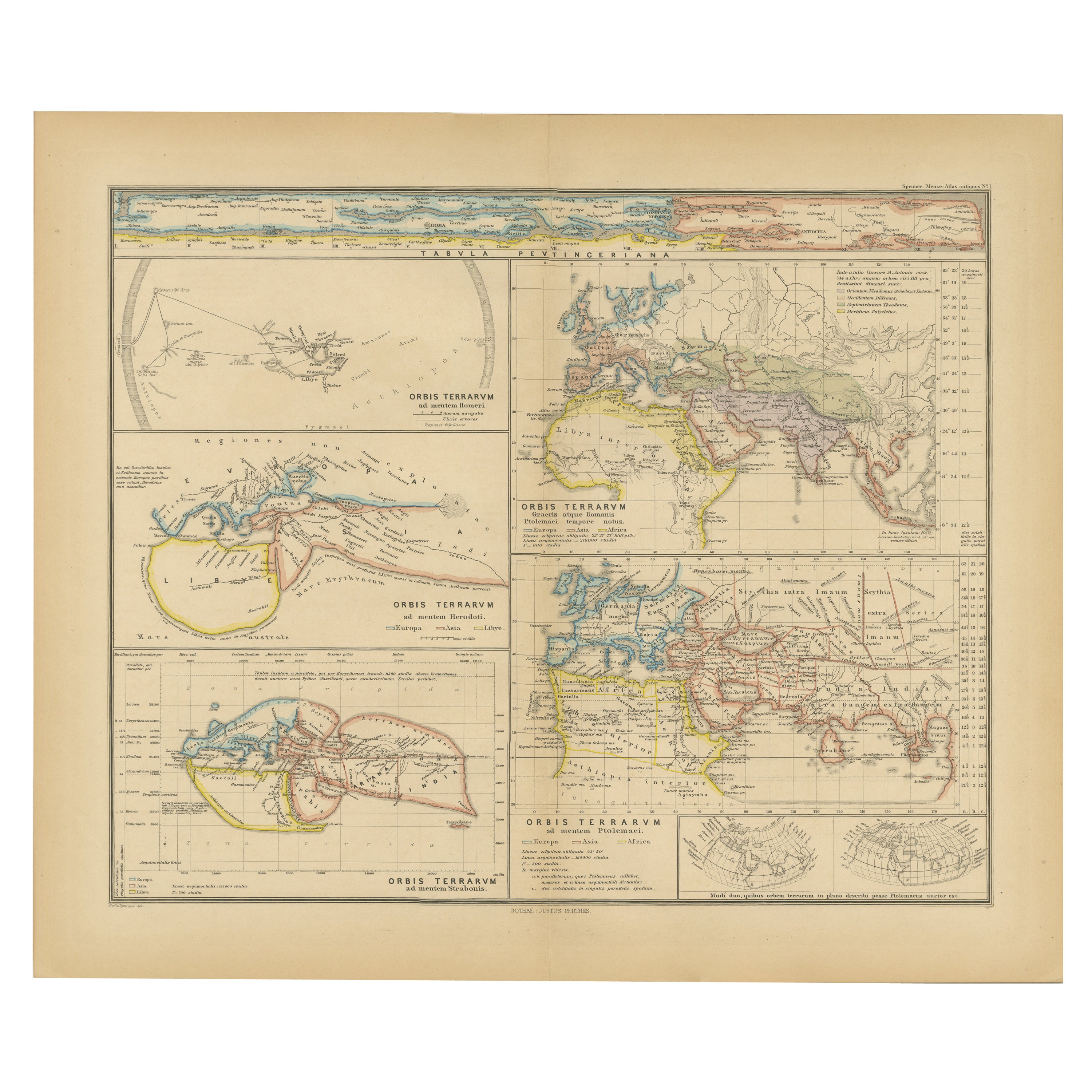
Original Old Composite of Several Maps of the Ancient World on One Sheet, 1880
Located in Langweer, NL
This original antique map is from Karl Spruner von Merz's "Atlas Antiquus", later edited by Theodorus Menke. The map is a detailed depiction of the ancient world. The atlas it comes ...
Category
Antique 1880s Maps
Materials
Paper
$355 Sale Price
20% Off
Free Shipping
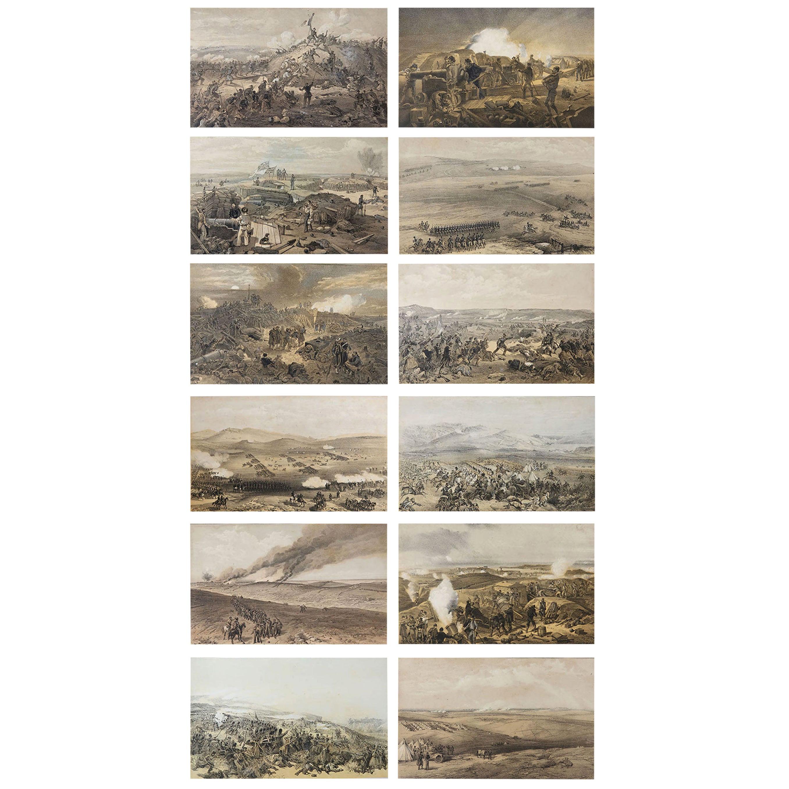
Napoleonic Battles Collection: Corunna, Gaeta and Another Engagement, 1860
Located in Langweer, NL
This collection features three exquisite 19th-century steel engravings depicting key battles and sieges from the Napoleonic Wars. These prints, created by Théodore Yung and originating from the Album de Vingt Batailles de la Révolution et de l'Empire, showcase moments of historical significance, skillfully captured with artistic precision and hand-painted watercolors.
1. Bataille de la Corogne (16 Janvier 1809): This print depicts the Battle of Corunna, where the French army under Marshal Soult attacked British forces commanded by Sir John Moore...
Category
Antique 1860s Prints
Materials
Paper
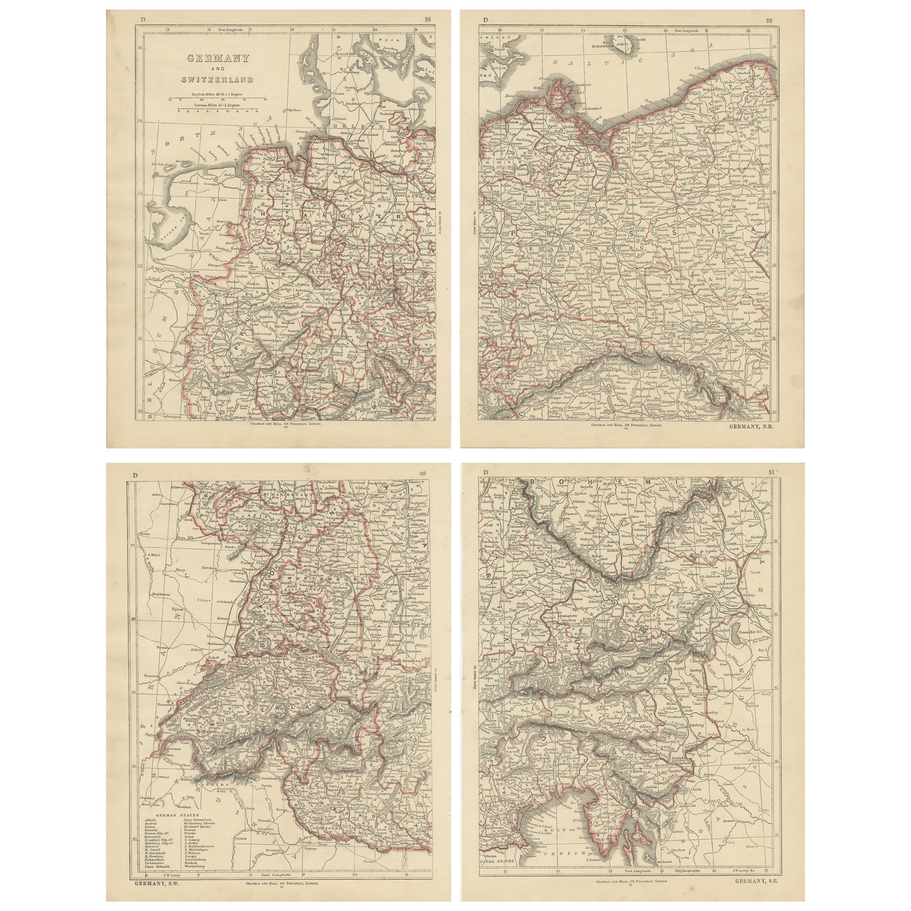
Antique Map of Germany and Switzerland by Lowry,
1852
Located in Langweer, NL
Antique map titled 'Germany and Switzerland'. Four individual sheets of Germany and Switzerland. This map originates from 'Lowry's Table Atlas constructed and engraved from the most ...
Category
Antique Mid-19th Century Maps
Materials
Paper
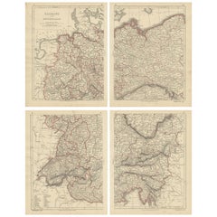
$240 Sale Price / set
20% Off
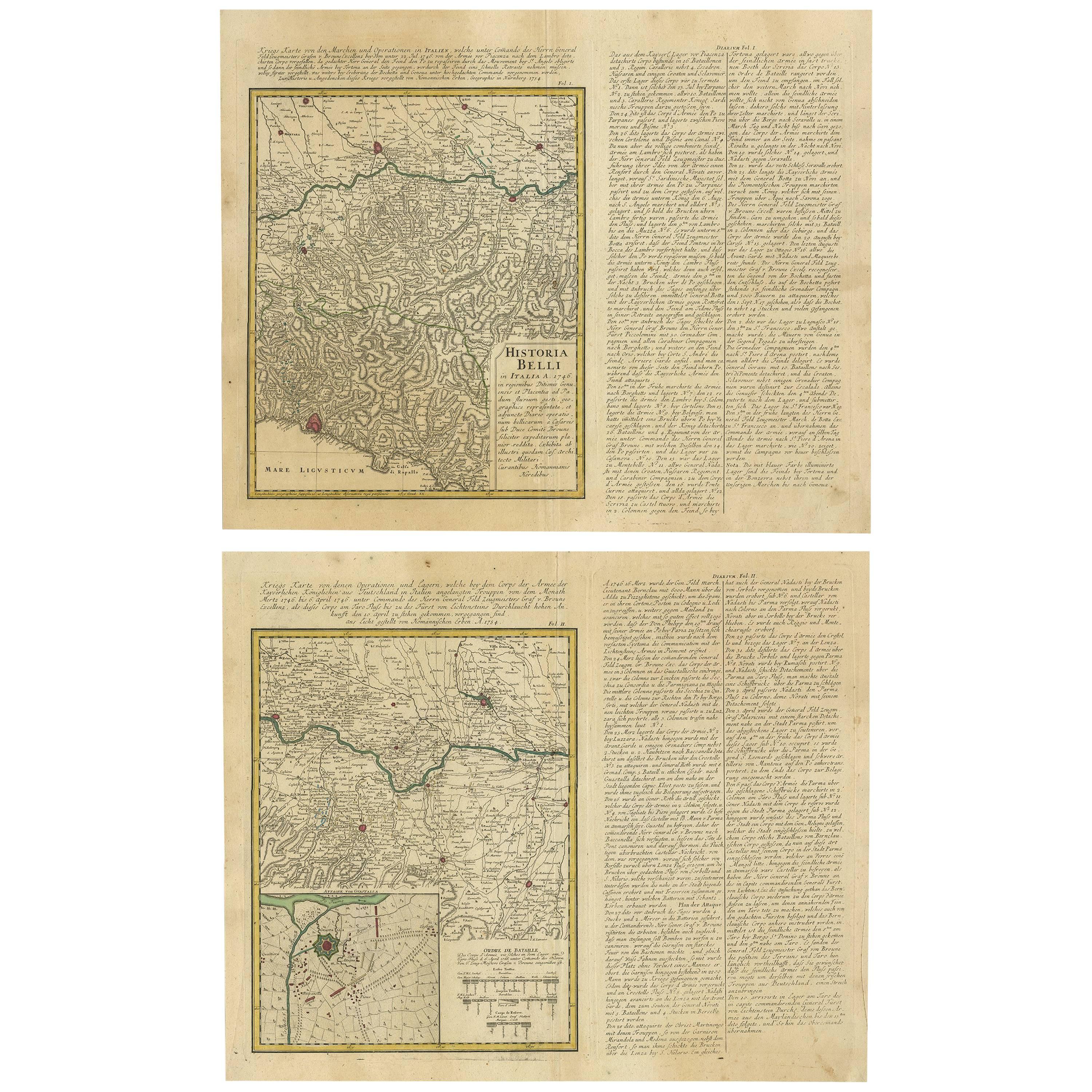
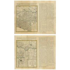
Set of Two Antique Maps of Northern Italy by Homann Heirs, 1754
Located in Langweer, NL
Set of two maps of northern Italy showing the position of troups during the war in April and March 1746. The area covered includes the course of the River Po between Valenza (north of Alexandria) and San Benedetto...
Category
Antique Mid-18th Century Maps
Materials
Paper
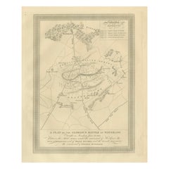
A Plan of the Glorious Battle of Waterloo: Allied Victory Over Napoleon, 1815
Located in Langweer, NL
Title: A Plan of the Glorious Battle of Waterloo: Allied Victory Over Napoleon, 1815
Description:
This finely engraved 1816 map presents a strategic overview of the Battle of W...
Category
Antique 1810s English Prints
Materials
Paper
You May Also Like
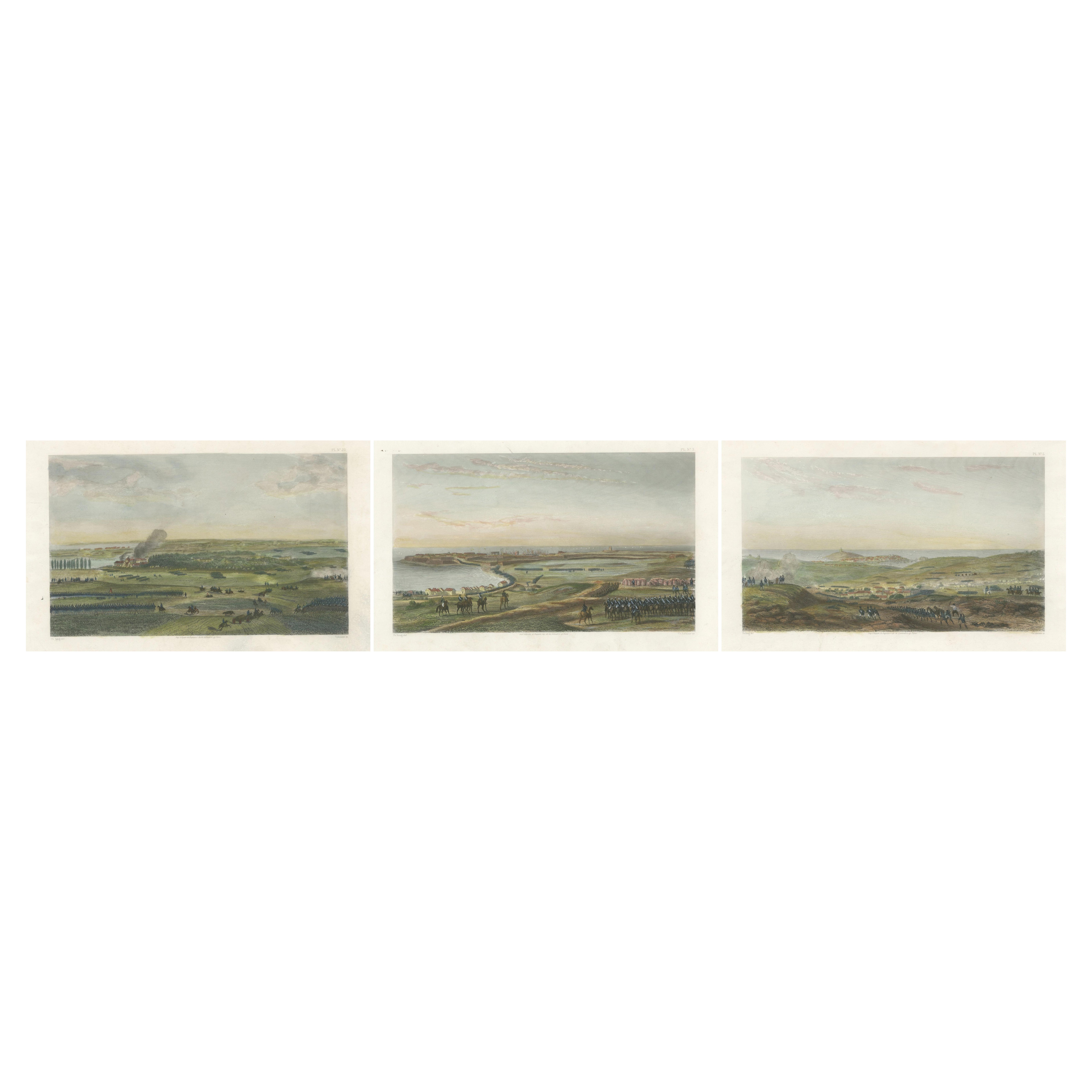
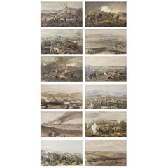
Set of 12 Original Antique Prints of the Crimean Wars, circa 1860
Located in St Annes, Lancashire
Great set of 12 military prints.
All related to the Crimean Wars.
Lithographs in original colors after William Simpson.
Published by P
D C...
Category
Antique 1830s English Other Prints
Materials
Paper
Old Map Depicting the Entire Earth
s Surface Divided into Six Parts France 1850
Located in Milan, IT
Map depicting the entire earth's surface divided into six parts which depicts the position of peoples on Earth based on the assumption that it is impossible for each people to have t...
Category
Antique Mid-19th Century French Maps
Materials
Glass, Wood, Paper

Plan of Paris, France, by A. Vuillemin, Antique Map, 1845
Located in Colorado Springs, CO
This large and detailed plan of Paris was published by Alexandre Vuillemin in 1845. The map conveys a wonderful amount of information and is decorated throughout with pictorial vigne...
Category
Antique 1840s American Maps
Materials
Paper

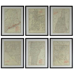
Set of 6 Original Vintage Maps of American States, circa 1900
Located in St Annes, Lancashire
Wonderful set of 6 vintage maps.
Random American states including Maine, Utah, New Hampshire, Nevada, Vermont and New Mexico.
Monochrome with red color outline.
Published by Rand,...
Category
Antique Early 1900s American Edwardian Decorative Art
Materials
Paper
1844 Map "Russia in Eurpoe, Part II to Part VIII", 7 Maps Ric.r023
Located in Norton, MA
1844 Map "Russia in Eurpoe, Part II to Part VIII"
7 Maps
Ric.r023
Fine, original, steel-engraved Map of Russia in Europe Part II t oPart VIII, by the Society for the Diffusion of Useful Knowledge. Detailed map of the regions to the northeast of Moscow. Including Arkhangel, Vologda, Viatka, Perm, Olonetz, Iaroslavl. The SDUK began its map publishing project under the leadership of Captain Francis Beaufort R.N. in 1829, and published the maps in parts, haltingly, over the next 15 years, completing the series in 1844, finally permitting the publication of a whole atlas. Many of the maps were actually drawn by Beaufort, who at the time was the Hydrographer to the Royal Navy, and all were closely supervised by him. J. & C. Walker worked closely with Beaufort in engraving the maps. Finely engraved, carefully researched, the maps set...
Category
Antique 19th Century Unknown Maps
Materials
Paper

Battle of Grocka Campaign Map, 1753 - James Oglethorpe, John Lindsay, Henry Köpp
Located in Savannah, GA
A campaign map of the Battle of Grocka, 1753.
Drawn and engraved by Henry Köpp for the journals of John Lindsay, 20th Earl of Crawford and dedicated to James Oglethorpe.
sight:...
Category
Antique 1750s British Prints
Materials
Glass, Wood, Paper
More Ways To Browse
Alejandro Selkirk Island
Antique Farm Animal Prints
Antique French Horse Prints
Antique Furniture Building Plans
Antique Furniture Staten Island
Arthur Weaver Golf
Atlantic Sturgeon
Cesar Daly
Chinese Bird Prints
Crimean Tatar
Ehret Botanical Prints
Engraving Giraffe
Engravings Hunt Scenes
Fox Hunting Lithographs
Frohse Anatomical Chart
Gold Framed Botanical Prints
Herman Miller Prints Summer Picnic
Hoi Lebadang Signed Lithograph