Items Similar to Solor Island View, Indonesian Harbor Engraving, French Voyage Plate c.1700
Want more images or videos?
Request additional images or videos from the seller
1 of 10
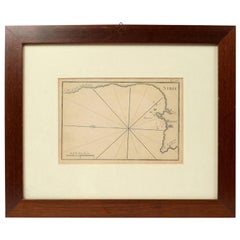
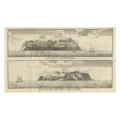
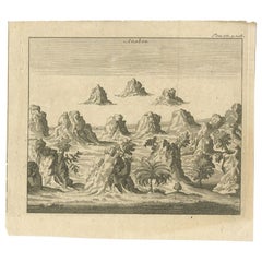
Solor Island View, Indonesian Harbor Engraving, French Voyage Plate c.1700
$252.40
£186.96
€210
CA$345.27
A$376.33
CHF 198.96
MX$4,530.30
NOK 2,525.33
SEK 2,315.21
DKK 1,600.08
About the Item
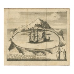
Solor Island View, Indonesian Harbor Engraving, French Voyage Plate c.1700
Description:
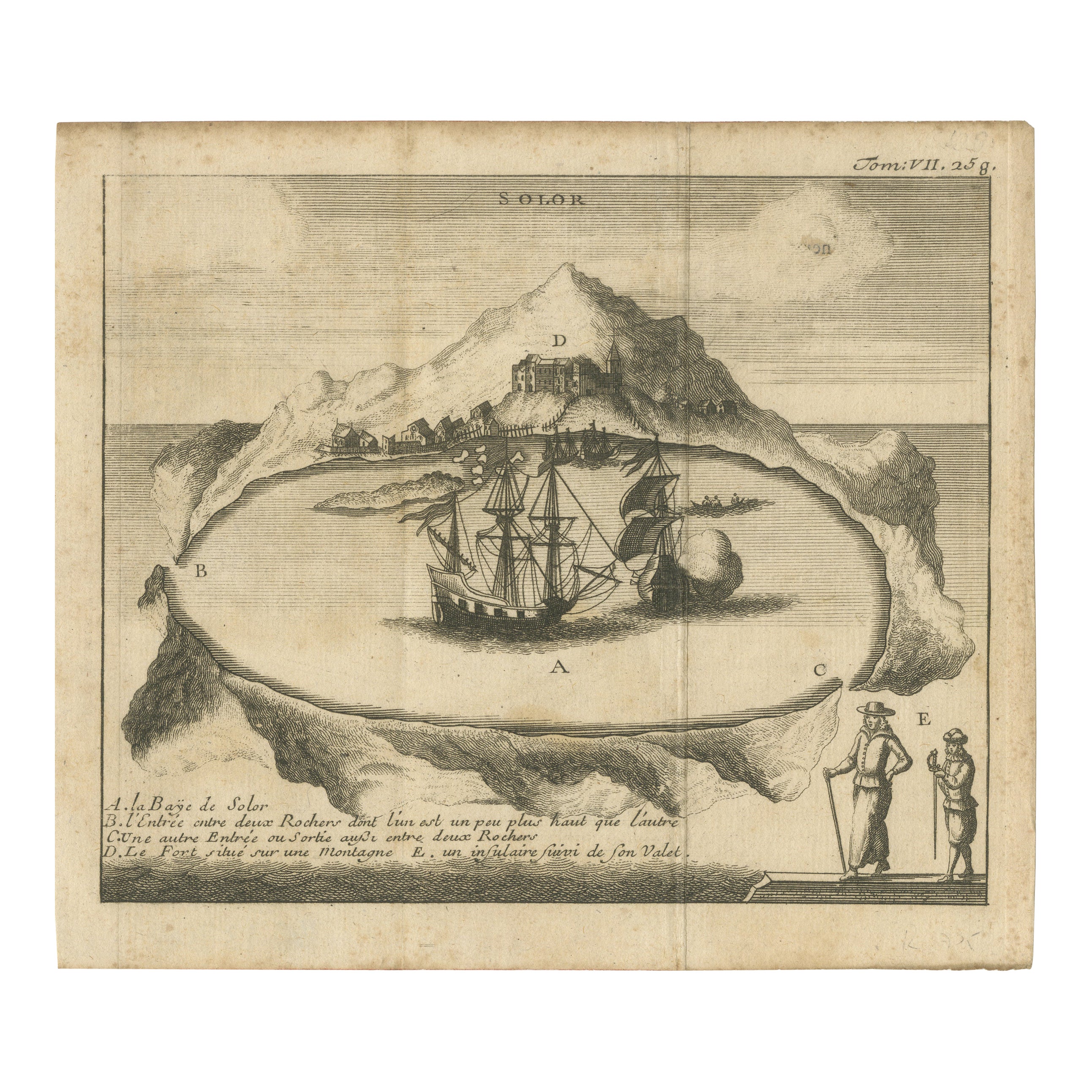
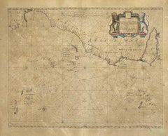
This engraved view depicts the island of Solor in present-day eastern Indonesia, shown as a sheltered harbor with European sailing vessels anchored offshore and a fortified settlement set against a mountainous coastline. The scene was produced for a French voyage or geographic publication of the late 17th to early 18th century and reflects early European exploration and navigation in the East Indies.
The composition is both descriptive and decorative. Ships are shown maneuvering within the bay, while coastal fortifications and settlements are carefully rendered to convey strategic importance. Lettered references identify key features, including the entrance between rocky headlands, the anchorage, and the fort positioned on elevated ground. Figures in European dress appear in the foreground, reinforcing the colonial and exploratory context of the image.
Engraved coastal views such as this served practical, documentary, and visual purposes. They provided readers with geographic understanding while also appealing to curiosity about distant lands. Today, these prints are valued for their strong graphic presence and their connection to early maritime history in Southeast Asia.
The engraving is printed on period paper and shows signs of age and use, consistent with working material from early travel publications. While not a pristine collector’s copy, it remains visually strong and highly suitable for decorative framing.
Condition Report:
Early engraving on paper. Overall age toning and surface wear. Light staining and handling marks visible. Margins uneven with minor edge wear. Image remains clear and legible. Condition reflected in price.
Framing Tips:
A floated mount or generous mat is recommended to accommodate the uneven edges and emphasize the engraving’s age. Dark wood or black frames pair well with the maritime subject and linear engraving style.
Technique: Copper engraving
Maker: French school, from a voyage or geographic publication, late 17th–early 18th century
- Dimensions:Height: 5.91 in (15 cm)Width: 8.27 in (21 cm)Depth: 0.01 in (0.2 mm)
- Materials and Techniques:Paper,Engraved
- Place of Origin:
- Period:
- Date of Manufacture:circa 1700
- Condition:Early engraving on paper. Overall age toning and surface wear. Light staining and handling marks visible. Margins uneven with minor edge wear. Image remains clear and legible. Condition reflected in price.
- Seller Location:Langweer, NL
- Reference Number:Seller: PCT-566891stDibs: LU3054348089162
About the Seller
5.0
Recognized Seller
These prestigious sellers are industry leaders and represent the highest echelon for item quality and design.
Platinum Seller
Premium sellers with a 4.7+ rating and 24-hour response times
Established in 2009
1stDibs seller since 2017
2,811 sales on 1stDibs
Typical response time: 1 hour
- ShippingRetrieving quote...Shipping from: Langweer, Netherlands
- Return Policy
More From This Seller
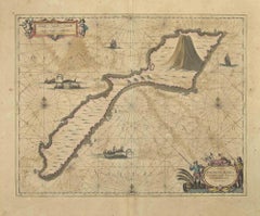
View AllRare 17th Century Engraving of Solor Island Fort and Bay, Indonesia, circa 1670
Located in Langweer, NL
Rare 17th Century Engraving of Solor Island Fort and Bay, Indonesia, circa 1670
Description:
This rare and finely detailed 17th-century copper engraving depicts the bay and fort of ...
Category
Antique Late 17th Century French Prints
Materials
Paper
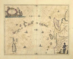
Engraving of Alejandro Selkirk Island, Juan Fernández-archipel, Chile, 1749
Located in Langweer, NL
Antique print titled 'Vue de la cote du N. E. de Masa-Fuero' - 'Vue de la cote occidentale de Masa-Fuero a la distance de quatre milles.' Views of Alejandro Selkirk Island...
Category
Antique 18th Century Prints
Materials
Paper
$211 Sale Price
20% Off
Old Print of VOC Ships
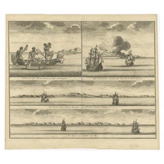
Native Fisherman and Coastal Views of New Guinea, 1726
Located in Langweer, NL
Antique print titled 'Volkeren van Nova Guinea , en hun Vaertuygen Het Brandende Eyland als het Noord West van u is De Kust van Nova Guinea beoosten het Eyland Jamma De Kust van Jamm...
Category
Antique 1720s Prints
Materials
Paper
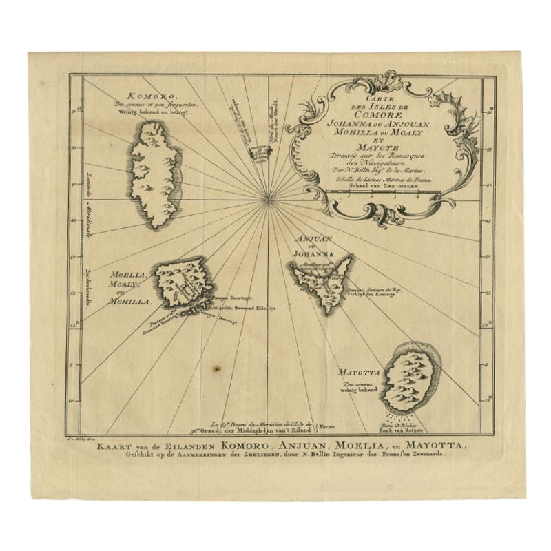
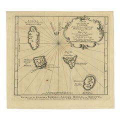
Comore Island Original Antique Engraving by Van Schley, 1749
Located in Langweer, NL
Antique map titled 'Carte des Isles de Comore Johanna ou Anouan Mohilla ou Moaly et Mayote (..) - Kaart van de Eilanden Komoro, Anjuan, Moelia, en Mayotta (..)'. Copper engraving of ...
Category
Antique 18th Century Maps
Materials
Paper
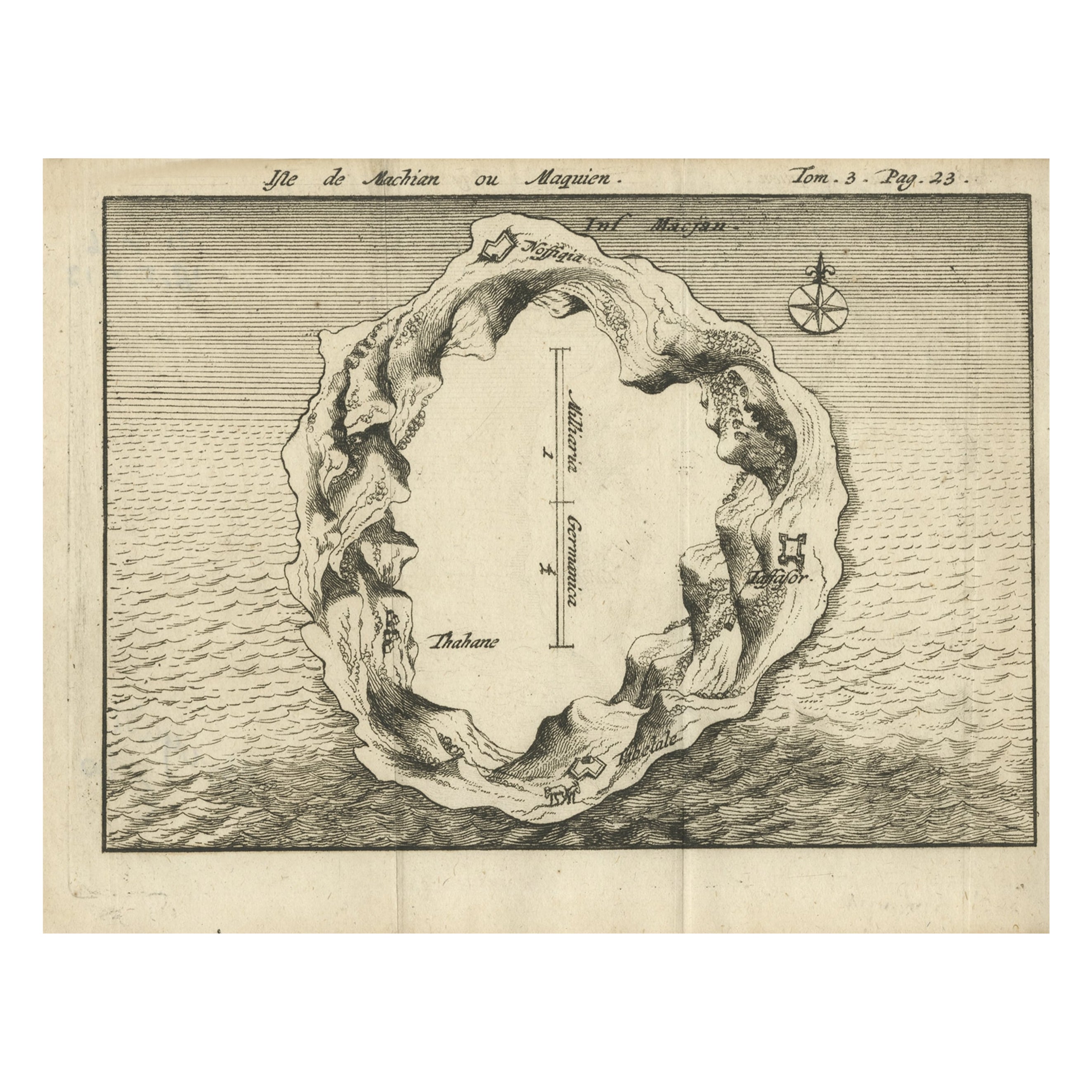
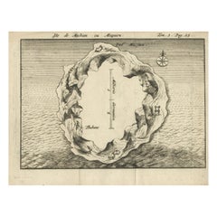
Antique Map of Macjan or Makian Island in the Moluccas, Indonesia, c.1740
Located in Langweer, NL
Antique map titled 'Isle de Machian ou Maquien'. Map of the island of Macjan, Moluccas. Source unknown, to be determined. Artists and Engravers: Anonymous.
Artist: Anonymous.
Con...
Category
Antique 18th Century Maps
Materials
Paper
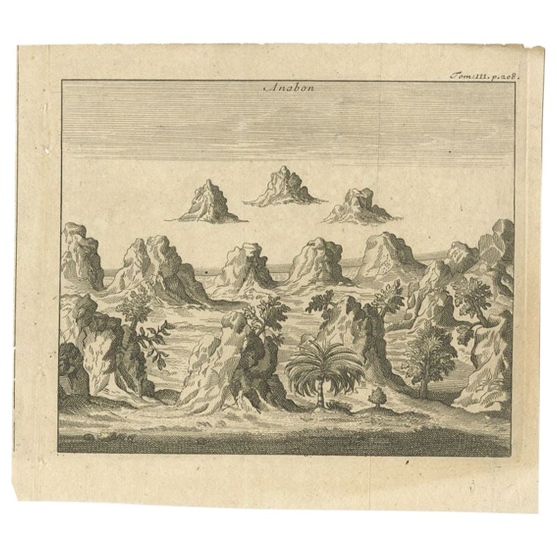
Antique Print of Ambon, Indonesia, c.1740
Located in Langweer, NL
Antique print Ambon titled 'Anabon'. Antique print of the island of Ambon, Indonesia. Source unknown, to be determined.
Artists and Engravers: Anonymous.
Condition: Good, gener...
Category
Antique 18th Century Prints
Materials
Paper
$94 Sale Price
20% Off
You May Also Like
Oceanus - Etching by Johannes Janssonius - 1650s
By Johannes Janssonius
Located in Roma, IT
Antique Map - Oceanus is an antique map realized in 1650 by Johannes Janssonius (1588-1664).
The Map is Hand-colored etching, with coeval watercoloring.
Good conditions with slight...
Category
1650s Modern Figurative Prints
Materials
Etching
S.Juan de Puerto Rico - Etching by Johannes Janssonius - 1650s
By Johannes Janssonius
Located in Roma, IT
S.Juan de Puerto Rico is an ancient map realized in 1650 by Johannes Janssonius (1588-1664).
Good conditions.
From Atlantis majoris quinta pars, Orbem maritimum [Novus Atlas, volum...
Category
1650s Modern Figurative Prints
Materials
Etching
Polus Antarcticus - Etching by Johannes Janssonius - 1650s
By Johannes Janssonius
Located in Roma, IT
Polus Antarcticus is a top rare ancient map realized in 1650 by Johannes Janssonius (1588-1664).
Good conditions.
From Atlantis majoris quinta pars, Orbem maritimum [Novus Atlas, v...
Category
1650s Modern Figurative Prints
Materials
Etching
Antique Map - Mare Pacificum - Etching by Johannes Janssonius - 1650s
By Johannes Janssonius
Located in Roma, IT
Mare Pacificum is an antique map realized in 1650 by Johannes Janssonius (1588-1664).
The Map is Hand-colored etching, with coeval watercolorang.
Good conditions with slight foxing...
Category
1650s Modern Figurative Prints
Materials
Etching

Mare Atlanticum - Etching by Johannes Janssonius - 1650s
By Johannes Janssonius
Located in Roma, IT
Mare Atlanticum is an ancient map realized in 1650 by Johannes Janssonius (1588-1664).
Good conditions.
From Atlantis majoris quinta pars, Orbem maritimum [Novus Atlas, volume V: c...
Category
1650s Modern Figurative Prints
Materials
Etching
1844 French Antique Nautical print Engraved Portolano of Syrie by Antoine Roux
By Antoine Roux
Located in Milan, IT
Antique portolano, nautical map of Syrie engraved on a copper plate by Antoine Roux, Marseille France 1844, from his work Recueil des principaux plans des ports et de Rades de la Mer...
Category
Antique 1840s French Nautical Objects
Materials
Paper