Items Similar to Villefranche, Nice
Monaco Coast – Rare German Copper Engraving c.1692
Want more images or videos?
Request additional images or videos from the seller
1 of 9
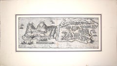
Villefranche, Nice
Monaco Coast – Rare German Copper Engraving c.1692
$1,112.43
£831.28
€940
CA$1,549
A$1,664.56
CHF 893.13
MX$19,607.51
NOK 11,230.16
SEK 10,258.68
DKK 7,165.69
About the Item
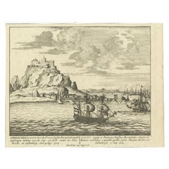
Villefranche, Nice
Monaco Coast – Rare German Copper Engraving c.1692
Description:
This rare late-17th-century copper engraving depicts the Mediterranean coastline between Villefranche, Nice and Monaco, shown in a continuous panoramic view with fortified harbours, rocky headlands and anchored sailing ships. The towns are rendered as strategic coastal strongholds, emphasizing their military and naval importance during a period of sustained conflict in southern Europe. Place names such as Villa Franca, Nizza di Provenza and Monaco are clearly identified, while the surrounding sea is prominently labelled Mare Mediterraneum.
The engraving originates from the German historical work “Des war verunruhigten doch dabeyn Allarten Deutschlands fünfter Theil”, published in 1692. This volume forms part of a broader contemporary chronicle documenting the political and military unrest affecting Europe in the late seventeenth century. The reference to page 329, titled “Villa Franca”, firmly anchors the print within this publication and supports the dating to 1692 rather than 1680. Prints from this work are scarce on the market, particularly coastal views of the Ligurian and Provençal border region.
Stylistically, the engraving combines cartographic clarity with pictorial elements, presenting the coastline as both a geographic overview and a strategic theatre. The compact horizontal format, strong line engraving and early paper tone give the piece a distinctly seventeenth-century character. Views of Monaco and Villefranche from this early period are notably rare, as most surviving depictions date from the eighteenth century or later.
This print holds strong appeal for collectors of early German engravings, Mediterranean coastal history, and military or maritime iconography, while its panoramic composition also makes it highly suitable as a refined and unusual wall piece.
Seize of the print is around 15.7 x 5.9 inch (40 x 15 cm).
Condition report:
Original copper engraving on laid paper, early paper with overall age toning, scattered foxing and staining consistent with period, clear legible impression, small edge wear visible, margins present. Protected by matting board.
Framing tips:
A dark wood or black-stained frame with a warm off-white mat complements the early paper tone; avoid overly bright mats to preserve the seventeenth-century character.
Technique: Copper engraving
Maker: German anonymous engraver, published in Germany, 1692
Keywords:
Villefranche-sur-Mer, Villa Franca, Nice, Nizza di Provenza, Monaco, Mediterranean coast, Mare Mediterraneum, 17th century engraving, German historical print, early coastal map, fortified harbour view, Baroque period, maritime history, rare antique engraving, Monaco history
- Dimensions:Height: 13.39 in (34 cm)Width: 19.69 in (50 cm)Depth: 0.08 in (2 mm)
- Materials and Techniques:Paper,Engraved
- Place of Origin:
- Period:Late 17th Century
- Date of Manufacture:circa 1692
- Condition:Original copper engraving on laid paper, early paper with overall age toning, scattered foxing and staining consistent with period, clear legible impression, folding lines as issued. Protected by matting board.
- Seller Location:Langweer, NL
- Reference Number:Seller: BG-13894-101stDibs: LU3054348131892
About the Seller
5.0
Recognized Seller
These prestigious sellers are industry leaders and represent the highest echelon for item quality and design.
Platinum Seller
Premium sellers with a 4.7+ rating and 24-hour response times
Established in 2009
1stDibs seller since 2017
2,834 sales on 1stDibs
Typical response time: 1 hour
- ShippingRetrieving quote...Shipping from: Langweer, Netherlands
- Return Policy
More From This Seller
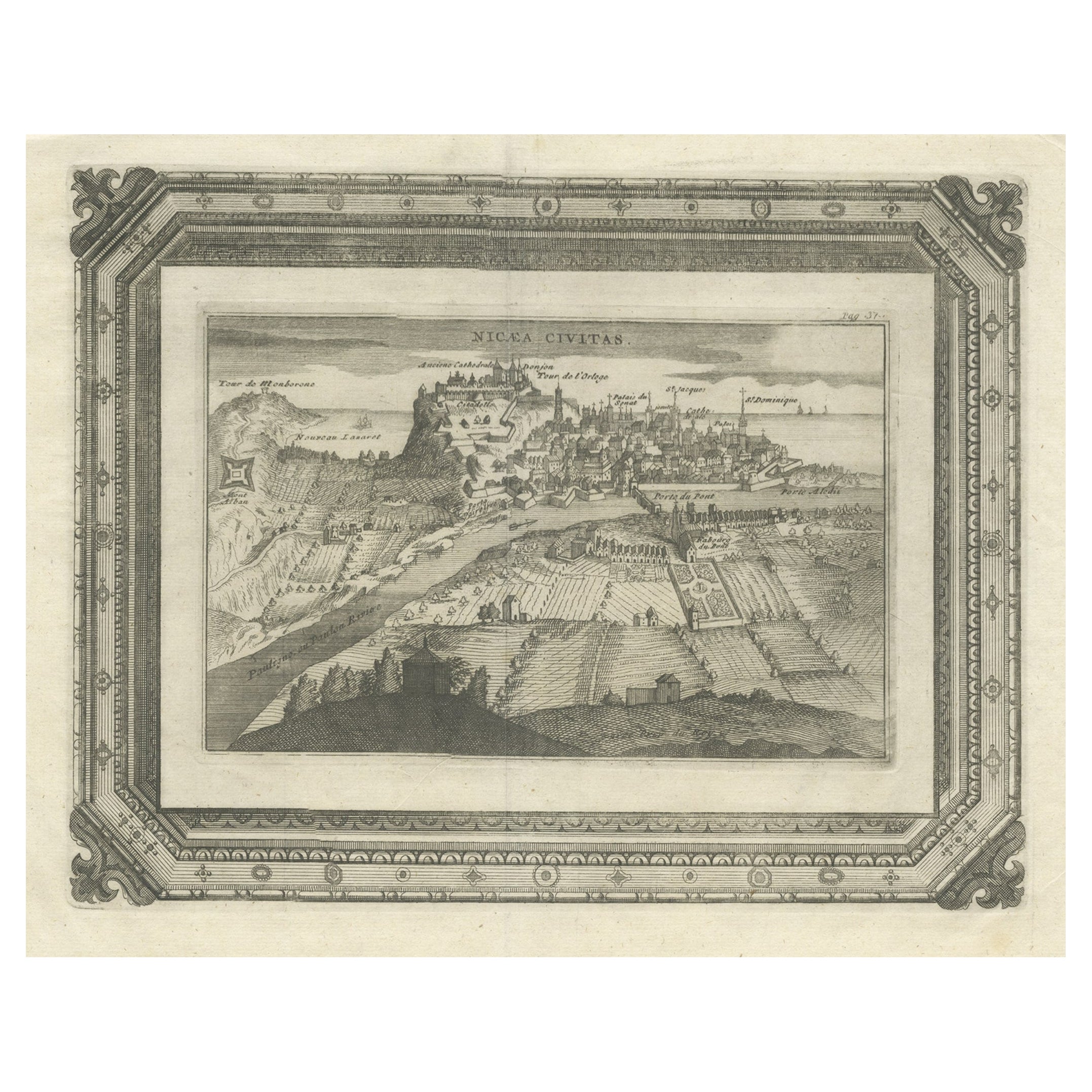
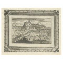
View AllVery Rare Antique Print of the City of Nice in France, c.1700
Located in Langweer, NL
Antique print titled 'Nicaea Civitas'. Original antique print with a view of the city of Nice, France. Rare in this edition. Source unknown, to be determined.
Artists and Engraver...
Category
Antique 17th Century Prints
Materials
Paper
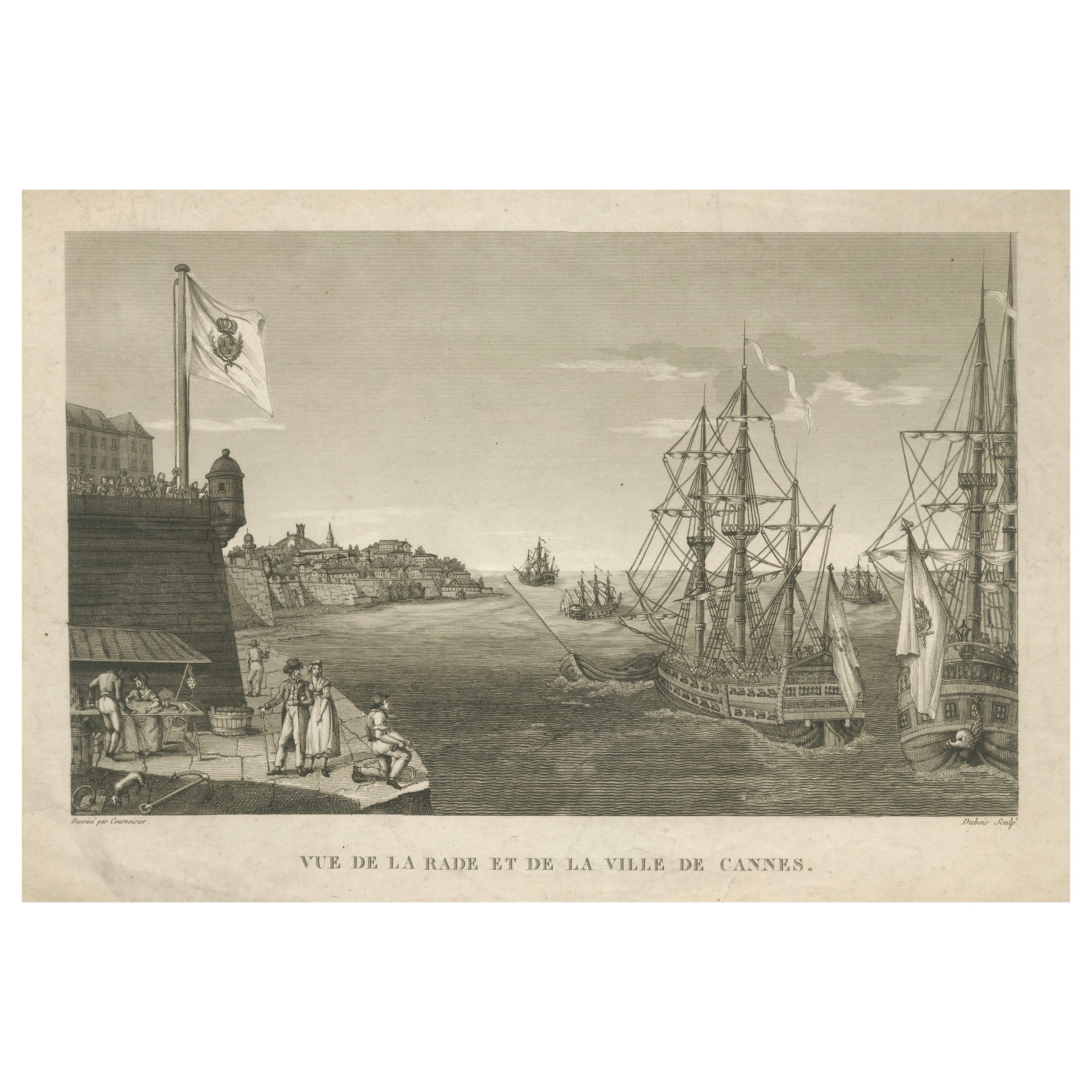
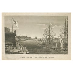
View of the Harbor of Cannes – Engraving by Dubois after Courvoisier, 1784
Located in Langweer, NL
View of the Harbor and City of Cannes – Engraving by Dubois after Courvoisier, 1784
Description:
This fine 18th-century engraving titled “Vue de la Rade et de la Ville de Cannes” (V...
Category
Antique 1780s French Prints
Materials
Paper
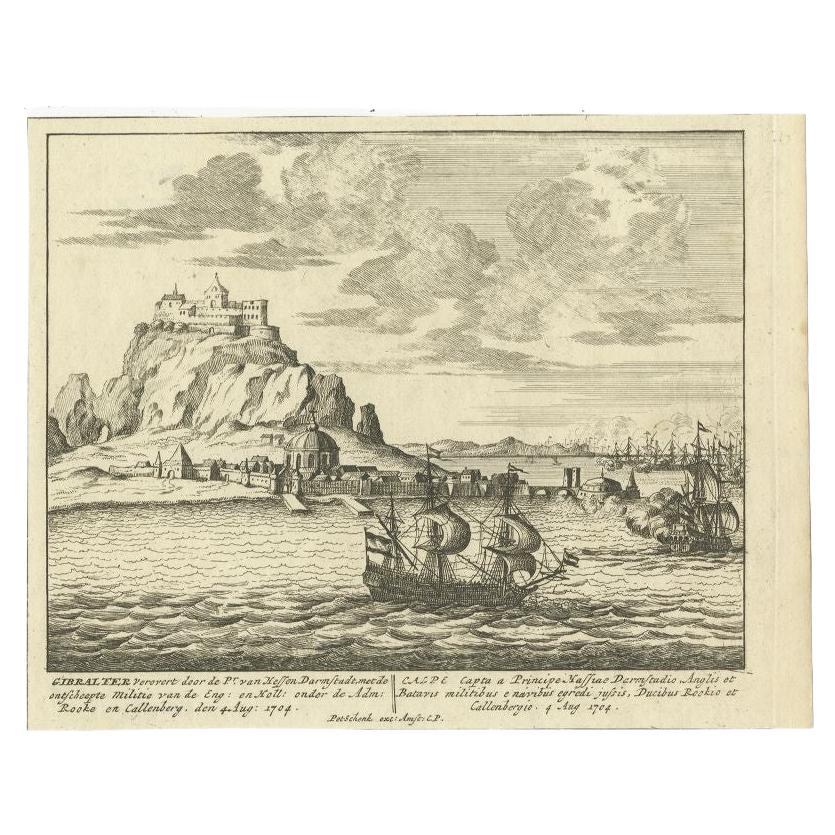
Antique Print of Gibraltar, c.1720
Located in Langweer, NL
Antique print titled 'Gibraltar verovert door de Pr. van Hessen Darmstadt (..)'. Copper engraving of the capture of the fortified town of Gibraltar in 1704 during the War of the Span...
Category
Antique 18th Century Prints
Materials
Paper
$416 Sale Price
20% Off
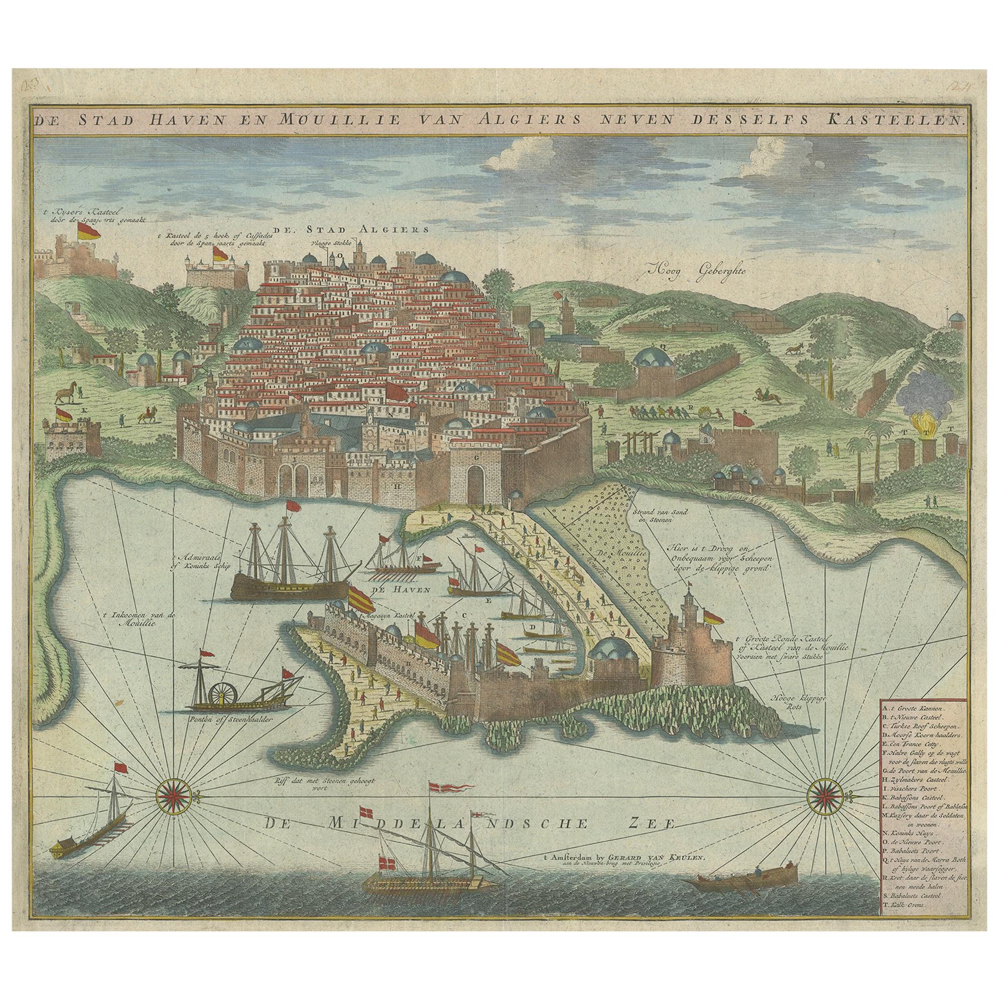
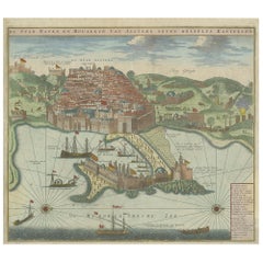
Antique Print of the Port and City of Algiers by Van Keulen, circa 1720
Located in Langweer, NL
Antique print titled 'De Stad Haven en Mouillie van Algiers neven desselfs Kastelen'. Rare double-page bird's-eye view of the port and city of Algiers. With detailed key in the lower right corner. Published by G. van Keulen...
Category
Antique Early 18th Century Dutch Prints
Materials
Paper
$1,331 Sale Price
25% Off
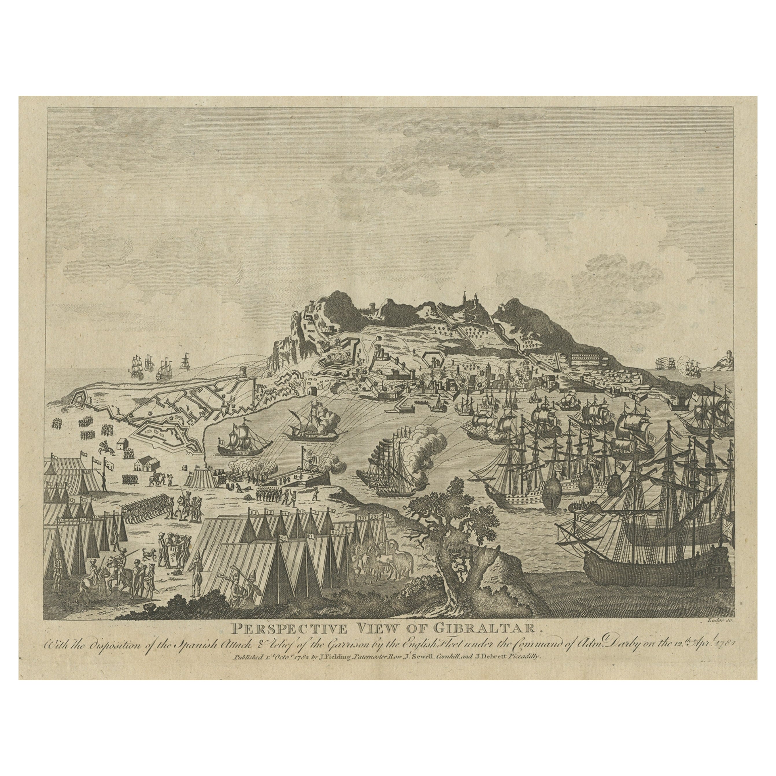
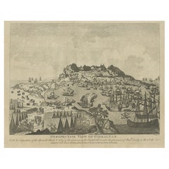
Antique Print of Gibraltar Showing the Spanish and English Fleet, 1782
Located in Langweer, NL
Antique print titled 'Perspective View of Gibraltar. With the the Disposition of the Spanish Attack, and Relief of the Garrison by the English Fleet under the command of Admiral Darby, 12 April 1781'. View of the island clearly showing the fortifications, during a bombardment, with the Spanish encampments on the left wing of the bay and a few Spanish ships...
Category
Antique 18th Century Prints
Materials
Paper
$407 Sale Price
20% Off
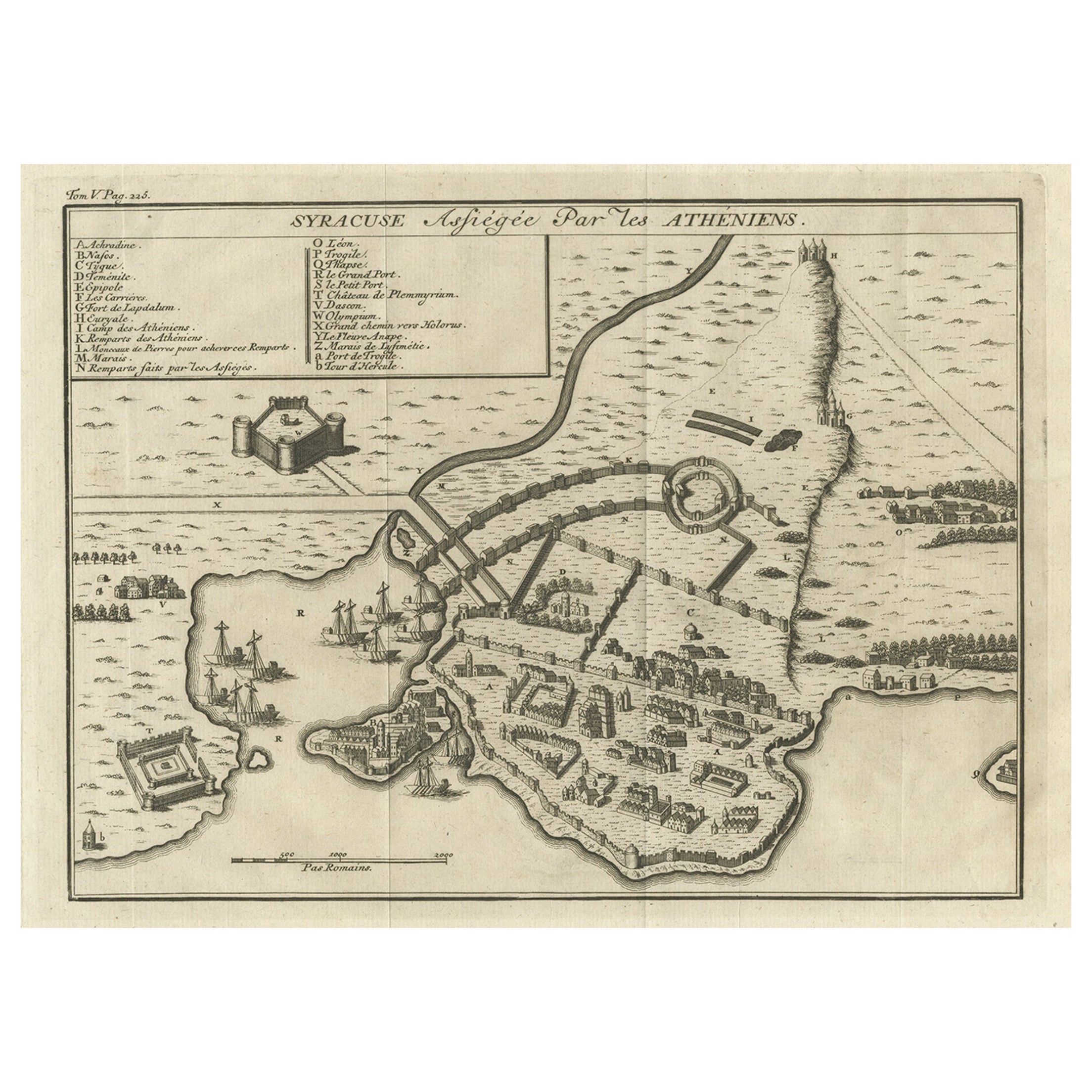
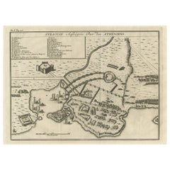
Old Copper Engraving of the Siege of Syracuse, Sicily, Italy, Published, ca.1740
Located in Langweer, NL
Antique print titled 'Syracuse, Assiégée par les Atheniens'.
Old print of the siege of Syracuse, Sicily, Italy. Source unknown, to be determined.
The siege of Syracuse by the...
Category
Antique 1740s Maps
Materials
Paper
$265 Sale Price
20% Off
You May Also Like
Corfu, Big Antique Map from "Civitates Orbis Terrarum" - 1572-1617
By Franz Hogenberg
Located in Roma, IT
Braun G. and Hogenberg F., Corfu, from the collection Civitates Orbis Terrarum, Cologne, T. Graminaeus, 1572-1617. Image dimensions: cm 19 x 48; dimensions: cm 40 x 70.
Very lovely ...
Category
16th Century Landscape Prints
Materials
Etching
18th Century Map Engraving - Plan of the Works of the City of Messina, Sicily
Located in Corsham, GB
A map of Messina, a harbour city in northeast Sicily. Inscribed with the title in plate to the lower edge, 'Plan of the Works of the City of Messina, one of the strongest and most co...
Category
18th Century More Prints
Materials
Engraving

Mare Atlanticum - Etching by Johannes Janssonius - 1650s
By Johannes Janssonius
Located in Roma, IT
Mare Atlanticum is an ancient map realized in 1650 by Johannes Janssonius (1588-1664).
Good conditions.
From Atlantis majoris quinta pars, Orbem maritimum [Novus Atlas, volume V: c...
Category
1650s Modern Figurative Prints
Materials
Etching
Maris Mediterranei - Etching by Johannes Janssonius - 1650s
By Johannes Janssonius
Located in Roma, IT
Maris Mediterranei is an ancient map realized in 1650 by Johannes Janssonius (1588-1664).
The Map is Hand-colored etching, with coeval watercoloring.
Good conditions with slight fo...
Category
1650s Modern Figurative Prints
Materials
Etching
Ancient View of Lyon - Etching - 1748
Located in Roma, IT
Etching on paper realized in 1748.
Very good condition except for some minor foxing.
Includes a wooden frame cm. 27.5x41.5
Category
1740s Modern Figurative Prints
Materials
Etching
18th Century French Map and City View of Joppe/Jaffa (Tel Aviv) by Sanson
By Nicholas Sanson d
Abbeville
Located in Alamo, CA
An original antique engraving entitled "Joppe; in ’t Hebreeusch by ouds Japho; hedendaags Japha, of Jaffa; volgens d’aftekening gedaan 1668", by Nicholas Sanson d'Abbeville (1600 - 1667). This is a view of the city of Joppe (in Hebrew Japho), now called Japha or Jaffa, the harbor portion of modern day Tel Aviv, Israel as it appeared in 1668 . It depicts a very busy harbor with numerous boats. A large ship on the left appears to be firing its canons and a small ship on the right appears to be sitting very low in the water, either heavily loaded with cargo or sinking. The town is seen on the far shore with a fortress on a hill across in the background. The map is printed from the original Sanson copperplate and was published in 1709 by his descendants.
The map is presented in an ornate brown wood frame embellished by gold-colored leaves and gold inner trim with a double mat; the outer mat is cream-colored and the inner mat is black. There is a central vertical fold, as issued. There are two small spots in the lower margin and one in the upper margin, as well as two tiny spots adjacent to the central fold. 1717 is written below the date 1668 in the inscription. The map is otherwise in very good condition.
Another map of the "Holy Land" (by Claes Visscher in 1663), with an identical style frame and mat is available. This pair of maps would make a wonderful display grouping. Please see Reference #LU117324709892.
Artist: Nicholas Sanson d'Abbeville (1600 - 1667) and his descendents were important French cartographer's active through the 17th century. Sanson started his career as a historian and initially utilized cartography to illustrate his historical treatises. His maps came to the attention of Cardinal Richelieu and then King Louis XIII of France, who became a supporter and sponsor. He subsequently appointed Sanson 'Geographe Ordinaire du Roi' the official map maker to the king. Sanson not only created maps for the king, but advised him on geographical issues and curated his map collection...
Category
Early 1700s Prints and Multiples
Materials
Engraving
