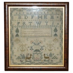
Items Similar to Antique Elizabeth Mason Signed 1789 George II Needlework Sampler Map of England


Want more images or videos?
Request additional images or videos from the seller
1 of 20
Antique Elizabeth Mason Signed 1789 George II Needlework Sampler Map of England
$3,909.23
£2,850
€3,331.96
CA$5,365.50
A$5,860.77
CHF 3,102.28
MX$70,455.68
NOK 39,434.47
SEK 36,069.16
DKK 24,886.91
About the Item
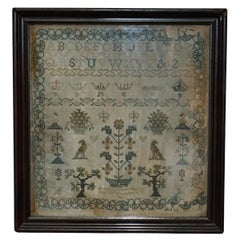
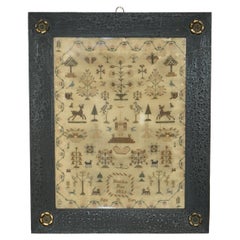
We are delighted to offer for sale this rather stunning, 1789 dated needlework sampler signed by Elizabeth Mason and dated 1789
I have three other versions of these samplers for sale, they are dated 1830, 1747 and 1888, this sale is for the only map, the others were made by children
This really is a piece of history, pure folk art, its super decorative and highly collectable, I have never seen another map and mind blowing to think it is 233 years only
The condition is as you can see in the pictures, it has some discolouration but for the period, this is a 10/10
Dimensions
Height:- 70cm
Width:- 57.5cm
Depth:- 3cm
Please note all measurements are taken at the widest point, if you would like any additional or specific measurements please ask
Any questions please feel free to ask before you bid
Condition
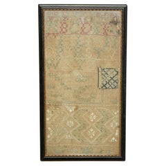
Please view the very detailed pictures as they form part of the description around condition
Please note vintage period and original items such as leather seating will always have natural patina in the form of cracking creasing and wear, we recommend regular waxing to ensure no moisture is lost, also hand dyed leather is not recommended to sit in direct sunlight for prolonged periods of time as it will dry out and fade.
- Dimensions:Height: 27.56 in (70 cm)Width: 22.64 in (57.5 cm)Depth: 1.19 in (3 cm)
- Style:George II (Of the Period)
- Materials and Techniques:Cotton,Embroidered
- Place of Origin:
- Period:1780-1789
- Date of Manufacture:1789
- Condition:Wear consistent with age and use. Minor fading.
- Seller Location:West Sussex, GB
- Reference Number:1stDibs: LU2823334760902
About the Seller
4.7
Platinum Seller
Premium sellers with a 4.7+ rating and 24-hour response times
Established in 2012
1stDibs seller since 2017
2,103 sales on 1stDibs
Typical response time: 1 hour
- ShippingRetrieving quote...Shipping from: West Sussex, United Kingdom
- Return Policy
More From This Seller
View AllCOLLECTABLE ANTIQUE ANTIQUE 1791 GEORGE III NEEDLEWORK SAMPLER ORiGINAL STAMPED
Located in West Sussex, Pulborough
Royal House Antiques
Royal House Antiques is delighted to offer for sale this rather stunning, 1791 dated needlework sampler from Scotland
I have a number of these samplers for sal...
Category
Antique 1790s English Regency Tapestries
Materials
Cotton
ANTIQUE 1838 ORIGINAL EARLY ViCTORIAN NEEDLEWORK SAMPLER IN THE PERIOD FRAME
Located in West Sussex, Pulborough
Royal House Antiques
Royal House Antiques is delighted to offer for sale this rather stunning, 1838 dated needlework sampler made in the second year of Queen Victoria's reign
I ha...
Category
Antique 1830s English William IV Tapestries
Materials
Cotton
Gold Leaf Foil Pictorial Plan Map of the West Country of England Antique Style
Located in West Sussex, Pulborough
We are delighted to offer for sale this lovely Antique style pictorial plan map of the West Country of England etched in gold leaf foil
This is a very interesting and decorative p...
Category
20th Century English Adam Style Maps
Materials
Gold Leaf

Antique 1747 Mary Campbell of Scotland George II Needlework Sampler
Located in West Sussex, Pulborough
We are delighted to offer for sale this rather stunning, 1747 dated needlework Mary Campbell sampler from Scotland
I have three of these samplers for sale, they are dated 1830, 17...
Category
Antique 1740s Scottish Victorian Antiquities
Materials
Cotton
Greece 1660 Jan Jansson Watercolour Map Peloponesus Sive Morea I Laurenbergio
Located in West Sussex, Pulborough
We are delighted to offer for sale this Jan Jansson Date: 1660 (published) Amsterdam map of Greece.
This is an authentic antique map of Peloponnese or...
Category
Antique 1660s Danish Dutch Colonial Maps
Materials
Copper

ANTiQUE 1825 ORIGINAL KING GEORGE IV NEEDLEWORK TAPESTRY SAMPLER ELIZA ANN PRATT
Located in West Sussex, Pulborough
Royal House Antiques
Royal House Antiques is delighted to offer for sale this rather stunning, 1825 dated needlework sampler made during the reign of King George IV by Eliza Ann Pra...
Category
Antique 1820s English Early Victorian Tapestries
Materials
Cotton, Wood
You May Also Like
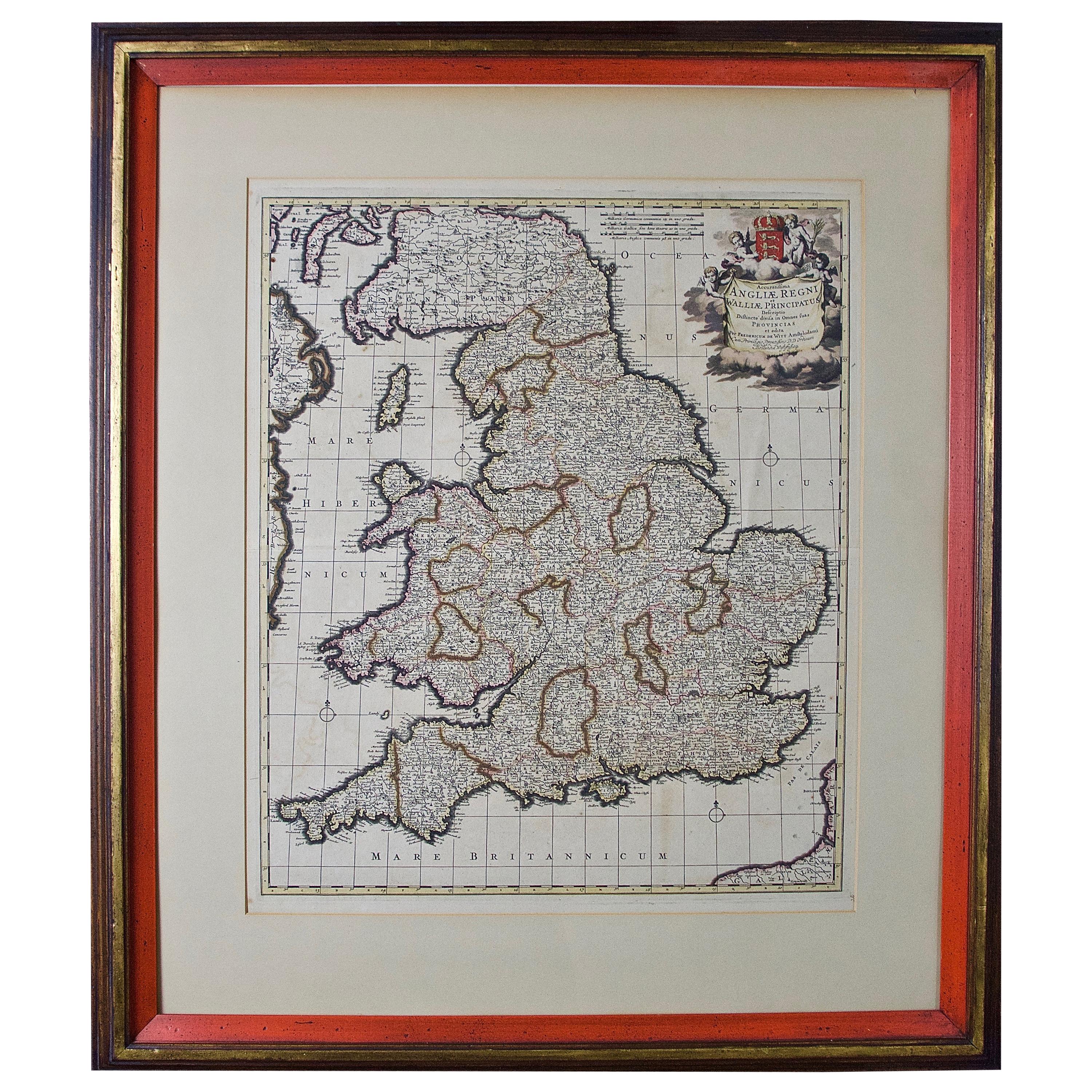
Large 17th Century Hand Colored Map of England and the British Isles by de Wit
By Frederick de Wit
Located in Alamo, CA
A large hand colored 17th century map of England and the British Isles by Frederick de Wit entitled "Accuratissima Angliæ Regni et Walliæ Principatus", published in Amsterdam in 1680. It is a highly detailed map of England, Scotland, the Scottish Isles...
Category
Antique Late 17th Century Dutch Maps
Materials
Paper

$940 Sale Price
20% Off
Framed 17th Century Map of Cumberland, England by John Speed, 1610
By John Speed
Located in Middleburg, VA
A fascinating and richly detailed antique map of Cumberland County in northwest England, drawn and published by the celebrated English cartographer John Spe...
Category
Antique Early 17th Century English British Colonial Maps
Materials
Copper, Gold Leaf

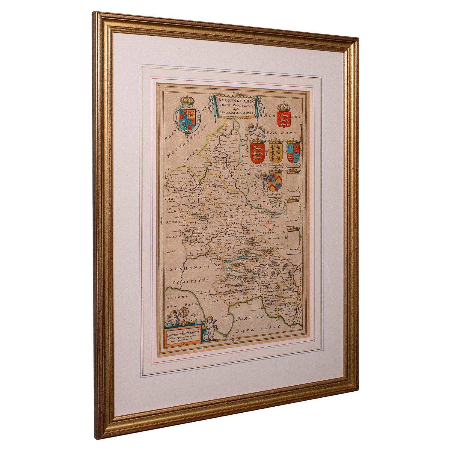
Antique Buckinghamshire Map, English, Framed 17th Century County Cartography
Located in Hele, Devon, GB
This is an antique county map of Buckinghamshire. An English, framed atlas engraving reproduction by Dutchman Joan Blaeu, dating to the 17th century and later.
A treat for the colle...
Category
Early 20th Century British Victorian Maps
Materials
Glass, Paper
Antique Map of Essex by Overton, circa 1710
Located in Langweer, NL
Antique map titled 'Essex, devided into Hundreds, with the most antient and fayre Towne Colchester (..)'. Map of Essex, England. Includes an inset town pl...
Category
Antique Early 18th Century Maps
Materials
Paper

$909 Sale Price
20% Off
Antique County Map of Cheshire, Dutch, Framed, Cartography, Janssonius, C.1660
Located in Hele, Devon, GB
This is an antique county map of Cheshire. A Dutch, framed atlas engraving by Johannes Janssonius, dating to the 17th century and later.
A treat for the collector or county native,...
Category
Antique Mid-17th Century Dutch Charles II Maps
Materials
Glass, Wood, Paper

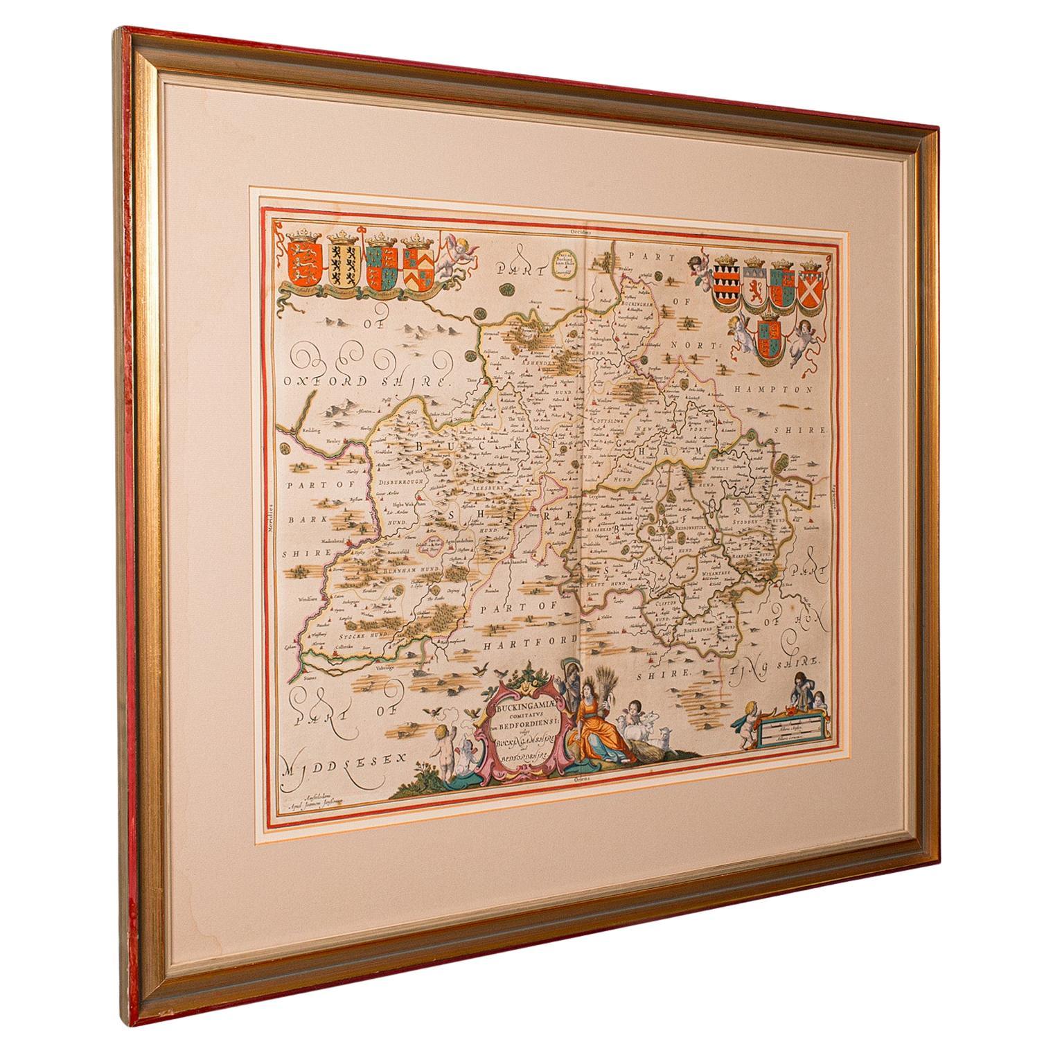
Antique County Map, Buckinghamshire, Bedfordshire, Dutch, Framed, Janssonius
Located in Hele, Devon, GB
This is an antique county map of Buckinghamshire and Bedfordshire. A Dutch, framed atlas engraving by Johannes Janssonius, dating to the 17th century and later.
A treat for the col...
Category
Antique Mid-17th Century Dutch Maps
Materials
Paper

More Ways To Browse
Needlework Sampler
Antique Needlework Sampler
Sampler Map
Diana Tapestry
Dora Jung
English Coat Of Arms Tapestry
French Midcentury Modern Needlepoint
Genaro De Carvalho
Inca Textiles
Mathieu Mategot Tapestry
Millefleurs Tapestry
Mira Spectrum
Navajo Wall Hanging
Picasso Wall Hanging
Rene Fumeron Tapestry
Rene Perrot
Robert Debieve Tapestry
Robert Debieve