Articoli simili a Egypt and Abyssinia – Nile Valley
Horn of Africa Maps, c.1817–1820


Vuoi altre immagini o video?
Richiedi altre immagini o video al venditore
1 di 9
Egypt and Abyssinia – Nile Valley
Horn of Africa Maps, c.1817–1820
560 €IVA inclusa
Informazioni sull’articolo
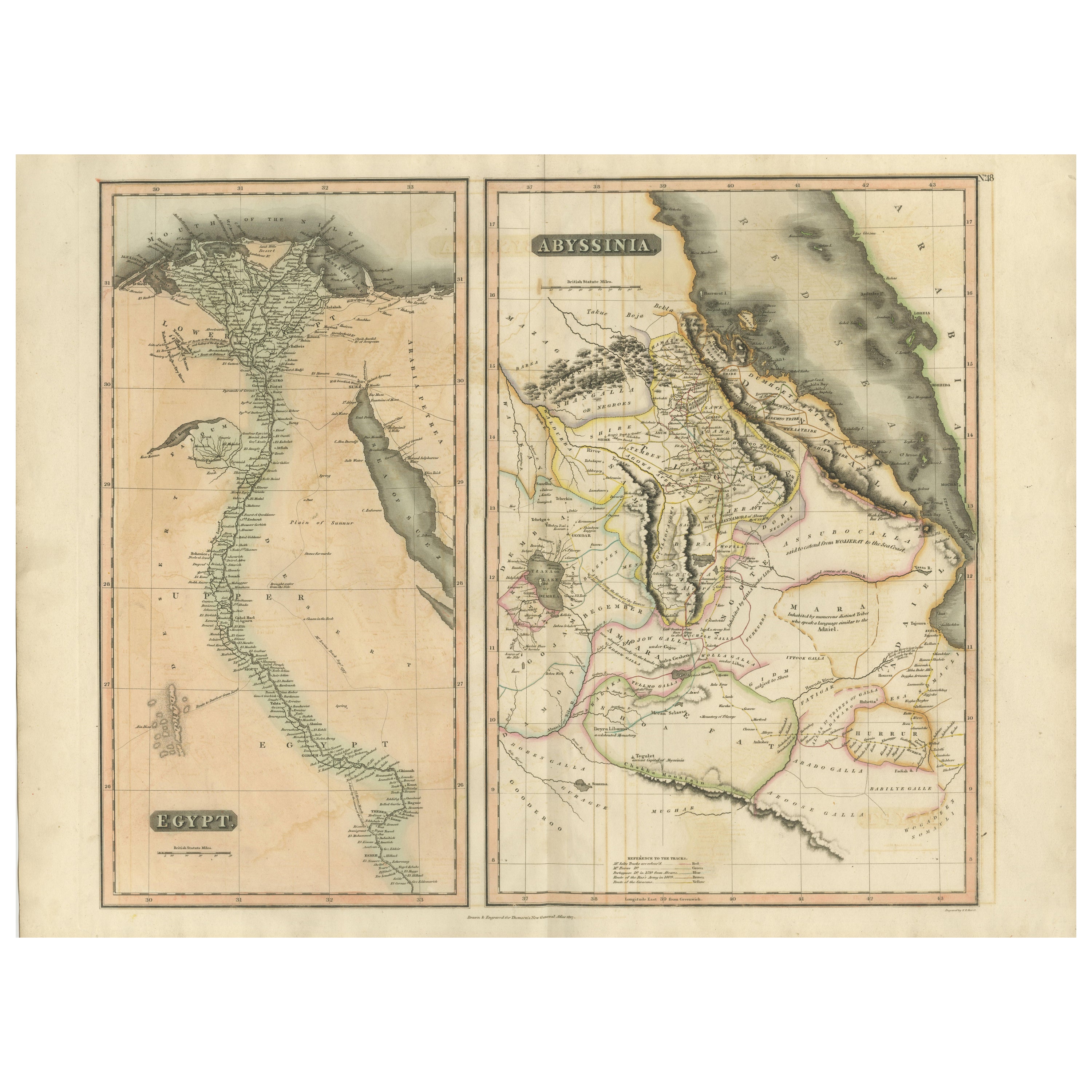
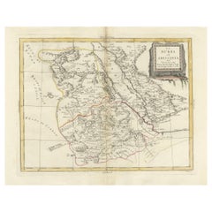
Egypt and Abyssinia – Nile Valley
Horn of Africa Maps, c.1817–1820
This refined early 19th-century paired map presents Egypt and Abyssinia (Ethiopia) as two complementary geographic studies, issued circa 1817–1820 during a period of renewed European scientific and political interest in Northeast Africa. Together, the maps offer a coherent and visually balanced view of the Nile Valley and the Horn of Africa.
The Egypt map is conceived as a tall vertical composition following the full course of the Nile from the Mediterranean Delta southward through Upper Egypt toward Nubia. Cities, river branches, cataracts, desert regions, and ancient sites are carefully engraved, emphasizing the Nile’s role as the structural and cultural backbone of Egyptian civilization. The elongated format gives the map strong architectural presence and makes it especially effective for wall display.
The Abyssinia map complements this view by depicting Ethiopia and the Horn of Africa, including the Red Sea coastline, inland highlands, river systems, and regional divisions. Contemporary outline hand color distinguishes political territories and neighboring regions while preserving clarity and balance. Together, the two maps place Egypt within its broader geographic and hydrological context, linking the Nile to the surrounding highlands and Red Sea world.
The engraving style is characteristic of early 19th-century British atlas cartography: precise, legible, and restrained. Subtle hand coloring enhances coastlines and borders without overpowering the detailed line work. Displayed side by side, the contrasting vertical and compact formats create a harmonious and scholarly composition with strong decorative appeal.
This pair is well suited to collectors of African cartography, Nile history, and Ethiopian history, while also offering excellent visual presence for both classic and contemporary interiors. Framed together, the maps form a balanced and intellectually engaging statement piece.
Condition report
Good condition overall. Central vertical folds as issued. Light age toning and mild discoloration consistent with period, slightly more noticeable on the Egypt sheet. Minor scattered spots and light handling marks. Original outline hand color. Plate marks visible. Margins intact.
Framing tips
Best framed as a pair using matching off-white or light sand-colored mats to unify the presentation. Medium to dark wood frames or softly ebonized frames enhance the engraving and give the pair a refined, gallery-ready appearance suitable for residential or hospitality interiors.
Technique: Copper engraving with contemporary outline hand color
Maker: British school, c.1817–1820
- Dimensioni:Altezza: 54 cm (21,26 in)Larghezza: 71,5 cm (28,15 in)Profondità: 0,2 mm (0,01 in)
- Materiali e tecniche:Carta,Inciso
- Luogo di origine:
- Periodo:
- Data di produzione:circa 1817
- Condizioni:Good condition overall. Central vertical folds as issued. Light age toning and mild discoloration consistent with period, slightly more noticeable on the Egypt sheet. Minor scattered spots and light handling marks. Original outline hand color.
- Località del venditore:Langweer, NL
- Numero di riferimento:Venditore: BG-14128-111stDibs: LU3054348017922
Informazioni sul venditore
5,0
Venditore riconosciuto
Questi venditori prestigiosi sono leader del settore e rappresentano il massimo in termini di qualità e design.
Venditore Platino
Venditori Premium con valutazione 4.7+ e tempi di risposta entro 24 ore
Fondazione nel 2009
Venditore 1stDibs dal 2017
2813 vendite su 1stDibs
Tempo di risposta standard: 1 ora
- SpedizioneRecupero del preventivo…Spedizione da: Langweer, Paesi Bassi
- Politica di reso
Alcune parti di questa pagina sono state tradotte automaticamente. 1stDibs non può garantire che le traduzioni siano corrette. L’inglese è la lingua predefinita del sito.
Altro da questo venditore
Mostra tuttoEgypt
Abyssinia – Original Nile Valley and Horn of Africa Maps, c.1817
Egypt & Abyssinia – Nile Valley and Horn of Africa Maps, c.1817–1820
This refined early 19th-century map composition presents two related geographic views of Northeast Africa: Egypt...
Categoria
Di antiquariato/d’epoca, Anni 1810, Britannico, Mappe
Materiali
Carta
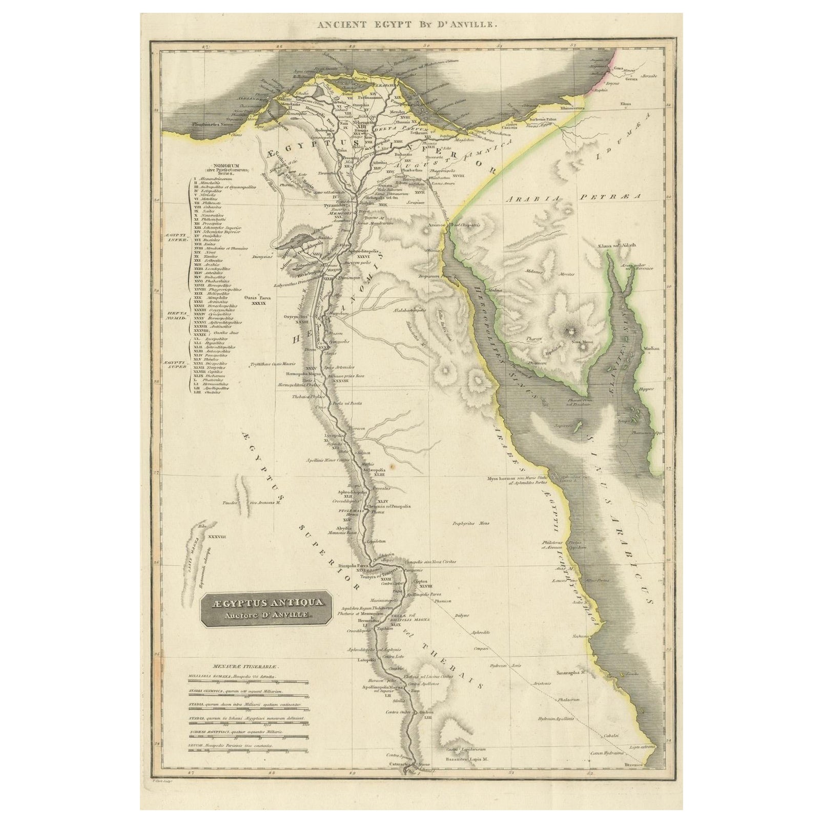
Ancient Egypt – Nile Valley Map by d’Anville, Classical Antiquity, c.1765
Ancient Egypt – Nile Valley Map by d’Anville, Classical Antiquity, c.1765
This finely engraved map depicts Ancient Egypt as understood through classical sources, extending along the...
Categoria
Di antiquariato/d’epoca, Anni 1760, Francese, Mappe
Materiali
Carta
Mappa antica dell
Egitto con inserto dettagliato del Delta del Nilo, 1799 ca.
Mappa antica dell'Egitto con inserto dettagliato del Delta del Nilo, 1799 ca.
Questa mappa antica finemente incisa, intitolata Carte Physique et Politique de l'Égypte, presenta una ...
Categoria
Di antiquariato/d’epoca, Inizio Ottocento, Francese, Mappe
Materiali
Carta

Grande carta geografica antica della Bassa Valle del Nilo, comprendente l
Egitto e la Nubia, 1842
Carta geografica antica intitolata "Carte de l'Égypte, de la Nubie, de l'Abissinie". Mappa dell'Egitto, che copre la bassa valle del Nilo e comprende l'Egitto e la Nubia. Questa mapp...
Categoria
Di antiquariato/d’epoca, XIX secolo, Francese, Mappe
Materiali
Carta

360 € Prezzo promozionale
20% in meno
Nubia and Abyssinia – Venetian Map of Northeast Africa, Zatta, 1784
Nubia and Abyssinia – Venetian Map of Northeast Africa, Zatta, 1784
This detailed late-18th-century map depicts Nubia and Abyssinia, covering large parts of present-day Sudan, Ethio...
Categoria
Di antiquariato/d’epoca, Anni 1780, Italiano, Mappe
Materiali
Carta
Egypt
Arabia Petraea – Large Nile Map, British Cartography, c.1815
Egypt & Arabia Petraea – Large Nile Map, British Cartography, c.1815
This impressive early 19th-century map depicts Egypt and Arabia Petraea with exceptional detail, extending from ...
Categoria
Di antiquariato/d’epoca, Anni 1810, Britannico, Mappe
Materiali
Carta

Ti potrebbe interessare anche
Africa. Part One. Atlante del secolo antica mappa d
epoca
L'Atlante del Secolo. Africa. Parte Nord-Est".
Mappa antica originale, 1903.
Mappa interna di "Delta del Nilo e Canale di Suez".
Piega centrale come da edizione. Nome e numero dell...
Categoria
Inizio XX secolo, Vittoriano, Altre stampe
Materiali
Litografia

Mappa antica originale dell
Africa di Dower, 1835 circa
Bella mappa dell'Africa
Disegnato e inciso da J.Dower
Pubblicato da Orr & Smith. C.1835
Senza cornice.
Spedizione gratuita
Categoria
Di antiquariato/d’epoca, Anni 1830, Inglese, Mappe
Materiali
Carta

Antica carta geografica italiana dell
Asia del 1803 comprendente la Cina, l
Indonesia e l
India
Antica carta geografica italiana dell'Asia del 1803 comprendente la Cina, l'Indonesia e l'India
Mappa molto bella dell'Asia. 1803.
Informazioni aggiuntive:
Tipo: Mappa
Paese di pro...
Categoria
Di antiquariato/d’epoca, XIX secolo, Europeo, Mappe
Materiali
Carta

379 € Prezzo promozionale
39% in meno
Costa occidentale dell
Africa, Guinea e Sierra Leone: Una mappa del XVIII secolo di Bellin
Di Jacques-Nicolas Bellin
La mappa in rame di Jacques Bellin intitolata "Partie de la Coste de Guinee Dupuis la Riviere de Sierra Leona Jusquau Cap das Palmas", che raffigura la costa della Guinea e della Sie...
Categoria
Di antiquariato/d’epoca, Metà XVIII secolo, Francese, Mappe
Materiali
Carta

398 € Prezzo promozionale
20% in meno
Antique French Map of Asia Including China Indoneseia India, 1783
Mappa dell'Asia molto bella. 1783 Dedie au Roy.
Informazioni aggiuntive:
Paese di produzione: Europa
Periodo: XVIII secolo Qing (1661 - 1912)
Condit: Condizioni generali B (buon usa...
Categoria
Di antiquariato/d’epoca, XVIII secolo, Europeo, Mappe
Materiali
Carta

421 € Prezzo promozionale
40% in meno
Mappa antica originale dell
antica Grecia - Beozia, Tebe, 1787
Grande mappa dell'Antica Grecia. Mostra la regione della Beozia, compresa Tebe
Disegnato da D. & J. Barbie Du Bocage
Incisione su lastra di rame di P. A. I. P.
Profilo origi...
Categoria
Di antiquariato/d’epoca, Anni 1780, Francese, Altro, Mappe
Materiali
Carta
