Articoli simili a Map of Côte-d
Or France with Dijon and Burgundy Wine Region, 19th Century


Vuoi altre immagini o video?
Richiedi altre immagini o video al venditore
1 di 10
Map of Côte-d
Or France with Dijon and Burgundy Wine Region, 19th Century
140 €IVA inclusa
Informazioni sull’articolo
Map of Côte-d'Or France with Dijon and Burgundy Wine Region, 19th Century
Description:
This beautifully engraved 19th-century map of Côte-d'Or, located in the historic region of Burgundy, was drawn by Alexandre Vuillemin and published by Migeon in Paris as part of the *Nouvel Atlas Illustré*. Meticulously detailed and adorned with elegant vignettes, the map presents one of France’s most prestigious wine regions with geographic clarity and cultural reverence.
The map is bordered in soft pink watercolor and includes all major roads, rivers, and towns. Dijon, the department’s capital and a center of culture and gastronomy, is prominently marked, as are Beaune, Nuits-Saint-Georges, and other key communes of the Côte d’Or vineyard belt. The topography emphasizes the region’s east-facing slopes that form the heart of the wine-producing Côte de Nuits and Côte de Beaune.
In the lower left is an engraving of the city of Dijon, framed by its Gothic spires and medieval architecture. In the upper right is a portrait of a notable local figure, finely framed with ornamental detailing. The departmental coat of arms appears in the upper left, flanked by grapevines and acanthus leaves, alluding to the wine heritage of the region.
Côte-d'Or is home to some of the world’s most renowned vineyards, producing exceptional Pinot Noir and Chardonnay wines. The Côte de Nuits is celebrated for its powerful, age-worthy reds, including grand crus like Romanée-Conti and Clos de Vougeot. The Côte de Beaune is known for both outstanding reds and whites, with names such as Meursault, Puligny-Montrachet, and Corton-Charlemagne. The region’s complex terroir, centuries-old wine tradition, and strict appellation controls make it a benchmark for fine wine globally.
This map is not only a tribute to the geography of the region but also a beautiful celebration of its vinicultural and architectural achievements. It is ideal for collectors of antique maps, wine history, or French decorative prints.
Condition summary:
Very good condition with minor foxing and some light toning to the outer margins. The hand-coloring remains vibrant, and the engraving is clean and crisp.
Framing tips:
A dark mahogany or black frame pairs elegantly with the refined engraving style and pink border. A warm cream or light grey mat complements the map's historical aesthetic. Use museum-grade glass to protect the artwork and enhance visual clarity.
- Dimensioni:Altezza: 32,5 cm (12,8 in)Larghezza: 26,1 cm (10,28 in)Profondità: 0,2 mm (0,01 in)
- Materiali e tecniche:Carta,Inciso
- Luogo di origine:
- Periodo:
- Data di produzione:circa 1850
- Condizioni:Very good condition with minor foxing and some light toning to the outer margins. The hand-coloring remains vibrant, and the engraving is clean and crisp.
- Località del venditore:Langweer, NL
- Numero di riferimento:Venditore: BG-13331-201stDibs: LU3054345363642
Informazioni sul venditore
5,0
Venditore riconosciuto
Questi venditori prestigiosi sono leader del settore e rappresentano il massimo in termini di qualità e design.
Venditore Platino
Venditori Premium con valutazione 4.7+ e tempi di risposta entro 24 ore
Fondazione nel 2009
Venditore 1stDibs dal 2017
2852 vendite su 1stDibs
Tempo di risposta standard: 1 ora
- SpedizioneRecupero del preventivo…Spedizione da: Langweer, Paesi Bassi
- Politica di reso
Alcune parti di questa pagina sono state tradotte automaticamente. 1stDibs non può garantire che le traduzioni siano corrette. L’inglese è la lingua predefinita del sito.
Altro da questo venditore
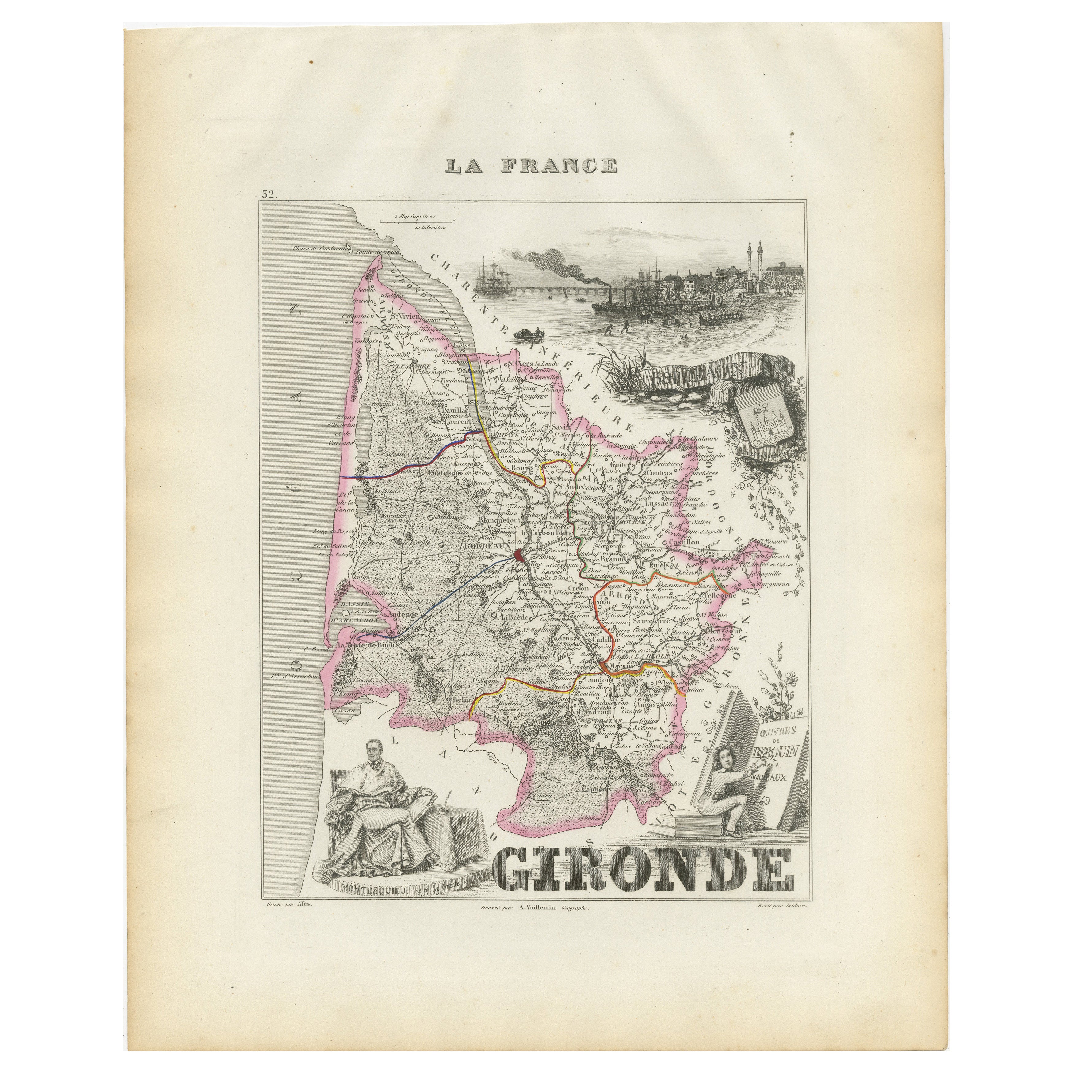
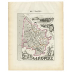
Mostra tuttoMappa della Gironda in Francia con la regione vinicola di Bordeaux di Vuillemin, XIX sec.
Mappa della Gironda in Francia con la regione vinicola di Bordeaux di Vuillemin, XIX sec.
Questa splendida mappa del XIX secolo della Gironda, in Francia, fa parte del Nouvel Atlas ...
Categoria
Di antiquariato/d’epoca, Metà XIX secolo, Francese, Mappe
Materiali
Carta
Map of Allier France with Saint-Pourçain Wine Region by Vuillemin, 19th c
Map of Allier France with Saint-Pourçain Wine Region by Vuillemin, 19th c
This decorative 19th-century map of Allier, a central department of France, comes from the celebrated Nouve...
Categoria
Di antiquariato/d’epoca, Metà XIX secolo, Francese, Mappe
Materiali
Carta

Mappa di Gers Francia con Auch e la regione vinicola dell
Armagnac di Vuillemin, XIX sec.
Mappa di Gers Francia con Auch e la regione vinicola dell'Armagnac di Vuillemin, XIX sec.
Questa mappa incisa e colorata a mano del XIX secolo del dipartimento di Gers, nel sud-oves...
Categoria
Di antiquariato/d’epoca, Metà XIX secolo, Francese, Mappe
Materiali
Carta

Map of Côtes-du-Nord France with Saint-Brieuc and Brittany Coastline, c.1850
Map of Côtes-du-Nord France with Saint-Brieuc and Brittany Coastline, 19th c
Description:
This elegant 19th-century map of Côtes-du-Nord, the historic name for what is now known as ...
Categoria
Di antiquariato/d’epoca, Metà XIX secolo, Francese, Mappe
Materiali
Carta

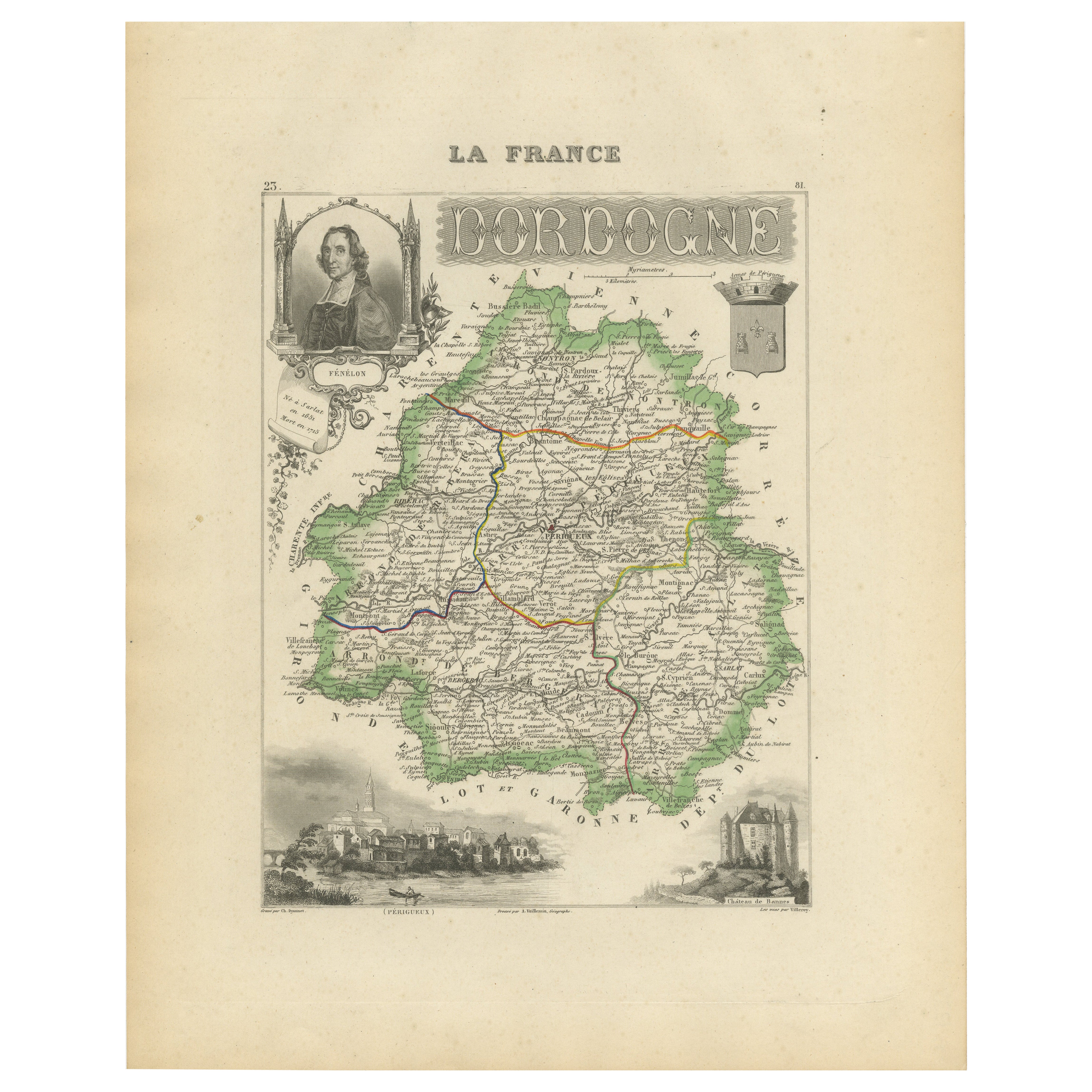
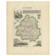
Map of Dordogne France with Périgueux and Château de Jumilhac, 19th Century
Map of Dordogne France with Périgueux and Château de Jumilhac, 19th Century
Description:
This richly detailed 19th-century map of the Dordogne department in southwestern France was ...
Categoria
Di antiquariato/d’epoca, Metà XIX secolo, Francese, Mappe
Materiali
Carta
Mappa della Loira con Saint-Étienne e Montbrison di Vuillemin, XIX sec.
Mappa della Loira con Saint-Étienne e Montbrison di Vuillemin, XIX sec.
Questa splendida mappa incisa e colorata a mano del dipartimento della Loira, nella Francia centro-orientale,...
Categoria
Di antiquariato/d’epoca, Metà XIX secolo, Francese, Mappe
Materiali
Carta

Ti potrebbe interessare anche
Grande mappa della Francia del XIX secolo
Grande mappa della Francia del XIX secolo.
Condizioni notevoli, con una piacevole patina di usura.
Incorniciato di recente.
Francia, circa 1874.
Categoria
Di antiquariato/d’epoca, Fine XIX secolo, Francese, Mappe
Materiali
Lino, Carta

Francia, Part One. Mappa antica Century Atlas
L'Atlante del Secolo. Francia, parte settentrionale".
Mappa antica originale, 1903.
Cartine di "Francia in Province" e "Parigi e dintorni".
Piega centrale come da edizione. Nome e ...
Categoria
Inizio XX secolo, Vittoriano, Altre stampe
Materiali
Litografia

Aude, Francia. Mappa antica di un dipartimento francese, 1856
Di Victor Levasseur
'Dept. de L' Aude', incisione in acciaio con colorazione a mano dei contorni originali, 1856, da 'Atlas National Illustre' di Levasseur.
Questa zona della Francia è famosa per l'am...
Categoria
XIX secolo, Naturalismo, Stampe (paesaggio)
Materiali
Incisione

Aube, Francia. Mappa antica di un dipartimento francese, 1856
Di Victor Levasseur
'Dept. de L'Aube', incisione in acciaio con colorazione a mano dei contorni originali, 1856, da 'Atlas National Illustre' di Levasseur.
Questa zona della Francia è nota per la prod...
Categoria
XIX secolo, Naturalismo, Stampe (paesaggio)
Materiali
Incisione

Indre e Loira, Francia. Mappa antica di un dipartimento francese, 1856
Di Victor Levasseur
'Dept. d'Indre et Loire', incisione in acciaio con colorazione a mano dei contorni originali, 1856, da 'Atlas National Illustre' di Levasseur.
Questa zona è nota per la produzione ...
Categoria
XIX secolo, Naturalismo, Stampe (paesaggio)
Materiali
Incisione

La regione francese della Normandia: Una mappa colorata a mano del XVII secolo di Sanson e Jaillot
Di Nicolas Sanson
Questa grande mappa colorata a mano intitolata "Le Duché et Gouvernement de Normandie divisée en Haute et Basse Normandie en divers Pays; et par evêchez, avec le Gouvernement General...
Categoria
Di antiquariato/d’epoca, Anni 1690, Francese, Mappe
Materiali
Carta
