Articoli simili a Mediterranean
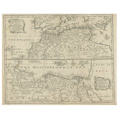
Barbary Coast – Elegant 18th Century Map by Bowen, c.1747

Vuoi altre immagini o video?
Richiedi altre immagini o video al venditore
1 di 10
Mediterranean
Barbary Coast – Elegant 18th Century Map by Bowen, c.1747
880 €IVA inclusa
Informazioni sull’articolo
Mediterranean
Barbary Coast – Elegant 18th Century Map by Bowen, c.1747
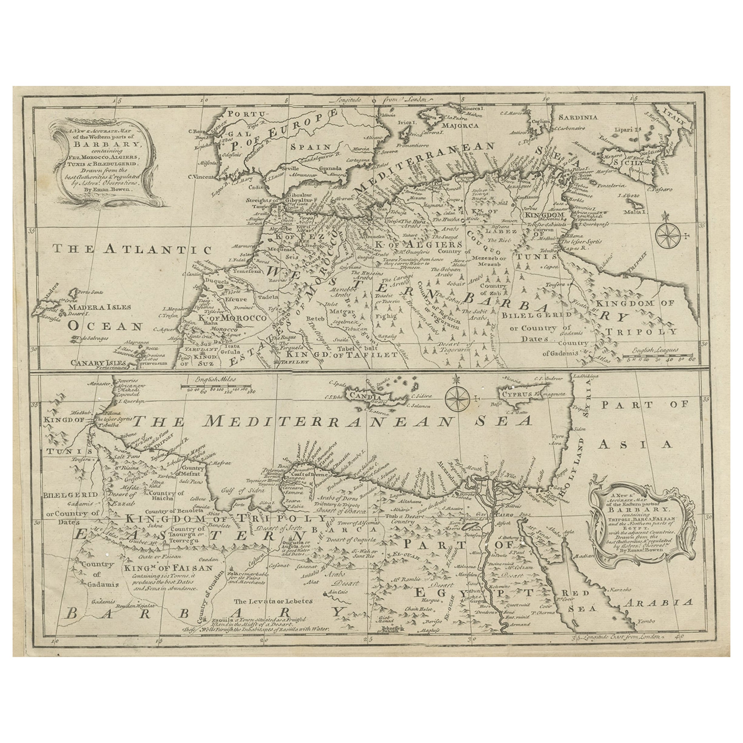
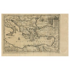
This elegant mid-18th-century engraved map presents the Mediterranean world with a strong focus on the Barbary Coast and North Africa, extending from the Atlantic coast of Morocco across the Mediterranean Sea to Egypt, the Levant, and parts of the Near East. The map encompasses southern Europe, including Spain, Italy, and the islands of the Mediterranean, while highlighting North African regions such as Morocco, Algiers, Tunis, Tripoli, Egypt, and Arabia.
The map was engraved by Emanuel Bowen and published circa 1747, during a period when European interest in the Mediterranean was driven by trade, naval power, diplomacy, and the strategic control of sea routes linking Europe, Africa, and the East. Bowen was one of the most prominent English mapmakers of the 18th century, serving as Royal Geographer to King George II, and his work is valued for its clarity, balance, and decorative refinement.
Coastal outlines, principal cities, kingdoms, and regions are clearly delineated, while inland territories are filled with place names, mountain ranges, and desert annotations that convey both geographic structure and contemporary European perceptions of North Africa and the eastern Mediterranean. The Barbary Coast is prominently labeled, with references to historic kingdoms, trading centers, and ports central to Mediterranean and trans-Saharan commerce. Egypt and the eastern Mediterranean are carefully rendered, including the Nile delta and surrounding regions.
The Mediterranean Sea itself dominates the composition, creating a calm, expansive visual rhythm that gives the map exceptional decorative presence. Decorative cartouches, compass roses, and neatline borders add elegance without overpowering the geography. The engraving style is refined and legible, making the map equally appealing to collectors and interior designers.
This map works beautifully as a statement wall piece, offering a timeless view of the Mediterranean world that complements both classic and contemporary interiors. It also integrates naturally with displays focused on North Africa, the Mediterranean basin, or 18th-century European cartography.
Condition report
Good condition overall. Central vertical fold as issued. Light age toning consistent with period, with a few scattered spots and minor surface marks. Plate mark visible. Margins intact.
Framing tips
A wide off-white or light sand-colored mat enhances the balance of the composition and allows the dense geography to breathe. A medium to dark wood frame or softly ebonized frame gives the piece a refined, hotel-ready appearance suitable for residential or hospitality interiors.
Technique: Copper engraving
Maker: Emanuel Bowen, England, c.1747
- Dimensioni:Altezza: 40,5 cm (15,95 in)Larghezza: 50,5 cm (19,89 in)Profondità: 0,2 mm (0,01 in)
- Materiali e tecniche:Carta,Inciso
- Luogo di origine:
- Periodo:1740-1749
- Data di produzione:circa 1747
- Condizioni:Good condition overall. Central vertical fold as issued. Light age toning consistent with period, with a few scattered spots and minor surface marks. Plate mark visible. Margins intact.
- Località del venditore:Langweer, NL
- Numero di riferimento:Venditore: BG-14128-81stDibs: LU3054348017132
Informazioni sul venditore
5,0
Venditore riconosciuto
Questi venditori prestigiosi sono leader del settore e rappresentano il massimo in termini di qualità e design.
Venditore Platino
Venditori Premium con valutazione 4.7+ e tempi di risposta entro 24 ore
Fondazione nel 2009
Venditore 1stDibs dal 2017
2811 vendite su 1stDibs
Tempo di risposta standard: 1 ora
- SpedizioneRecupero del preventivo…Spedizione da: Langweer, Paesi Bassi
- Politica di reso
Alcune parti di questa pagina sono state tradotte automaticamente. 1stDibs non può garantire che le traduzioni siano corrette. L’inglese è la lingua predefinita del sito.
Altro da questo venditore
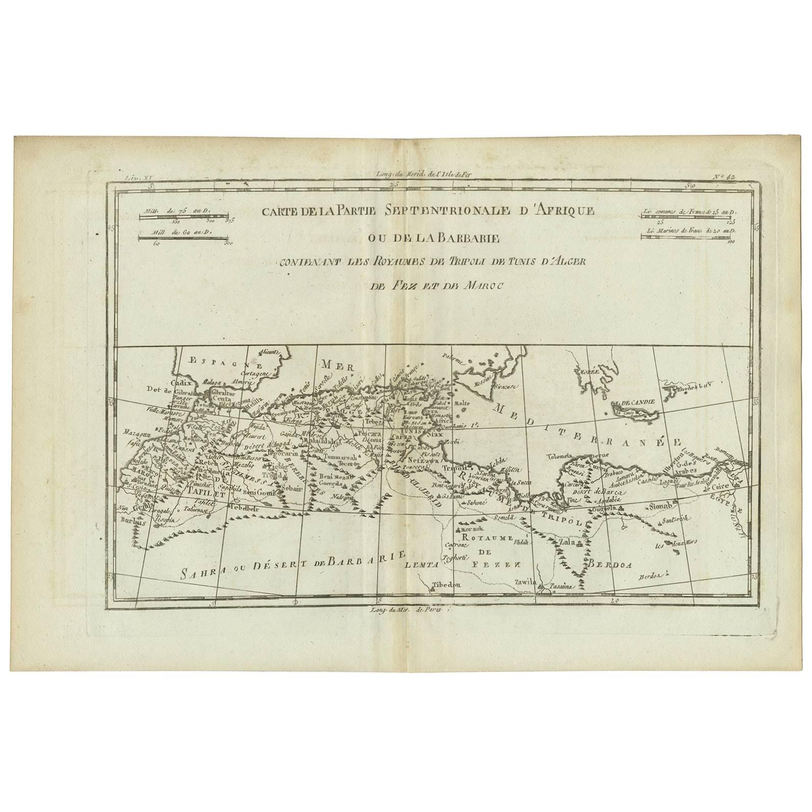
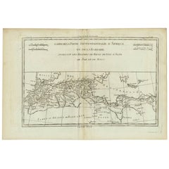
Mostra tuttoCarta antica della Barberia occidentale e orientale in Africa, 1744 ca.
Carta geografica antica intitolata "A New & Accurate Map of the Western Parts of Barbary" e "A New & Accurate Map of the Eastern Parts of Barbary". Mappe decorative del Nord Africa e...
Categoria
Di antiquariato/d’epoca, XVIII secolo, Britannico, Mappe
Materiali
Carta
Carta geografica antica dell
Africa settentrionale "Costa di Barberia" di R. Bonne, 1780 ca.
Un bell'esemplare della mappa del 1780 di Rigobert Bonne e Guilleme Raynal dell'Africa nord-occidentale o Costa di Barberia. Include i paesi moderni di Marocco, Algeria, Tunisia, Lib...
Categoria
Di antiquariato/d’epoca, Fine XVIII secolo, Francese, Mappe
Materiali
Carta
Carta antica della costa settentrionale dell
Africa e dell
Europa meridionale, 1745 ca.
Di Covens
Mortier
Carta geografica antica intitolata "In Notitiam Ecclesiasticam Africae Tabula Geographica". Mappa molto decorativa colorata a mano della costa settentrionale dell'Africa, della Spagn...
Categoria
Di antiquariato/d’epoca, Metà XVIII secolo, Mappe
Materiali
Carta

256 € Prezzo promozionale
67% in meno
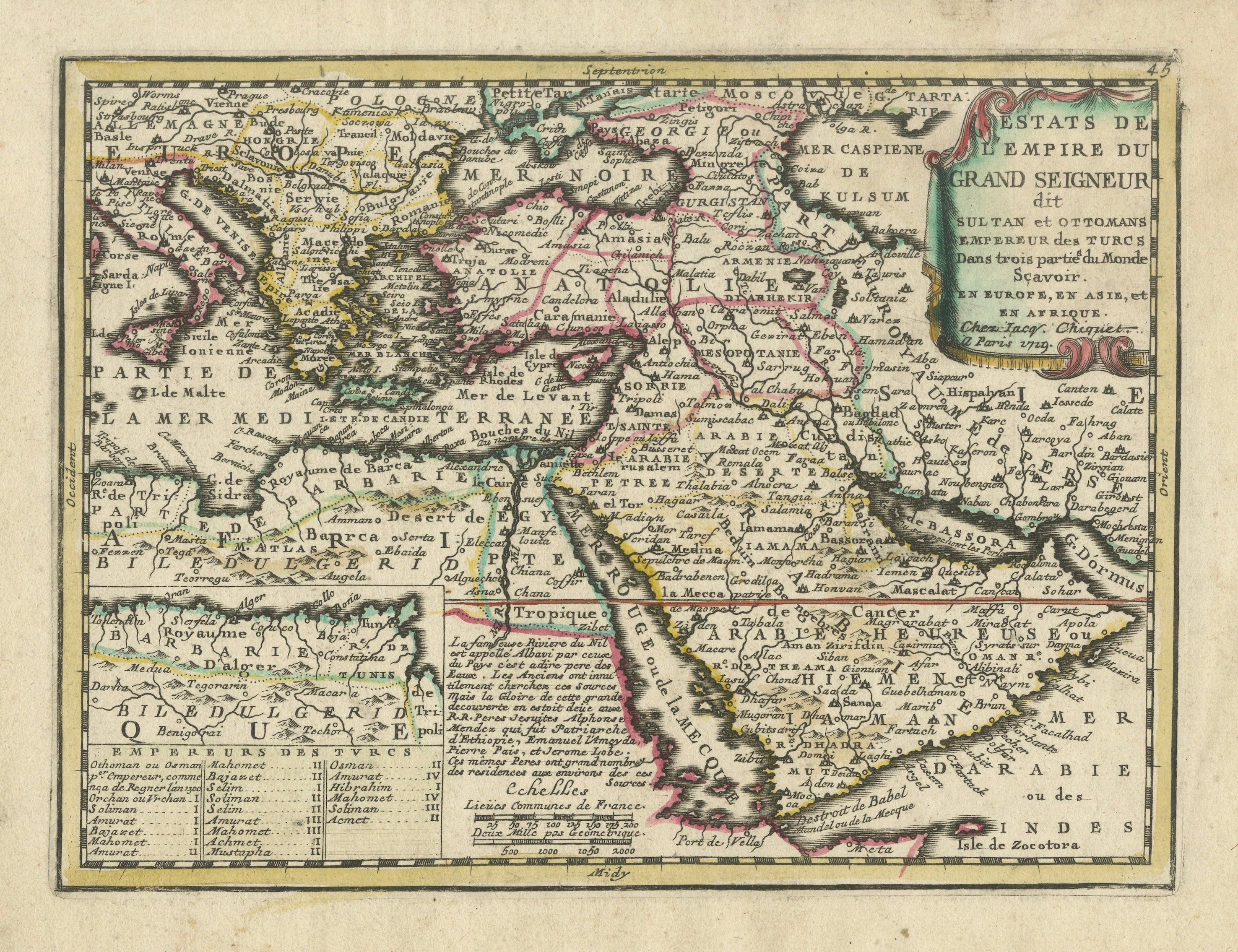
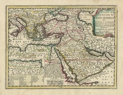
Ottoman Empire Map 1719 – Europe Asia Africa, Jean Chiquet, Paris
Title: Ottoman Empire Map 1719 – Europe Asia Africa, Jean Chiquet, Paris
Description:
Original early-18th-century engraved map titled Estats de l’Empire du Grand Seigneur, depicting...
Categoria
Di antiquariato/d’epoca, Inizio XVIII secolo, Francese, Mappe
Materiali
Carta
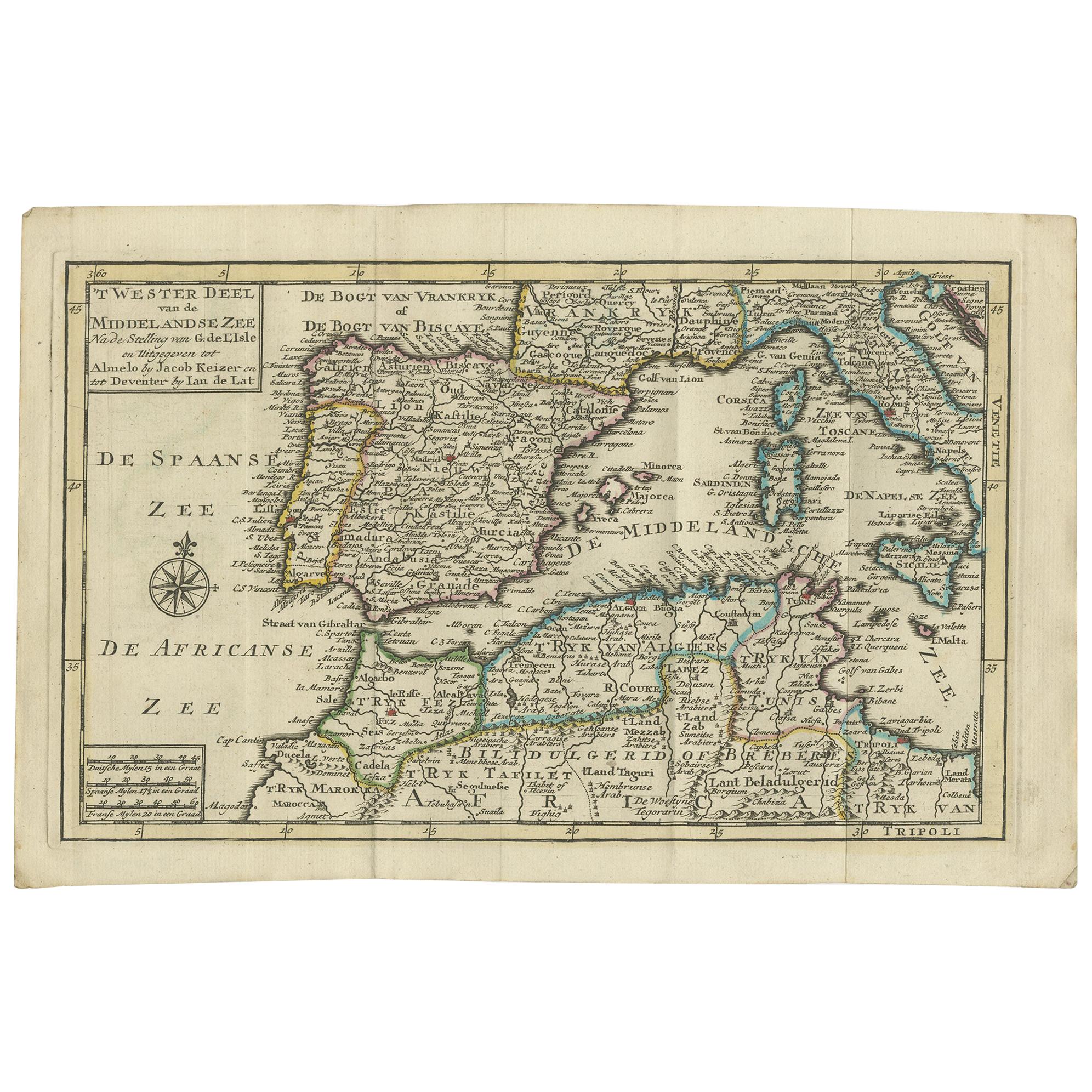
Carta antica del Mar Mediterraneo e dintorni di Keizer
de Lat, 1788
Carta geografica antica intitolata 't Wester Deel van de Middelandse Zee (..)'. Non comune mappa originale d'epoca del Mar Mediterraneo e dintorni. Questa mappa proviene da "Nieuwe N...
Categoria
Di antiquariato/d’epoca, Fine XVIII secolo, Mappe
Materiali
Carta

280 € Prezzo promozionale
20% in meno
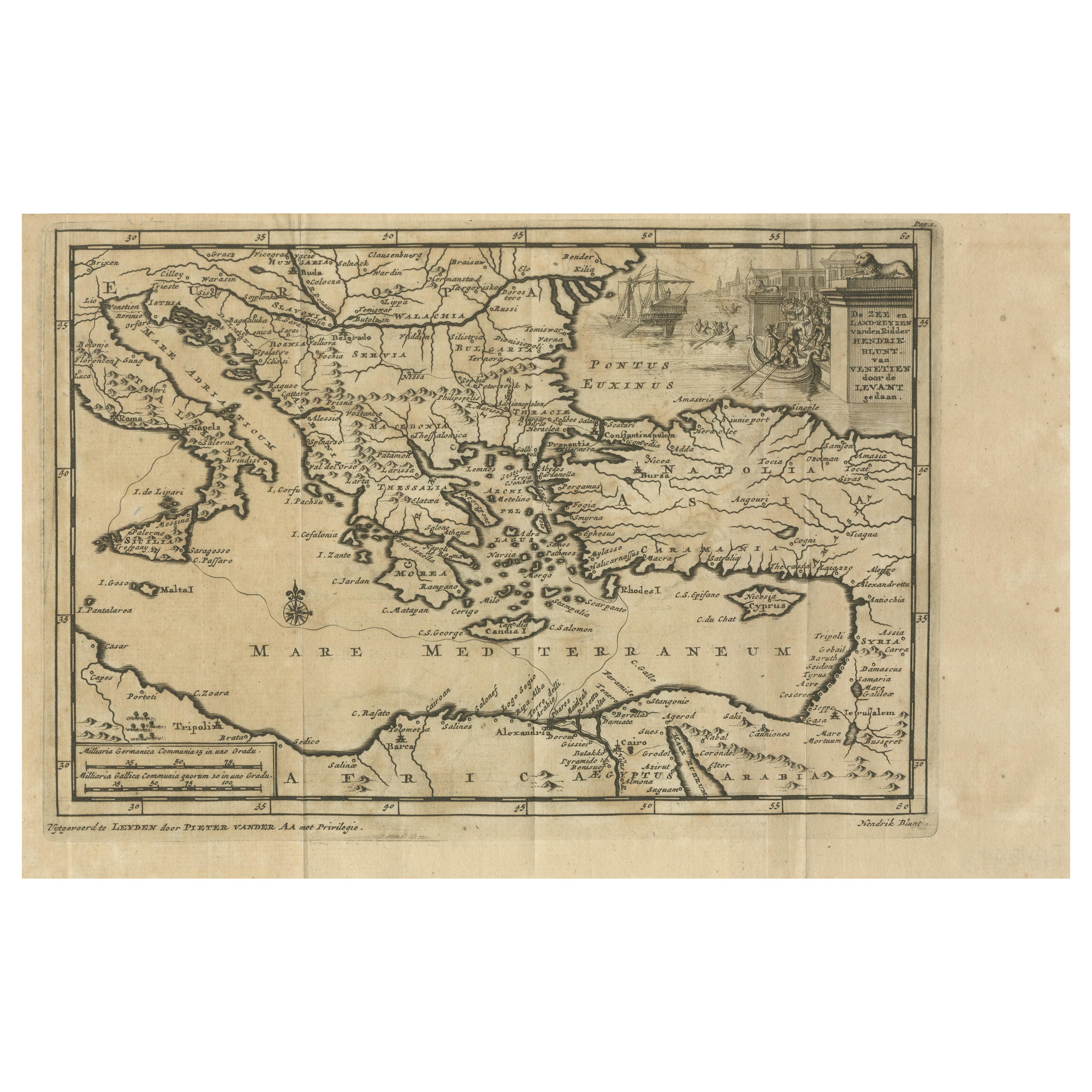
Le rotte commerciali veneziane nel Levante - Carta antica di Pieter Van der Aa, 1720 ca.
Le rotte commerciali veneziane nel Levante - Mappa antica di Pieter Van der Aa, inizio XVIII secolo
Questa mappa finemente incisa, pubblicata da Pieter Van der Aa a Leida, fornisce...
Categoria
Di antiquariato/d’epoca, Anni 1720, Mappe
Materiali
Carta
Ti potrebbe interessare anche
Mediterraneo e Adriatico: Mappa originale del XVIII secolo colorata a mano da Bowen
Si tratta di una mappa originale del XVIII secolo, colorata a mano, intitolata "Una carta accurata del Mediterraneo e dell'Adriatico, con l'arcipelago e parte del Mar Nero". Mostrand...
Categoria
Metà XVIII secolo, Antichi maestri, Stampe (paesaggio)
Materiali
Incisione

882 € Prezzo promozionale
20% in meno
Costa occidentale dell
Africa, Guinea e Sierra Leone: Una mappa del XVIII secolo di Bellin
Di Jacques-Nicolas Bellin
La mappa in rame di Jacques Bellin intitolata "Partie de la Coste de Guinee Dupuis la Riviere de Sierra Leona Jusquau Cap das Palmas", che raffigura la costa della Guinea e della Sie...
Categoria
Di antiquariato/d’epoca, Metà XVIII secolo, Francese, Mappe
Materiali
Carta

398 € Prezzo promozionale
20% in meno
Africa: Una grande mappa colorata a mano del XVII secolo di Sanson e Jaillot
Di Nicolas Sanson
Questa grande mappa originale dell'Africa incisa su rame e colorata a mano intitolata "L'Afrique divisee suivant l'estendue de ses principales parties ou sont distingues les uns des ...
Categoria
Di antiquariato/d’epoca, Anni 1690, Francese, Mappe
Materiali
Carta

1506 € Prezzo promozionale
20% in meno
Carta geografica antica - Mare Pacificum - Acquaforte di Johannes Janssonius - 1650
Di Johannes Janssonius
Il Mare Pacificum è un'antica mappa realizzata nel 1650 da Johannes Janssonius (1588-1664).
La mappa è un'acquaforte colorata a mano, con acquerello coevo.
Buone condizioni con leg...
Categoria
Anni 1650, Moderno, Stampe figurative
Materiali
Acquaforte

Carta geografica antica - Mar Di Athiopia - Acquaforte di Johannes Janssonius - 1650
Di Johannes Janssonius
Mappa antica - Marli Di Athiopia è una mappa antica realizzata nel 1650 da Johannes Janssonius (1588-1664).
La mappa è un'acquaforte colorata a mano, con acquerello coevo.
Buone co...
Categoria
Anni 1650, Moderno, Stampe figurative
Materiali
Acquaforte

Mappa delle Indie Orientali: Una mappa originale del XVIII secolo colorata a mano da E. Bowen
Si tratta di una mappa originale del XVIII secolo colorata a mano intitolata "An Accurate Map of the East Indies Exhibiting the Course of the European Trade both on the Continent and...
Categoria
Metà XVIII secolo, Antichi maestri, Stampe (paesaggio)
Materiali
Incisione

882 € Prezzo promozionale
20% in meno